
All Activity
- Past hour
-
Garner 1:55 We have had spectacular thunder for a good while-window rattling About that rain-where it be at? It isn't here
-

E PA/NJ/DE Summer 2026 Obs/Discussion
The Iceman replied to PhiEaglesfan712's topic in Philadelphia Region
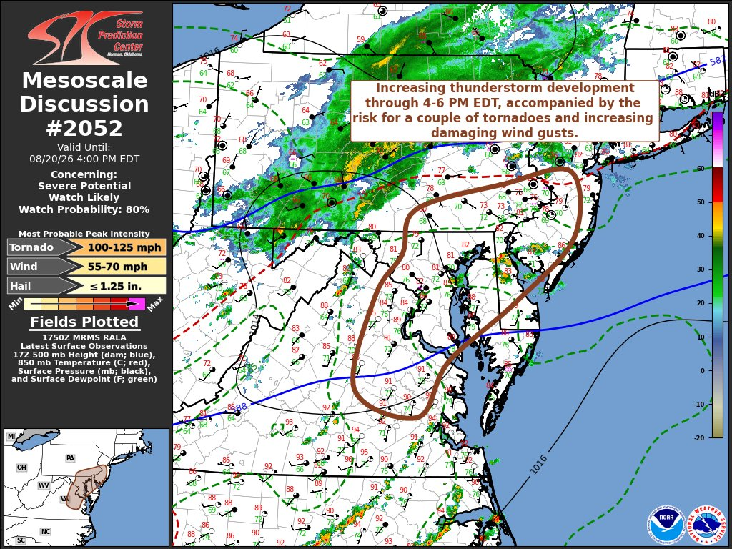
Mesoscale discussion out Mesoscale Discussion 2052 NWS Storm Prediction Center Norman OK Aug 20, 2026 17:53Z Areas affected...parts of southeastern Pennsylvania...central and southern New Jersey...north central and eastern Virginia...much of Delaware and Maryland. Concerning...Severe potential...Watch likely Valid 201753Z - 202000Z Probability of Watch Issuance...80 percent SUMMARY...Thunderstorms are likely to develop and intensify through 4-6 PM EDT, accompanied by the risk for a couple of tornadoes initially and increasing potential for strong to severe gusts spreading toward coastal areas into early evening. DISCUSSION...Moderate to strong boundary-layer destabilization is ongoing across much of the northern Mid Atlantic, particularly within seasonably high moisture content air advecting northward through the coastal plain, to the east of deepening (albeit weak) surface troughing to the lee of the Blue Ridge. This is occurring downstream of mid-level troughing, with at least a couple of convectively generated perturbations and belt of augmented westerly flow (30-50 kt in the 700-500 mb layer). It appears that associated forcing for ascent may increasingly begin to impact a corridor from central Maryland through southeastern Pennsylvania by 20-22Z, if not a bit earlier, supporting the initiation of intensifying thunderstorm development. At least initially, this may include a few evolving supercell structures in the presence of strong deep-layer shear. Downstream of a developing wave along a weak low-level baroclinic zone strengthened by differential heating, low-level hodographs are forecast to remain modest to weak. However, they may still be sufficient to contribute to potential for a couple of tornadoes, aided by appreciable near-surface buoyancy developing in associated with insolation, warm advection and dew point increases into the lower 70s F. Otherwise, at least some upscale growth of initial storms will contribute to increasing potential for damaging surface gusts, with additional thunderstorm development southward along and east of the deeper lee surface troughing. ..Kerr/Smith.. 08/20/2026 ...Please see www.spc.noaa.gov for graphic product... ATTN...WFO...PHI...AKQ...CTP...LWX... MOST PROBABLE PEAK TORNADO INTENSITY...100-125 MPH MOST PROBABLE PEAK WIND GUST...55-70 MPH MOST PROBABLE PEAK HAIL SIZE...UP TO 1.25 IN -

2026 Mid-Atlantic Severe Storm General Discussion
wxmeddler replied to Kmlwx's topic in Mid Atlantic
Red Box coming soon.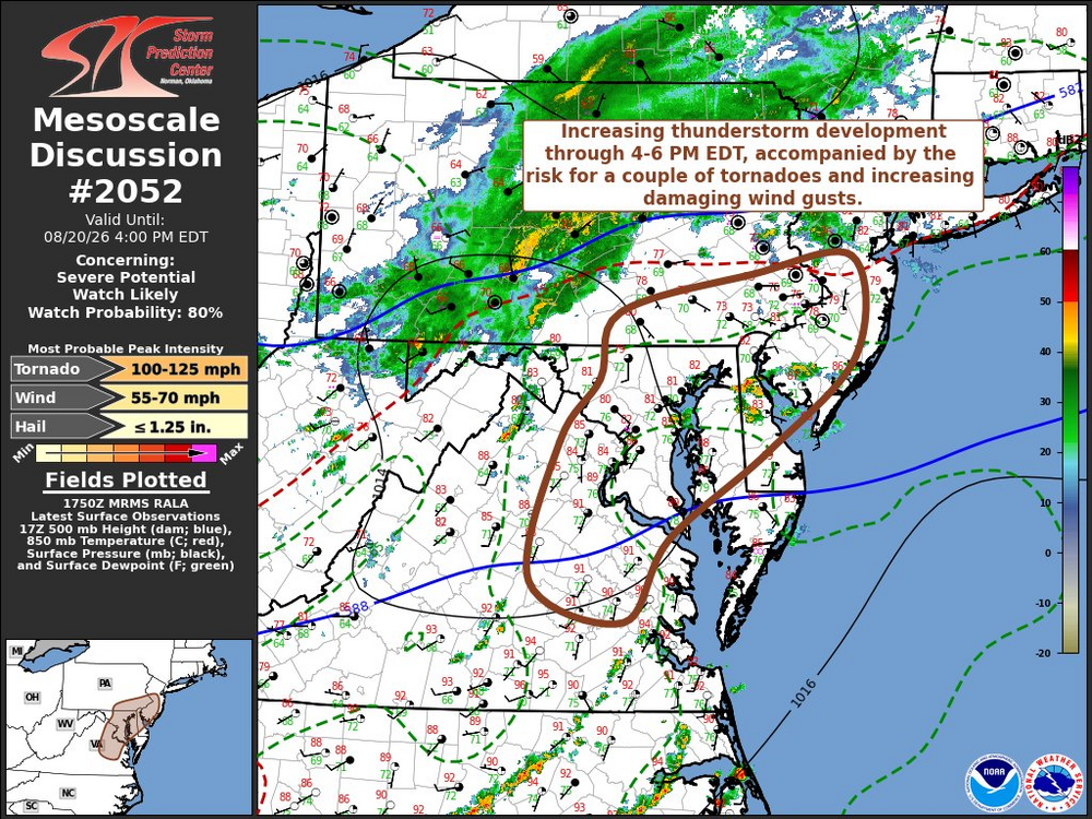
-
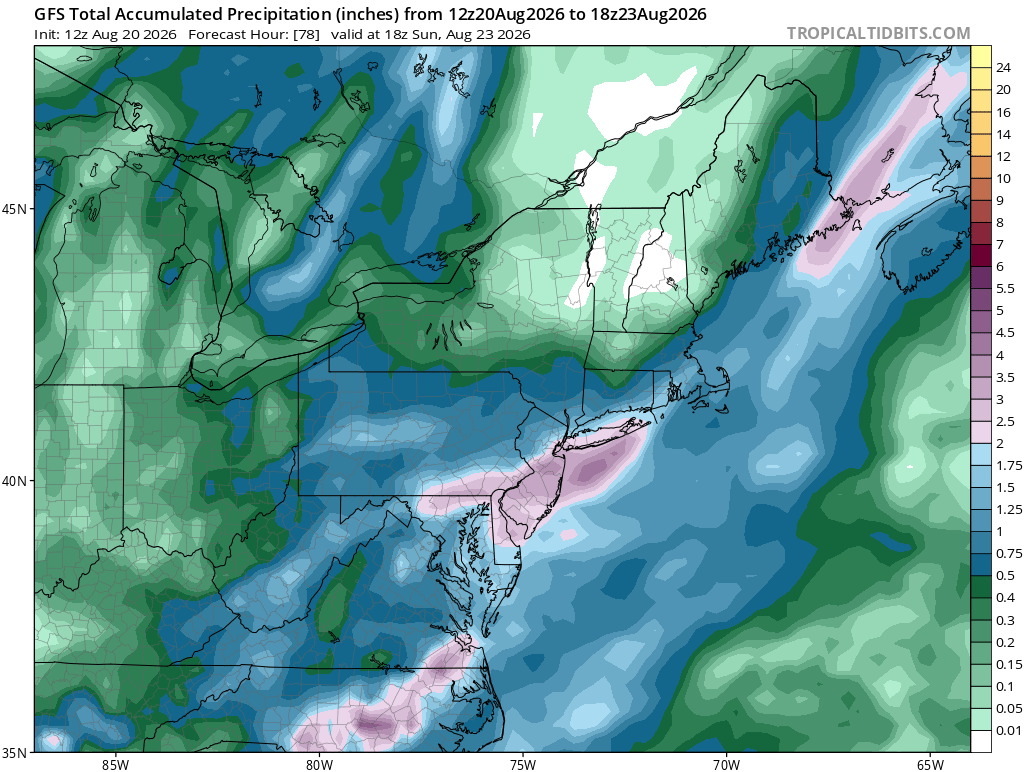
No reason to think this train pauses before printing some 1.8-2.0 months.
-

Augdewst 2026: Summer's Last Stand
powderfreak replied to Prismshine Productions's topic in New England
Can you meh yourself back into 1”+?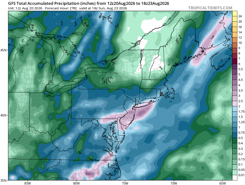
-
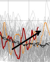
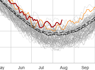
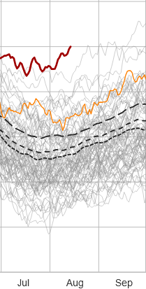
the s. hemisphere the tropics are lewd while the antarctic itself has a scary trend line originating over the last 1.5 months. It'll likely correct down some - we hope. The scalar value at the end of that rust curve is ~ 4th or 5th overall, to date. You don't wanna see early positive anomaly investments of that look before their annual recover is set to get going, in about a 3 weeks.
-
wow! This guy did the math!
-
-

Augdewst 2026: Summer's Last Stand
Sey-Mour Snow replied to Prismshine Productions's topic in New England
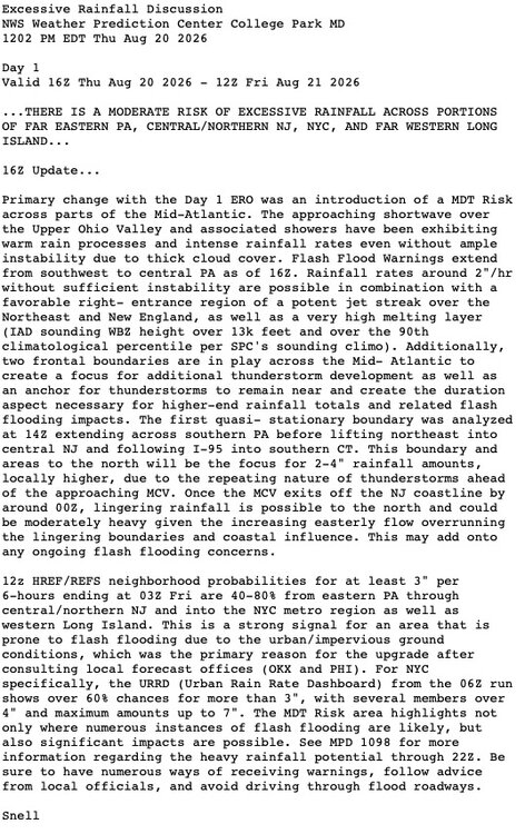
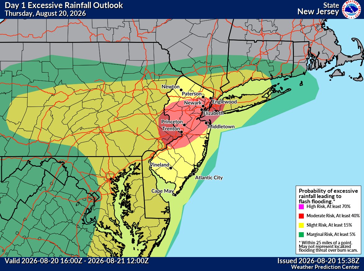
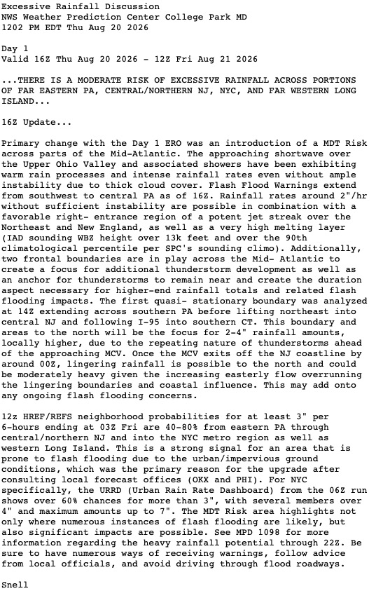
Upgraded WPC outlook looking like southern CT will see a good 2-4” soaking tonight.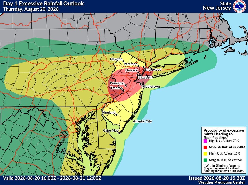
-

2026 Mid-Atlantic Severe Storm General Discussion
SnowenOutThere replied to Kmlwx's topic in Mid Atlantic
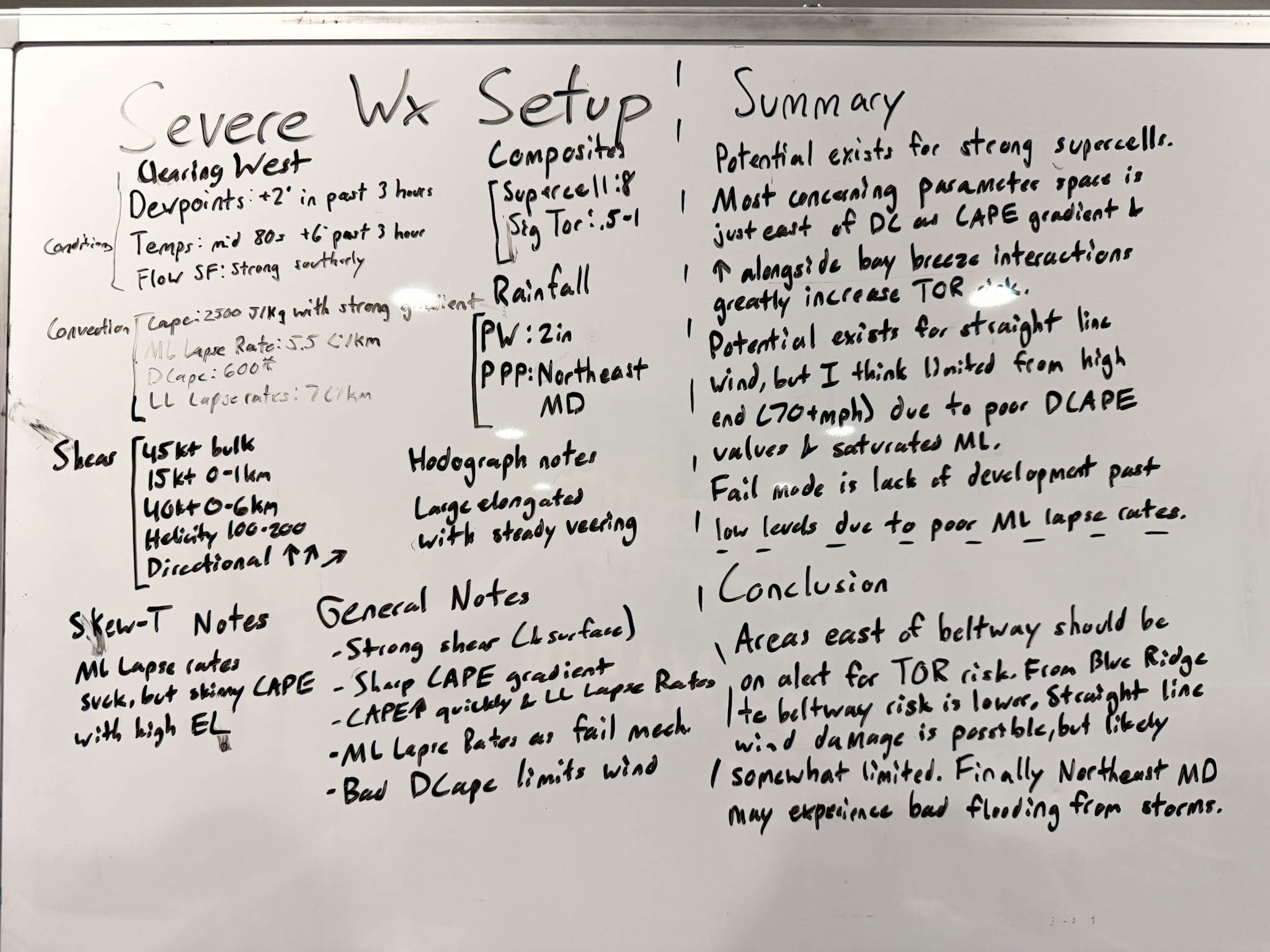
My take on today. Made before the Dulles sounding, but I doubt that changes too much from the parameters shown on mesoanalysis.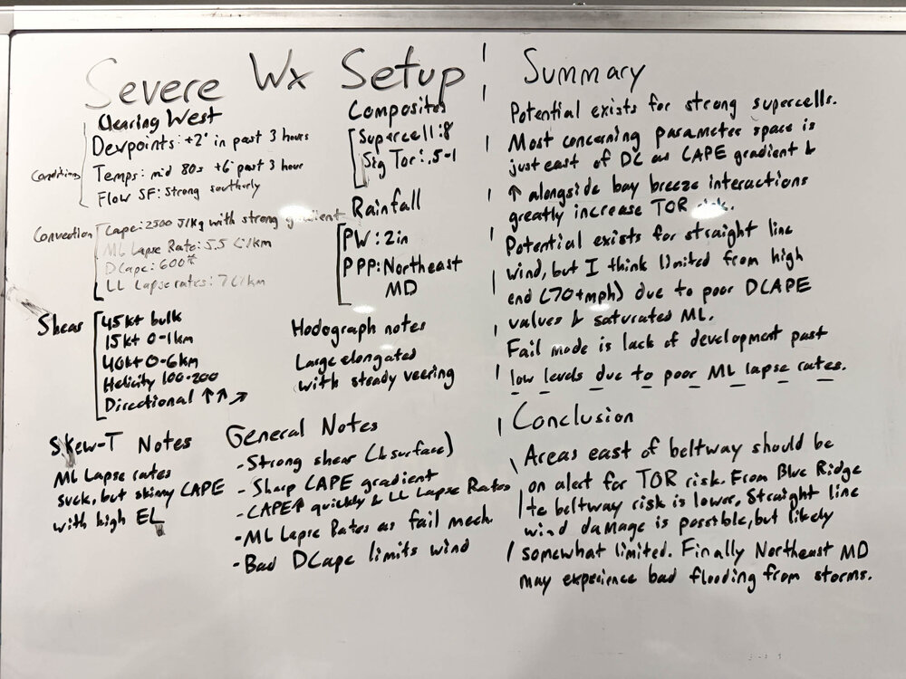
- 2,040 replies
-
- 1
-

-
- severe
- thunderstorms
- (and 7 more)
-
I share your skepticism, b/c so many fails this summer. But past performance does not....
-
Stay safe.
-
2026 Mid-Atlantic Severe Storm General Discussion
wxmeddler replied to Kmlwx's topic in Mid Atlantic
-
 https://tadahealthrx.com/# Buy Tadalafil 10mg
 -
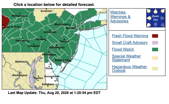
Associated discussion and Flash Flood Watch was also lifted slightly north and NW from earlier this morning.
-
I'm trying to finish a job in Crofton and I'm getting nailed with heavy rain. It's a small shower but it's heavy.
-

2026 Mid-Atlantic Severe Storm General Discussion
batmanbrad replied to Kmlwx's topic in Mid Atlantic
CSU-MLP latest had the best TOR chances between Baltimore and Philly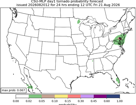
-
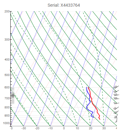
The 18z sounding should be very interesting
-

2026-2027 Record-breaking El Nino
GaWx replied to Stormchaserchuck1's topic in Weather Forecasting and Discussion
The average 3.4 SSTa adjusted for GW has leaned significantly toward La Niña the last 20 years with an avg anomaly of -0.3C. -

2026 Mid-Atlantic Severe Storm General Discussion
dailylurker replied to Kmlwx's topic in Mid Atlantic
Raining and cloudy in Crofton. I've seen this one before lol -
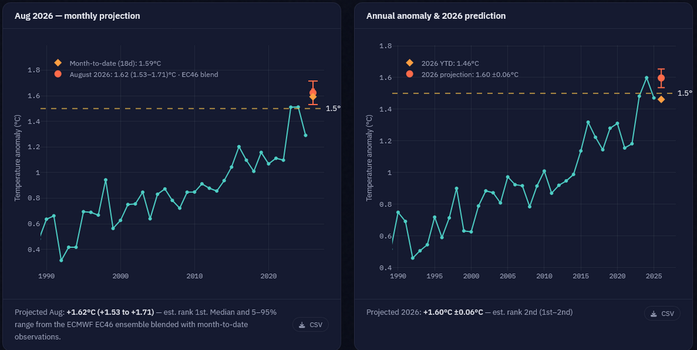
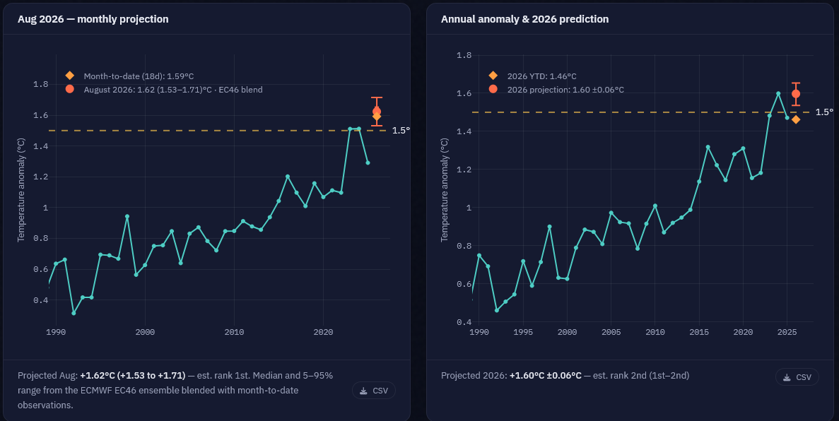
Here's Zeke H latest forecasts (updated daily). An August record is almost guaranteed, while a record for 2026 is currently a coin flip. Monthly and yearly record odds have both been increasing as the month continues to run warm. https://dashboard.theclimatebrink.com/#global
-
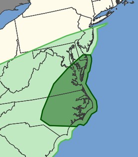
I know the event has yet to unfold, but recall a few days go, someone asked "is this it for svr for awhile for the region? And look at the DY3 outlook from 8/18 (attached). Now? 5% tor risk hatched? So it shows how things that do not look so good 3+ days out, can turn around, and sometimes big. The fine mesoscale details are everything, and sometimes it is only apparent that day hours before, or sometimes in real-time (June 5, 2024 comes to mind). May 3, 1999 epic OK tor outbreak. It was clear as mud as to the extent of that event. Morning outlook had SLGHT, upgraded to MDT by 1630z, and the 20z outlook when HIGH. The issue that day was lots of clouds and enough diurnal heating for storm to fire in the first place. And it was not synoptically-evident big tor outbreak day. And yet the result was the biggest single day OK tor outbreak for total tors (66) on record, and some monsters that revealed some amazing data from the DOWs. June 29.,2012 derecho here. That morning it was SLGHT, and by the aftn update, it was upgrade to HIGH as it was apparent the derecho in the OH Valley was taking on a life of its own, and again a historic event. The above are the exceptions, not the rule, but it shows how we can still be "surprised." And that uncertainty still exists today, despite all our advances.
-
Cool nights/dry weather can't help but notice.
.thumb.jpg.eeeac01e117609e140b013a6e9be623f.jpg)
-
12:58 it got sunny. I missed it by 6 fcking minutes
- 2,040 replies
-
- 5
-

-

-

-
- severe
- thunderstorms
- (and 7 more)
-
1. Yes 2. I went from the beautiful Estes Park to Rock Cut (where I walked a bit) and then turned around. On the way back at Forest Canyon, I walked the entire paved path and checked out all of the amazing views. I also stopped at most of the pullovers on each side going and coming back. On the way down, I walked a short dirt path to a beautiful meadow with a tiny stream surrounded by wildflowers. Very peaceful with nobody nearby! (I can’t post because pics are way too large for the attachment limits here.) I spent a total of ~3 hours inside the park. 2. Thanks! Next time I may try Old Fall River Road. How does it compare to TRR safety wise? Even though I loved driving TRR and was very careful, I admit slight feelings of danger on the many parts with a steep drop right off the edge! @mayjawintastawm












.jpg.1a3ea2a934474fef1d988453ff0e4570.jpg)
