All Activity
- Past hour
-
its shrinking as it moves east - also there are no severe warnings with it
-

Augdewst 2026: Summer's Last Stand
ineedsnow replied to Prismshine Productions's topic in New England
about to leave for the Southwick's zoo.. seems like a great day for it -
Looks like Middlesex on south for that first one
-

2026-2027 Record-breaking El Nino
GaWx replied to Stormchaserchuck1's topic in Weather Forecasting and Discussion
1982-3 and 2015-6 are two super strong ones with both a +QBO and descending solar fwiw. 1957-8 was a super strong with a +QBO and was barely after peak. -
nest with a goofy looking convective evolution hate seeing our friends in droughtville struggling
-

2026 Mid-Atlantic Severe Storm General Discussion
Paleocene replied to Kmlwx's topic in Mid Atlantic
12z 3k NAM has a line moving thru the DC metro around 21z. Latest HRRRs are less enthused. -
Good morning, all! Long time, no talk. I'm going to share more specific thoughts as we get closer to DJF, but for now I want to offer a reminder for those newer to the forum. When we start talking super ENSO, you're inevitably going to hear about the climatology-backed warm biases—and understandably so, given precedent. But speaking strictly as a layman with more than 30 years of lived weather experience in Middle Tennessee, I've learned not to equate the seasonal mean with our ability to capitalize on a winter-weather window. Those windows may be fewer or shorter in a super ENSO regime, but every super ENSO winter I've experienced here has still produced at least one notable storm to hang a hat on. Are we overdue for a dud? Absolutely. But some of the best winter-weather windows I've experienced have been sandwiched inside otherwise meh winters on paper. Give me a highly amplified, mobile, extreme pattern with radical variables in play, and I'll take my chances.
-
The early morning round that some of the models had for this area ended up not existing. Looks like the late day action will be another northeast IL hit. Dogshit pattern lol.
-
# 1 threat with these storms this afternoon is the wind - usually strongest right at the beginning of the storm unless one is in an MCS complex where it lasts most of the storm
-
So are the storms currently in Ohio the ones we should be watching for this afternoon?
-
warm and rainy
-
He's just regurgitating what the ECMWF shows.
-
Rain looks just about done
-
 Maple Trust Rx: Maple Trust Rx - Maple Trust Rx
 -
Couple of MCS complexes look to move through. One in east PA will clip us over next couple hours with much more significant one in the evening
-

2026 Atlantic Hurricane Season
tiger_deF replied to Stormchaserchuck1's topic in Tropical Headquarters
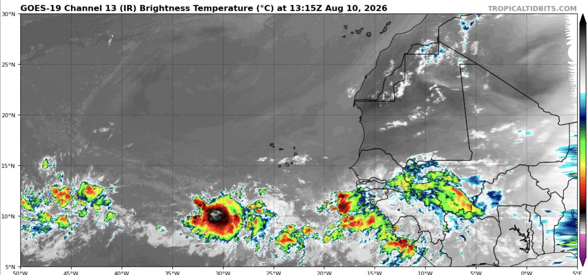
The first tropical wave (10/10) is looking rough, but this is the first time all season that there's been a healthy looking disturbance in the eastern MDR with a good moisture pocket. Low level vorticity is starting to increase as well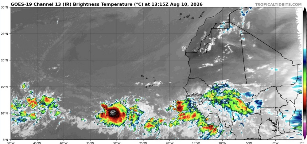
-
https://mapletrustrx.shop/# Maple Trust Rx
-

2026-2027 Record-breaking El Nino
40/70 Benchmark replied to Stormchaserchuck1's topic in Weather Forecasting and Discussion
The westerly QBO and the descending solar are two red flags for that kind of an outcome in the seasonal mean, neither of which were present in 2009....not to mention nearly 20 years of CC. -
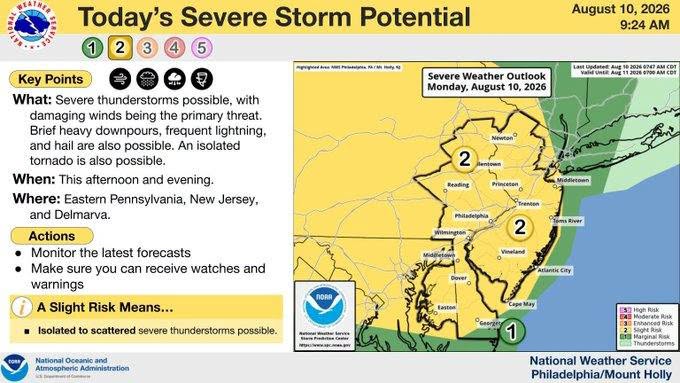
Slight Risk of Severe has been expanded by SPC east into our area - also that area of showers/storms in eastern PA is not the main event - look further west in eastern Ohio - also expect additional pop ups to develop starting at some point this afternoon when the atmosphere has had enough and needs to develop storms........who gets what and where lines of storms develop is the # 1 question
-
Threat increased
-
2026-2027 Record-breaking El Nino
40/70 Benchmark replied to Stormchaserchuck1's topic in Weather Forecasting and Discussion
I would be careful with buying into it full-stock....I feel like these Modoki like solutions are overdoing it in the seasonal mean because they are undergoing the magnitude of the warmer interludes early on. Rather, I interpret those solutions as validation for my conceptualization of how the second half will evolve. -

2026 Mid-Atlantic Severe Storm General Discussion
toolsheds replied to Kmlwx's topic in Mid Atlantic
Surprising I could hear them all the way down here by 70. -
The mid range looks super hot. I am ready for fall
-

2026-2027 Record-breaking El Nino
PhiEaglesfan712 replied to Stormchaserchuck1's topic in Weather Forecasting and Discussion
Yeah, it's time to start paying attention. When there is a cold signal this strong during a robust el nino, it's trying to tell you something. Just look at 2009-10, which had a very strong cold signal there in the fall (of 2009). That one came with a backlash la nina. The 2009-10 strong el nino formed and dissipated quickly, which allowed a transition to a strong la nina. I wonder if the upcoming el nino peaks early and gives way to the development of a strong la nina in 2027-28. If it does, then expect a record warm summer in the East. Backlash la nina years, like 1973, 1988, and 2010, have produced record warm summers at PHL. - Today
-
Some activity as the season gets into its peak period