All Activity
- Past hour
-
Here too. We sent the kid out to the pool to grab floaties just before gust front hit
-
Hobart, IN is about to be absolutely smoked
-

- 555 replies
-
- 1
-

-
- severe
- thunderstorms
- (and 7 more)
-
Massive debris ball near Merrillville
-
But you still got a warning, though. Local NWS offices do not issue watches; that’s the SPC.
-
Niece has a wedding tomorrow at 5:00PM in eastern Hawkins. Ya'll keep that out of here between 5:00-5:30. I already gave them a heads-up. 80mph wind gusts and 1" hail on the NWS graphic - NOPE!
-

2026 Mid-Atlantic Severe Storm General Discussion
AmericanWxFreak replied to Kmlwx's topic in Mid Atlantic
Had a similar thought looking at them approaching. -
PDS warned

-
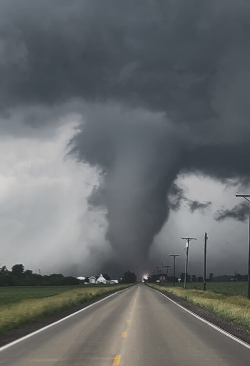
That is a major tornado in the middle of the Lake County burbs, that is not going to be good.
-
The temperature soared to 91° in Central Park. As a result, 2026 became New York City's first year on record with a high of 80° or above in March and then 90° or above in April, May, and June. Aside from a potentially strong to severe thunderstorm tonight, tomorrow will be another hot day. The temperature will likely top out in the upper 80s to lower 90s. Very warm conditions will likely continue through Sunday. Parts of the region could experience a heatwave. Humidity levels could make the heat particularly uncomfortable. In addition, strong to severe thunderstorms could develop tomorrow. Cooler weather will return for at least the first half of next week. Some rain is also likely early next week, but rainfall amounts could be fairly light. The ENSO Region 1+2 anomaly was +2.6°C and the Region 3.4 anomaly was +1.3°C for the week centered around June 3. For the past six weeks, the ENSO Region 1+2 anomaly has averaged +1.95°C and the ENSO Region 3.4 anomaly has averaged +0.98°C. The ongoing El Niño will continue to strengthen through the summer. The SOI was -5.69 yesterday. The preliminary Arctic Oscillation (AO) was +0.779 today. Based on sensitivity analysis applied to the latest guidance, there is an implied near 78% probability that New York City will have a warmer than normal June (1991-2020 normal). June will likely finish with a mean temperature near 74.7 (2.7° above normal). That would tie June 2026 the fifth warmest June on record with 1899 and 2010. Supplemental Information: The projected mean would be 3.3° above the 1981-2010 normal monthly value.
-

2026 Mid-Atlantic Severe Storm General Discussion
SolidIcewx replied to Kmlwx's topic in Mid Atlantic
Smoke city -
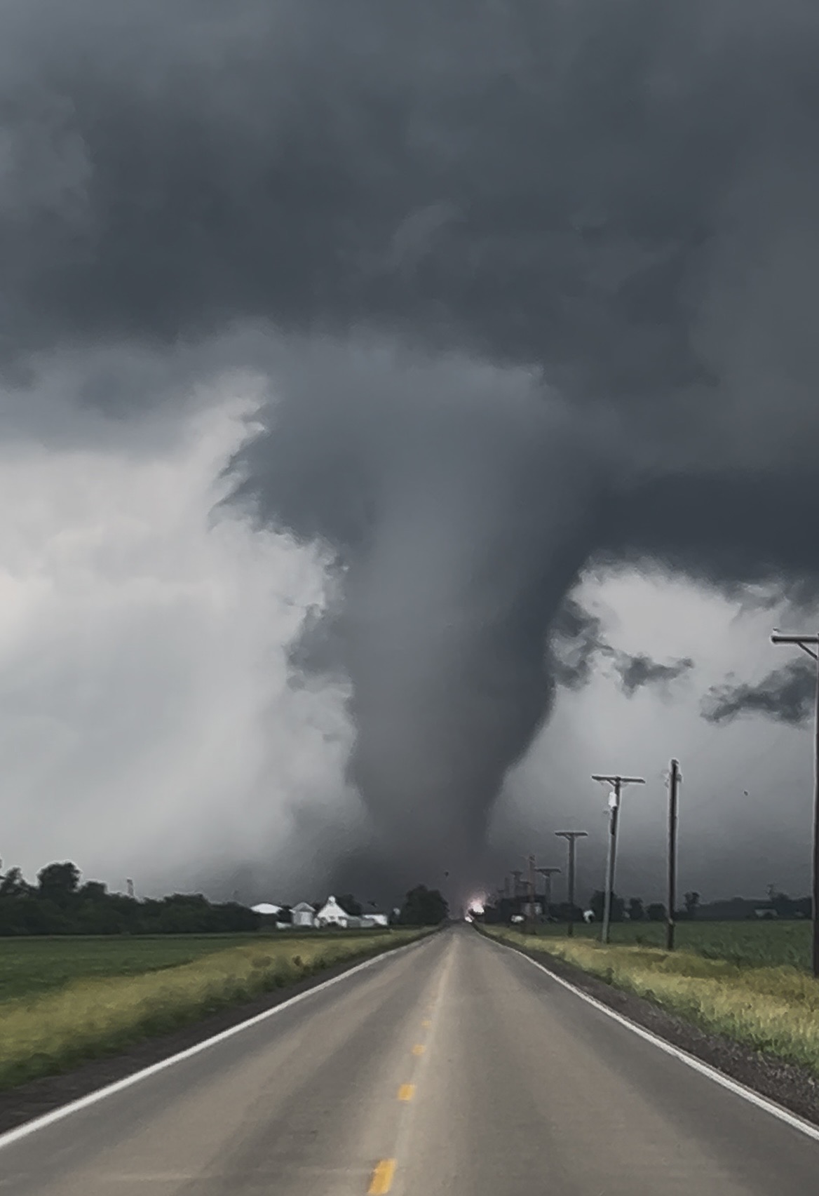
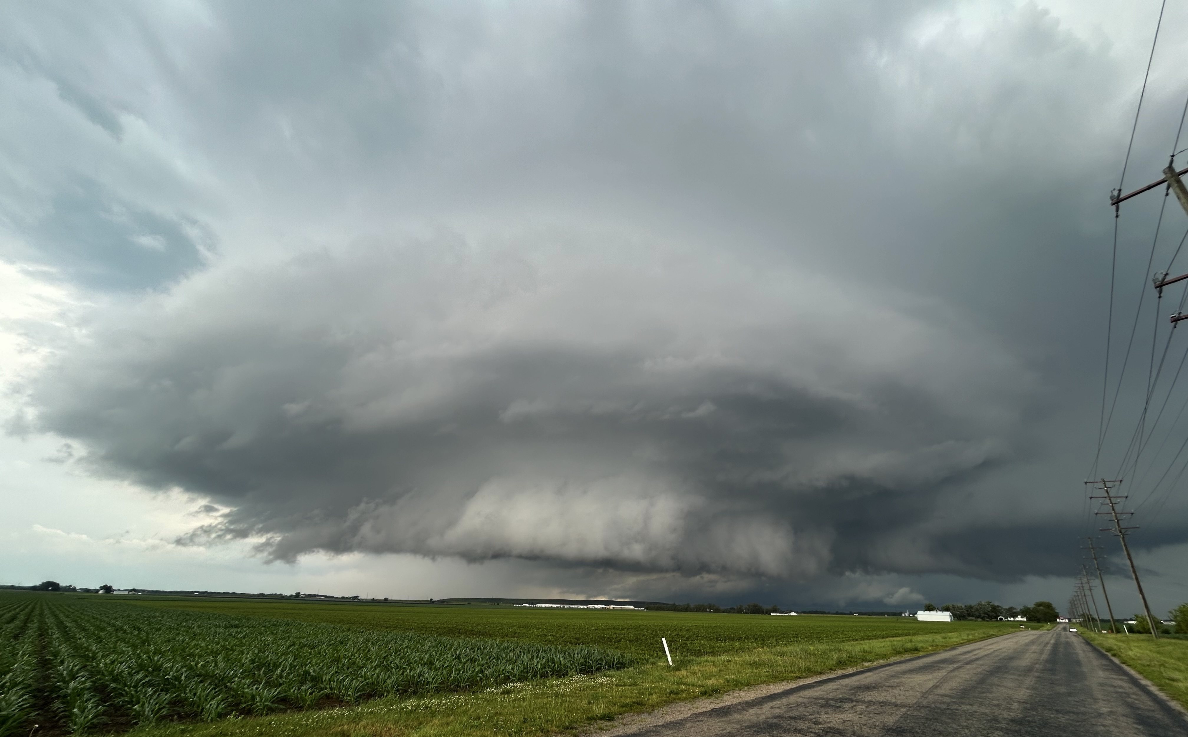
Still of video from tornado near Reddick tonight. Other pic is Sup before going tornadic.

-

2026 Mid-Atlantic Severe Storm General Discussion
SnowenOutThere replied to Kmlwx's topic in Mid Atlantic
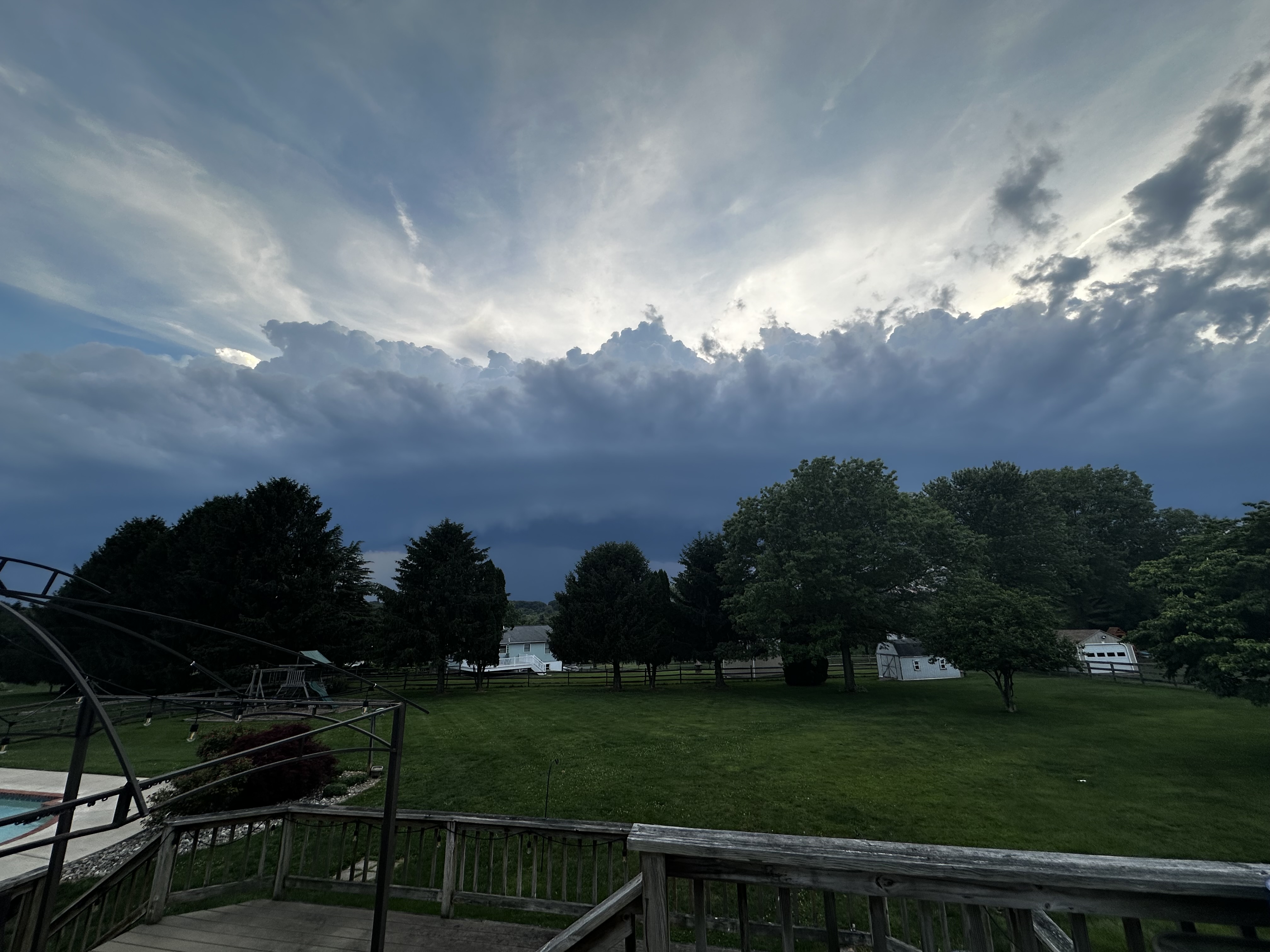
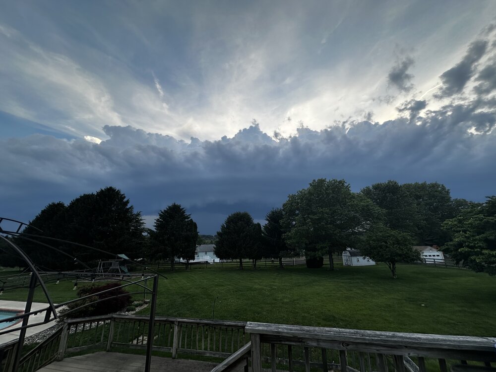
Sorta weird how these storms didn’t have the sky filling effect they sometimes do. Had a good shelf and then some smooth bands but didn’t build up as a thunderhead and barely had cirrus. Made me seem insane when I kept telling my coaches a storm was coming in. Any met want to take a stab at why these looked atypical? -
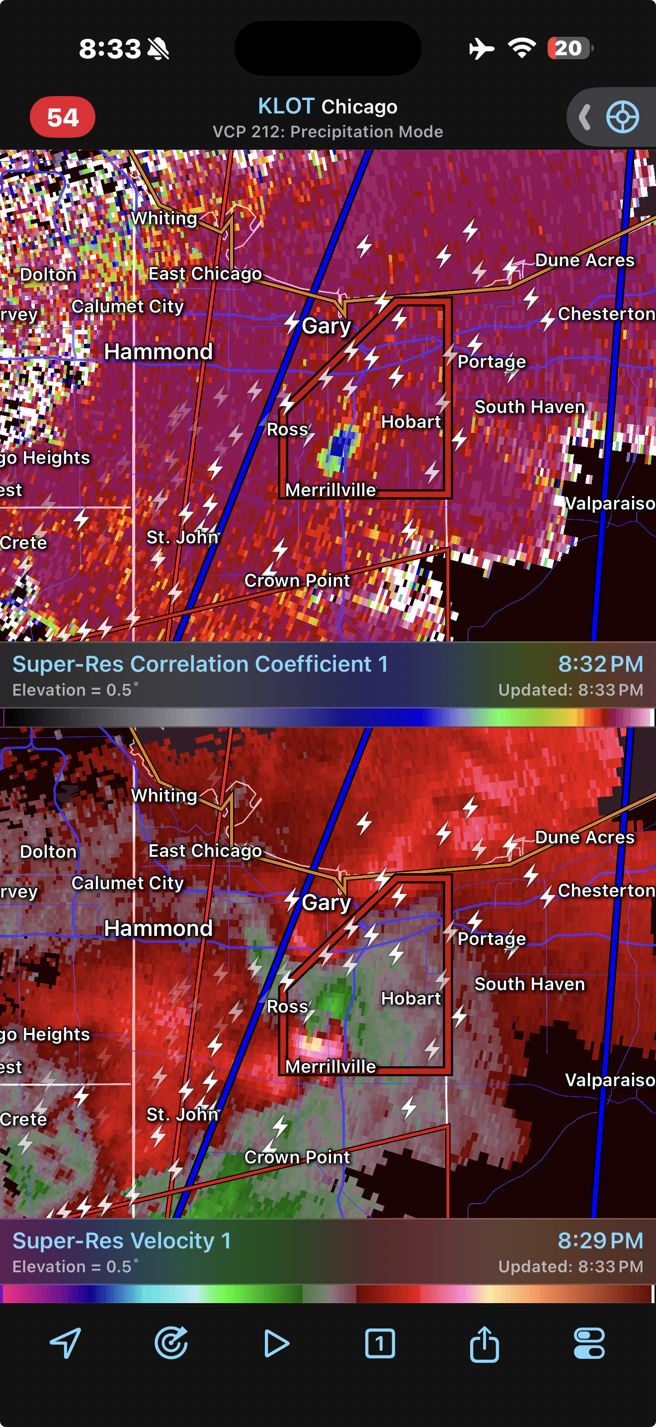
Big TDS north of Merrillville, IN
-

2026 Mid-Atlantic Severe Storm General Discussion
Eskimo Joe replied to Kmlwx's topic in Mid Atlantic
Just imagine if this thing hit at 4pm with some better lapse rates and a touch more shear. -
Gust front was potent, power went off and on few times, then the downpour which had little to no wind associated with it. Not much thunder or lightning either, but just heard some thunder right now as it seems to have mostly passed, just some light rain lingering.
-
Spc issues the watches not the local nws offices
-
Woah those were big gusts with the outflow
- 555 replies
-
- 3
-
-

-
- severe
- thunderstorms
- (and 7 more)
-
It was still 90.5° at 8:15, no rain today. Hopefully soon though.
-
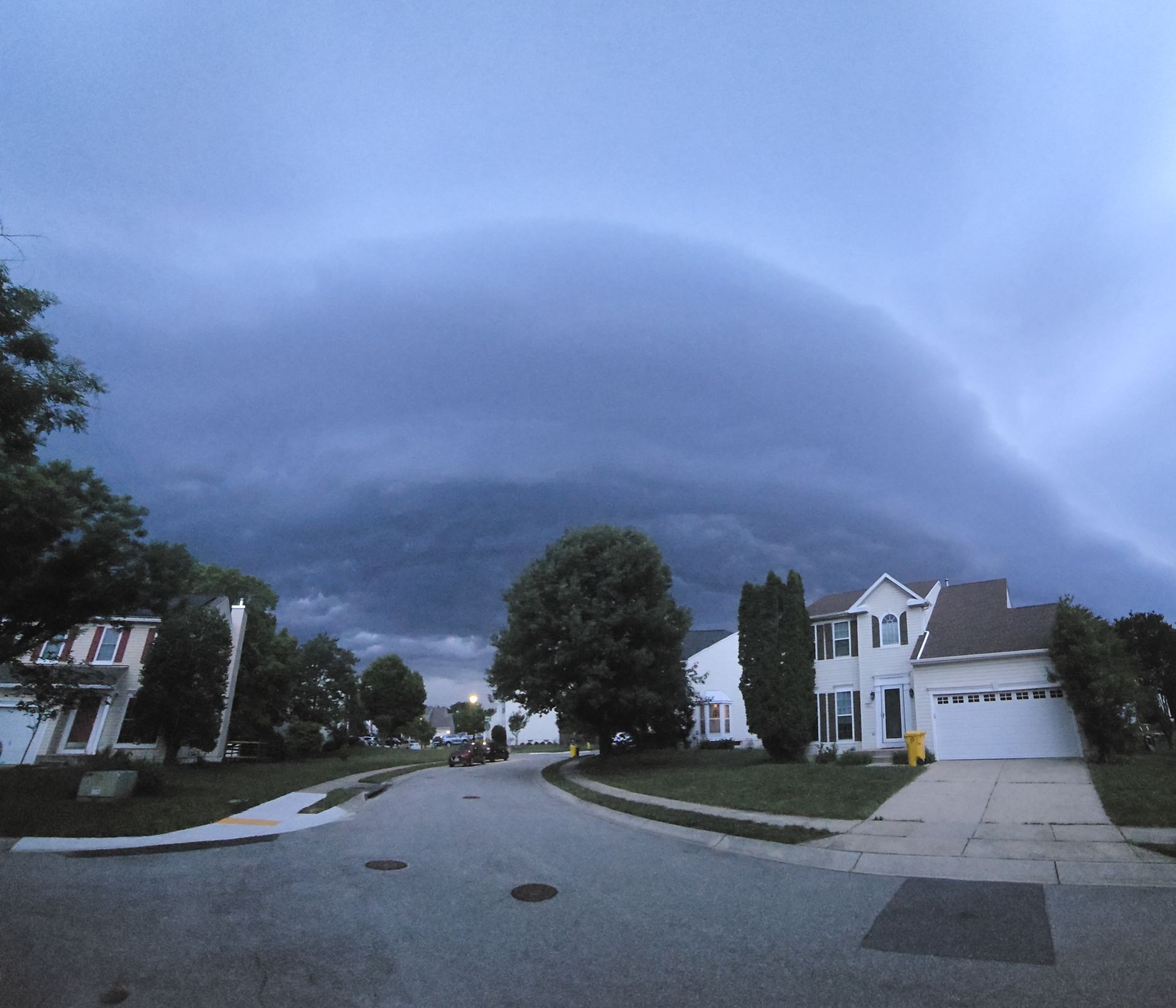
Got home from dance taxiing before the storm
- 555 replies
-
- 5
-
-
- severe
- thunderstorms
- (and 7 more)
-
Joined as a founder and already enjoying it.
-
Big tree down the yard behind us
-
probably pretty populated where that is.. I was looking at the warnings and that one wasn't up yet
-
That was a nice hit of wind. My tumbleweeds were flying And now getting some really good rains. FINALLY
-
I'm surprised it wasn't a touch higher, honestly.