All Activity
- Past hour
-

E PA/NJ/DE Winter 2025-26 Obs/Discussion
Kevin Reilly replied to LVblizzard's topic in Philadelphia Region
Mood flakes have arrived here in Media with a slight dusting on all surfaces. 22f humidity 75% 16f All snow showers moving NW to SE across the area. -

December 2025 regional war/obs/disco thread
40/70 Benchmark replied to Torch Tiger's topic in New England
I am definitely prone to those negative aspects, but not to this extent.....not looking back at my climo. Now, this spot is hostile to jackpots for the reasons that you have mentioned, yes....but more often than not I get enough to still average over 60". The point I will disagree most with is the SWFE....this area cleaned up in 1970, 2007 and 2008. -
Made it down to 10.8 F IMBY this morning at 6:33 AM. Brrr!! .
-
-

Central PA Winter 25/26 Discussion and Obs
Caveman replied to MAG5035's topic in Upstate New York/Pennsylvania
The cold definitely held serve with this "occluded confusion"...my drive from KMDT to Newberrytown was a real treat; 65 minutes vs a "normal" 25 minutes... -

Central PA Winter 25/26 Discussion and Obs
Itstrainingtime replied to MAG5035's topic in Upstate New York/Pennsylvania
I had a burst of big dendrites that added up quickly. I was watching the band diminish as it moved east and was fortunate to maximize it. -
Syosset 9.0 in 0900 AM 12/15 COOP Coop Observer who is S of me and I think it's the Jericho Water District on Convent Road just E of my kid's elementary school.
-
19.7/12.2 at 7:45 pm after a 28.9 high. Forecast is an 18 low? Someone better tell the atmosphere to hit the brakes.
-

December 2025 Short/Medium Range Forecast Thread
Matthew70 replied to John1122's topic in Tennessee Valley
All these teleconnections can cause headaches & burn out. It’s like playing old maid over & over getting the maid. Lol. -
Its like trying to analyze something from the JMA
-

December 14th - Snow showers or Plowable snow?
psv88 replied to Sey-Mour Snow's topic in New England
There are no rich people in the Hamptons in December. -
That is super interesting on the micro-scale.
-
Tomorrow will be another cold day. Temperatures will then moderate for Wednesday through Friday. Thursday and Friday could be mild days with the mercury approaching or reaching 50° in parts of the region. Rain is likely on Friday. Behind the storm, the weekend will turn somewhat cooler. The probability that December 2025 will have a maximum monthly temperature below 60° is increasing. The last time that happened was in 2019 when the monthly high was 58°. If 2025 has a monthly high below 60°, that would be only the fifth such occurrence since 2000 (2003, 2004, 2005, and 2019 are the cases since 2000). The ENSO Region 1+2 anomaly was -0.3°C and the Region 3.4 anomaly was -0.7°C for the week centered around December 10. For the past six weeks, the ENSO Region 1+2 anomaly has averaged -0.33°C and the ENSO Region 3.4 anomaly has averaged -0.67°C. La Niña conditions will likely continue through at least mid-winter. The SOI was +0.26 today. The preliminary Arctic Oscillation (AO) was +2.095 today. Based on sensitivity analysis applied to the latest guidance, there is an implied near 97% probability that New York City will have a cooler than normal December (1991-2020 normal). December will likely finish with a mean temperature near 34.3° (4.8° below normal). Supplemental Information: The projected mean would be 3.1° below the 1981-2010 normal monthly value.
-

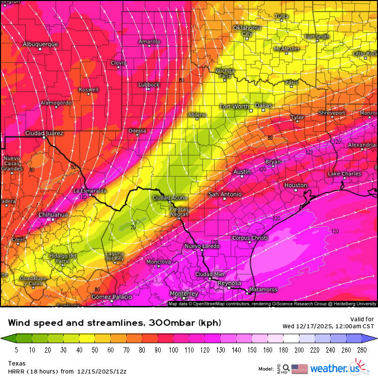
Texas 2025 Discussion/Observations
Stx_Thunder replied to Stx_Thunder's topic in Central/Western States
Hail threat (once again this ongoing cool season), looks to return to STX and coastal region tomorrow night (16th). Some severe hail is not out of question inland. Even if storms stay elevated. There was some embedded supercellular structures with hail cores in an MCC that actually separated into 2 opposite moving clusters not far off the coast last Friday night. The models (not too surprisingly) have been somewhat downplaying convective instability and moisture parameters lately around here. And the incoming mid-upper trough out west that SPC claims to be "weak" last night on D2 outlook has not appeared to be so on Euro since over a week ago. With even H5 flow still possibly going over 30 knots later tomorrow. 12z and 18z HRRR runs today now are also showing fairly stout 850mb southerly WAA flow potentially over 40 knots tomorrow as well. And even a split-jet flow regime moving over the state, tomorrow night (on Euro also). Which typically induces even more support for lift & dynamics aloft ahead of it.
-

December 2025 Short/Medium Range Forecast Thread
Holston_River_Rambler replied to John1122's topic in Tennessee Valley
Good question. That's something I'd like to figure out: how to read via satellite to see where impactful tropical convection is (for the pattern over N.America in general and the TN Valley in particular) and how it that convection is evolving (moving, increasing, and decreasing) to potentially modulate weather in extra tropical regions. -

12/14: Sunday funday? Will the south win again?
PrinceFrederickWx replied to TSSN+'s topic in Mid Atlantic
LWX had my spotter report posted for awhile yesterday, but once again later dropped it for State Highway’s inflated 2.0” I noticed hardly anyone is submitting spotter reports in Calvert anymore- or else they’re just not using them. Idk They still take all the (more accurate) Cocorahs reports at least. Calvert had a lot of those (including mine, which is still up). The BWI measurement was absolute bullshit too… I was up there today lol -

December 2025 regional war/obs/disco thread
WinterWolf replied to Torch Tiger's topic in New England
This can be true…but he used the logic that the GFS is what’s being advertised. Well now so is the 12z Euro. So I mean, c’mon. If you’re just saying what’s being advertised, as he said he was, then where’s his good remarks for the nice looking model run? -
Wonder who the 9” is in Nassau
-

December 2025 Short/Medium Range Forecast Thread
Golf757075 replied to John1122's topic in Tennessee Valley
When the RMM charts show between phase 8 and cod, does that make sense to you based on convection or is there something else going on? -

2025-2026 ENSO
JenkinsJinkies replied to 40/70 Benchmark's topic in Weather Forecasting and Discussion
Confirmation bias -

Central PA Winter 25/26 Discussion and Obs
Mount Joy Snowman replied to MAG5035's topic in Upstate New York/Pennsylvania
Oh wow nice. Not nearly that much here but you could see it diminishing quickly on the radar as it worked its way east so not surprising. -
December 2025 Short/Medium Range Forecast Thread
Holston_River_Rambler replied to John1122's topic in Tennessee Valley
No worries at all. I've been trying to think of some way to contribute, but I'm kind of burned out on looking at tropical convection, lol. -
December 2025 Short/Medium Range Forecast Thread
Holston_River_Rambler replied to John1122's topic in Tennessee Valley
I've been thinking about weighing in on the MJO stuff, but I'm not really sure what I make of it. This sort of mess is new to me: For what seems like most years lately, its been doing this loop d loop mess between 5 and 6. When I look at the Maritime Continent region, it basically looks how it has looked to me for most of the times I've looked at it over the past few years: Sahara satellite just because it is so fun: So what are we looking for wrt tropical convection and why? I can look at the RMMs as well as anyone and see where it is, but I'd like to start to dig deeper. I'm going to poke around in this article for a while and see if I can come up with a useful summary: https://journals.ametsoc.org/view/journals/wefo/29/1/waf-d-13-00102_1.xml -

December 14th - Snow showers or Plowable snow?
CCHurricane replied to Sey-Mour Snow's topic in New England
A parting view on the ride out of town last night.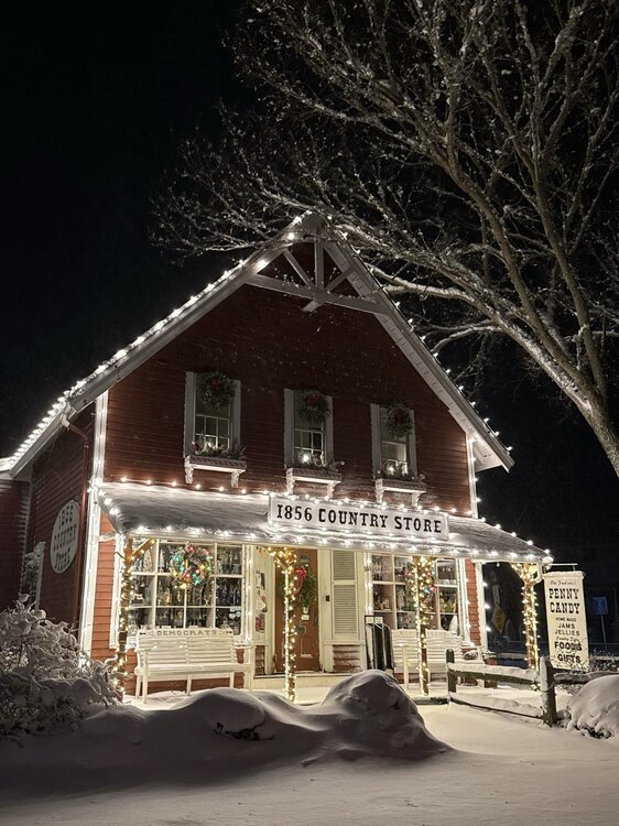
-
(002).thumb.png.6e3d9d46bca5fe41aab7a74871dd8af8.png)
E PA/NJ/DE Winter 2025-26 Obs/Discussion
ChescoWx replied to LVblizzard's topic in Philadelphia Region
Mood flakes here in East Nantmeal 19.9 degrees....light dusting on all surfaces