All Activity
- Past hour
-
Low of 26.6 Still a wintry loom with the remaining patches of snow.
-
Lol. Everywhere but paved really, makes for nice distinct lines like landscaping. It looks great right now as the sun is coming up over the ridge
-
24.4 for a low. 25.5 currently
-

Central PA Spring 2026 Discussion/Obs Thread
mahantango#1 replied to Voyager's topic in Upstate New York/Pennsylvania
Found this on facebook I didn't know NWS was doing a storm survey. Nepa Storm Chasers eSnosprdot8ch492c2au0hctgtfa7h30f8lhi1ct786i7mh7um2c3693i7t3 · Dauphin County Tornado Update Some followup on the tornado warned storm in Dauphin County on Wednesday. I have actually drive on the exact road in the exact rural area it struck and there's a solid chance it missed every home as it's extremely rural in Shermans Dale and Blain, PA. The storm would have only been on the ground for a short time maybe 10-15 mins, 3-8 miles max before lifting. This may have hit a house or just tore up some woods but there was clearly evidence to suggest it was causing damage. I clipped a photo of the debris ball with the overlay of the general area it would have been. It's all thick woods and very rural homes. I personally stayed in a cabin about 2-4 miles from the exact spot this storm happened at. I'm very curious to see what the NWS survey team determines when they conclude their investigation. Anyway, thought this may be interesting to everyone. I'll update when I found out. - Espresso -
BWI failure meanwhile DCA revised up to 0.2”
-
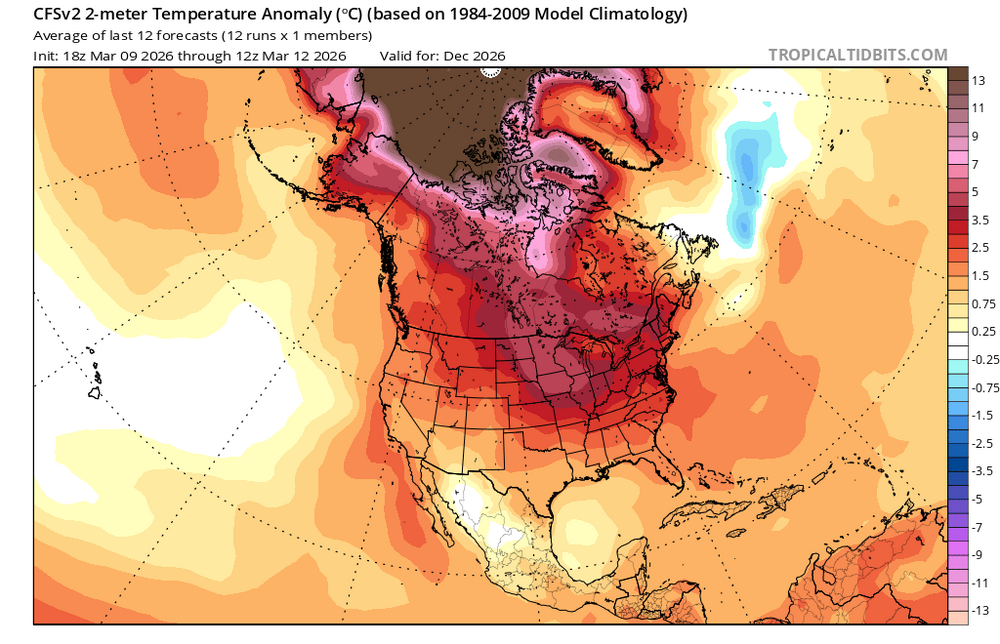
Its like the spring barrier doesn't exist. Every year same time all the Nino talk is speculation.
-

80 Degrees to Ripping Snow: March 12th
dailylurker replied to SnowenOutThere's topic in Mid Atlantic
Absolutely! So many memorable experiences this season. Truly an incredible winter. The winter of 26 The Little Devil winter. -
20.4° Feels brutal after the past week
-

Winter 2025-26 Medium/Long Range Discussion
Baum replied to michsnowfreak's topic in Lakes/Ohio Valley
Shot with your own gun -
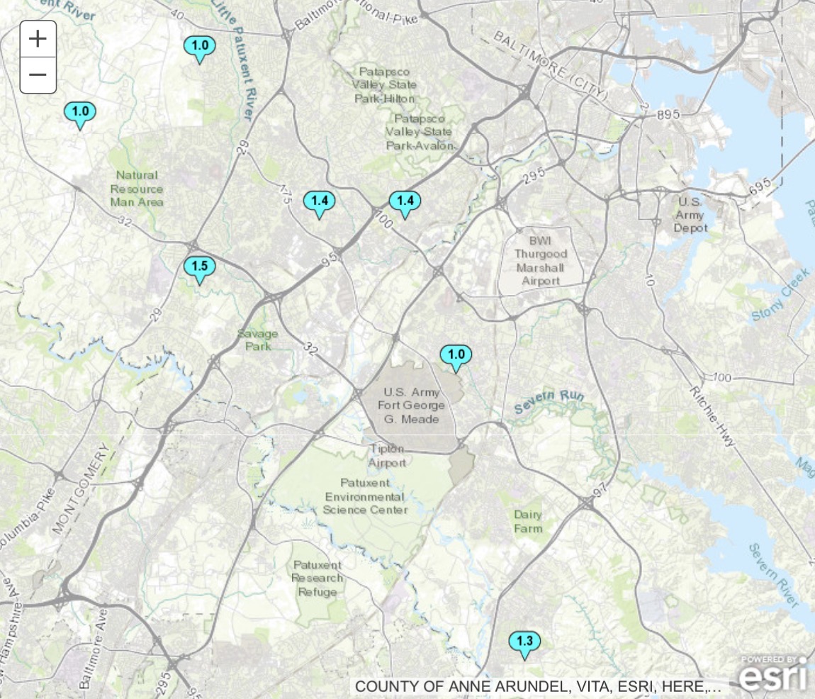
How did BWI only have a T? Did they measure after it melted? Did they measure on the tarmac?
-
Yeah, I agree. It was significantly deeper than the Blizzard of 1888. Had March 1993 taken a benchmark track instead, then we would have had a 40”+ jackpot with 80-100 mph gusts somewhere in the OKX forecast zones and drifts approaching 6-10 feet high in spots. https://www.weather.gov/media/ilm/Overview_Kocin_Schumacher_Morales_Uccelini.pdf
- Today
-
If (IF) there’s actually a super El Niño (region 3.4 over +2.0C), it’s very, very unlikely to be a cold winter. Snow is a different matter, since one major KU can skew the entire winter (i.e., 82-83, 15-16). 97-98 was a total dud for snow obviously
-
33 years ago, the Storm of the Century: https://www.meteo.psu.edu/ewall/NARR/1993/us0313.php
-
I’m sure that tiny light blue blob will work its way toward the NE and social media will be flooded with “so much for CC” posts again.
-
AC on for the NYC police cruisers through New Years.
-
26 Just a bit colder than this time yesterday
-
-
31.6
-
After Monday it looks like we stay on the cool side but no real signs of storms. Just useless cold.
-
.thumb.jpg.6a4895b2a43f87359e4e7d04a6fa0d14.jpg)
Central PA Spring 2026 Discussion/Obs Thread
Yardstickgozinya replied to Voyager's topic in Upstate New York/Pennsylvania
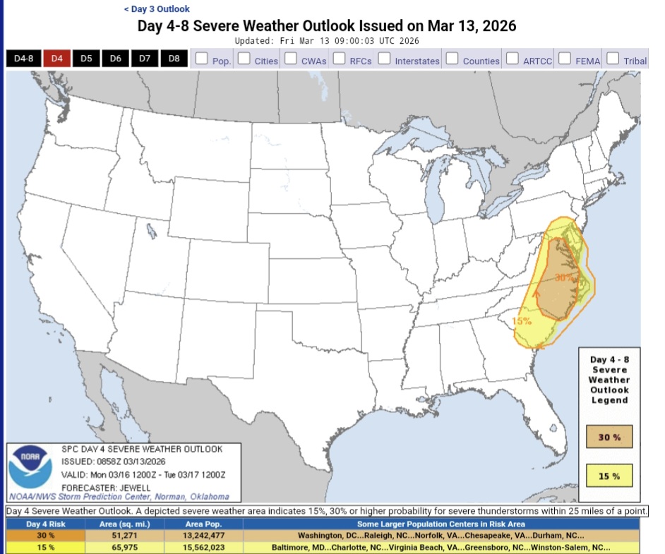
Big potential Monday creeping into southeast and south central Pennsylvania with a negatively tilted system. ...DISCUSSION... Significant severe winds and the potential for a few tornadoes will develop on Monday over parts of the Carolinas and Mid Atlantic. https://www.spc.noaa.gov/products/exper/day4-8/#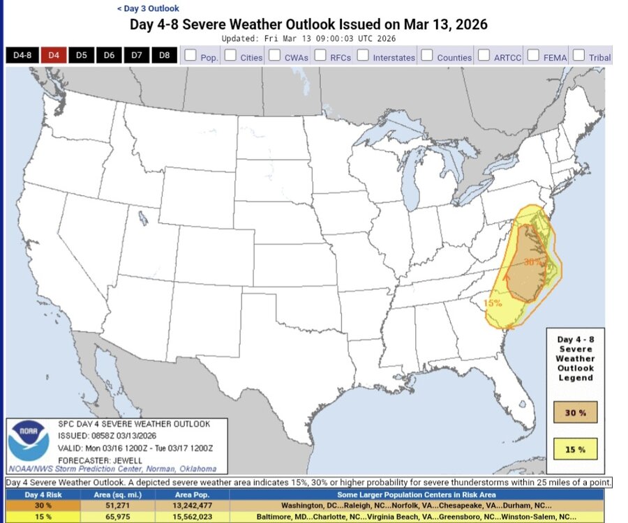
-
It would be like spring for you, but different!
-
Garbage can tops? Zilch here, not even a trace on the board.
-
Day 4-8 Convective Outlook NWS Storm Prediction Center Norman OK 0358 AM CDT Fri Mar 13 2026 Valid 161200Z - 211200Z ...DISCUSSION... Significant severe winds and the potential for a few tornadoes will develop on Monday over parts of the Carolinas and Mid Atlantic. Models are in good agreement with the large scale pattern on Monday/D4, depicting a deep upper trough moving out of the Mississippi Valley and ejecting in negative-tilt fashion across the Mid Atlantic and into to the Northeast. Given the antecedent upper ridging on the previous day, low-level southerly winds will help to moisten the air mass well ahead of an approaching cold front. By 12Z Monday, 60s F dewpoints will already extend from northern GA across the Piedmont and into southeast VA, and this plume of moisture will rapidly spread north with near 60 F dewpoints into southeast PA by 00Z. There appears to be two regimes for severe potential on Monday. First, up to 1000 J/kg MUCAPE may develop well ahead of the approaching cold front, and there is some indication that scattered convection may occur across the warm sector from mid to late afternoon. If this occurs, supercells would be most likely, with potential for a few tornadoes from the Carolinas into eastern VA. Models also indicate an elongated pressure fall/rise couplet, which when combined with 50-70 kt 850 mb winds and extreme low-level shear, could easily result in a QLCS along the cold front with corridors of significant damaging winds and embedded tornado risk.
-
Oh okay then
-
LWX already talking it up for Monday (this morning AFD) KEY MESSAGE 2...Another strong cold front will arrive Monday, bringing strong winds and the potential for severe thunderstorms. A strong cold front associated with a powerful low pressure across the western Great Lakes will cross the area Monday. Better moisture recovery is expected ahead of this front compared to the one tonight which will result in numerous showers and scattered thunderstorms. Given favorable wind speeds aloft and modest instability for mid-March, there is a noteworthy threat for severe weather. The storm mode looks mostly linear this time with a QLCS of sorts favored in nearly all extended guidance. While the kinematics look a lot stronger with this next system, there is still a high degree of uncertainty with the thermodynamic environment and the exact timing of the frontal passage with recent trends showing an earlier frontal passage prior to peak diurnal heating. SPC has a 15% contour on Day 4, which is not super common in the Mid-Atlantic. Numerous AI and ML guidance continue to paint a moderate to high end ceiling for damaging winds with this frontal passage on Monday as well. Regardless of severe weather, strong winds will accompany this front both in the pre-frontal and post-frontal environment
- 135 replies
-
- 1
-

-
- severe
- thunderstorms
- (and 7 more)