All Activity
- Past hour
-
Does this seem like snowstorm in December for I 95!!??? Uggg
-
NHC has this as a cat 2 right now 48 hours ago on their forecast
-
Models were bad on holding a signal for TC genesis, bad on initially predicting Jerry wouldn’t impact the islands, and then were even worse modeling the environment that led to Jerry’s untimely demise. Rough storm for the guidance on balance.
-
More heavy rain in SLC, too. Closing in on a record wet October.
-
 Literally all models coming in wetter now. Started with the NAMs, now the ICON and RGEM as well
- 326 replies
-
- 2
-

-

-
- heavy rain
- damaging wind
- (and 2 more)
-
I’ve gotten 0.20” the last 24 hours ending 11PM this evening from the trough coming out of the low then off of FL. About all of it fell overnight through mid morning. I’ve received 2.2” MTD.
- Today
-
Hopefully the mesos are right with 1-2” up here. HRRR and 3k are soakers.
-

The return of the elusive Nor'easter. Drought buster or bust?
87storms replied to dailylurker's topic in Mid Atlantic
More than sprinkles rn though it’s a pretty isolated batch. Feels and looks like Fall out there. -

Spooky Season (October Disco Thread)
bristolri_wx replied to Prismshine Productions's topic in New England


-
Spooky Season (October Disco Thread)
bristolri_wx replied to Prismshine Productions's topic in New England
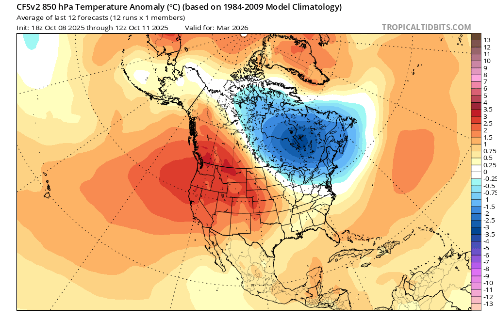
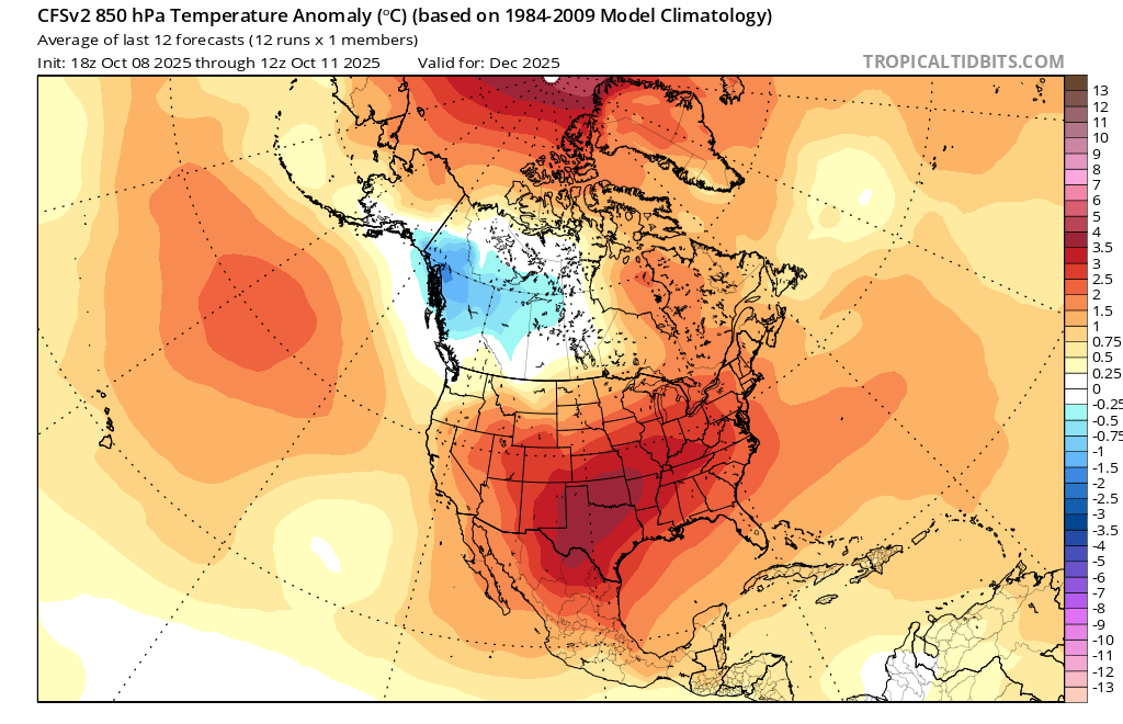
You should upgrade your computer so you can post more than one frame/month of the CFS.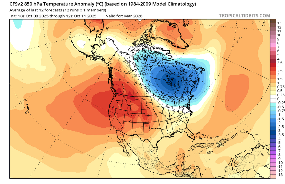
-

The return of the elusive Nor'easter. Drought buster or bust?
ravensrule replied to dailylurker's topic in Mid Atlantic
Please just give us heavier rain and stronger winds between 1-4 pm tomorrow in downtown. -
 Duration and strength of winds also increased a bit.
- 326 replies
-
- 1
-
-
- heavy rain
- damaging wind
- (and 2 more)
-
Such for euro moving south. POS.
-
Euro and AI look decent. Nam too.
-
And like the Ravens and Harbaugh...time for the Terps to move on from Locksley, lol I have a feeling that 2026 is gonna be a much better year for all 3 major MD sports
-

Spooky Season (October Disco Thread)
Torch Tiger replied to Prismshine Productions's topic in New England
h85 and 2m. nothing to worry about !
.thumb.png.bde2e6aec10577cbf003e95544519bde.png)
-
Atrial flutter
-
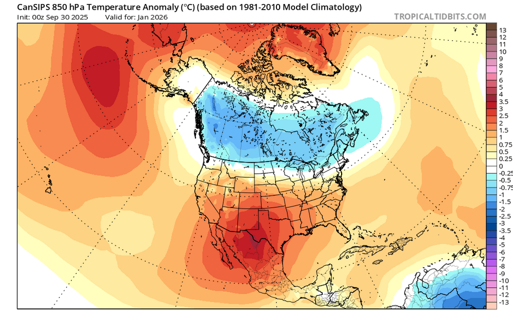
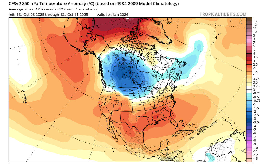
It’s too late, Raindance! I had just posted this at another BB: Those that follow Raindance know he’s well respected due to his pretty good record and very extensive research/detailed presentation. The highlight for the SE and nearby areas is a cold January that’s nearly as cold as Jan of 2025 (mainly 4-5 BN). This is a result of a 40% weighting of each of 2014, the coldest SE Jan since 1986, and the cold 2025.
-

The return of the elusive Nor'easter. Drought buster or bust?
clskinsfan replied to dailylurker's topic in Mid Atlantic
Left OC around 11 this morning to head back to Winchester for the winter. Was pretty dreary in OC over the past couple of days. Got back to the Shenandoah Valley with sunshine and temps in the low 70's was a beautiful afternoon. Nice to be back home for the winter. Now if we can just keep the Nor'easters rolling for the next few months we will all be happy. -
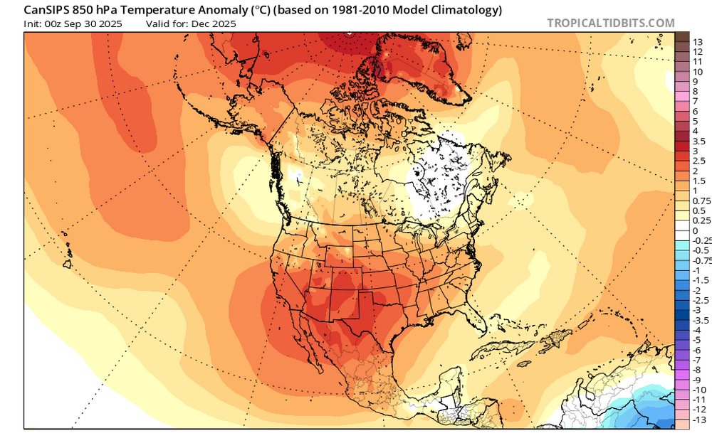
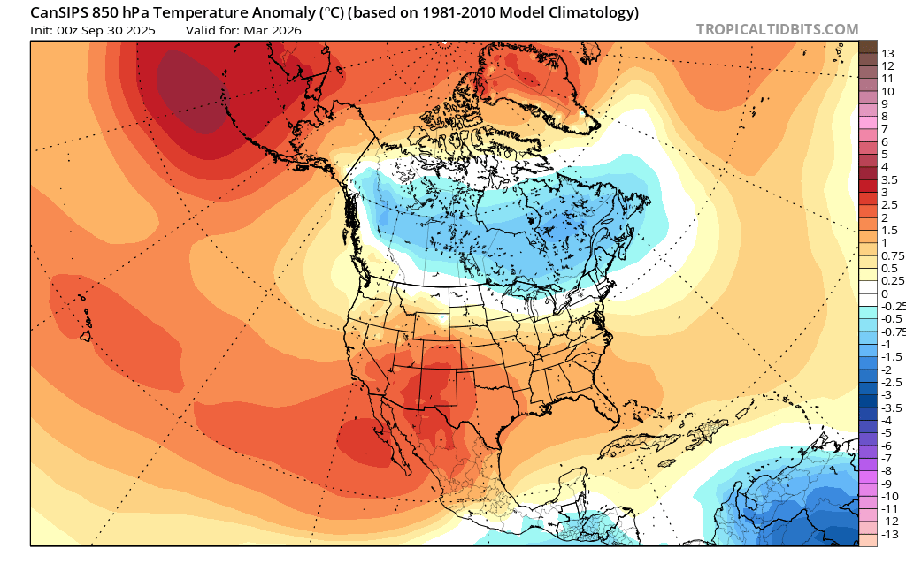
They use the last month as the year. So Dec-Jan 2001 would be 00-01. US Climate division data uses the year for the first month, and those monthly climate maps use the last month.
-
I don't necessarily expect the cold to show up as severely as it does on those maps. It probably will come in warmer by 1-3F in two of the three months in Jan-Mar, and then as severe as depicted in the other(s). Taken verbatim the weighting would make Jan-Feb as cold almost as both 2014 and 2025 nationally, which is pretty unlikely. I also don't expect the WPO to flood Canada/Alaska with warm air all winter. If models are right the PDO/ENSO should move toward their warmer cycles and you should see a corresponding change in the Northern Hemisphere patterns. The 100-180W heat content at the equator down to 300m got to -1.33 last in Jan 2025 but is trending warmer/weaker this year, so you should see an easier breakdown of whatever the dominant pattern is late winter when the ocean heat content warms rapidly. It went all the way to -0.06 by March 2025. If we top out at -0.8 to -1.0 this year, the flip to 'warmth' that coincides with the surface pattern ENSO flips should happen a lot faster. https://www.cpc.ncep.noaa.gov/products/analysis_monitoring/ocean/index/heat_content_index.txt
-
The way that plot is made, doesn’t Dec-Jan 2001 mean Dec 2001-Jan 2002??
-

Central PA Fall Discussions and Obs
canderson replied to ChescoWx's topic in Upstate New York/Pennsylvania
Drizzle is so light it’s just a trace so I wouldn’t worry about it not registering more -
Probably a bit less precipitation and wind in the valley with the shadowing affect. Overall, not expecting anything overly exciting around here. Probably 1-1.5 inches of rain and 30 mile per hour wind gusts


.png.afa3ba823ba68dc2d81c04893151851c.png)


