All Activity
- Past hour
-
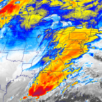
It’s moving in from the nw to se
-
DCA 98 so far
-
93/77 Hx 107 but it feels hotter out than the 100 degree days we had. Just nasty We are halfway through met summer. I will be happy to see September
-
maybe the mountains will help block the lower level stuff. Air Quality is bad in Philly/NYC but not purple-bad.
-
 Are those temperatures in the 60s behind this front dropping through central New England?
 -
Hmmmm... sounds like Saturday could be quite interesting... afternoon AFD from LWX on the threat @wxmeddler @Eskimo Joe @Kmlwx @high risk KEY MESSAGE 2...A strong cold front brings the threat of severe weather Saturday, possibly lingering into Sunday to the south. An unseasonably strong upper trough and embedded shortwave/jet streak will pivot near and north of the area Saturday. Strong height falls associated with this trough, coupled with high low-level moisture content and modest mid-level lapse rates will likely result in strong instability, perhaps even if cloud breaks are muted by early day precip. The strong deep layer flow will lead to effective shear magnitudes of 30-40 kts, helping to organize storms that develop in the vicinity of a pre-frontal surface trough in the wake of any morning activity. Low-level flow will be a bit weaker during the day, so although transient supercell structures are possible, the main risk should be damaging wind gusts and perhaps large hail as opposed to tornadoes. This could change if the effective warm front lingers overhead. Depending on storm coverage, temps could reach well into the 90s Saturday. With high humidity, heat indices may approach 100. Heading into Saturday evening, low-level flow increases again ahead of the approaching synoptic cold front associated with the aforementioned upper trough. This sends PWATs hurdling to over 2.2" and keeps CAPE elevated well into the evening. The expectation is for a strongly forced line of storms to develop in the unstable airmass from the eastern Great Lakes into the upper Ohio Valley (i.e. western NY/PA into OH/WV). This line of storms may be slow to weaken as it treks into the area from the northwest through the evening, especially if there is moderate to strong instability left (depends on earlier activity). The main threat at this point would appear to be gusty to damaging winds and heavy rain due to multiple rounds of storms. High instantaneous/sub-hourly rain rates would be plausible in this setup. If any discrete activity develops in the evening ahead of the line as the LLJ increases, there may be a risk for large hail as well as a couple tornadoes, particularly in areas for surface flow is backed (i.e. near/east of I-95 near any bay breeze boundaries, increasing SRH). Some guidance such as the NAM12/RRFS-A has the SigTor parameter in the 1-3 range Saturday evening in this environment. Activity should wane during the overnight hours Saturday as the front and associated convection drop south and the atmosphere gradually stabilizes. The front will probably end up near or south of I-64, with any remaining severe threat later on Sunday ending up near and south of the effective frontal boundary.
-
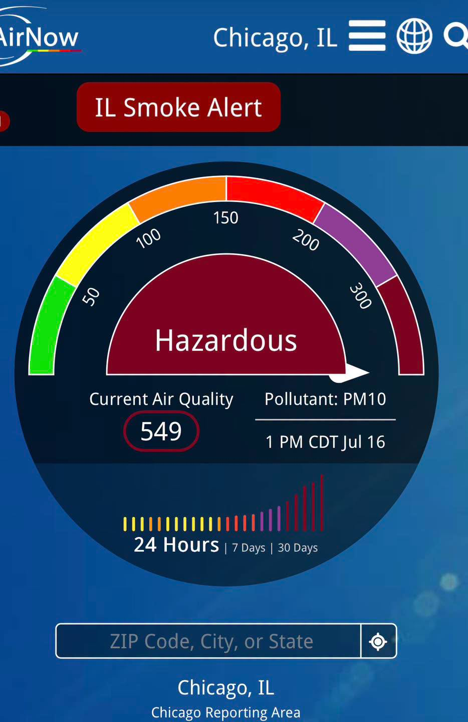
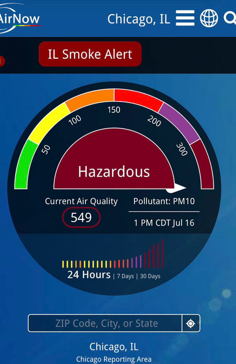
From Mike Caplan Chicago Meteorologist: This is incredible. AQI of 549 in downtown Chicago at 1pm
-

E PA/NJ/DE Summer 2026 Obs/Discussion
Birds~69 replied to PhiEaglesfan712's topic in Philadelphia Region
92F/DP 76F at 2:50pm. The high dew points are making me shit crazy... -
87/75/99
-
There is a 844 reading out in OHIO right now that is just ridiculous!
-
I haven’t seen it back off much from what I seen. And air qualities as worse than forecasted in parts of central Pa nw Pa right now.
-
There are 190 -218 readings near me now.
-
Good news is that the HRRR is being less aggressive on the smoke over the past several runs. Bad news is that it is undershooting the visibility reduction in the Great Lakes right now. Much of WI and MI have 1 mile or less visibility.
-
After 2 runs forming a TS from this, the last 2 runs dropped that and instead both develop something well out in the Atlantic subtropics: 0Z 7/16/26 UKMET NEW TROPICAL CYCLONE FORECAST TO DEVELOP AFTER 156 HOURS FORECAST POSITION AT T+156 : 27.9N 63.9W LEAD CENTRAL MAXIMUM WIND VERIFYING TIME TIME POSITION PRESSURE (MB) SPEED (KNOTS) -------------- ---- -------- ------------- ------------- 1200UTC 22.07.2026 156 27.9N 63.9W 1014 29 0000UTC 23.07.2026 168 30.6N 66.2W 1013 31 —————————— 12Z 7/16/26 UKMET NEW TROPICAL CYCLONE FORECAST TO DEVELOP AFTER 150 HOURS FORECAST POSITION AT T+150 : 28.4N 62.9W LEAD CENTRAL MAXIMUM WIND VERIFYING TIME TIME POSITION PRESSURE (MB) SPEED (KNOTS) -------------- ---- -------- ------------- ------------- 0000UTC 23.07.2026 156 29.1N 63.9W 1014 30 1200UTC 23.07.2026 168 32.3N 65.2W 1014 31
-
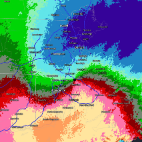 Helpful--TY! Was wondering if it would hold out until this evening to get the lawn mowed. Probably not, if that model verifies.
 -
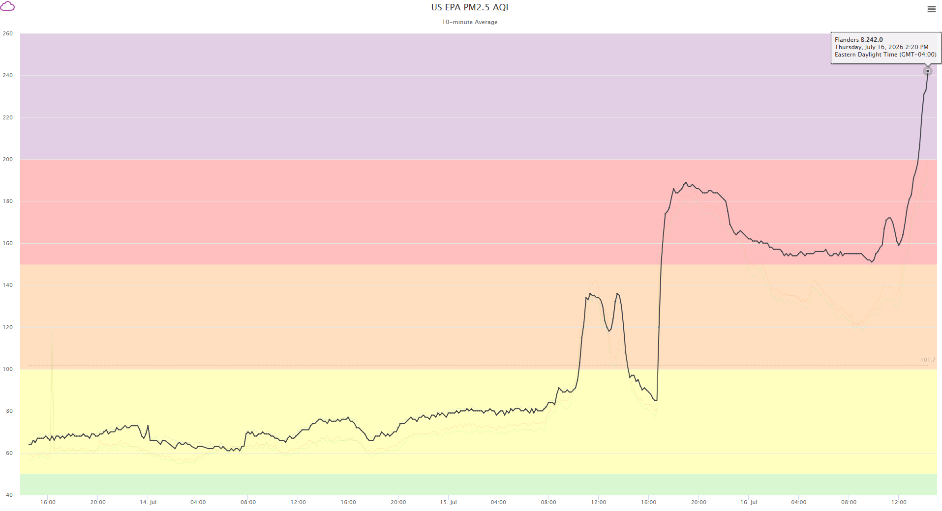
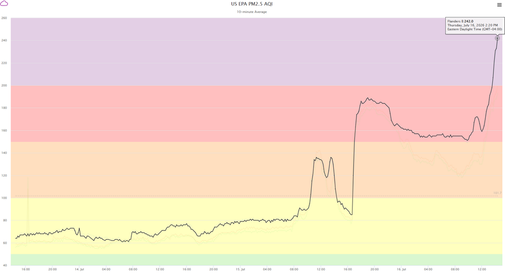
PurpleAir has a nice map that updates every 10 minutes or so: https://map.purpleair.com/air-quality-standards-us-epa-aqi?opt=%2F1%2Flp%2Fa10%2Fp604800%2FcC0#9.74/40.8063/-74.416 Getting heavier for sure.. This is for a sensor near Dover.
-
Naaaa.. he's not one of us lol. I'm super ready! It's great watching these heat domes turing the lakes into batch water. Man.. those first cold shots in late November are going to produce epic rates. As a rate chaser I approve.
-
Starting to permeate my office in Oakland NJ. Noticing more co-workers clearing their throats as the day goes on.
-
Perhaps he would also enjoy a winter trip to the NY Snowbelt?
-

Central PA Summer 2026 Discussion/Obs Thread
mahantango#1 replied to Voyager's topic in Upstate New York/Pennsylvania
Within the last half hour the thicker smoke showed up here, and you can smell it. -
 The sun just feels incredible after yesterday’s shit show. Haven’t seen smoke that thick and noxious in a long time. Back to summah for now!
 -
 Has a 40% penumbra look out there For areas east of Worcester, 17z HRRR has the worst ~21-23z, plume sweeping southward from NH
 -
 Right on cue the smell of smoke has returned to methuen. Not as strong as yesterday but still noticeable.
 -
Smoke is getting heavier . My eyes are starting to hurt here in Brooklyn.
-
Have a feeling air going to get nasty around here tonight into tomorrow. Areas in PA going into very unhealthy to hazardous air quality which they only had it getting to code red. Pittsburgh already into very unhealthy levels.