All Activity
- Past hour
-
Looking ahead: CIPS is suggesting some severe threat starting up by the 156hr timeframe and extending into the longer range as well. There's an especially strong signal for 168hr long range panel from the 0z images.
-

E PA/NJ/DE Spring 2025 Obs/Discussion
RedSky replied to PhiEaglesfan712's topic in Philadelphia Region
Heavy rain- 13" within reach -
May 2025 was an up and down month at DCA, with May 1-19 recording a relatively warm 69.7 degrees, but May 20-31 recording a decidedly cool 62.7 degrees. The net result was an average May 2025 temperature of 67.0 degrees, which was 0.2 below the 1991-2020 normal and only the 46th warmest in DC history. That resulted in a January-May 2025 DCA temperature of 51.7 degrees, well behind last year's first five months (53.2) and even further behind the record high first five months established in 2012 (54.4). The bigger story of May 2025 at DCA was the drought-busting precipitation of 7.73 inches, 9th highest May total in DC history and the highest monthly total at DCA since August 2021 (9.07).
-
@powderfreak has experience. What’s the estimate on this?

-
4.76" for the day. 12.86 for the month. We need a good 2 week dry streak
-
I had almost .80 this afternoon of mainly upslope
-
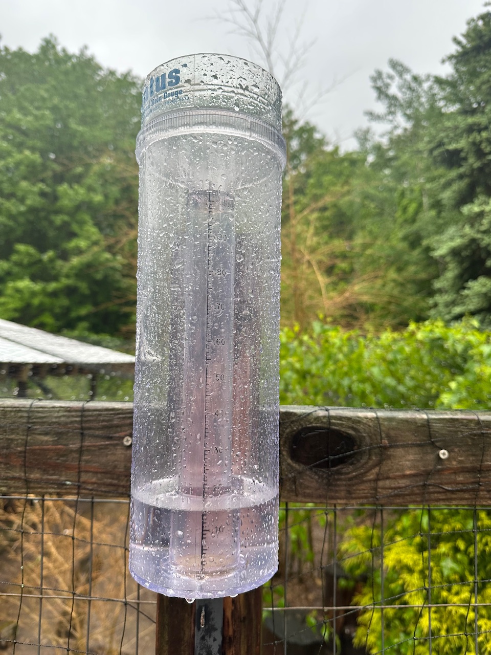
Haven’t seen the water out back like this in awhile. Complete river. Stratus looks like 2-2.5” but hard to tell until I measure and add the samples.
-
Mostly dry day here, everything's dried out from the earlier sprinkles/light showers
-
Pool is open and ready for warmer temps!
-
Dew points in the low 40s as June comes in is the good life
-
Any snow with it?
-

E PA/NJ/DE Spring 2025 Obs/Discussion
PhiEaglesfan712 replied to PhiEaglesfan712's topic in Philadelphia Region
We got this cold in June just 2 years ago, right around the summer solstice. -
3 rounds of rain this afternoon. 0.35”
-
-
Blowing 40 for the last 2 hours here.
-
1.15” here since midnight. 53.8F
-
It is a popular landfall location now.
-
That is an interesting radar into your area. Does appear to be low level generated and stationary wave like.
-
18z GFS has a major cane in the Gulf
-
Upslope rain here relentless. Can’t get this in winter but upslope for 6 hours on last day of Mayorch
-
 DCA: +0.8 NYC: +1.2 BOS: +1.4 ORD: +0.4 ATL: +0.8 IAH: + 0.5 DEN: -0.4 PHX: +0.4 SEA: +0.9
 -
I will say it again, and again..I had enough of this wind. And it's almost June.
-
impressive radar
-
It’s 62 out with 35 mph winds. That’s not a great day for a bbq
-
I really hate to be a Debbie Downer, but... Thursday A chance of showers after 2pm. Partly sunny, with a high near 87. Chance of precipitation is 30%. Thursday Night A chance of showers. Mostly cloudy, with a low around 67. Chance of precipitation is 30%. Friday Showers likely. Mostly cloudy, with a high near 82. Chance of precipitation is 60%. Friday Night Showers likely. Mostly cloudy, with a low around 63. Chance of precipitation is 60%. Saturday A chance of showers. Mostly cloudy, with a high near 77. Chance of precipitation is 50%.