All Activity
- Past hour
-
 sildenafil online: MedMenNews - Viagra Tablet price
 -
 I can’t believe you took your brain over your inner weenie.
 -
.thumb.gif.f92b16c631a1d15d405ed77b33f0710d.gif)
Dewgust 2026: Summer's Last Stand
Torch Tiger replied to Prismshine Productions's topic in New England
they're in desperation mode Ya love to see it -
Well.... my sunny early morning has gone partly to mostly cloudy?? The forecast is 100% sun today. Glancing at satellite you can see the clouds filling in over the area from WV. I'll blame the NW flow.
-
Waning
-

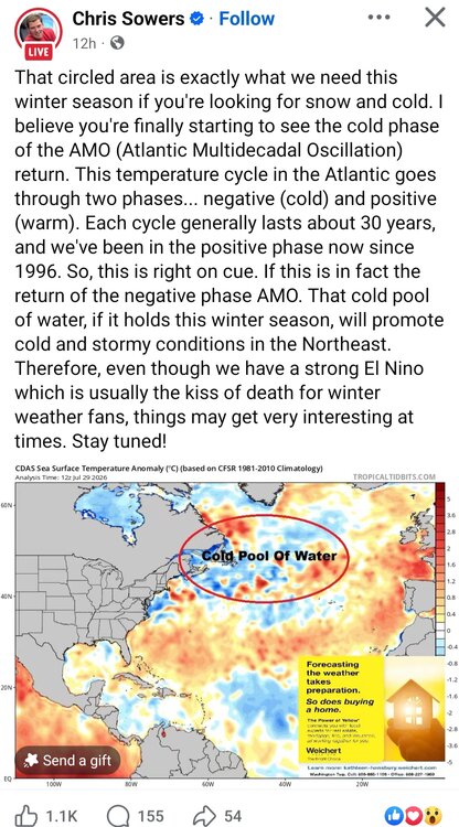
2026-2027 Super El Nino
MJO812 replied to Stormchaserchuck1's topic in Weather Forecasting and Discussion
-
 This.is true.. when I saw the springfield tornado I could of got closer.. my heart was like do it.. but my brain was saying your close enough and try to live another day to see another one
 -
 No-I equate them with American Steakhouse type joints...average food at best-there's enough decent places around here so no need to visit those kinds of restaurants
 -
Close to 5 so far... hoping for more today
-

2026-2027 Super El Nino
GaWx replied to Stormchaserchuck1's topic in Weather Forecasting and Discussion
Darwin has had 21 straight days of 1015+ mb pressure. Based on records back to to 1991, that’s a new record long string breaking the old record of 20 days set in Aug of 2015. -
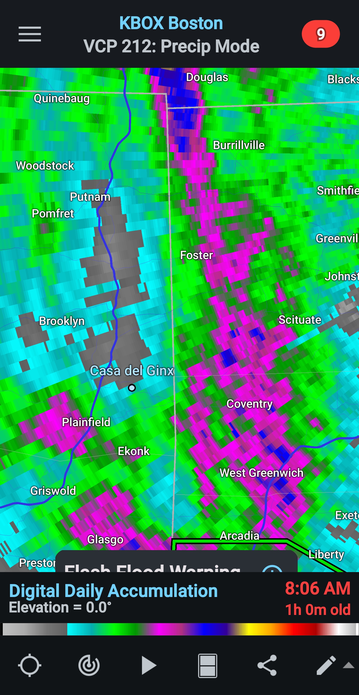
4.00" event total. .59" since midnight and 12.29" for the year. Mosquitoes are very happy. Can't go anywhere near the edge of the woods or you'll perish
-
 Some years back my sister-in-law gave us a gift card for Red Lobster. Unfortunately, the 3-4 RLs in Maine had closed - couldn't compete with the locals. We had to go to northern Mass to use the card; combined it with a Bible conference in Concord, NH so didn't need a special trip. GYX overnight forecast (<0.1") was on target (sadly) - 0.07". Radar isn't very promising, either. NNJ where I grew up got pounded, 3-7". We'd lived in the hills, avoiding flood damage, but the Pompton/Passaic river system flooded frequently. Unfortunately, the Passaic took the lives of two 10-year-olds yesterday.
 -
 Just saw some 2.5-3 inch rates on my wunderground station at my sisters place on Pt Judith. https://www.wunderground.com/dashboard/pws/KRINARRA66
 -

Central PA Summer 2026 Discussion/Obs Thread
Blizzard of 93 replied to Voyager's topic in Upstate New York/Pennsylvania
My family & I are leaving on a cruise out of Philly. We get a couple of days in Bermuda & a day in Halifax, Nova Scotia. I’ll be back late next week! -
My brother-in-law had a firewood business for years, I used to get 4 cords fort $600. He retired a couple years ago so lost the deal.
-
 Not sad to be slotted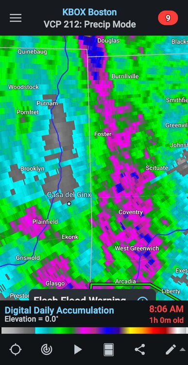
-
i don't disagree with the need for the warning, just saying that particular warning did not result in a touchdown. The rotation went over my house and was definitely visually there.
-
Shortly after moving to Maine in 1973, I read that more than half the world's people used wood as a heat source, and I thought that to be sort of quaint. At our NNJ home in NNJ, we had a fireplace, but it was more for atmosphere than heat. We moved from a Fort Kent apartment to our first house (tiny 2-story) in mid-May 1977 and couldn't wait to add a woodstove. I'd installed a Jotul 602 the day before the move. We've run woodstoves as a major heat source ever since - no chimney fires (yet).
-
Records: Highs: EWR: 101 (1949) NYC: 98 (1988) LGA: 99 (1988) JFK: 96 (2002) Lows: EWR: 57 (1946) NYC: 57 (1956) LGA: 61 (1956) JFK: 59 (1968) Historical: 1906: Fresno, CA recorded their 28th 100 degree or higher day for the month setting a record for the most triple digit high temperatures ever in July. This record was tied in July 1931. (Ref. Wilson Wx. History) 1913: Violent thunderstorms hit the Washington, DC area with 55 mph winds and 1.21 inches of rain in 10 minutes and 1.51 inches in 15 minutes. (Ref. Washington Weather Records - KDCA) 1913: Offshore winds negate the cooling effect of Lake Michigan as Muskegon hits 99° for its all-time record high temperature. Temperatures are actually a bit lower inland as Grand Rapids was 96° and Lansing 92°. Bloomington, IN soared to a record high of 108°. (Ref. Wilson Wx. History) 1923: The greatest daily precipitation to occur in the month of July in Richmond, Virginia was 7.24 inches. (Ref. Richmond Weather Records - KRIC) 1949 - The state record for Connecticut was established when the town of Greenville registered an afternoon high of 102 degrees. (The Weather Channel) 1955: Bakersfield, CA managed an afternoon high of only 67°, their lowest maximum temperature on record for July and the low of 45 °F is the record coldest low minimum for July at that location. This is also the only time the temperature has dropped below 50 °F in July at Bakersfield. (Ref. Wilson Wx. History) 1965 - The temperature at Portland, OR, reached 107 degrees to equal their all-time record high. (The Weather Channel) 1970: Hurricane Celia was born in the northwest of the Caribbean Sea on this day. The hurricane would be one of the worst ever to hit Texas and would reach Texas late on August 3. The storm reached its peak as it made landfall near Corpus Christi, Texas, as a strong Category 3 hurricane. Hurricane Celia is currently the last major hurricane to make landfall on the middle Texas Coast until Hurricane Harvey in 2017. 1978: Tropical Storm Amelia moved inland on the Texas coast north of Brownsville, TX and moved northward into Texas. The storm would not be known for damage along the coast, but rather for extensive flooding that it caused in the Texas Hill Country and in the Big Bend Area near Abilene, TX. (Ref. Wilson Wx. History) 1979 - A forty-minute hailstorm bombed Fort Collins, CO, with baseball to softball size hail. Two thousand homes and 2500 automobiles were damaged, and about 25 persons were injured, mainly when hit on the head by the huge stones. A three month old baby died later of injuries. (The Weather Channel) 1982: 4.22 inches of rain fell in Amarillo, TX setting a 24-hour July record. (Ref. Wilson Wx. History) 1987 - Afternoon highs of 105 degrees at Aberdeen SD, 102 degrees at Bismarck, ND, and 102 degrees at Pueblo, CO, were records for the date. Pueblo, CO, reported just .09 inch of rain for the first thirty days of the month. (The National Weather Summary) 1988 - A dozen cities in the north central and northeastern U.S. reported record high temperatures for the date. Downtown Baltimore, MD, hit 103 degrees, marking a record eight days of 100 degree heat for the month, and ten for the year. The high of 101 degrees at Billings, MT, marked a record seventeen days of 100 degree heat for the year. Thunderstorms produced severe weather in the northeast, with nearly fifty reports of large hail or damaging winds in Pennsylvania and New York State. A tree fell on a car at Erie, PA, injuring four persons. (The National Weather Summary) (Storm Data) 1989 - Morning thunderstorms over central Missouri deluged Columbia with 5.98 inches of rain causing flash flooding. Daytime thunderstorms in Kentucky drenched Paducah with 1.73 inches of rain in less than half an hour. Evening thunderstorms in the north central U.S. produced wind gusts to 78 mph east of Moccasin, MT. (The National Weather Summary) (Storm Data) 1999: An intense heat wave began across the Midwest on the 28th and continued through the 31st. The heat peaked on this date with high temperatures in the Chicago area over 100 with heat indexes between 115 °F and 120 °F. Early morning, Chicago set their all-time highest dew point reading of 82 °F at Midway Airport. There were a total of 99 fatalities with the majority in Cook County. The overnight low of 77 °F at Rockford, IL set a record high minimum. (Ref. WxDoctor) 2000: Virginia Beach, VA a 39-year-old man was killed while doing yard work under a tree. (Ref. Lightning - Virginia Weather History) 2005: The temperature hit 101° at Denver, CO setting a new record high for the date. This was also the 7th day of the month with a high temperature of 100 or higher, which set a new record for the most 100 degree days in a month, for a season and in a year.(Ref. Wilson Wx. History) 2008: Heavy rains from the remnants of Hurricane Dolly drench section of Missouri. Total rainfall amounts included 3.05 inches at Lees Summit; 2.78 inches at Kansas City; MO and 1.63 inches at St. Louis, MO. (Ref. Wilson Wx. History) 2016: A massive rainfall caused a devastating flash flood in Ellicott City, Md., a 1-in-1,000-year event that has been happening with unprecedented frequency since 2010, meteorologists said. The storm, killed two people, dumped 6.5 inches of rain on Ellicott City in only about 3 hours, with 5.5 inches falling in just 90 minute. One nearby spot recorded 8.22 inches, amounts that weather service meteorologist Greg Carbin called 'off the charts...' A 1-in-1,000-year rain event is a statistical way of expressing the probability of such a massive rainfall occurring in any given year in a given location, according to the NCEI. In other words, it had a 1 in 1,000 chance of occurring in Ellicott City ," (Ref. The Washington Post, Capital Weather Gang, NWS and NCEI)
-
70 / 64 cloudy - cut off spinning around with clouds over most of the area and some scattered showers. Break and stretches of sunshine later this afternoon but these cut offs are stubborn to clear out. Hoping we're partly sunny Friday and Saturday before clouds/showers return Sunday but even Saturday could see clouds for a good part of the day. Overall warmer to hot at times 8/4 - beyond - Humid flow also supports continued rain chances pending on your liking thats fortunate or unfortunate.
-
 lol
lol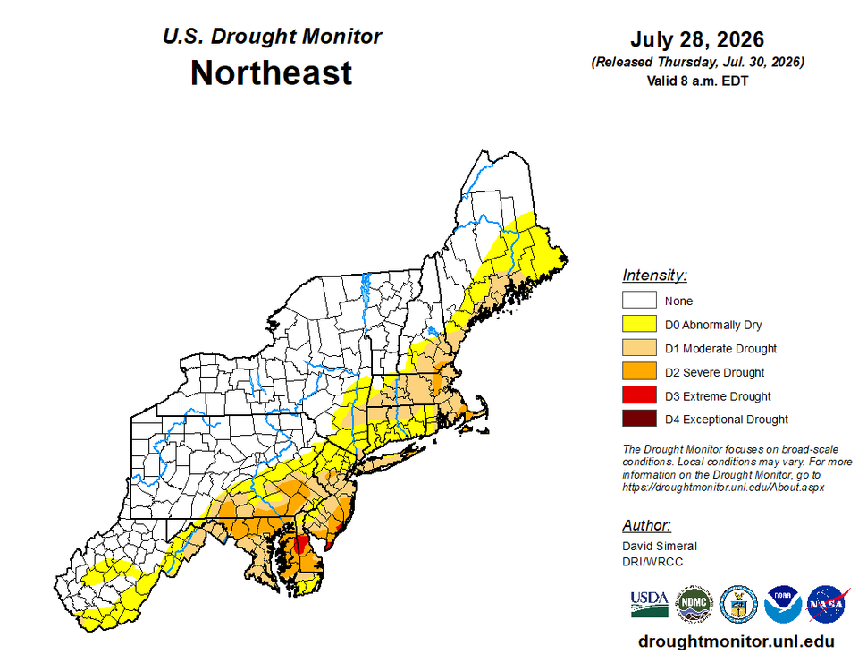
-
2026-2027 Super El Nino
GaWx replied to Stormchaserchuck1's topic in Weather Forecasting and Discussion
The hot summer of 1991 was an exception. -

super el nino banter thread
LakePaste25 replied to forkyfork's topic in Weather Forecasting and Discussion
Hope so, if it’s not going to snow then i want BBQ and shorts weather for the holiday -
But the potential was there based on radar, so the warning is going out at that point, as it should.
-
Perfect-track, mild Nor'easters followed by cold shots after the storms pull away. I guess.