All Activity
- Past hour
-
So many warm and sunny days. Stein snuck in though . Hopefully not a sign of a Stein summer
-
Well I have to eat my words - a very quick .23" last night.
-
We had a lot of excellent days.
-

Central PA Spring 2026 Discussion/Obs Thread
pawatch replied to Voyager's topic in Upstate New York/Pennsylvania
.43 “ picked up from the overnight rain. Picked up 02” today from the drizzle. Not a great day today. -
Maybe Saturday; Sunday could turn out alright.
-
At least it's going to be cool. Should be a strong CAD Saturday.
-
.28" so far
-
In Maine we call those tiny screen-penetrators mingies. In local French it's 'bruleau' - 'burning'. One rarely feels single bites, but hundreds of teeny-tiny attacks earn that description.
-
F**K!!
-
Idk yall, I may be out on this one. The HP to the north just doesn’t seem strong enough. It screams 5:1 ratio slop fest that melts on contact.
-
We're due to dry out. Shame it comes at the peak of tornado season. Still plenty of hope for derecho season. #teamderecho
-
Fantastic Napril

- Today
-

Central PA Spring 2026 Discussion/Obs Thread
mahantango#1 replied to Voyager's topic in Upstate New York/Pennsylvania
Yes right now @3:25pm this weather plainly sucks. -
12Z EPS and Euro AIFS love to hang some cooler wx through mid month. They'll be milder days for sure...but kind of an overall cooler regime.
-
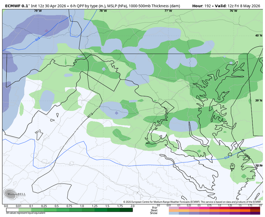
WB 12Z EURO: snow only 8 days away...
-
Looks like a coastal but it's a close call
-
It's here! Severe season!!!
-
-
Well today's been grand for the Orioles.
-

2026-2027 Strong El Nino
snowman19 replied to Stormchaserchuck1's topic in Weather Forecasting and Discussion
I actually think it ends up as a top 3 super El Niño. IMO it peaks at over +2.5C (ONI and RONI) in the November/December time frame. I also believe it’s going to be an east-based/East Pacific event -
Really feels like it doesn't it? I just know its really dry and breeze today in WNC and I have a hard time believing it will rain much with this strong NW flow.
-
Based
-
I feel like persistent 40's are close to being done with. 50's/60s are next on the ladder for immediate coast.
-
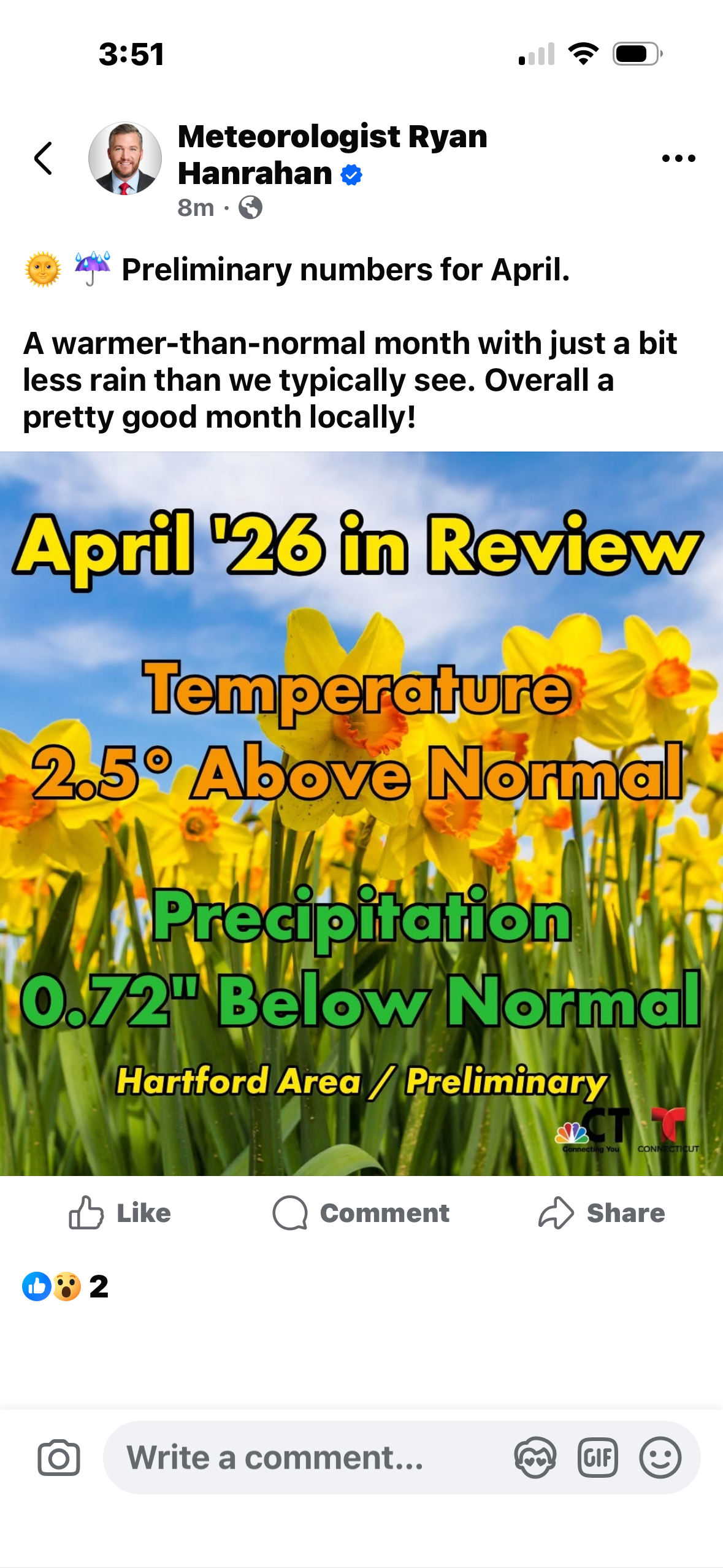
Columbia imby: 4/29 received 0.47” and 2.10” for April
-
Lol, are we sure it's not January? A model battle between GFS CMC ICON vs Euro, UKMET, RGEM, north trend south trend disagreement, low tracking of the coast of Florida? But what about sun angle?


.thumb.gif.f92b16c631a1d15d405ed77b33f0710d.gif)


