All Activity
- Past hour
-

February 2026 OBS & Discussion
donsutherland1 replied to Stormlover74's topic in New York City Metro
The longest stretch of subfreezing days since 2017-18 ended today. The ECMWF weeklies show a distinct milder period of 1-2 weeks duration. Social media is suddenly abuzz about the warmth it has noticed. Still, there's no need to despair. Winter 2025-2026 has already delivered some genuinely great moments. Although those moments might be in the past, they cannot be erased by the forecast moderation that lies ahead beginning around February 10th. Some highlights: New York City experienced its coldest December-January period since 2014-2015. New York City saw an 11.4" snowfall with many areas outside the City picking up 12"-18". New York City has seen two highs in the teens and two lows in the single digits. Outside the City, numerous locations have experienced subzero lows. Ice and ice floes have reappeared in the Hudson River for the first time in years. In a wider perspective, parts of the Great Lakes Region saw a record November daily snowfall, Toronto experienced its biggest snowstorm on record, and parts of Georgia, South Carolina, and North Carolina enjoyed a generational snowstorm. Nothing is cast in stone. Model skill beyond two weeks is low. Forecast patterns can change. Sometimes abruptly. IMO, rather than riding an emotional roller-coaster with each turn of the models or allowing the most negative outcomes to drive winter's wonderful moments from memory, it's better to appreciate what we've already experienced and stay patient about what lies ahead. Spring will come. It always does. But Winter 2025-2026 may still bring additional cold and snowfall, even if the models cannot currently see the cold and snow at the long lead times involved. -
RGEM is killing it this year.
-

Winter 2025-26 Medium/Long Range Discussion
McHenrySnow replied to michsnowfreak's topic in Lakes/Ohio Valley
Light at the end of the tunnel? Are you fucking kidding me? -
Yeah it's great to see that we could get accumulating snow even with the less amplified solutions knowing that a more amplified look would increase rates and crash temps even faster. That is, if the trough can stay sufficiently far south
-
That's the 18z NAM.
-

Central PA Winter 25/26 Discussion and Obs
canderson replied to MAG5035's topic in Upstate New York/Pennsylvania
Was saying this to a coworker today. If we get a big rain event we’re in for trouble. -

Jan 30th-February 1st 2026 Arctic Blast/ULL Snow OBS Thread.
Jed33 replied to John1122's topic in Tennessee Valley
Clouds kept the lid on the temps today. It was a pretty big bust on temps all around from morning lows to afternoon highs. Looks like it made it to 28 here but back down to 26 now. -
GFS also improved at 500. Much more expansive precip
-
18z GFS increases a little more from 12z.
-
It's kind of impressive how the Euro OP manages to engineer a way to avoid snow for the next 15 days. Barely a dusting in 2+ weeks. And it has support from the other globals and ensembles. In November, sure... but early Feb?!
-

February 2026 Medium/ Long Range Discussion: Buckle Up!
dallen7908 replied to Weather Will's topic in Mid Atlantic
Warmer as in multiple days in the 50s - may or may not make it to 60. -

January 30th- Feb 1st ULL and coastal storm obs
StantonParkHoya replied to JoshM's topic in Southeastern States
Ever? No . -
Jan 30th-February 1st 2026 Arctic Blast/ULL Snow OBS Thread.
Jed33 replied to John1122's topic in Tennessee Valley
Powell posted it in banter. -

February 2026 Medium/ Long Range Discussion: Buckle Up!
psuhoffman replied to Weather Will's topic in Mid Atlantic
Where the warmest anomalies are changes exactly how the pattern sets up. A more west based Nino places the tropical forcing closer to the dateline which is where we want it. That tends to correlate with a trough southwest of Alaska...the downstream impacts of which are good for us. An east based nino shifts the whole pattern further east and often we see the north pacific trough end up too close to the Pacific NW which floods the CONUS with pac puke. We need that to be pulled back some. -
3" ?? I just looked on a map of Sebago for the location of Great Bay. Now I understand. Crazy how infrequently Sebago now freezes.
-

February 2026 Medium/ Long Range Discussion: Buckle Up!
JenkinsJinkies replied to Weather Will's topic in Mid Atlantic
Warmer as in closer to average after exiting the arctic or warmer as in our first 60 since December? -

E PA/NJ/DE Winter 2025-26 Obs/Discussion
jimmosk replied to LVblizzard's topic in Philadelphia Region
I am somewhat stunned to discover that, if the temperature goes up high enough, snow will actually turn into a liquid. -
Had a high temp of 37 here today. It was nice to be able to go for a run outside this afternoon. Last week I used the exercise bike in the house all week because I don't like running in frigid weather. It felt pretty good out there today.
-

Winter 2025-26 Medium/Long Range Discussion
Powerball replied to michsnowfreak's topic in Lakes/Ohio Valley
A lot of these PV Stretch / SSW events have been happening well into Met Spring as of late though, so the cold anomalies do end up eventually happening, but relative to average and thus haven't been all that cold. -
38.6° for the high
-
Friday afternoon into Saturday....the 12z Euro continues to advertise a NW flow event. The RGEM at 18z definitely looks snowier...see John's post immediately above this. Is that the 18z RGEM?
-
I agree with this.
-

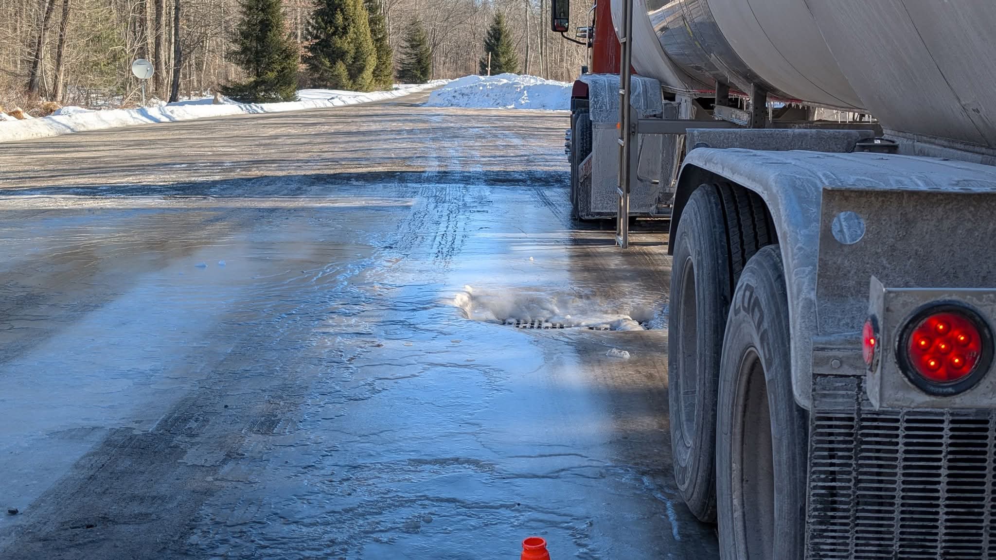
Central PA Winter 25/26 Discussion and Obs
Voyager replied to MAG5035's topic in Upstate New York/Pennsylvania
So this is my work environment. Unfortunately, ice that thick isn't going anywhere anytime soon...
-

February 2026 Medium/ Long Range Discussion: Buckle Up!
stormtracker replied to Weather Will's topic in Mid Atlantic
No turning back. Fuck it. -

Feb 4-5 significant SE snow threat
WinstonSalemArlington replied to GaWx's topic in Southeastern States

.thumb.jpg.9707d4addca3d84715ae3d888c5c10d6.jpg)