.jpg.949052775cf13715749e9bd3740a4bd3.jpg)
Bigbald
-
Posts
253 -
Joined
-
Last visited
About Bigbald

-
Last night's 0z Euro Ai run was very similiar to Cmc today, I was pretty disappointed to look at the 6z this a.m.
-
RGEM is killing it this year.
-
.thumb.jpg.9707d4addca3d84715ae3d888c5c10d6.jpg)
Jan 30th-February 1st 2026 Arctic Blast/ULL Snow OBS Thread.
Bigbald replied to John1122's topic in Tennessee Valley
It is pretty cool to think the whole synoptic of the storm will show itself in the next 2 hrs, or at least from our perspective. Kind of wild! -
Jan 30th-February 1st 2026 Arctic Blast/ULL Snow OBS Thread.
Bigbald replied to John1122's topic in Tennessee Valley
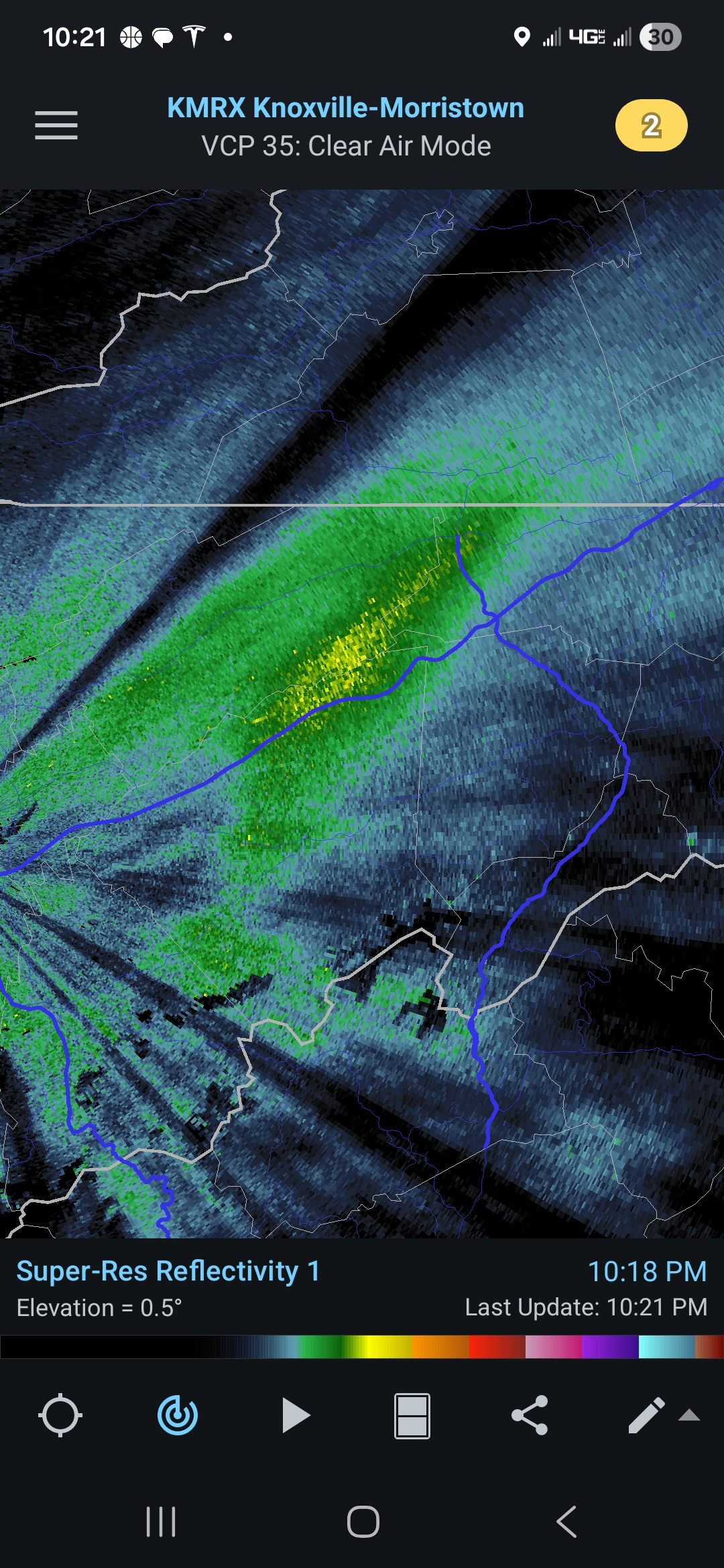
I have noticed Falls Branch to Baileyton has had some impressive radar returns since I left work.
-
Jan 30th-February 1st 2026 Arctic Blast/ULL Snow OBS Thread.
Bigbald replied to John1122's topic in Tennessee Valley
I like the Nam 12k 0z although its alot more robust than the 3k and longer range nam. It doesnt end the snow in the higher northwest favored mountains in swva and east tn until late Sunday, with this kind of cold air I got to believe thats going to be an accurate wringing of every last drop of moisture. Oz rgem similiar too. -
Jan 30th-February 1st 2026 Arctic Blast/ULL Snow OBS Thread.
Bigbald replied to John1122's topic in Tennessee Valley
I got in that as well. Some monster rates and looked really bad down from it on i 81 (should read Bays mtn) -
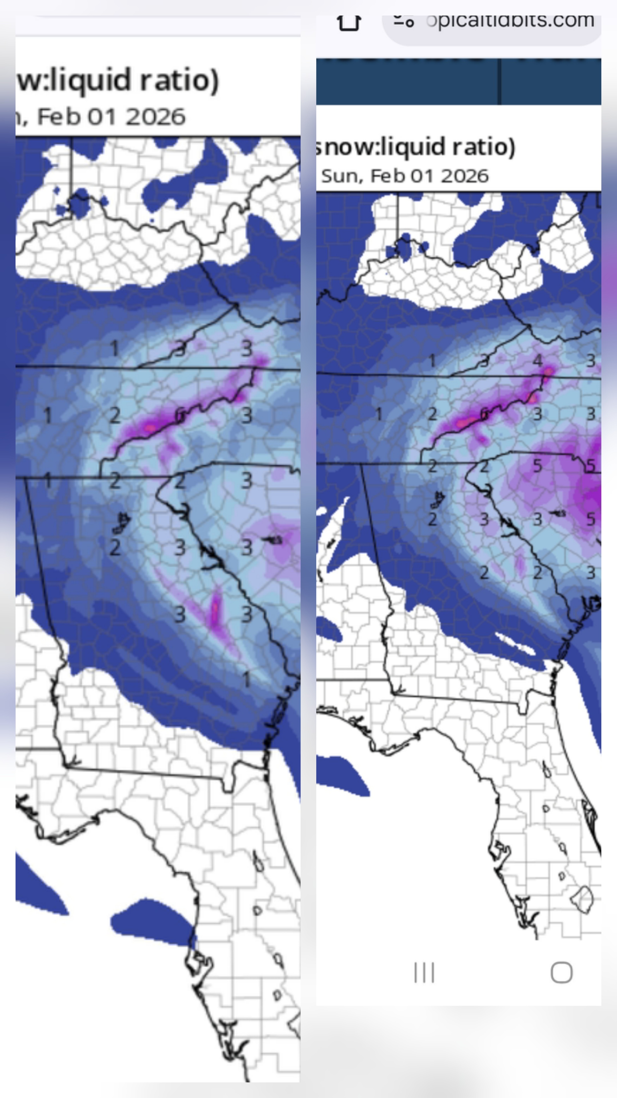
Taken from Mtn thread southeast, 18z euro
- 782 replies
-
- 1
-

-
- extreme cold
- snow
- (and 1 more)
-
- 782 replies
-
- 4
-
-

-
- extreme cold
- snow
- (and 1 more)
-
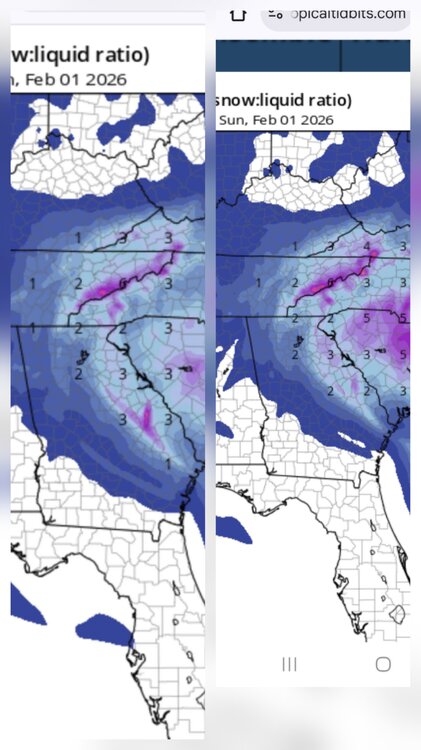
Looks considerably beefier east 18z on readers right 12z on left
- 782 replies
-
- 4
-
-
- extreme cold
- snow
- (and 1 more)
-
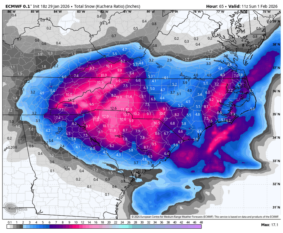
How did the rrfsa perform last storm? Its truely an outlier on right now on precip amounts.
-
- 782 replies
-
- 3
-

-
- extreme cold
- snow
- (and 1 more)
-
Incredible, thanks!
- 782 replies
-
- 1
-
-
- extreme cold
- snow
- (and 1 more)
-
Anyway to post a map?
-
Should be money for the slopes. Id have to believe Beech and Sugar get at least a foot of powder. I am thinking of heading up there Saturday morning, hoping that the long duration powdery snow makes it a pretty managable drive for 4wd/ awd.
- 782 replies
-
- 3
-
-
-
- extreme cold
- snow
- (and 1 more)
-
This is looking like a State of Franklin special. I am surprised MRX hasnt expanded the watch west, 6z and 12z are beefing up throughout.
- 782 replies
-
- 3
-
-
- extreme cold
- snow
- (and 1 more)