All Activity
- Past hour
-
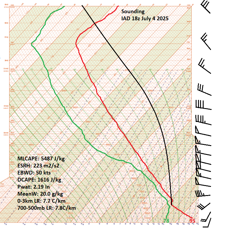
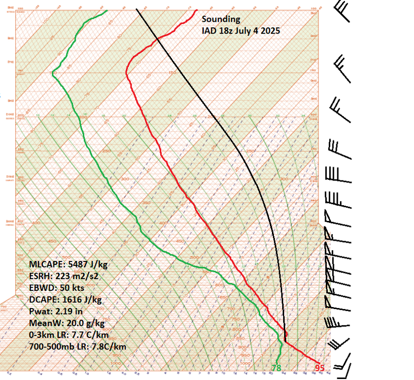
Baby Yoda: I mean it's no surprise when you see the kind of CAPE and shear that the 18z special sounding showed. Also from the latest meso discussion from SPC: "... A well-established cold pool and rear-inflow jet have accelerated the forward speed of the MCS to over 60kts. The extreme instability and moist airmass coupled with the large downdraft CAPE values will further increase the wind threat with corridors of 100+ mph wind gusts associated with embedded microbursts/macrobursts..." SnowingOverThere: Yeah. I better pack it up now. The tornado is probably embedded in that wall of rain that's protruding ahead of the main rain curtain. The greenage is unreal.

-
My Ob is that this Spring sucks. I am done with the cold and wet. DONE.
-
Not that the starters were hitting but my god everyone is injured. Entire outfield and half the infield.
-
Beautiful day today here. Fresh northerly breeze, minimal wildfire smoke, amd now going into the low 40s to welcome met summer.
-

Central PA Spring 2025
Mount Joy Snowman replied to canderson's topic in Upstate New York/Pennsylvania
Wind was insane tonight. Downright chilly. -
See answers above
-
.7” today and 6.07” for the month. Plenty, thank you. Ready for some warm dry weather.
-
For the city and on Long Island I'm seeing mostly mid-upper 80s Thursday & Friday. I do not think Central Park will notch its first 90 this week but they could get close on one of the days. I still think 84-88 degree high temperatures are more likely. Next weekend once again looks active and showery even though we may still be in the warm air. The shower activity along with local afternoon onshore winds should help keep Central Park and LI below 90. WX/PT
-
With the wind blowing, this evening felt colder than a lot of Winter days lately.
- Today
-
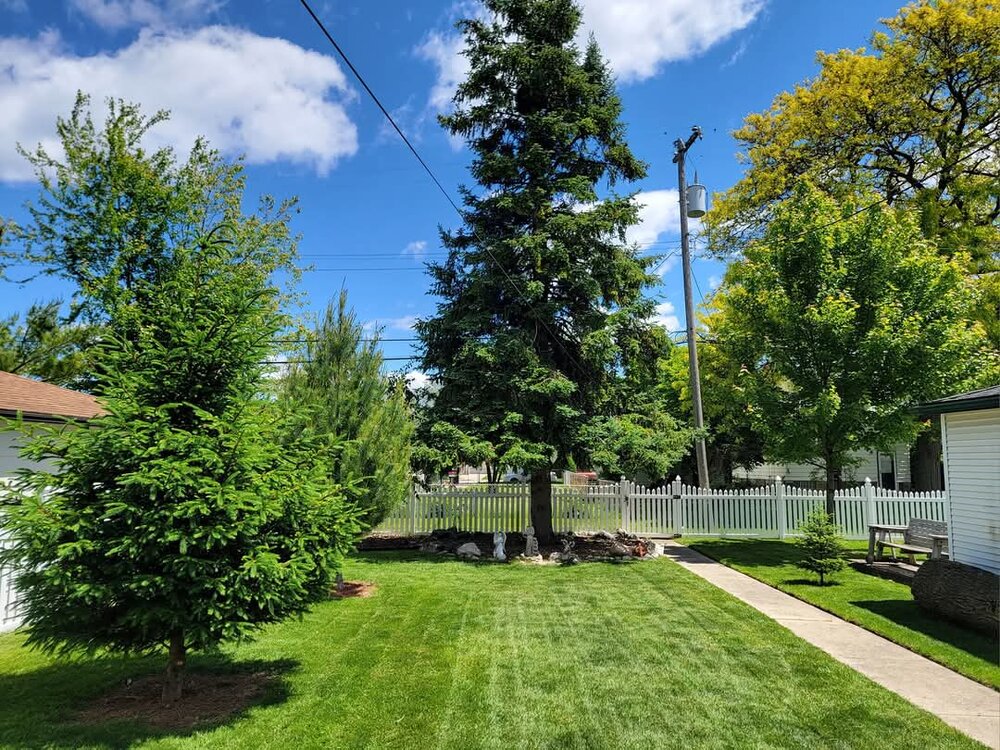
Didn't get any rain today since the overnight. 1.26" event total and a wrap for Miraculous May. The wettest month I have ever seen. It looks like Ireland around here on the first day of Summer; a stark difference from the past several years.
-
It's been there last 2 days.
-
0.13" today for a workman like 1.28" for the week and a workman-like 4.37" for the month. Got rain on 5 of 7 says this week but mostly just crumbs. 5/27 0.86" 5/28 0.02" 5/29 0.06" 5/30 0.21" 5/31 0.13"
-
On a scale of 1 to 10. Tonight is an 11.
-
-
Wth is blowing toward lava and dryslot?
-
Looking like it could be a very smoky June on tap.
-
Rain band has been nearly stationary for hours. Temp down to 50. Today really went downhill in the afternoon.
-
0.43” from today’s storm, 0.88” 3 day total here. Unfortunately lost my monthly data with station change out and being out of town.
-
I’m at 50 now, supposed to drop to 45. Windows wide open.
-
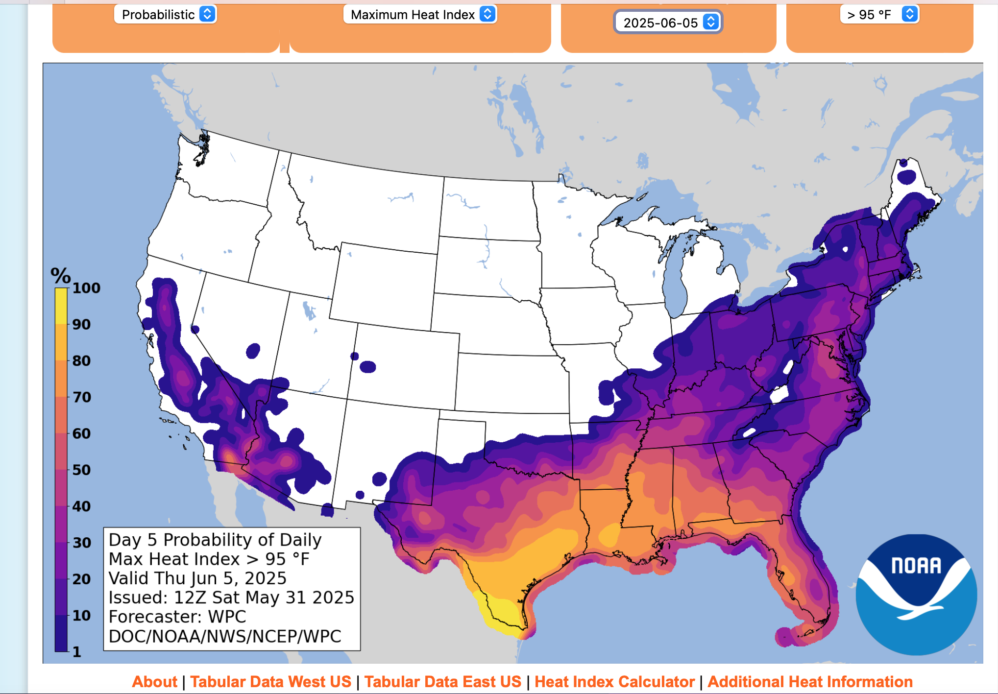
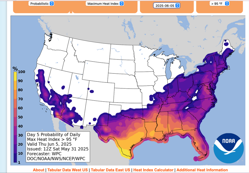
New product from NWS... I like it. No hover output-unfortuntely, but probabilistically a 30-40% chance of a Max HI 95+ on Thursday interior NJ.
-
It's just sitting over your head too, not moving.
-
Happy birthday! 25?
-
Just took the dog for a walk, nice out, windy and dry.
-
Yeah, we’d be flooding here. Nonstop rain today.
-
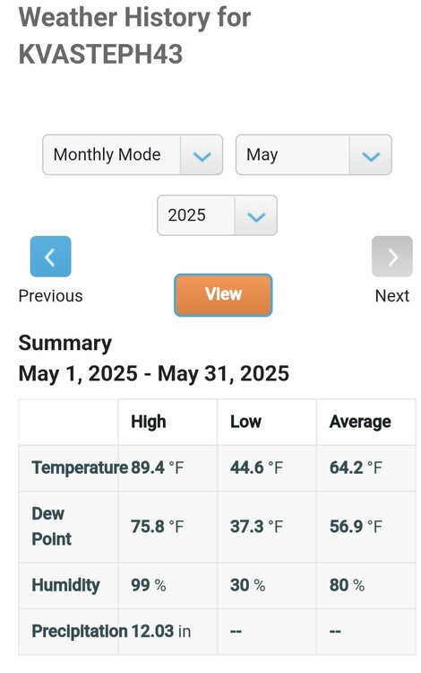
Low of 58, high of 80. Severe warned line of storms broke apart 10 miles from me and the dying line only dropped .07" but did drop the temp from 75 to 62 in less than 30 minutes. My monthly totals: Highest temp: 94 Lowest temp: 55 Highest dew point: 79 Lowest dew point: 43 Rainfall: 7.92"