All Activity
- Past hour
-
Key West afternoon

-
It seems RAH has had a handful of 1pm 100 degree obs but none at 12pm. Impressive stuff!
-
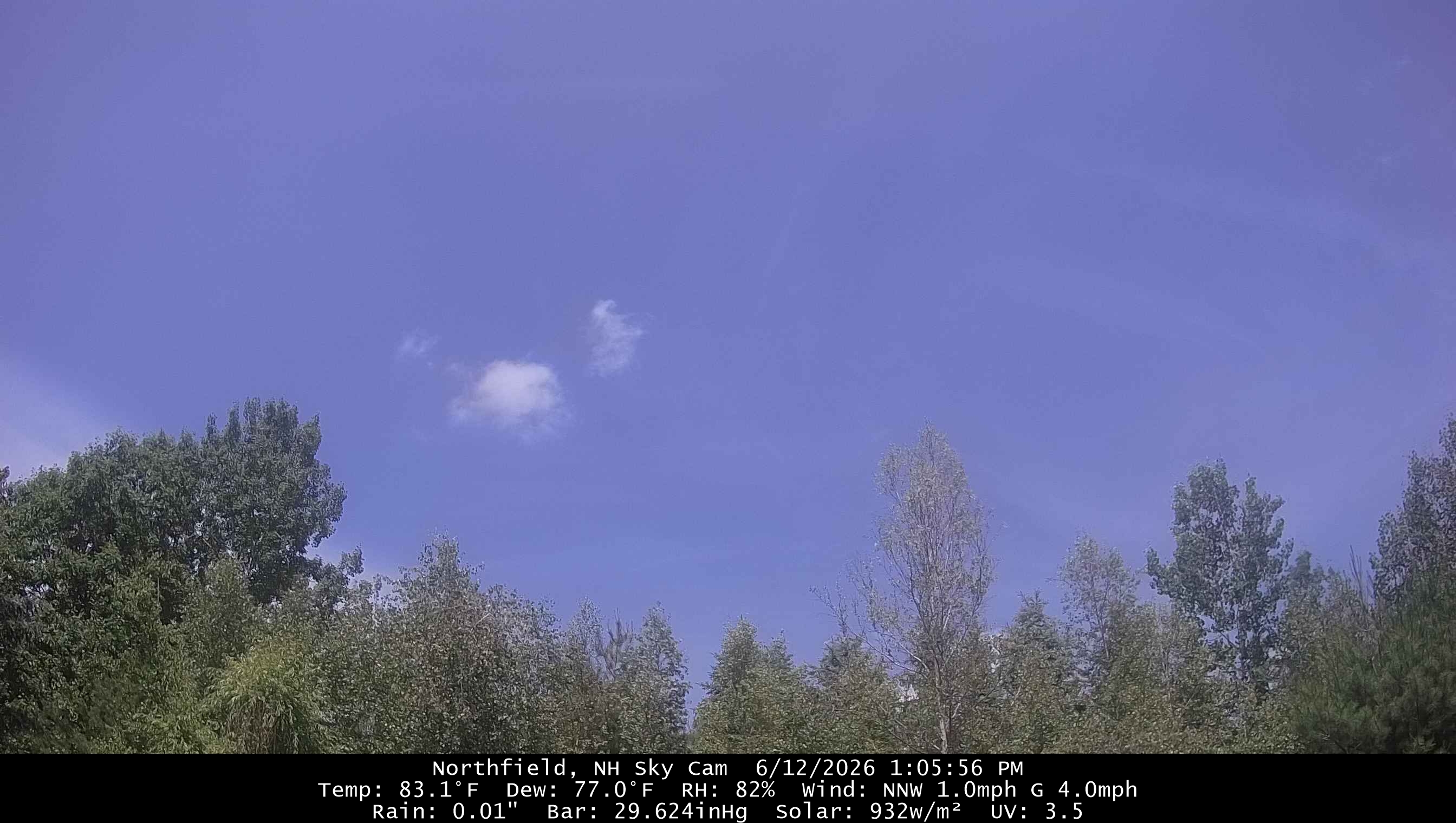
96/79 here at 1 pm. Feels like 114.
-

Junorch obs and discussion 2026
CT Valley Snowman replied to Damage In Tolland's topic in New England
94-95 is probably off the table. 88 and mostly cloudy. -
1pm NWS Obs: JFK-91 EWR-92 LAG-N/A CP-87 Dews a couple of degrees lower (right around 70) with the westerly wind component
-
Did you get a measurement from what we got from that line last night up our way? Something was blocking the gauge and I didn’t register anything even tho it rained hard for about 15 -20 minute….
-
91/74 HI-100
-
Off to Wilton, CT. Decided on a bit farther south and can adjust north or a bit south if need be...traffic dependent.
-
Deep summer
-
This heat always surprises me in terms of how little is needed to make it happen.
-
s tier weekend weather after some action and drought relief best climo
-

super el nino banter thread
roardog replied to forkyfork's topic in Weather Forecasting and Discussion
As long as we have the strong El Niño cool summer then it’s all good. -
100.3 at 12:30!!! This has to be the earliest in day 100 degree reading ever here. Up 2 degrees in last hour. We are heading for 103-104 I believe
-

2026 Mid-Atlantic Severe Storm General Discussion
high risk replied to Kmlwx's topic in Mid Atlantic
We've had huge shortcomings in terms of shear the past few days (and today), but that won't be a problem on Sunday. Deep and perhaps even low-level shear look to be really good. There are some model differences in terms of timing and mid-level lapse rates, but Sunday probably has higher potential for coverage and intensity than today does.- 595 replies
-
- 2
-

-
- severe
- thunderstorms
- (and 7 more)
-
Not a drop of rain last night, just some lightning.
-
A bit cloudy here so the 90+ is probably in trouble.
-
Already 100
-

-
I had exactly 0.5" in the plastic gauge on my back deck post. It put on a helluva show that I didn't expect. You'll catch the next one and then I'll miss out. It doesn't show on the map, but I think parts of far NW Sussex County had well in excess of a inch since they got hit with the earlier part of the round too. Edit: 1.27" at Sandyston Mesonet (Rutgers)
-
Briefly touched 100 right at noon.
-
yeah that was a fail. it look promising on radar, then after about 2 mins of rain, it went pooof
-
79/73 Sun is close to emerging here
-

Junorch obs and discussion 2026
Damage In Tolland replied to Damage In Tolland's topic in New England
75 dew currently, This is what it’s all about. - Today
-

2026 Atlantic Hurricane Season
WxWatcher007 replied to Stormchaserchuck1's topic in Tropical Headquarters
-
Time for the first analysis of the 2026 season. As @nw baltimore wx notes, our area of interest, which was the first lemon of the season deep in the Bay of Campeche, is now a banana, which scrapes the western Gulf. 1. Western Gulf: A broad area of low pressure has formed over the far southern Bay of Campeche and is producing disorganized showers and thunderstorms. Environmental conditions are forecast to be only marginally conducive for development before the system moves inland over eastern Mexico late Saturday or Sunday. The system could re-emerge over the northwestern Gulf on Tuesday and Wednesday while interacting with a frontal boundary, but there too, conditions are only expected to be marginally conducive for any development. * Formation chance through 48 hours...low...10 percent. * Formation chance through 7 days...low...10 percent. You can see below that we have a broad area of spin, and in the Bay of Campeche, where the concave nature of the coastline allows for consolidation of vorticity, this may be a favorable factor that's now being picked up by the AI models--which have frankly outperformed the legacy models recently. Aside from being buried currently in the geographically favorable BoC, the conditions for tropical genesis look marginal. SSTs are fine, but they're marginal. Nothing too surprising for this time of year. Wind shear currently isn't an issue, but upper level winds do not look favorable outside of a small window, with a huge ribbon of high shear across the Gulf and through the Caribbean and Atlantic. That said, you don't need much for marginal development this time of year, and while the legacy models (GFS/Euro and their ensembles) were bullish earlier on central/eastern Gulf development that ended up being wrong, with AI so far winning out on the possible zone of development. While the legacy ensembles quickly bury this broad low in Mexico and crucially--keep it there. The AI models pick up the low before it gets too far inland. That keeps the window open for development as it curves around the western Gulf. Note the difference between the EPS and AI EPS! Google DeepMind, which I believe performed the best in highlighting tropical genesis signals last season, is starting to show more interest in this idea as well. This one has a chance for some marginal development, if it can stay offshore for an extended period of time. Either way, this continues to highlight the signal I've mentioned before for heavy rain in the southeast.