All Activity
- Past hour
-
BULLETIN - EAS ACTIVATION REQUESTED Tornado Warning National Weather Service Baltimore MD/Washington DC 610 PM EDT Tue Jul 28 2026 The National Weather Service in Sterling Virginia has issued a * Tornado Warning for... Northern Anne Arundel County in central Maryland... * Until 645 PM EDT. * At 610 PM EDT, a severe thunderstorm capable of producing a tornado was located over Odenton, or near Severn, moving east at 30 mph. HAZARD...Tornado. SOURCE...Radar indicated rotation. IMPACT...For those in the direct path of a tornado touchdown, flying debris will be dangerous to those caught without shelter. Damage to roofs, siding, and windows may occur. Mobile homes may be damaged or destroyed. Tree damage is likely. * This dangerous storm will be near... Severn, Riviera Beach, Glen Burnie, Severna Park, Odenton, Pasadena, Arnold, Lake Shore, Millersville, and South Gate around 615 PM EDT. Sillery Bay, Pinehurst, Fort Smallwood State Park, and Dobbins Island around 620 PM EDT. Gibson Island, Magothy River, and Bodkin Point around 625 PM EDT. Other locations impacted by this tornadic thunderstorm include Herald Harbor, Belvedere Heights, Gambrills, Chelsea Beach, and Cape St. Claire.
-

2026-2027 Super El Nino
snowman19 replied to Stormchaserchuck1's topic in Weather Forecasting and Discussion
Not according to the study @EasternLIprovided. It shows that +QBO/El Nino strengthens the STJ “During El Niño and +QBO, the strongest STJs occur, and a warm pole/wave two pattern is found.” Here is the link: https://agupubs.onlinelibrary.wiley.com/doi/full/10.1029/2022JD036691 -
Loaded just may train over the same areas that got 3-4 inches of rain earlier sparing most of NYC. We’ll see though .
-
looks like a bust incoming. No sun to convectively fire these storms ahead of the front!. I think we'll get some rain but there no great lift like we usually get from summer storms
-
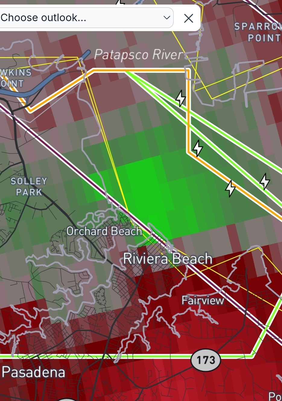
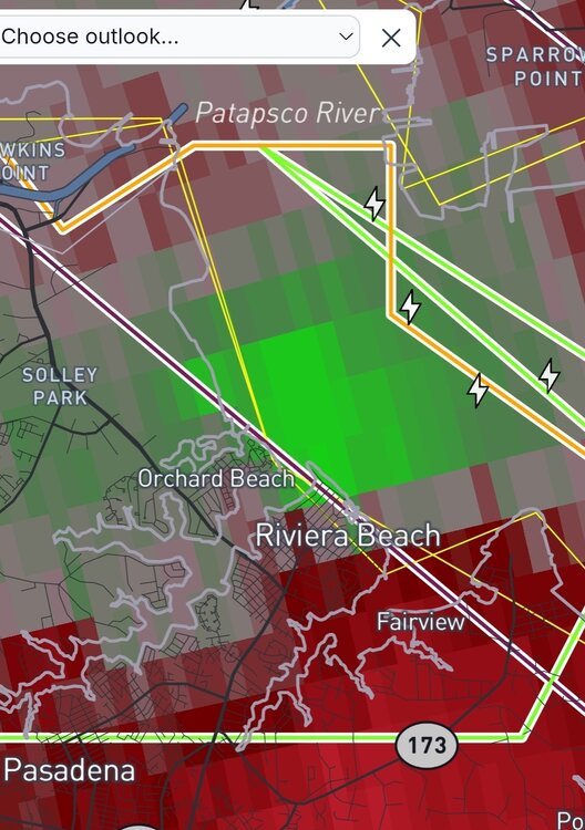
Some rotation enhancement with the line coming through down near Riviera Beach. Curious to see the next few scans. Edit: Now tornado warned, but seems to have fallen apart now. Seems to be a recurring theme today.
-
I get both of your frustrations, and it seems like you have lived in a donut hole for the past couple of years. I was only responding to comments regarding the monsoon bust, which it clearly is not busting. Obviously, the SE metro begs to differ but that is more localized rather than indicative of the status of the region as a whole.
-
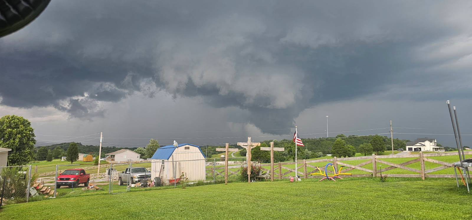
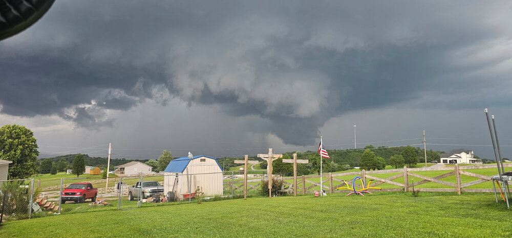
This is a picture looking into the supercell’s Wall Cloud in Greene County from the perspective of Mosheim which later spawned a (debris radar confirmed) tornado near the base of Viking Mountain and Margarette Falls.
-
 Dendy wants a shower I think Stein should get off him first I think he wants some water To put out the blowtorch
 -
Tornado OTG confirmed
-
Some loudly barking storms came through, but didn't drop much rain. Only 0.2" Overall a much better day for the region and my local area, helping the water tables some.
-
Caught a debris ball, I think, for the Greene county storm: Looks like a similar place to the couplet: A friend sent my wife these pics of the Greene County storm. Looks like they are pretty zoomed in: Another pic of the storms growing down this way:
-

2026 Mid-Atlantic Severe Storm General Discussion
AlexD1990 replied to Kmlwx's topic in Mid Atlantic
All kidney shaped. The one has a warning on it -
 Not sure there is an elevation component to this. These events usually are strictly convergence/frontal or meso low type deals.
 -
Stein as you are, as you were?
-
 That’s it?!? Just over the river in Hudson the water was coming up out of the storm drains it rain so hard. #stein
 -

2026 Spring/Summer Mountain Thread
Maggie Valley Steve replied to Buckethead's topic in Southeastern States
Looks like the storms just to my NW are about to go severe. Hopefully Buckethead will check in after that tornado warned cell passes by. These storms going to produce rotating super cells. -
 Smells Like Stein Spirit?
 -
Lost power twice in these storms tonight . In curious to see how much rain I'm getting
-
Know that feeling.
-
Looks like you may get wet with just the tip.
-
I've been locked inside a Stein shaped box for weeks
-
If that line holds together I might get hit but looks like a whiff for you. Maybe it'll fill in a bit more.
-

2026 Mid-Atlantic Severe Storm General Discussion
RickinBaltimore replied to Kmlwx's topic in Mid Atlantic
Hailing in Dundalk, pouring rain.- 1,613 replies
-
- 1
-

-
- severe
- thunderstorms
- (and 7 more)
-
Now inside new warning box, here we go.