All Activity
- Past hour
-
 Agree I'm seeing the range of possibilities maybe being 6-18 inches in this storm. The stakes aren't that high, It's not a nothing or 2 feet scenario here.
 -

MO/KS/AR/OK 2025-2026 Winter Discussion
StormChazer replied to stormdragonwx's topic in Central/Western States
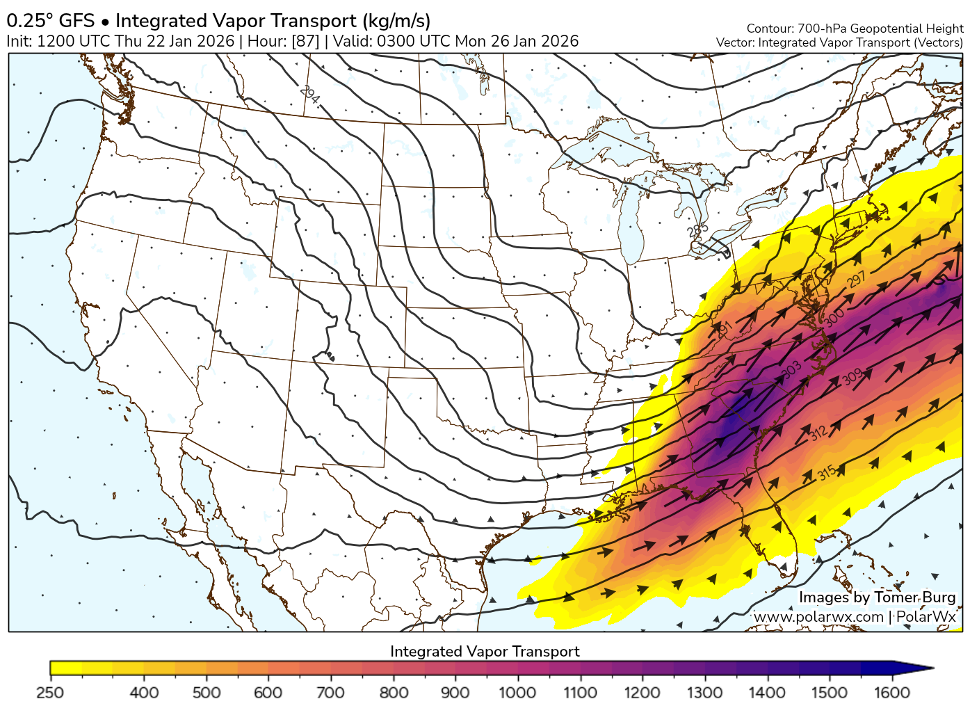
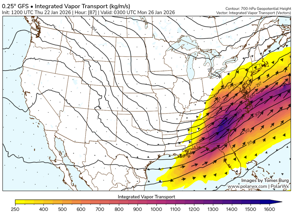
Luckily, this type of setup doesn't really give us a dry slot issue, so that's good news. -
I've been using that storm as a guide here but displaced 75 miles south or so...very similar but the thermal boundary is a little further south this time.
-

Possible Record Breaking Cold + Snow Sunday 1/25 - Tuesday 1/27
NEG NAO replied to TriPol's topic in New York City Metro
I wouldn't even venture a guess except the farther south the primary transfers to the coast the more snow here -

January 24-26: Miracle or Mirage Thread 2
StormyClearweather replied to mappy's topic in Mid Atlantic
https://i.ibb.co/1GXQtC88/ukmo-global-prateptype-ukmo-imp-us-ma-2026012212-78.png -
UKMET also starting to show a Hudson Bay/James Bay low like the GFS and ICON… may help us.
-

Possible Record Breaking Cold + Snow Sunday 1/25 - Tuesday 1/27
NorthShoreWx replied to TriPol's topic in New York City Metro
Nexactly! -

Pittsburgh/Western PA WINTER ‘25/‘26
MikeB_01 replied to Burghblizz's topic in Upstate New York/Pennsylvania
Ukie... The mix and dry slot getting close on that run
-
-
Ukie a bit slower i think... at 66 its just starting to show snow at DCA
-
I think you’ll need to tack on 6”+ after the initial overrunning thump to get 20” amounts. That’s possible but it requires some form of a CCB even if it’s mostly lower level…all that onshore flow from 850 and below. Guidance disagrees on the extent of that type of setup early Monday.
-

January 2026 regional war/obs/disco thread
metagraphica replied to Baroclinic Zone's topic in New England
At least today is 44. Not looking forward to 40 days and 40 nights of BN and snow. Feels like 2015 walking in the door. -
I'm seeing single digit lows for Monday morning.
-

Possible Record Breaking Cold + Snow Sunday 1/25 - Tuesday 1/27
Joe4alb replied to TriPol's topic in New York City Metro
hoping the UKIE looks a bit better. 500 level seems to indicate northern stream lagging a bit compared to 6z, let's see if that leads to a bit less amplification.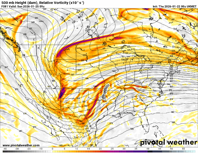
-

Central PA Winter 25/26 Discussion and Obs
Itstrainingtime replied to MAG5035's topic in Upstate New York/Pennsylvania
79/71 here in Miami. 71 dewpoint! @mahantango#1 let's trade places. -
Heights lower out front at 66 (UKMET)
-
-
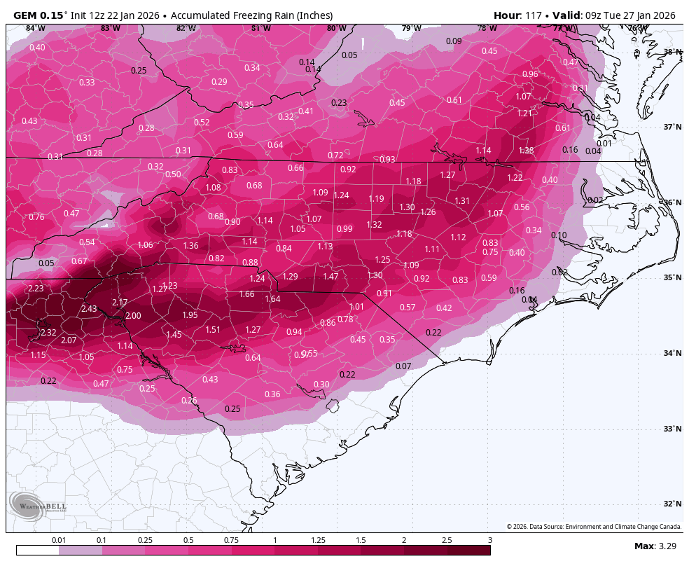
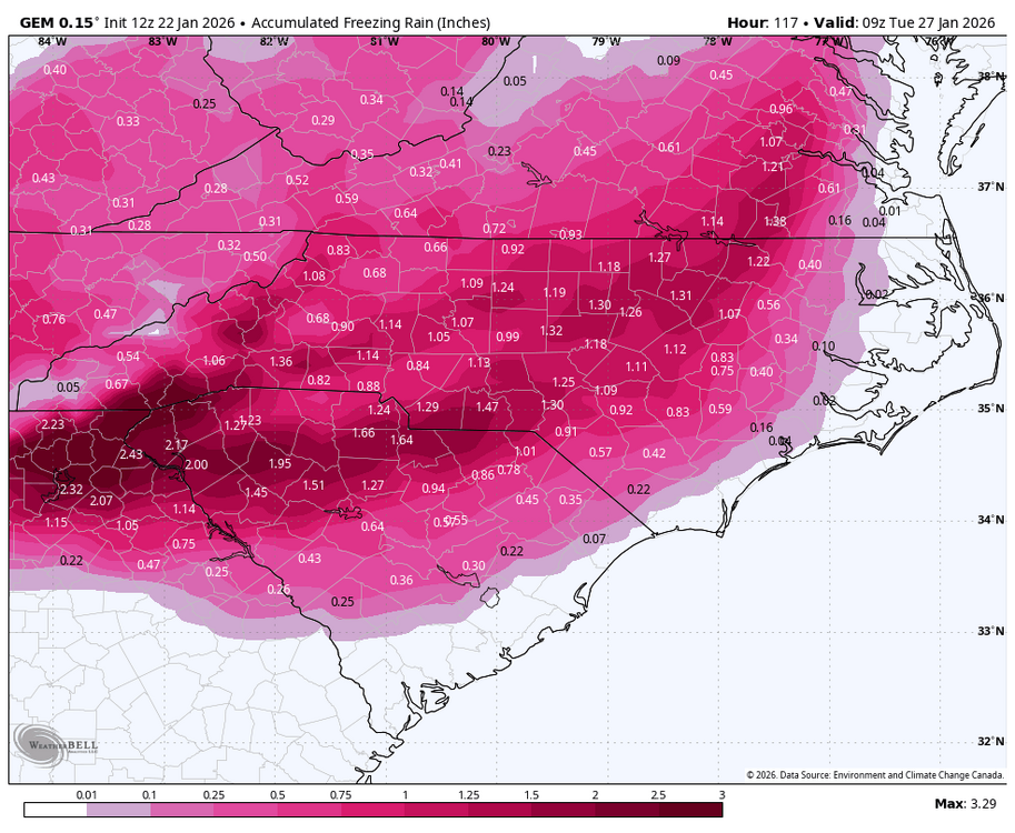
I agree with you. I think temperatures above 29° will not cause a problem on the road considering precipitation rates and standing water. .
-
It is and does not get mixing as far north.
-
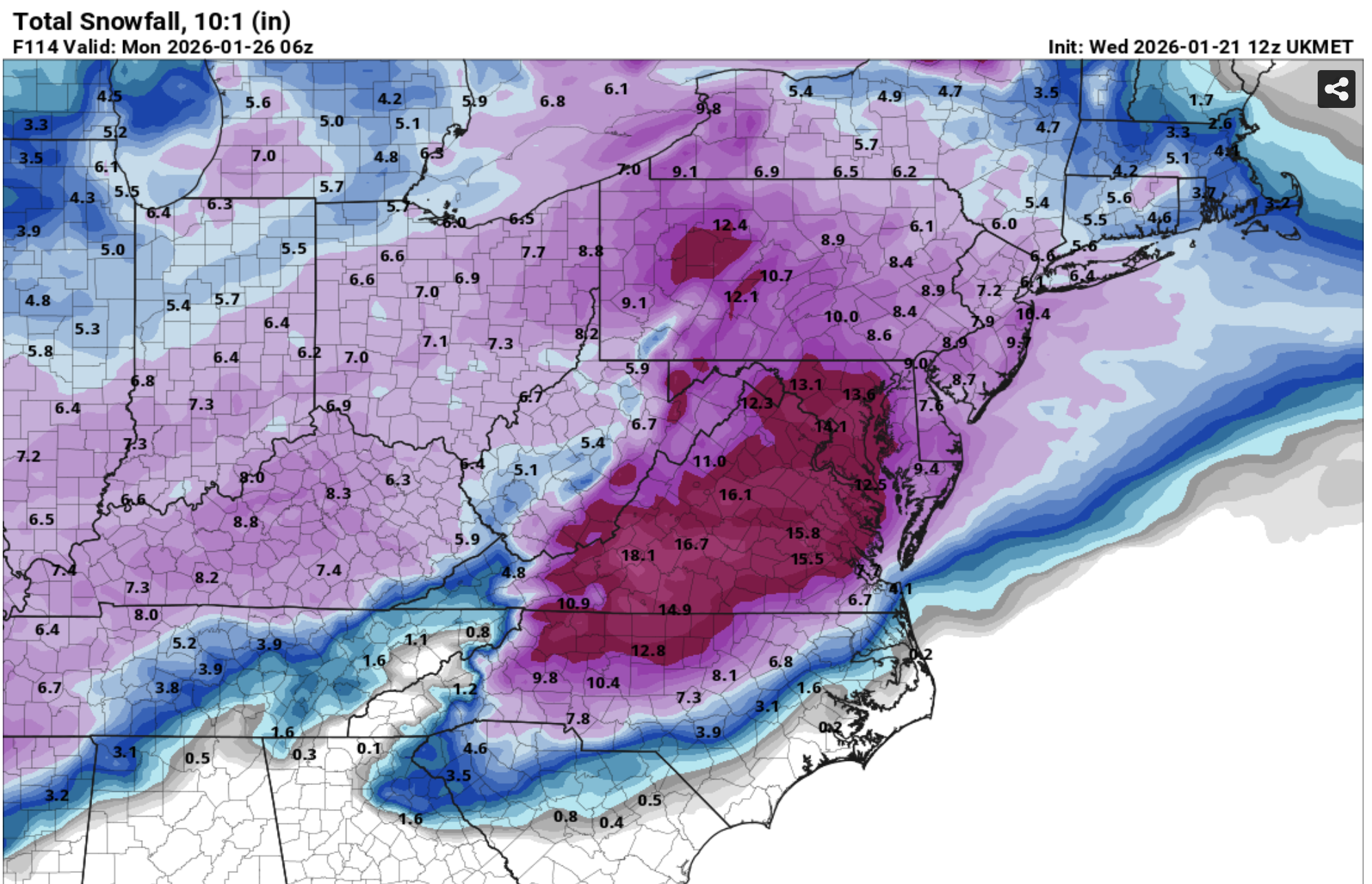
Apple weather is still showing 20-25 inches in DC… some people are going to be very disappointed.
-
Sorry for referring it to a name lol I can’t remember dates .
-
Fwiw at 60hrs, snow/sleet line along KY/TN border looks fairly similar between 3k NAM, FV3, and RGEM.
-
Agree, one of the more suspenseful remaining aspects of this imo if we're looking for the more "exotic" "nirvana" solutions of SWFE + CCB to get us to 20" and over I think ICON has had some of the better depictions of this, by virtue of faster infusion of energy and tilting of the trough
-
If you include the big maps from Monday Tuesday, plus the big maps of the possible snowstorm in the mountains from this previous weekend when I was in East Tennessee. Ive missed about 30-35 inches of snow in a week lol.
-
Feb 2007 was the biggest sleet storm I've ever seen. That storm has been a top 5 analog leading into this weekend lol. My buddy's wife is an Xray tech and she said they had a line out the door for 3 days following that storm. Mostly from sledding accidents lol. It was an absolute glacier in my yard. It was supposed to be a big snow storm and I was initially bummed when the flip came in quick but as the sleet kept piling up I was fascinated hahaha