Nomz
-
Posts
705 -
Joined
-
Last visited
About Nomz

-
The week+ of inches of snow sticking around were really fun as well
-
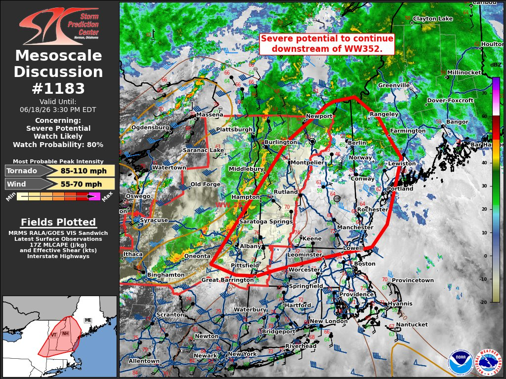
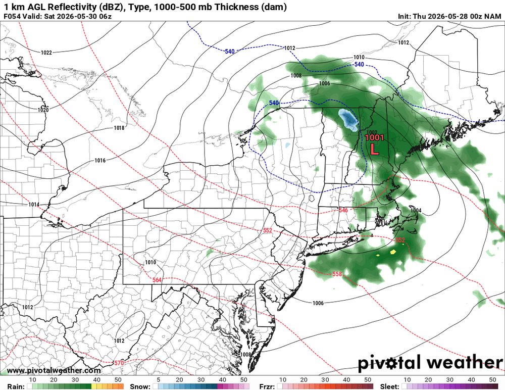
There’s your downstream MCD:

-
12z Buffalo sounding looked pretty good. Low toppers but 3cape and deep layer shear are good. That air mass should be advecting towards us through the day.
-
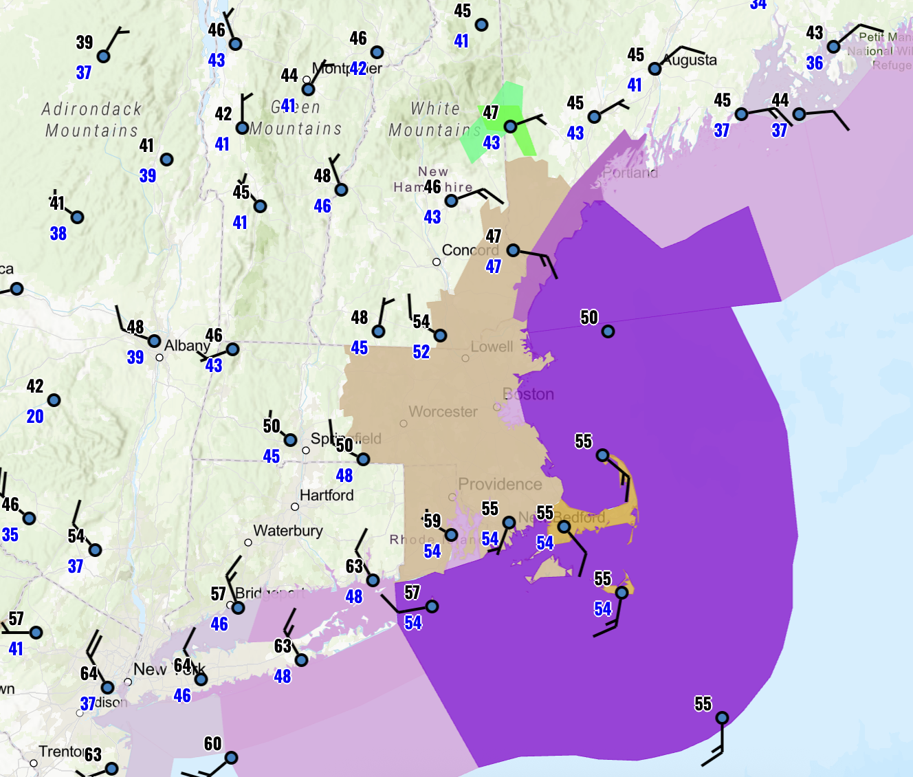
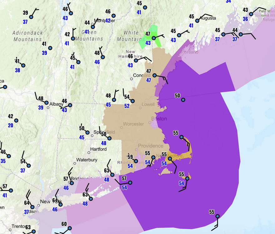
Not that bad of a look for svwx tomorrow from the 00z HRRR. Shear is great, and as we saw today in Indiana, >500 3k srh can make triple-digit CAPE work. I think a 5% could be added for tomorrow around the i91 corridor.
-
Nice idyllic cumulus clouds @ 22z
-
I'm a snow weenie down by DCA and a severe weenie up in BOS. Who has it worse than me?
-
Stormnet ringing bells for us Thursday. For those unaware, Stormnet is a new AI tool for SVWX forecasting that came out this year and has performed exceptionally well. Green is about equivalent to an SPC slight or enhanced, so this is quite a strong signal for d5. I know some may hesitate due to relatively modest forecast EMLs, but globals tend to underestimate thermos, and with the forecast shear (60-70+ EBWD and 300+ 3k SRH), I wouldn't want to count anything out. We await the king NAM.

-
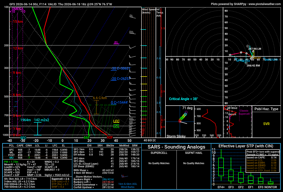
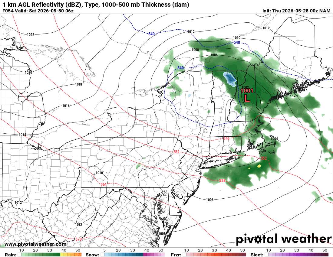
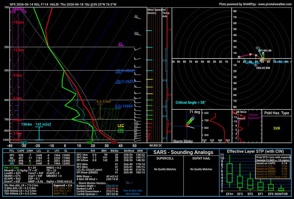
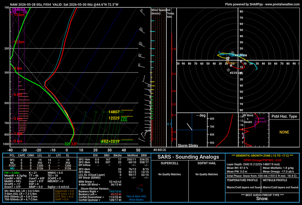
Since I'm back home in Boston, I've mostly been following our weather, but I wanted to stop by here. Obviously, insanely potent jet for this time of year, with 100+ kt on Wednesday over the Midwest and nearly 100kt as it takes on a negative tilt on Thursday over NE, both per 00z euro. The GooFuS solution favors you all with the trough swinging down a little bit more and overspreading the region with 40-50kt flow, which is good for this time of year. It should be noted that with these super-fast (speed and translation) punching jets, you don't need to be right in the centroid to see good storms. Deep-layer shear should be pretty good due to the strength of the jet, although it remains to be seen whether the LLJ and associated SRH will reach down to MA. Attached is a model sounding at BWI at 18z from the 00z GFS. 41 EBWD supportive of supercells, but, as you can see, it's mostly speed shear with no real turning with height due to a very modest 850mb jet. CAPE is skinny on this sounding in particular, but I wouldn't worry, as many others were 1000-1500+, and globals tend to underestimate thermos anyways. We will have to wait for the SVWX king, the NAM, to bring us the goods.
- 1,041 replies
-
- 1
-

-
- severe
- thunderstorms
- (and 7 more)
-
So I should just pencil in my PDS blizzard warning?

-
I wonder where the low pressure is????
-
That's not supposed to be there...
-
Per RONI, JFM for 96-97 was 1.8 so I didn't count it
-
Given that we have a realistic shot of a 2.0+ °C El Niño this year, I decided to check how DCA has done snow-wise in those years. I used RONI, which goes back to 1950, and selected winters with ENSO >= 2.0 °C for DJF and JFM. 1972-73: 0.1" season total 1982-83: 27.6" season total, including 16.4" during the February 1983 blizzard 1991-92: 6.6" season total 2015-16: 22.2" season total, including 17.8" during January 2016 blizzard 50/50 odds, I'll take that
-
and both events suck! we are who we thought we were
- 1,093 replies
-
- 1
-

-
- severe
- thunderstorms
- (and 1 more)