All Activity
- Past hour
-
it's moving so fast that we might not get all that much maybe .25
-
Yep.

-
The timing may be after daytime heating is subsiding - it's possible that instability could become more elevated versus surface based is my assumption.
- 498 replies
-
- 1
-

-
- severe
- thunderstorms
- (and 7 more)
-
Yea. It looks like heavy rain chances are actually going up. Along and south of I-80 is where the sups will be though.
-
86/74 Maxed out at 92
-
Your still going to get plenty of rain and thunder out of this.
-
I just came to say, I may be eating crow on the rain. Currently on the lake and was watching some towering cumulus/stratus as depicted on radar to my SW. It appears to be hitting a brick wall. Haven’t even lost the sun over here yet. Just as quick as they were building they’ve dissipated to mid level haze. We shall see.
-
Curious as to why, meteorologically, they would not survive? From my very very novice observations, the ingredients seem to be present to keep fueling them. I would love to know what the pros and the models are seeing that could cause them to die out. Thanks for broadening my knowledge.
- 498 replies
-
- 1
-

-
- severe
- thunderstorms
- (and 7 more)
-
The rain is decaying pretty fast
-

Junorch obs and discussion 2026
Damage In Tolland replied to Damage In Tolland's topic in New England
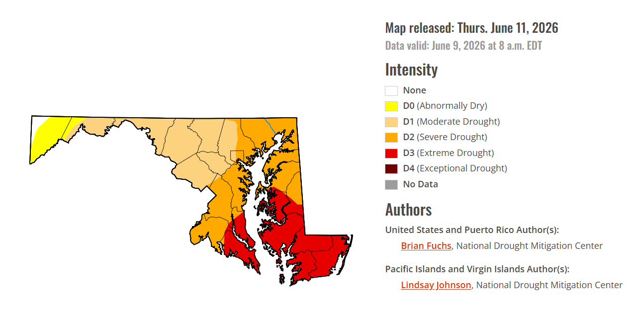
Just little to no rain thru day 10 for SNE. Wait till weekend is 90 with low dews . By Monday morning lawns will be torched out . Starting around here now -
A bunch more rain behind the morning line boosted my daily total to 2.21". My June total is up to 5.97". Just about everyone in eastern Iowa got 1-2+", so the drought concern is fading.
-
Nice! Lots of thunder with this cell near me
-
Sun back out here in IKK an hour after that severe warned storm came through. Very soupy out
-
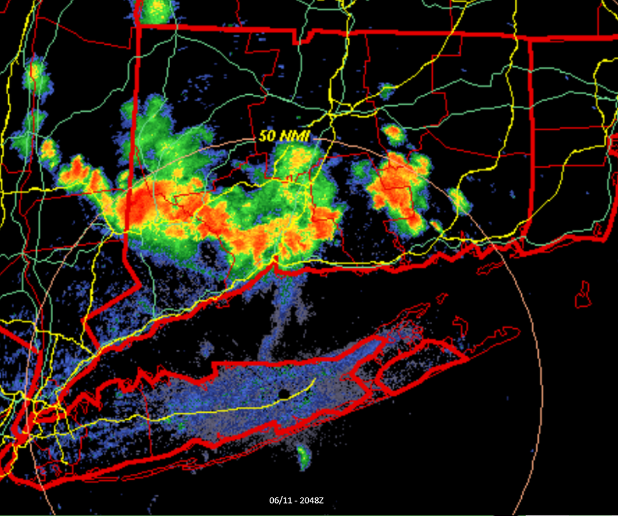
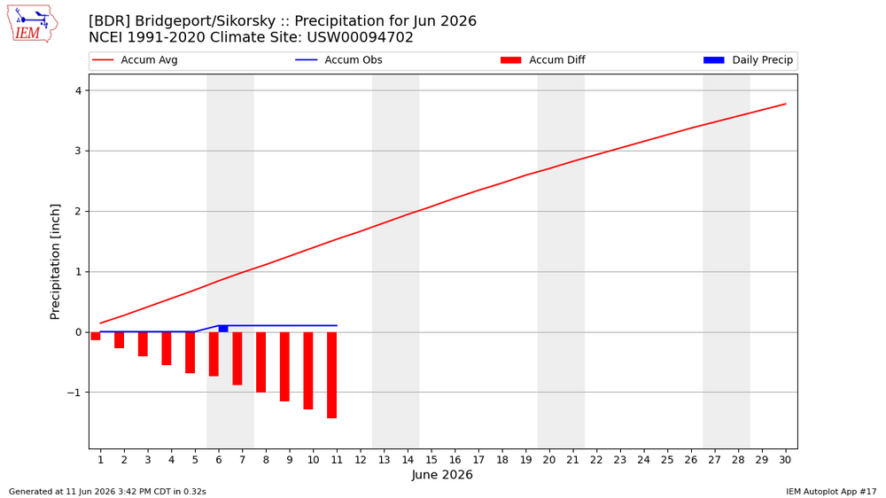
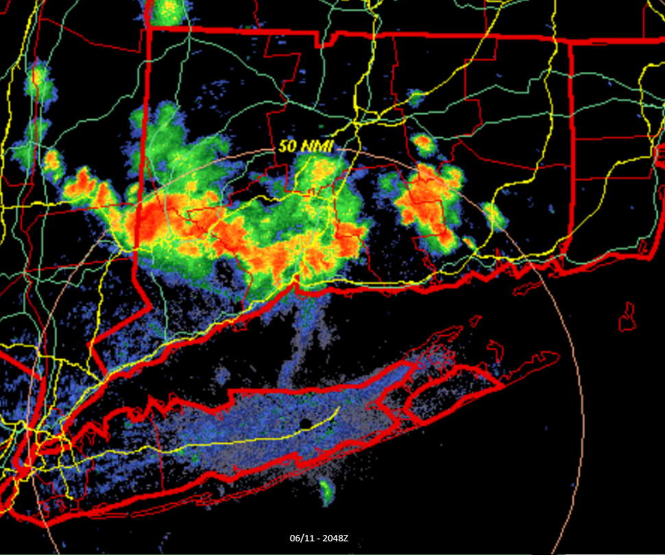
BDR needs the rain badly. That area is torched. Thinks its been close to like 20 days since they had any decent rain over like a 1/2 inch.
-
Yesterday had about 10 raindrops hit my windshield on the way home, 98 for a high. Currently 101 today.
-
Yeah we bust on this one, have some stratiform rain in the sights down this way.

-
95 degrees with a dewpoint of 69 here right now.
-
Yesterday's line of storm was officially a derecho. Congrats to all who participated: NWS - Northern Indiana Good afternoon partners... Just as an FYI, we just received word from SPC that they confirmed yesterday's system was classified as a Derecho as it moved from Eastern Iowa through Lower Michigan. The wind swath had a track length over 400 miles, with a footprint just under 100,000 square miles. The strongest known gust was measured at 94 mph.
-

2026 Mid-Atlantic Severe Storm General Discussion
Eskimo Joe replied to Kmlwx's topic in Mid Atlantic
That cell approaching Garrett County looks legit. Little notch and everything else to it. -
Most won't see rain till Sunday
-

E PA/NJ/DE Summer 2026 Obs/Discussion
Mikeymac5306 replied to PhiEaglesfan712's topic in Philadelphia Region
Storm watches hoisted for Lancaster and parts west. -
There was a line of weather over central PA this morning when I left the west coast for the redeye home. By time we reached chicago, it was gone. Not even a bump on descent
-
96 was our high. Currently 92/78 for a feels like temp of 107. Temp is slowly dropping thanks to the sea breeze. Temps in the low 80's down at the coast.
-
88 here; dews are up.
-
Hit 101.5 today. Boooooooooo


.thumb.jpeg.f5c6ba9d911ec96b3b124f8606aee58e.jpeg)


