All Activity
- Past hour
-
F#%K
-
Yeah no s***.
-

2026 Mid-Atlantic Severe Storm General Discussion
SnowenOutThere replied to Kmlwx's topic in Mid Atlantic
Going for my Herndon metro intercept point- 844 replies
-
- 1
-

-
- severe
- thunderstorms
- (and 7 more)
-
It's coming down in buckets in Midtown.
-
.03". Next round moving in from PA...
-

2026 Mid-Atlantic Severe Storm General Discussion
batmanbrad replied to Kmlwx's topic in Mid Atlantic
whoa that cell near Manassas sure got itself together in a hurry... could be heading for DC? -
There is a force field over the northeast it seems
-
Absolutely pouring at times here in Kearny. Skies were black as might earlier.
-
Best rains may by CT/RI/SE MA with this batch.
-
Drought busting 0.03 with this batch
-

E PA/NJ/DE Summer 2026 Obs/Discussion
Hurricane Agnes replied to PhiEaglesfan712's topic in Philadelphia Region
TOR up -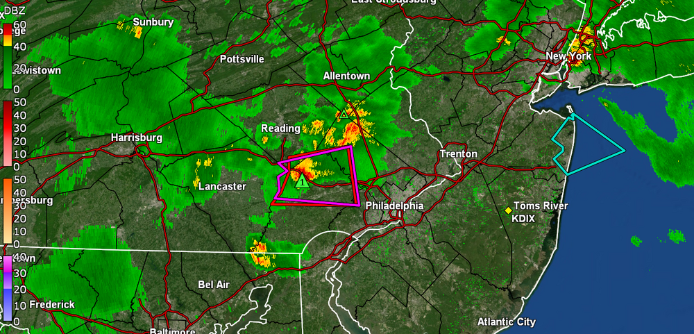
-

E PA/NJ/DE Summer 2026 Obs/Discussion
mattinpa replied to PhiEaglesfan712's topic in Philadelphia Region
Tornado warned -
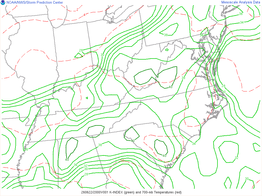
It's juiced in the column for sure. K-index as high as 40 in w-cntrl VA. That is about as high as it gets these parts.
- 844 replies
-
- 1
-
-
- severe
- thunderstorms
- (and 7 more)
-

Occasional Thoughts on Climate Change
TheClimateChanger replied to donsutherland1's topic in Climate Change
Ah yes, the famous 1919 heat wave where Orlando had 2 weeks more 90F days than anywhere else. The same year where Pensacola registered 4 days at or above 90F, Miami recorded 6 - yes 6, and Key West a paltry 21. These numbers are unthinkable today. Did you ever stop to think that perhaps century-old local observations, with questionable exposure, rooftop siting, nonstandard instruments, observer changes, missing data, and who knows what else, should not be treated as sacred, apples-to-apples climate records? Or do you just repeat the one raw number that flatters your narrative while ignoring the rest of the statewide data screaming that something may be off? -
Steady mod/hvy rains here
-
the models that showed rains from NYC north nailed it. Heavy steady rain here.
-

E PA/NJ/DE Summer 2026 Obs/Discussion
LVblizzard replied to PhiEaglesfan712's topic in Philadelphia Region
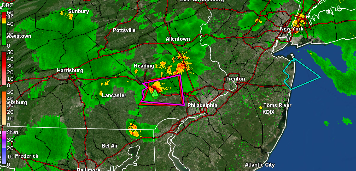
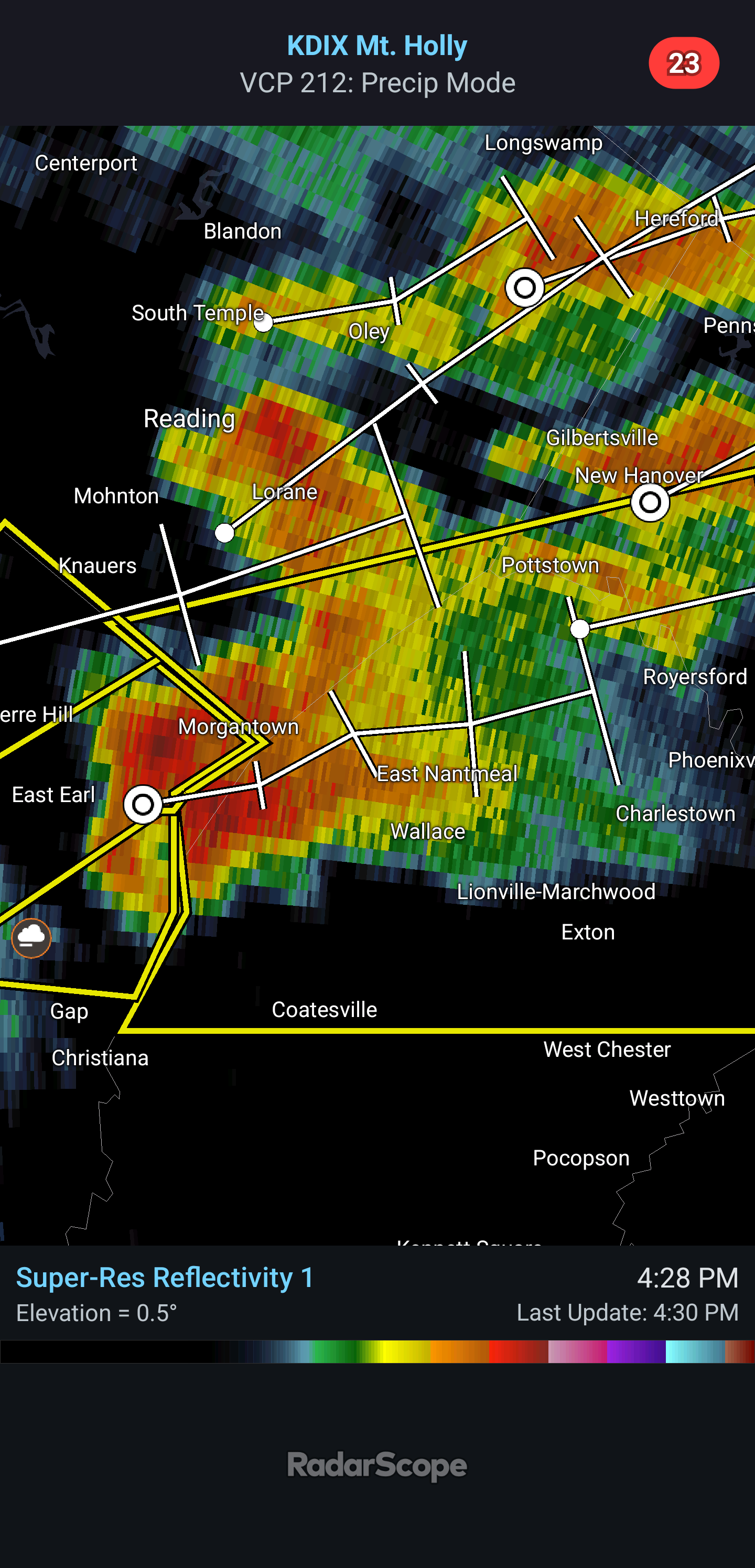
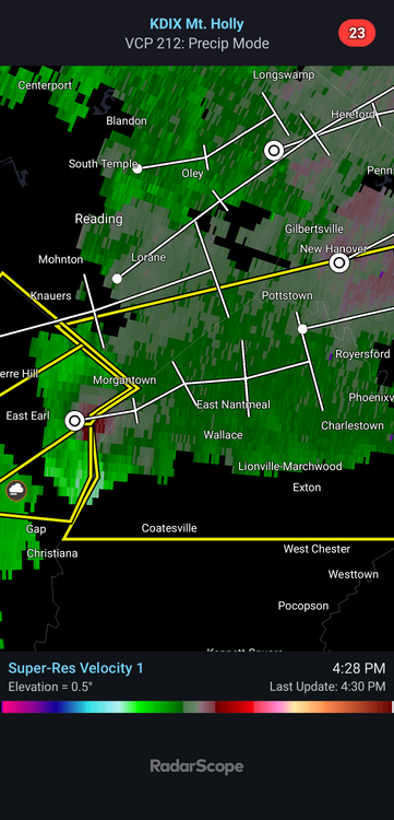
I’ve seen storms tornado warned for a lot less than that cell south of Reading right now, just saying… -
Yes, all states under-counted a lot prior to the 1990s. Once the NWS Modernization and Restructuring occurred in the 90s, detection or documentation of tornadoes improved considerably.
-

E PA/NJ/DE Summer 2026 Obs/Discussion
WxUnit replied to PhiEaglesfan712's topic in Philadelphia Region
Supercell coming into Chester County with decent rotation. Large rotating wall cloud already reported on it.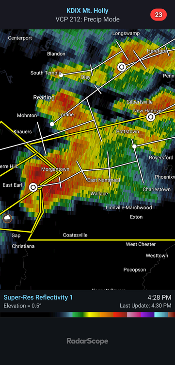
-
Wouldn't they have been under counted in Oklahoma as well?
-

Junorch obs and discussion 2026
Damage In Tolland replied to Damage In Tolland's topic in New England
Nothing is modeled -
Got lucky with two quick downpours. Up to .70 on the day with additional showers building to the west
-
2026 Mid-Atlantic Severe Storm General Discussion
Roger Ramjet replied to Kmlwx's topic in Mid Atlantic
I had a high of 82 today and was cloudy 95% of the time. Radar activity is weakening as it approaches western Loudoun. Looks like anything severe will be south and east of me. Not sure why the STW extended so far northwest. -

2026 Mid-Atlantic Severe Storm General Discussion
midatlanticweather replied to Kmlwx's topic in Mid Atlantic
Cell north of Culpepper looks interesting. -
Not enough to get through the trees here in SW Nassau .