All Activity
- Past hour
-

1/24-1/25 Major Winter Storm - S. IL, IN, and OH
Stevo6899 replied to A-L-E-K's topic in Lakes/Ohio Valley
I'd imagine by looking at radar, it's snowing and inch per hour. I'd say the models did pretty good with this, atleast in se mi. -

January 25-26 Winter Storm Potential
LVLion77 replied to Ralph Wiggum's topic in Philadelphia Region
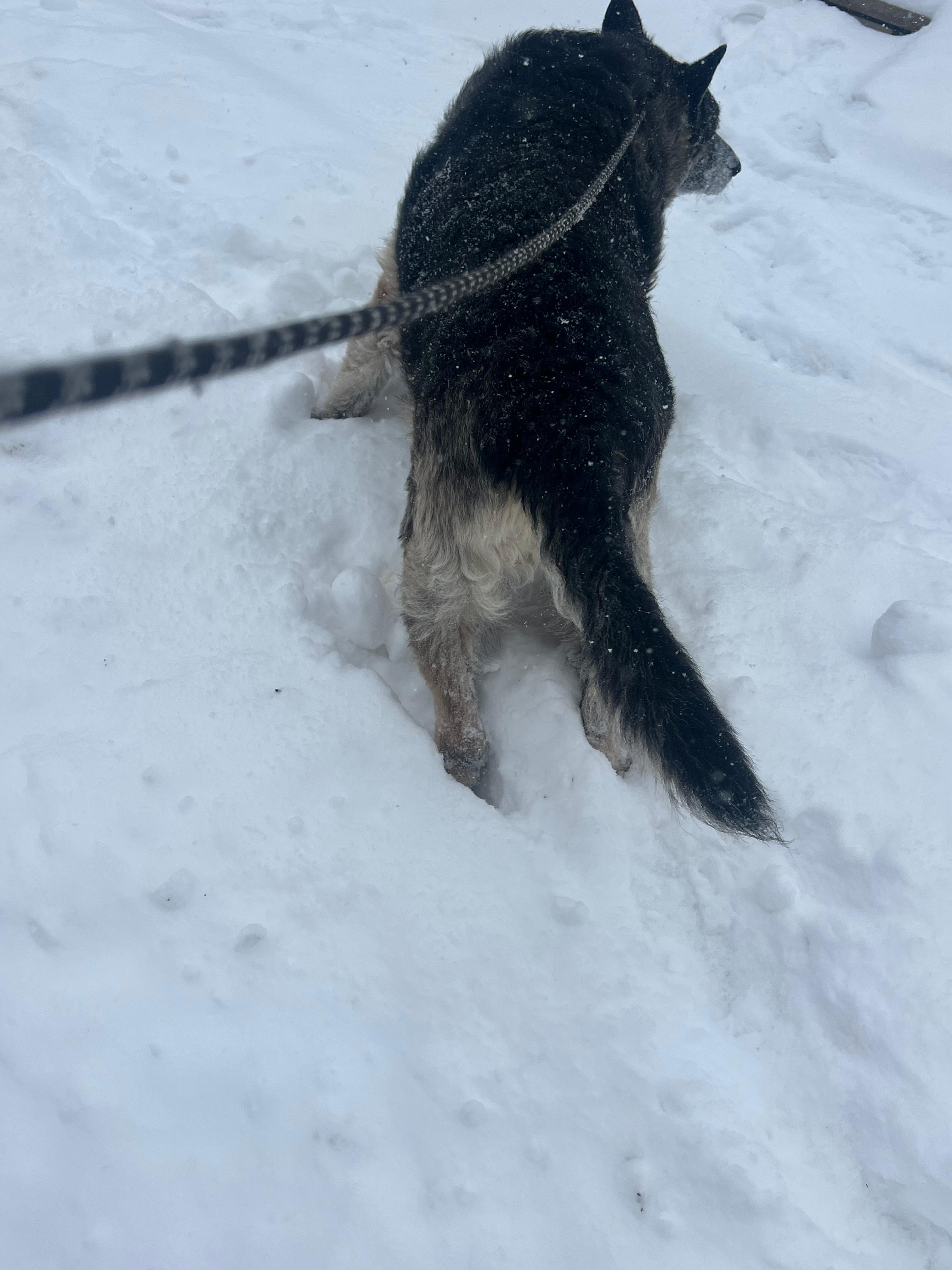
No official measurement as I just took the dog out but at least 5” and 9.6 F. Wish the coastal was off the coast another 50 miles! -

January 24-26: Miracle or Mirage OBS Thread!
North Balti Zen replied to Jebman's topic in Mid Atlantic
The sledding has to be epic. Just ideal conditions. same for people that have their cross country skis. -
Prepare for the Day After Tomorrow script. We going Deep Deep winter if PV modeling and blocking is correct. Reload after reload. QBO doing its part. Some AO ensembles members take the AO below 6 SD.
-
Lol we need some thurmont posters. I bet they’re gonna hold on longer there.
-
 3k was ran from your basement
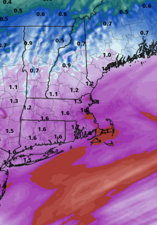
-
Still 27 here with moderate freezing rain. This crap is a disaster.
-
Very heavy sleet right now. Heaviest I have seen so far at any point in this storm. Still, hardly any glaze to speak of in the trees.
-
I thought the general public would be thrilled that it didn’t happen. Maybe I underestimated them.
-
Seems we’re at the point where if there’s radar returns overhead, I’m sleet. If there’s nothing on radar, I’m light drizzle
-

Extreme Cold, Snow & Sleet: SECS 1/24 - 1/26
TriPol replied to TriPol's topic in New York City Metro
I love this group. After about a week of debate about if it will snow, sleet, or suppress... we get snow. The largest snow of the year. And so do we want to go outside, enjoy the snow, maybe build a snowman or a snow castle... we track the sleet line. Like it's a predator hunting us. You guys are great. I'll admit I was refreshing tropical tidbits and pivotal weather for the next frame on the EURO like a madman... but you guys got me beat. -
DELDOT cameras show some snow still falling south of there.
-

“Cory’s in LA! Let’s MECS!” Jan. 24-26 Disco
Typhoon Tip replied to TheSnowman's topic in New England
Heh... crazy having this be the antecedence any storm. Hearkens to the rareness of this whole thing
-
Just about 3.75-4 inches in new rochelle! .
-

January 24-26: Miracle or Mirage OBS Thread!
SnowenOutThere replied to Jebman's topic in Mid Atlantic
It’s not. Really fun burst of sleet though! -
 Anyone want to take a guess at a jackpot spot/amount? I’m sticking with the Cape Ann area. I will go Ipswich. 26”
 -
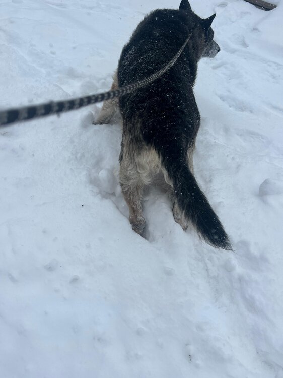
The big dog is drowning in the snow, probably a solid 5" now in fair lawn
-
 Turn the HandyCam on stat!
 -
 Prayers and well-wishes to you guys out west. Hang in there!!
 -
(002).thumb.png.6e3d9d46bca5fe41aab7a74871dd8af8.png)
January 25-26 Winter Storm Potential
ChescoWx replied to Ralph Wiggum's topic in Philadelphia Region
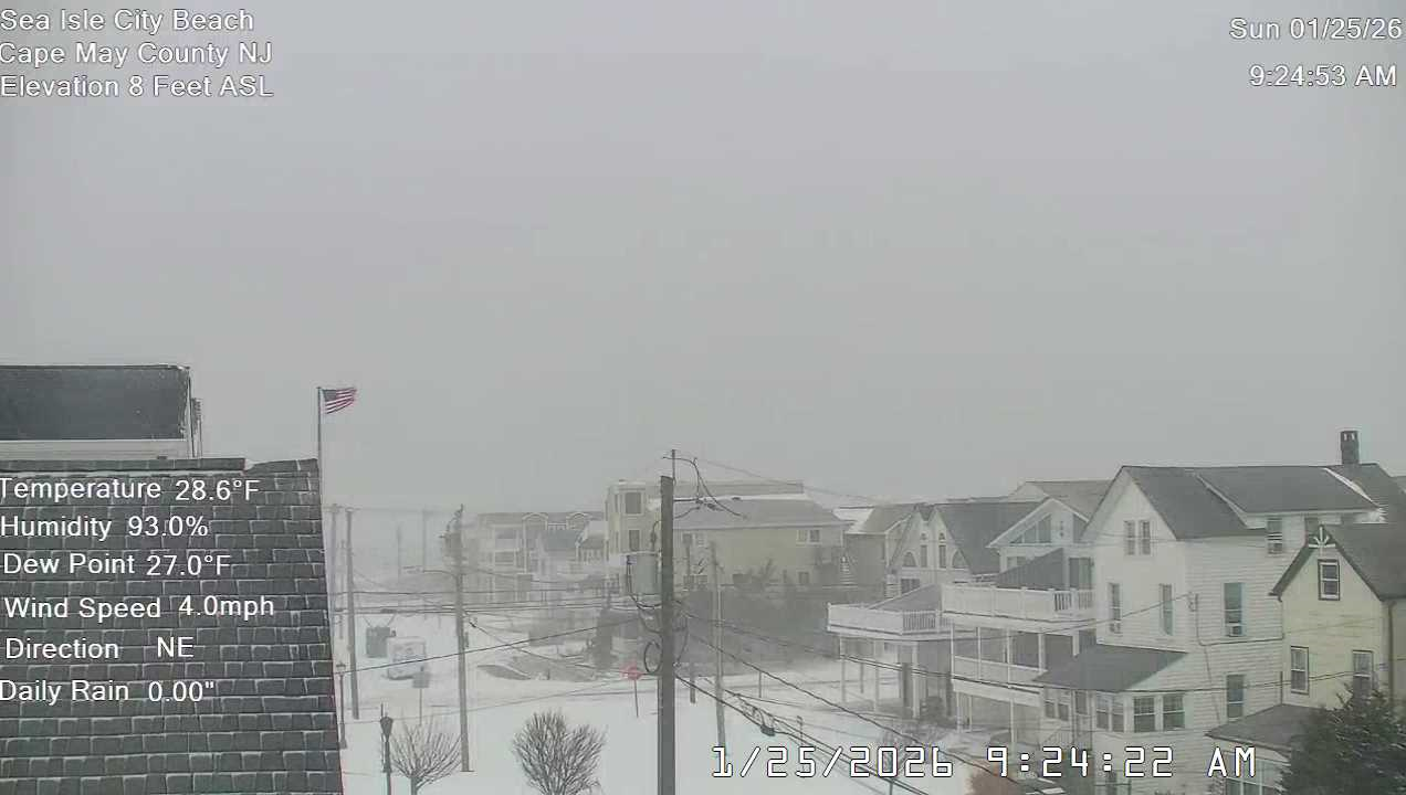
Still snow down in SIC....for now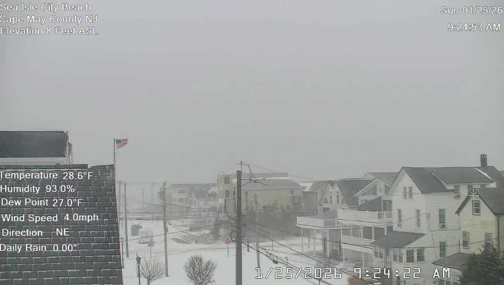
-
Records: Highs: EWR: 59 (2024) NYC: 60 (1967) LGA: 57 (2024) JFK: 55 (2024) Lows: EWR: -1 (1935) NYC: 2 (1945) LGA: 2 (1945) JFK: 5 (1961) Historical: 1821 - The Hudson River was frozen solid during the midst of the coldest winter in forty-one years. Thousands of persons crossed the ice from New York City to New Jersey, and refreshment taverns were set up in the middle of the river to warm pedestrians. (David Ludlum) 1837 - At 7 PM a display of the Northern Lights danced above Burlington, VT. Its light was equal to the full moon. Snow and other objects reflecting the light were deeply tinged with a blood red hue. Blue, yellow and white streamers were also noted. (The Weather Channel) 1937: Las Vegas, Nevada dropped to 8 degrees above zero, setting a record low for the city. 1949: Las Vegas, Nevada, recorded 4.7 inches of snow. This brought the monthly snowfall total to 16.7 inches which still ranks as their snowiest month on record 1965 - Alta, UT, was in the midst of a storm that left the town buried under 105 inches of snow establishing a record for the state. (David Ludlum) 1987 - The second major storm in three days hit the Eastern Seaboard producing up to 15 inches of snow in Virginia, Maryland and Delaware. Up to 30 inches of snow covered the ground in Virginia following the two storms. (National Weather Summary) (Storm Data) 1988 - High winds created blizzard conditions in the mountains of Colorado. Winds gusted to 109 mph at Echo Lake, and a wind gust to 193 mph was reported atop Mount Evans. A "nor'easter" moving up the Atlantic Coast spread heavy snow from the Carolinas to New England, with as much as 16 inches reported in the Poconos of eastern Pennsylvania. (National Weather Summary) (Storm Data) 1989 - Bitter cold air, coming down from Alaska, settled over the Northern Rockies. Wilson WY reported a morning low of 48 degrees below zero. Thunderstorms produced severe weather in the south central U.S. One thunderstorm in north central Texas spawned a tornado which injured three persons at Troy. (National Weather Summary) (Storm Data) 1990 - Low pressure developed explosively over east central Missouri and moved into Lower Michigan producing high winds and heavy snow across parts of Iowa, Illinois and Wisconsin. Wind gusts to 60 mph and up to a foot of snow created near blizzard conditions in southeastern Wisconsin and northern Illinois. Wind gusts in Indiana reached 76 mph at Wabash. Thunderstorms associated with the storm produced wind gusts to 54 mph at Fort Madison IA. (National Weather Summary) (Storm Data) 2000 - Heavy snow fell from the Carolinas to New England, with up to 20 inches of snow and five deaths reported. (NCDC) Jan 25, 2000: 5.6 inches of snowfall (combo of mix / dry slotted kept totals down) Other areas 6 - 12 inches, more north and the mid atlantic
-
So dumb give the kids a day to enjoy the snow. Childhood memories are a thing of the past.
-
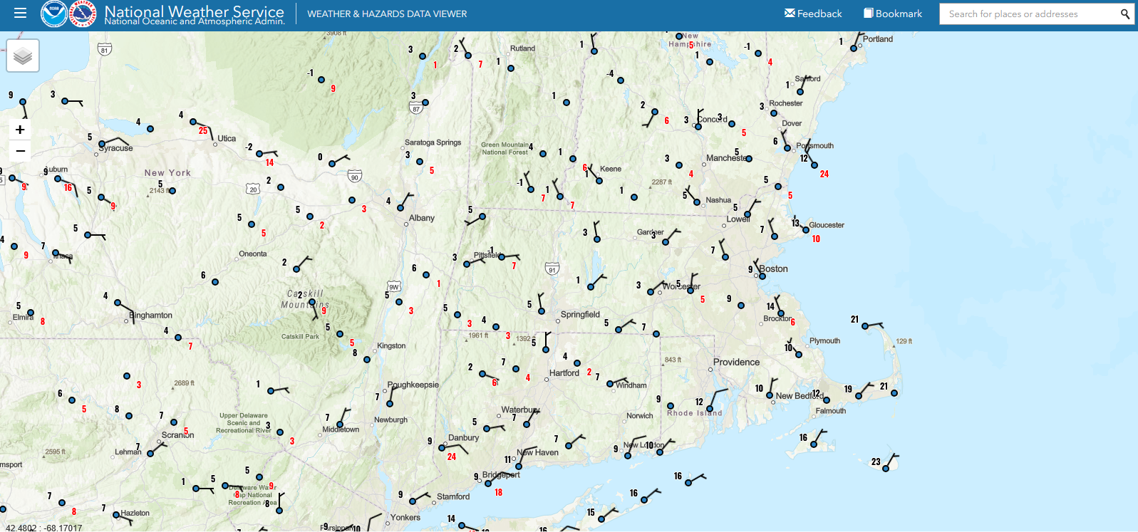
 The advance of the sleet line is way behind schedule in the MA region. How is that for weenie map analysis?
 -
Still pouring sand in HdG. You got this.