All Activity
- Past hour
-

Central PA Summer 2026 Discussion/Obs Thread
TheDreamTraveler replied to Voyager's topic in Upstate New York/Pennsylvania
Up to 103 Heat Index values Thur and Friday here. I might have to be outside for hours on Friday so that'll be fun lol -
Been a while that we have had 2 30 wind forecast days back to back from SPC... today and tomorrow
- Today
-
Still an enhanced risk; 20 minutes late just to roll back to the original Day 2 outlook.
-
89/75 sweaty balls today. Somehow managed to gather strength to smoke/grill on the pitboss pellet grill twice before each rd in oak brook. the img compressor shit here sucks
-
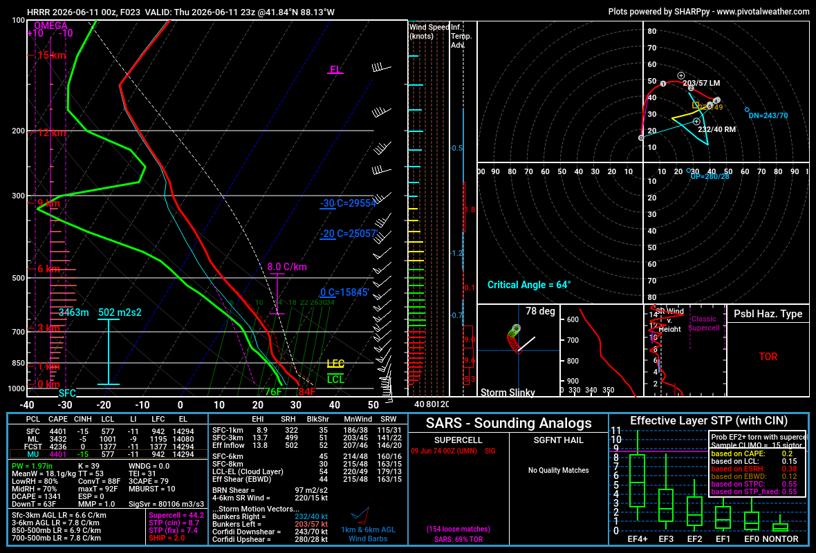
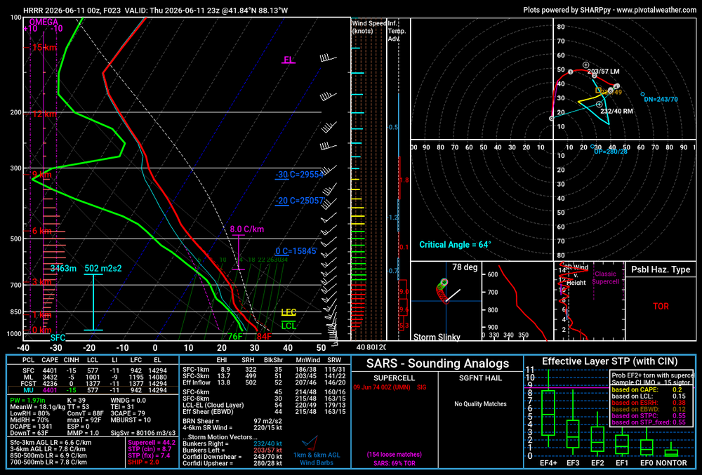
Thoughts on later today for northern IL and points just nearby: - Locally sky high potential if supercell mode is maintained in the maxed out environment. - There appears to be a play for prefrontal supercells, possibly followed by an intense (likely prolificically tornadic) QLCS. - There also looks to be a play for QLCS being the primary mode, which could yield multiple EF0-1 tornadoes and a few EF2s in addition to corridors of enhanced straight line wind damage. - It seems unlikely we'll get through the event relatively unscathed given the high end parameter space. - Current thinking on most likely area to have a EF2+ tornado (if supercell(s) are there to tap into environment around 21z) is far northern IL (and adjacent southern WI) closer to the forecast surface low and warm front position. Of course neither of these elements are set in stone so a farther south sfc low track and/or warm front position would up the ante for a sig tor threat farther south.
-
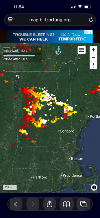
Yeah prolific lightning, just non-stop.
-
They owe you huh
-
Today;s (6/10) Highs PHL: 88 TEB: 86 EWR: 85 New Brnswck: 85 BLM: 85 LGA: 84 TTN: 84 ACY: 84 NYC: 82 JFK: 77 ISP: 76
-
Kind of the state of the game in a nutshell - Knicks played old school, grind it out. Spurs kept shooting 3s. Who won?
-
72/66 at midnight is summery.
-
I find the NBA to be a terrible product (flops, 3s, fouls is basically the game) but wowowowow that Knicks comeback. The 4th quarter was insane.
-
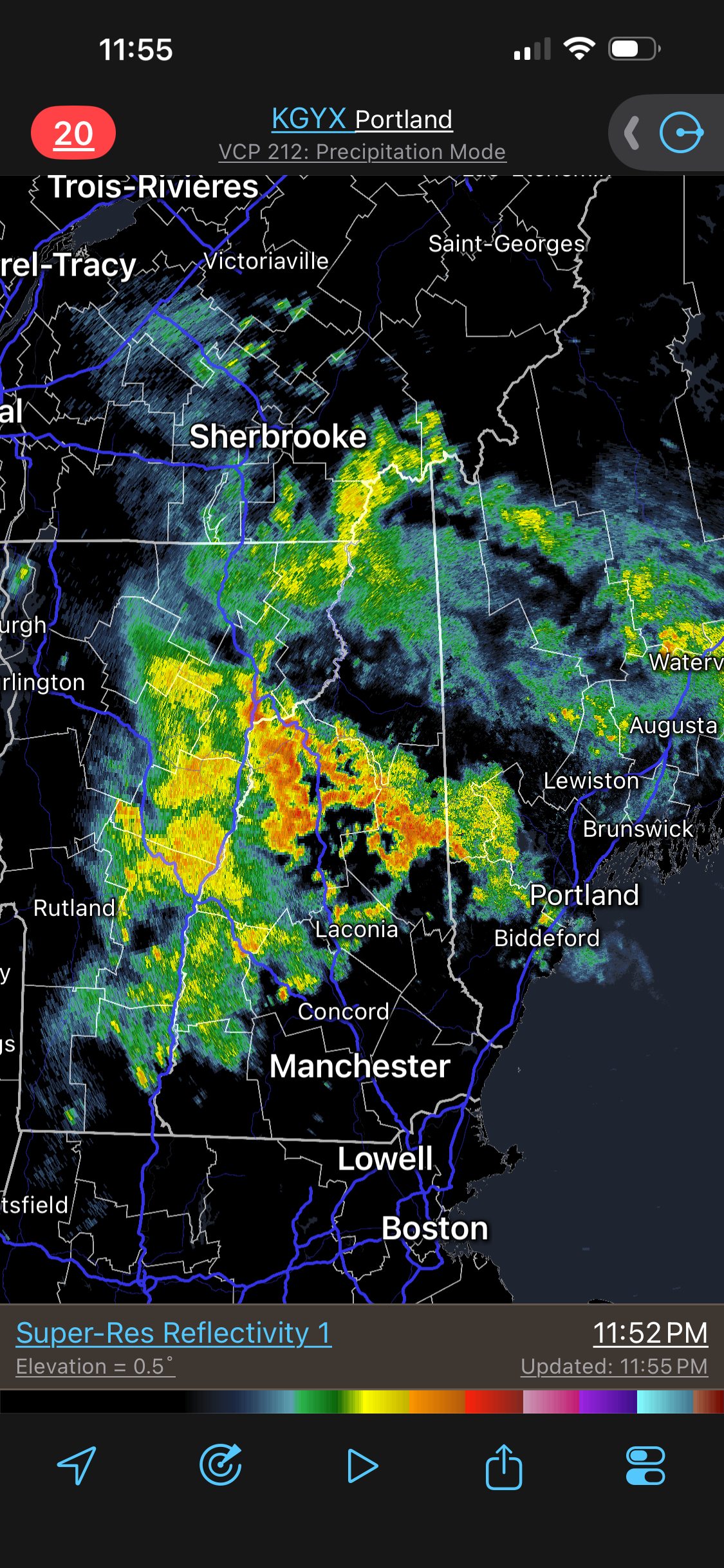
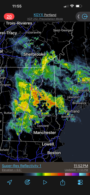
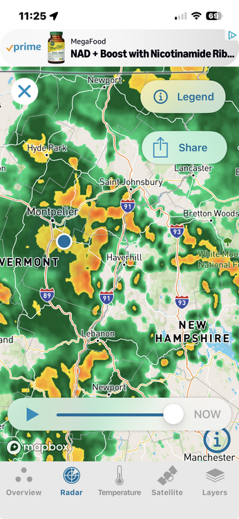
Doing quite well in NNE for a "general tstm" outlook days. Stormin' since 3pm NH/VT! CoastalWx proby miffed the Lakes Region got hit again.
-
May need a FFW around Lincoln soon
-
Scott HATES Dec 11-12, 1992. Just 5 mi away over a foot while Brockton got shafted. Even Logan got more (9") than Brockton. I got 18" in Woburn -- that officially ended the snow drought and it was my first foot plus over 8 years. Then the "good years" followed. What about March 2001? 22" In Woburn and Logan was MEH, so Scott really got stiffed in GHG!
-
March 1960 was epic, and so was Feb 1969 for different reasons.
-
Pot calling kettle! This is coming from the same person who just said to me in an email "SNE SUCKS!" when I sent him pix and video of the possible spinner in Thornton NH on 6/6. He got a spinner in his city a few years ago -- but not gouud enough -- "I WANT IT EVERY YEAR!" Nothing short of 2014-15 winter will ever make him content at this rate!
-
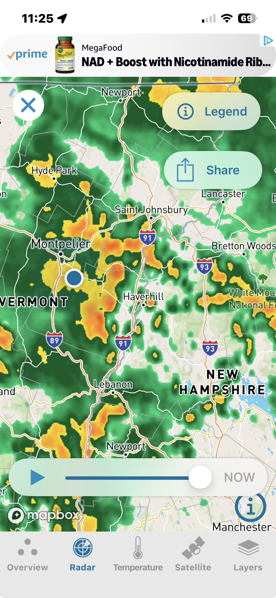
Did these storms roll through your area? Flash Flood Warning out for Wolcott
-
92 here in the armpit of the MRV.
-
+ENSO tends to be more borderline, where -ENSO can flatten out the Atlantic ridge in -EPO.
-
Yet south of there- eastern MD and DE- have done very well with snowfall wrt to avg since 2017. Rehoboth has had 3 or 4 blizzards between 2017 and last year. Pretty anomalous.
-
We've had 13 straight February's with +NAO. 10/13 were >+1.00. Something has to give there. For comparison, our last Winter one month (DJFM) with NAO <-1.11 was Dec 2010.
-
Just wild.
-
Before last Winter, PHL's lowest 7-year snowfall on record was 13.3"/yr. 2018-2025 was 10.5"/yr, a pretty big difference. They were the epicenter of the snow drought but I think had a near average season last year.
-
Sure is nice. 66/64. Nice cool breeze coming in through the window.
-
Looking like it's just gonna be some rain that should be long gone by daybreak instead of sustained overnight development, could be a rocking day