All Activity
- Past hour
-
 Yeah the euro backed way off
 -
Based on NYC 30”+ snowfall, a Niña wasn’t a winter killer in: 2020-1, 17-18, 16-17, 10-11, 05-06, 00-01, 95-6, 55-6, 38-9, 33-4, 17-8, 16-7, 03-4, 1893-4, 86-7, 72-3 So, out of 43 La Niña winters including the unofficial 2024-5, 16 of them (37%) had 30”+ of snow at NYC.
-

Hurricane Erin: 140 MPH - 937 mb - NW @ 10
BarryStantonGBP replied to BarryStantonGBP's topic in Tropical Headquarters
lopsided lmao erin just go to istanbul at this point is she ever going to redeem herself from this crap or what -
 Most models don't have very much for most of the area
 -
Rain, wind, big waves on the shore from the leftover front. Day to go the outlets...
-
Might even be NYC
-
Congrats CT. AWT.
-
 I think 75 but that was when the Hillsborough thermo was busted
 -

2025 Lawns & Gardens Thread. Making Lawns Great Again
jbenedet replied to Damage In Tolland's topic in New England
Crab grass war finally over and won. Time to reseed the bare spots—-going primarily Texas bluegrass in these patches… -
Do any of the other current tropical waves have a shot at the east coast or are they doomed to follow the Erin path again? Edit: or is it just too early to make that determination?
-
Nothing like that here.
-
Crazy how on the WNC side of the apps this month has erased all drought conditions and we can't dry out at all. I think we had a brief window this weekend but then rain yesterday evening and this morning raining already.
-
kids go back to school next week, it's over....
-
Lots of NC live cams at this link. https://www.surfchex.com/cams/hatteras-web-cam/
-
We can only hope-got .50 here Sunday night it's all dried up now
-
Another fantastic day on tap today!
-
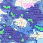
 No thread until 230PM: PRE seems in play but best axis for 2-4" rain, isolated 5" is unknown though may be favoring LI or NJ. Just too soon. It's banded so some folks only 1/4" and others rejoice in 2+. 12z/19 guidance may be helpful. Timing of wetting event (positive impact imo for many in recent drought) is Noon Wed-Noon Thu. While impacts positive for needed rain, I think there will be fairly high negative impact Wed even-Thu AM commutes in and out of NYC. Second part of a potential thread is the unknown, whether TS gusts will reach s LI and Nj coasts (gusts 40-50 MPH) later Thu. Possibility of moderate coastal flooding, mainly NJ coast Thu eve. Rip currents and high surf are a given.
 -

2025 Spring/Summer Mountain Thread
Met1985 replied to Maggie Valley Steve's topic in Southeastern States
Rain already this morning in parts of the mountains with a 4 car wreck on I40 going towards Asheville from Haywood. -
 BLD on top of the recent loss of the ash trees is just heart breaking. At least they working on the American chestnut!
 -
 69 / 56 clear out. Into the cool we descend. Period of onshore and cooler with potential localized (much discussed) rain from influences of Erin Wed-Thu (AM). Beyond there drier and another (5th or 6th in a row) nice weekend coming up. Riding near to slightly below normal Thu - Sun. Front arrives and late Sunday and overnight into Monday then trough into the northeast Mon - most of next week. Some moderation towards the close of the month but likely the reversal waits till the last day of August to shift warmer and beyond. 8/19 - 8/21 : Cooler / Rain localized Erin influenced/enhances Wed/Thu. (north) 8/22 - 8/24 : Near normal - great dry weekend 8/25 : Front - storms next chance after the Wed/Thu AM Erin rain. 8/26 - 8/30 : Trough - cooler - perhaps wetter overall 8/31 - Beyond : Ridge building east - Warmer overall
 -
As previously mentioned, it will likely not technically reach a Niña (5 consecutive tri-monthly SSTA of -.5C at ENSO 3.4), but other measurements like MEI and RONI likely will. So it shouldn't be overwhelming.
- Today
-
Depends on strength and other factors. Right now we are looking at a weak La Nina.
-
The heat has definitely brought on flash drought conditions for much of middle & west TN. Moderate drought in some places already. Heading into the drier months is not helping either. Hope for a tropical system to be a drought buster otherwise.
-
The summer of cloudy, humid, swampy continues. The NAM has been way overdone with rain. The HRR looks more credible imo. It just has a bit of drizzle for basically the entire week.
-
50’s and rain for many tomorrow ?


