All Activity
- Past hour
-
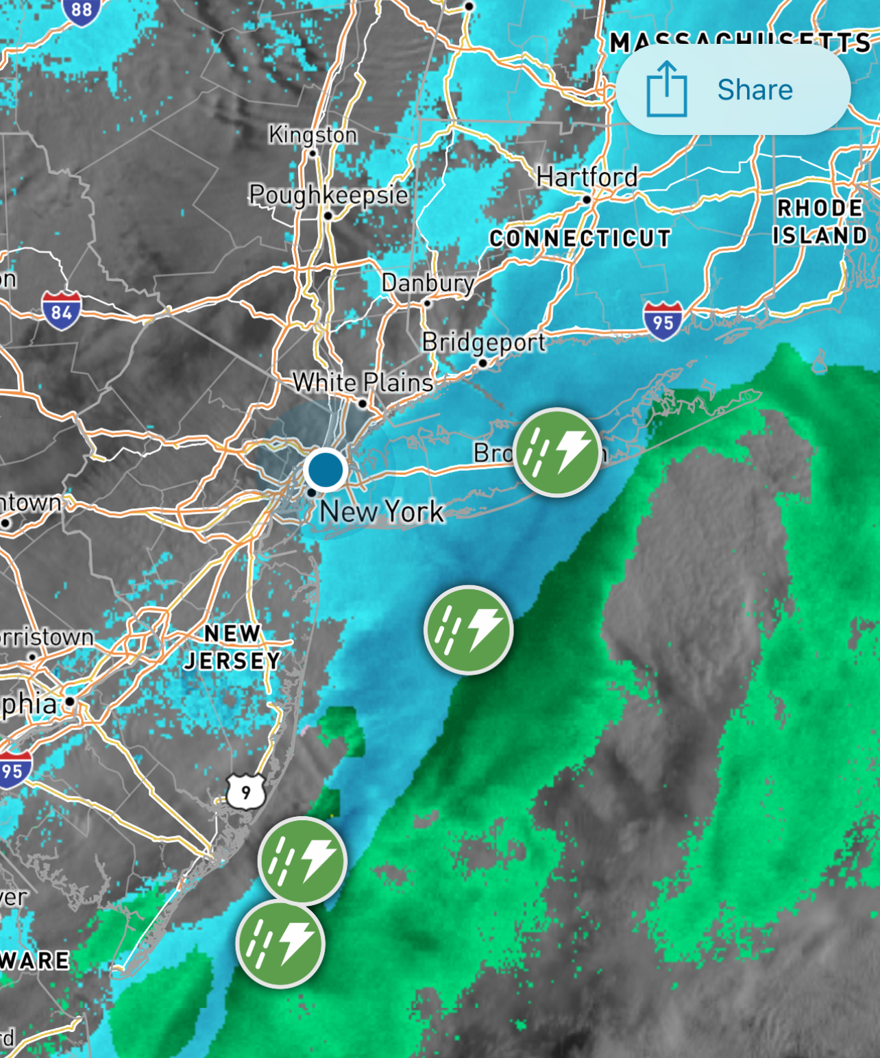
I would be infinitely grateful if you shared where this radar is.
-
Score another win for the SPC HREF as it had that heavier band into Fairfield.

-
Tomorrow night
-

Is we back? February discussion thread
40/70 Benchmark replied to mahk_webstah's topic in New England
We have spoken about how this was due to happen because we are usually close, and you had been killing me the past several years. -

2/24 - 2/25 Clipper Obs (1 - 2" for many on forum)
mikem81 replied to Northof78's topic in New York City Metro
Almost at 2 inches here in SW Nassau. Seem to be winding down -
Yeah it looks like it picked up on the radar off the jersey coast (now)
-
(002).thumb.png.6e3d9d46bca5fe41aab7a74871dd8af8.png)
Central PA Winter 25/26 Discussion and Obs
ChescoWx replied to MAG5035's topic in Upstate New York/Pennsylvania
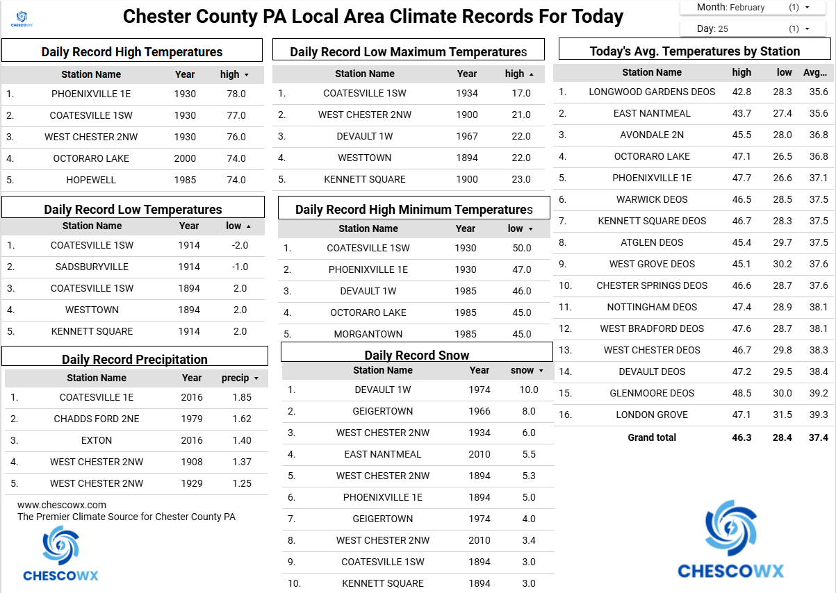
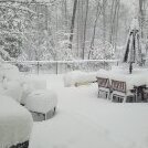
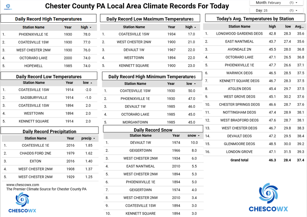
Some light snow has crossed the area this morning with mainly a coating here in NW Chester County to some reports of a 1/4 inch across southern Chesco. We warm up nicely today to near normal in the low to mid 40's which should help melt some of our snowpack that has now reached 40 straight days with at least an inch of snow on the ground. This is the 9th longest stretch since 1894. Another shot at some light snow tomorrow evening. A little cooler on Friday before our warmest day of the year looks possible on Saturday with temps in the low 50's. We turn colder Sunday and there will be some potential for yet another winter storm early next week but way too early to nail down specifics.
-
E PA/NJ/DE Winter 2025-26 Obs/Discussion
ChescoWx replied to LVblizzard's topic in Philadelphia Region
Some light snow has crossed the area this morning with mainly a coating here in NW Chester County to some reports of a 1/4 inch across southern Chesco. We warm up nicely today to near normal in the low to mid 40's which should help melt some of our snowpack that has now reached 40 straight days with at least an inch of snow on the ground. This is the 9th longest stretch since 1894. Another shot at some light snow tomorrow evening. A little cooler on Friday before our warmest day of the year looks possible on Saturday with temps in the low 50's. We turn colder Sunday and there will be some potential for yet another winter storm early next week but way too early to nail down specifics.
-
Is we back? February discussion thread
40/70 Benchmark replied to mahk_webstah's topic in New England
Yup, absolutely, but I have had pretty much the lowest relative to average over the past 10 years considering I've been largely just too far south/close to the coast for the large interior/NNE events. Sure, I got thrown a bone on 2/1/2021, 1/7/2024, but the numbers don't lie...there is a reason I went 8 years without getting within 10" of average. I wasn't implying that I got screwed in a mesoscale sense on Monday...maybe a bit considering there was a weak H7 band to the NW, but that was mainly a collective screwing ...agreed. -

Clipper Fires In Wednesday Feb 25 Disco/ Obs
Lava Rock replied to Damage In Tolland's topic in New England
was driving to work and needed the sunglasses. -
Didn't think WOR was that far ahead of the mean. More than Caribou, lol.
-

Pittsburgh/Western PA WINTER ‘25/‘26
colonel717 replied to Burghblizz's topic in Upstate New York/Pennsylvania
4.5 days away pretty much in the bullseye. Like that will work out... Plus EURO has it way north and later. I'd like to see the models show it south of us for now. Then bring it north Sat and Sunday. -
-

2/24 - 2/25 Clipper Obs (1 - 2" for many on forum)
donsutherland1 replied to Northof78's topic in New York City Metro
With today's 1.4" (3.6 cm) snowfall, New York City (Central Park's) season total snowfall has reached 43.4" (110.2 cm). That makes Winter 2025-2026 the 30th snowiest winter on record. Records go back to 1869. -

Clipper Fires In Wednesday Feb 25 Disco/ Obs
WxWatcher007 replied to Damage In Tolland's topic in New England
Nice, congrats. Just ripping here. On the back edge. -

Clipper Fires In Wednesday Feb 25 Disco/ Obs
Greg replied to Damage In Tolland's topic in New England
Moderate snow falling here 18.0F -
Moved to banter, lol.
-

Central PA Winter 25/26 Discussion and Obs
Jns2183 replied to MAG5035's topic in Upstate New York/Pennsylvania
What was your question? The reason the odds were so high there wasn't because it snowed a 100". It was because it did so essentially back to back years. You essentially have two 99th percentile winters happening in a rough. I accounted for the "stickyness" of winters through autocorrelation Sent from my SM-S731U using Tapatalk -
Tomorrow night or next week lol. There are so many.
-

Clipper Fires In Wednesday Feb 25 Disco/ Obs
HoarfrostHubb replied to Damage In Tolland's topic in New England
Leominster MA looking into Lancaster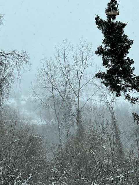
-
2.0" here, solid little clipper
-

Clipper Fires In Wednesday Feb 25 Disco/ Obs
dryslot replied to Damage In Tolland's topic in New England
Sun was out 15 mins ago,
-

February 2026 OBS & Discussion
WeatherGeek2025 replied to Stormlover74's topic in New York City Metro
there was some thunder and lightning with this event
-

Clipper Fires In Wednesday Feb 25 Disco/ Obs
mahk_webstah replied to Damage In Tolland's topic in New England
I don’t see any back building of any significance up here. Very light now and that’s about it. Maybe it’ll backfill down south. -

Clipper Fires In Wednesday Feb 25 Disco/ Obs
EastonSN+ replied to Damage In Tolland's topic in New England
2.75 Easton CT. 52.7 on the year. Solid A- winter here.