All Activity
- Past hour
-
Radar looks plenty juiced to me. That dry slot is over Southern PA and might not even make it that far North. The HRRR has a very brief dry slot before another band comes through overnight.
-
18z Euro Ai keeping hope slightly alive for next week, 12z eps still had a few good members in there. .
-

January 25-26 Winter Storm Potential
RU848789 replied to Ralph Wiggum's topic in Philadelphia Region
As of 6 pm, we've gotten 2.5" of mostly sleet since 1 pm (1/2" the past hour, which is 1.5" worth of snow as we've been under an intense band); that brings our total up to 10.8" of snow/sleet and we have a shot at a foot. 17F. -

Pittsburgh/Western PA WINTER ‘25/‘26
MikeB_01 replied to Burghblizz's topic in Upstate New York/Pennsylvania
its coming.. I can smell it -
Extreme Cold, Snow & Sleet: SECS 1/24 - 1/26
RU848789 replied to TriPol's topic in New York City Metro
As of 6 pm, we've gotten 2.5" of mostly sleet since 1 pm (1/2" the past hour, which is 1.5" worth of snow as we've been under an intense band); that brings our total up to 10.8" of snow/sleet and we have a shot at a foot. 17F. -
IAD (Dulles Int'l Airport) is currently at 2.02" qpf for this event. Over 2 inches of qpf all frozen. Wet storm.
-

Southern MD / Lower Eastern Shore weather discussion
csnavywx replied to PrinceFrederickWx's topic in Mid Atlantic
About a quarter inch of glaze so far. -
 Looks like it
 -
That line just came through here. Wind chill around -10. Too bad it won't last long.
-

Southern Crippler - Get well soon Jimbo Storm Obs
WinstonSalemArlington replied to BooneWX's topic in Southeastern States
Franklin, TN is a disaster area https://x.com/claytravis/status/2015535968091037730?s=46&t=5ny5bPgiX5Vy3bQMvYTY5g -
I saw it on my laptop. It's like every other page.
-

Central PA Winter 25/26 Discussion and Obs
AccuChris replied to MAG5035's topic in Upstate New York/Pennsylvania
Still sleeting in Lebanon. Measured another 1” of sleet since 2PM making the total snow/sleet here of 12” . -

Southern Crippler - Get well soon Jimbo Storm Obs
Leesville Wx Hawk replied to BooneWX's topic in Southeastern States
We may pull something off possibly! If we can get mainly sleet with say 0.3”QPF, that could equal almost an inch. I would take 0.5” and be satisfied. Winter storms need an inch on the ground that’s white imho. . -

Pittsburgh/Western PA WINTER ‘25/‘26
blackngoldrules replied to Burghblizz's topic in Upstate New York/Pennsylvania
I hope we can get in on some of that down here. Looks like we got dry slotted a bit but it's trying to fill back in here. -
I had 7.6" around the time of transition, and every time I went back out to measure each hour, it remained at 7.6". So there was enough compaction to counter any sleet accum. Haven't been out since 4 PM though, so will check again at 7:00. Hopefully have resumed a bit of accumulation since then, rather than only making the existing back denser (but not deeper).
-
I see it now too. Def not sleet. It's floaty and going sideways.
-
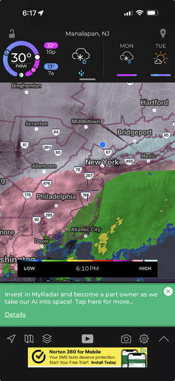
looks like a lull but there's more over Allentown PA area moving ENE
-

Southern Crippler - Get well soon Jimbo Storm Obs
NorthHillsWx replied to BooneWX's topic in Southeastern States
Imagine this but all day -
 Wondering the same thing.
 -

Southern Crippler - Get well soon Jimbo Storm Obs
EarlGrey replied to BooneWX's topic in Southeastern States
Sleeting hard here in Cary right now. -
 The town typically runs hot because of the nuclear waste dump over by the Little League fields.
 -

Southern Crippler - Get well soon Jimbo Storm Obs
SouthboundYank replied to BooneWX's topic in Southeastern States
Yeah. No way in HELL that DCA, despite being an official airport, should be an actual reporting station...because its recorded obs in no way reflect real-world conditions even several to ten miles radius from that freakin' UHI. So ridiculous...but this has been discussed ad nauseum in the MA forum for many years. -
 10°/8° just topped 13", still coming down, first time today we are out of the single digits temp wise, watching the echoes down to the SW moving up into CT, hopefully these rates keep until at least midnight, we'll definitely top 18" if so.
 -
 Back to snow se ct


