All Activity
- Past hour
-
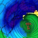
Possible coastal storm centered on Feb 1 2026.
mahk_webstah replied to Typhoon Tip's topic in New England
It wants to come north, but does it want to come west? -
Possible coastal storm centered on Feb 1 2026.
Kitz Craver replied to Typhoon Tip's topic in New England
Maybe the GFS becomes the Euro, and the Euro becomes the GFS. Up becomes down and all the like, because that’s what happened in 2013! Just wait for it! -
1/24-1/25 Major Winter Storm - S. IL, IN, and OH
Stevo6899 replied to A-L-E-K's topic in Lakes/Ohio Valley
Those old school maps had us in dark red, 2 feet plus for like 2 days and if had not gone nw last min, I think we would've been close to 20-24. I think one year soon we're gonna get a big dog the same night the lions win the sb in buffalo when they host it in their new stadium. What a night it will be. -

January 2026 Short/Medium Range Thread
Save the itchy algae! replied to John1122's topic in Tennessee Valley
Don’t tempt me with a good time sir. . -
Pinkham Notch started out with 37" OTG, wound up with 50.
-
bearman started following 1-30/2-1-26 Arctic Blast, ULL Snow Event
-
Oh, my it sounds like we are in the same place we are always in two days from a storm. No one knows if we are going to get zip or if we are going to get a good dry powder dump. i remember back in 93 living in Chattanooga, and we had a meteorologist that I really liked, Neal Pascal. We had been told for the most part we were going to have a big storm for a week. I had a friend from Fla that had never been in a real snow, and he wanted it to happen so bad. Then right before the storm hit Neal did or said something on one of his updates right before the storm that gave the impression that it was not going to be all that bad, and some might not get much at all. It was such a gut punch that we took off up to the skyway down near Tellico. Bad decision. We barely made it home that evening. I just can not imagine living somewhere that when snow is forecast you can count on it.
- 54 replies
-
- extreme cold
- snow
-
(and 1 more)
Tagged with:
-

Central PA Winter 25/26 Discussion and Obs
pasnownut replied to MAG5035's topic in Upstate New York/Pennsylvania
and just like that.....CMC tries to pull off my wish. Notably more neg tilt, but still a whiff. Now IF that could be the start of the normal north trend, I'd not write this one off. Lots stacked against right now. -

The Jan 31 Potential: Stormtracker Failure or 'Tracker Trouncing
rjvanals replied to stormtracker's topic in Mid Atlantic
Ask yourself how confident would you be in Raleigh or Norfolk that you’d be getting a blizzard this weekend? -

The Jan 31 Potential: Stormtracker Failure or 'Tracker Trouncing
snowmagnet replied to stormtracker's topic in Mid Atlantic
What did Boxing Day do? It went south in the last 24 hours. It was supposed to be our storm. Last week it looked like Richmond was bullseye for 2 feet, and it went west, hitting PA, Boston, and NY in the last 24-48 hours. What about PD2? I don't know the details as I was pregnant and sick at the time, but I know we were not supposed to get nearly that much snow. It was either Feb 2013 or 2014 when the Polar Vortex caused some very confused models and we got a lot of cold and surprising high snow totals out of it. This is clearly not a 2016 storm, but coastal storms can be very tricky depending on where that Low decides to stall. I could be 100% wrong, which would make my Raleigh and Southern VA friends very happy, but I think the models will be struggling with this until game time. Just my amateur "cup is half-full" two cents. -
The “I bring the mojo” Jan 30-Feb 1 potential winter storm
SnowGoose69 replied to lilj4425's topic in Southeastern States
Many notable events here https://www.eas.slu.edu/CIPS/ANALOG/DFHR.php?reg=SE&fhr=F084&rundt=2026012812&map=thbCOOP72 -
They must be looking at just the low pressure because even without the low pressure forming we are still getting snow from the pv dropping down. These maps are stupid for us.
-

The “I bring the mojo” Jan 30-Feb 1 potential winter storm
NorthHillsWx replied to lilj4425's topic in Southeastern States
Eastern, especially NE NC is way underrated with regards to snowstorm performance. Perfect location when these cold coastals get cranking if they can avoid the warm nose. Elizabeth city has seen some of the biggest storms in the state. Recently they’ve done better than most on the board -
is there a good explanation for the big misses from the various model outputs? Was there a model that was better on our actual realized temps?
-
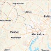
The Jan 31 Potential: Stormtracker Failure or 'Tracker Trouncing
aldie 22 replied to stormtracker's topic in Mid Atlantic
Being so far NW i'm kind of enjoying the angst and hair pulling to the south. All I know if we end up getting something out here it will be pretty awesome, if we don't we were never in the game anyway -

Possible coastal storm centered on Feb 1 2026.
mahk_webstah replied to Typhoon Tip's topic in New England
Did you just make that up or should we adopt it as a new rule? -
Many notable events here.....more for the SE overall https://www.eas.slu.edu/CIPS/ANALOG/DFHR.php?reg=SE&fhr=F084&rundt=2026012812&map=thbCOOP72
-
The trough orientation is neutral on the Canadian and actually does go negative at the last minute. I think it would have ended up better if not for the double barreled low.
-
Richmond Metro/Hampton Roads Area Discussion
ecrugger replied to RIC Airport's topic in Mid Atlantic
I think you'd be able to get out of here by Monday. The side roads will be messy, but at least driveable by then, and they'll have the interstate cleared. I'm making a decision the other way. I'm supposed to fly back into Norfolk Sunday night. -
I posted the wrong run.
-
does anybody have the GEFS individual ensemble members graphic chart ?
-
Still no consensus
-
Yeah but they are too far south. Get them clustered 100 miles north of there and lookout in Tom’s River.
-
Possible coastal storm centered on Feb 1 2026.
EastonSN+ replied to Typhoon Tip's topic in New England
Yeah GEFS just flat out worse. -
I think UK is never worth posting!
-
Anyone who's out now hasn't been at this for awhile. We got a day before the blinds start to close. Need to see those trends work in our favor on the 18z and 00z runs. If we're having this conversation at the same time tomorrow it's probably time to plan a trip to central NC or get out a pack of that smooth cold cirrus. I heard it doesn't have nicotine and isn't addictive.


