All Activity
- Past hour
-
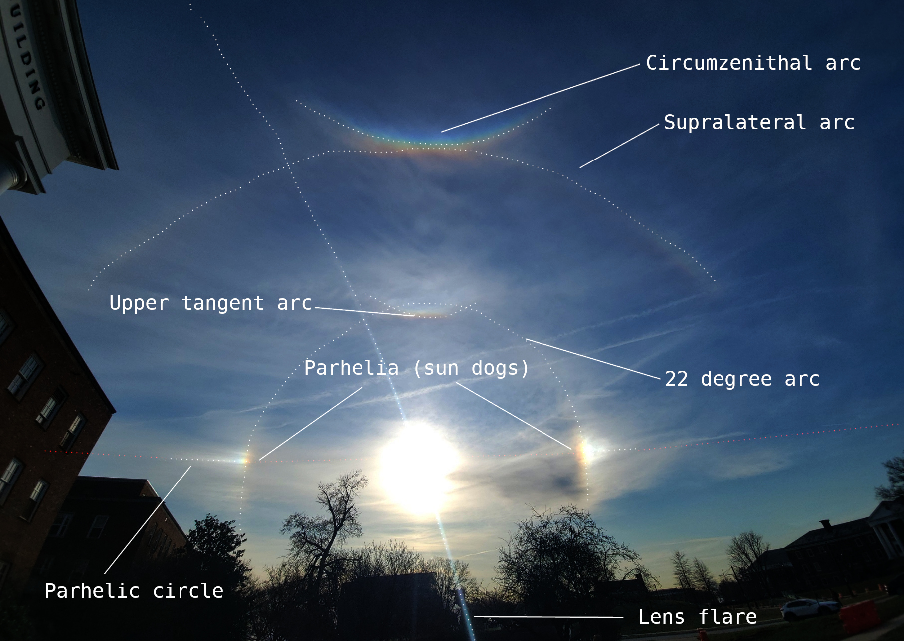
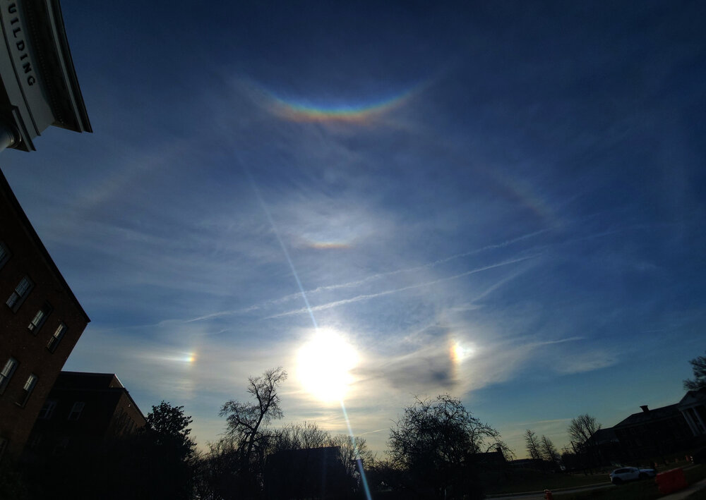
My son took this image from UMD last Friday of some cool optical images in the sky that I thought I would share. This thread seemed like the right place for them.

-
And now it's time for pressing the refresh button for the 1730z SPC OTLK lol
-
I’m so ready for the 3” of wet snow that will cover the remains of my house after it gets hit by a tornado
-

3/16/26 Severe Weather Event Thread (Day 2 MOD Risk)
Eskimo Joe replied to Kmlwx's topic in Mid Atlantic
That's an entirely different event. -
My wife disagrees with you
-
Send it up our way. Looking at 1". We'll take more Sent from my SM-S921U using Tapatalk
-
Updated
-

Central PA Spring 2026 Discussion/Obs Thread
Voyager replied to Voyager's topic in Upstate New York/Pennsylvania
When a Texas native, who is used to severe events, is deeply concerned about the set-up and potential for this one, it really makes me take notice. -
Into the warm sector now
-

3/16/26 Severe Weather Event Thread (Day 2 MOD Risk)
EstorilM replied to Kmlwx's topic in Mid Atlantic
I have a weird vibe about this one… going to be a wild day tomorrow. Wish I had my ham license but it’ll definitely be a Skywarn / spotter network day (I still have all the radios, just can’t really [legally] transmit lol.) -
That's what I was thinking however we did just jump to 33F here west of Madison. Reports of snow just to my NW.
-
Can’t really compare that. That day was almost 100 with ton of cape. Also wasn’t even in an Spc outlook for severe in the morning that day.
-
Going to go outside to enjoy the couple of hours above 50 here before the quick temp crash. It’s going to be a wild ride
-
Yeah I think we are going to have changeover sooner than expected here.
-

E PA/NJ/DE Spring 2026 Obs/Discussion
enpawx_observer replied to PhiEaglesfan712's topic in Philadelphia Region
Going to be interesting to see the evolution of this SPC outlook. HRRR and NAM both seem like the cool off a good bit as soon as the line enters Eastern Berks, Western Montco/Chesco. NAM also has been hinting at a later arrival time for the Philly burbs which might tamp down the storms a bit. -

E PA/NJ/DE Spring 2026 Obs/Discussion
Mikeymac5306 replied to PhiEaglesfan712's topic in Philadelphia Region
I could be wrong but if memory serves me right with these severe storms in March we (Philly forum) wind up with a more wind driven event than severe lighting and tornados and such. West of us could be an issue but the daytime heating is gone, and we get the leftovers especially east of 95. -
Northwest wind ripping. Temp has dropped 4 degrees quickly back to 51. Here we go.
-

Pittsburgh/Western PA WINTER ‘25/‘26
Ecanem replied to Burghblizz's topic in Upstate New York/Pennsylvania
68.7 on my tempest right now -
Chaser in WI and into MI. https://www.youtube.com/watch?v=dxFBUJmARtU
-

E PA/NJ/DE Spring 2026 Obs/Discussion
LVblizzard replied to PhiEaglesfan712's topic in Philadelphia Region
A lot of the mesos fail to advance the most favorable severe parameters past Berks/Lebanon counties tomorrow. This doesn’t diminish the wind threat much but the chance for supercells could be confined to central PA. -

3/16/26 Severe Weather Event Thread (Day 2 MOD Risk)
ibawahu replied to Kmlwx's topic in Mid Atlantic
How does this event compare to the 2012 derecho? -
I came home after a trip earlier this week to find 3 feet of meltwater in my basement after a sump pump failure. Should be under control now but the pump will certainly keep working with another inch of rain incoming
-
Been hovering right around freezing. Rain with sleet mixed in during the heavier returns. No ice on roads but sidewalks are definitely slippery ETA this is definitely running a bit colder than models showed yesterday
-
Lived in Wausau back in the day. That place is cold and snowy.