All Activity
- Past hour
-
We probably have a shot at something tomorrow night. Euro and ukie still seem way overdone
-
I've actually seen some damn good storms doing it.. and 6-1-11 one of the best storms I've seen in Northampton then coming home from that storm the Springfield tornado
-
Going to be an interesting anniversary dinner party for us.
-
It is nasty out.
-
I was just gonna post the same thing. Models not showing much anymore ... most of it stays to the north and west. We probably have to wait until Monday into Tuesday for our soaking. As long as it comes eventually.
-
My guess is this weekend will be predominantly dry. Especially tomorrow.
-
0.29"
-
Today and tomorrow will be warm and humid with highs well into the 70’s with some spots touching 80 degrees if we see enough sunshine. Rain chances to increase tomorrow and will last through Tuesday. Not a wash out but some beneficial rains look to be on the way. We should see some drying by Wednesday, but some shower chances look to continue.


-

E PA/NJ/DE Spring 2025 Obs/Discussion
ChescoWx replied to PhiEaglesfan712's topic in Philadelphia Region
Today and tomorrow will be warm and humid with highs well into the 70’s with some spots touching 80 degrees if we see enough sunshine. Rain chances to increase tomorrow and will last through Tuesday. Not a wash out but some beneficial rains look to be on the way. We should see some drying by Wednesday, but some shower chances look to continue.
-
Another day and another chance for severe. Yesterday stayed west and east so hopefully the same happens. There's still lines and trees down all over the city.
-
Was awakened by loud thunder. Fortunately sleep reclaimed me post bangers.
-
I suspect all weather dweebs had their chosen vantage points and would return to them, like a bear remembers a meal, when ever conditions qualified as an opportunity to eat in the specter of the clouds. Mine was the Coldwell Bankers/Insurance parking lot. It wasn't terribly huge, but Acton is one of those used to be forest townships typically found E of the Worcester Hills and west of I95; scoured out over 150 years of white man cometh farming and cow paths, turned eventually into single story shopping plazas separated by two-lane roads. There's still modestly wooded neighborhoods like all townships of this ilk, but that's not too ideal for dweebing. There were fields over by Acton/Boxborough Regional High School... Baseball and football complexes. Tennis courts etc. That town gentrified straight from 1960 provincial town Americana conservatism, right to self-righteous yuppification through the 1980s and '90s... replete with ultra competitive socially abusing rich shit assholes. Imagine a "Beverly's 90210" clone, only uncensored reality. The town actually built a parking lot for the high school students ( high school students!). On any given day ...one might see a BMW SUVs parked out among the other vehicles that no mere Junior in high school has any business sniffin' the interior of... Little oligarch larvae. I dunno. But it's a helluva lot different than when I was there hiding, lest risk ridicule for standing in fields watching TCU's poke up over the tree-lines ... waiting passionately to hear distant thunder murmurs. In other words ... kind of off-limits. I used stand there, arms crossed, in the old Coldwell parking lot, sometimes for up to an hour... I came to be known by the employees, too. Like, omg? What a dork... You ever think back to a time or place or event whence you were a part, and just seethe in private embarrassment? But one time someone emerged from the front of the building and as they passed by, she said, "We see you out here; what are looking for?" I had to laugh... I explained that I was a Meteorology major, the college I was attending ... prefacing the response regarding observing the thunder clouds. That actually made me feel a lot less self-conscious about being a creepy figure just loitering around outside their office windows... haha. She actually took interest and sidled up next to me and started looking at the features I was pointing out to her. Quite validating actually. I wasn't just a chapter out of a J.D. Salinger novel. I don't do that for every day crispy TCU's anymore. You get older and the art of it is reused. But, I do upon occasion stop and gawk if there's suspicion for rotation or just exceptional circumstances in general.
-
Rather warm and a bit humid in the sun here. Placing a compost, top soil mix into the garden this morning, to see if I get better results this year, both in crop yield, but also to see if maybe tomato blight might be reduced by having new soil onto of the over wintering blight spores.
-
Records: Highs: EWR: 92 (2001) NYC: 90 (2018) LGA: 90 (2018) JFK: 83 (2018) Lows: EWR: 35 (1943) NYC: 37 (1903) LGA: 40 (1978) JFK: 39 (1964) Historical: 1899 - A storm buried Havre, MT, under 24.8 inches of snow, an all-time record for that location. The water equivalent of 2.48 inches was a record 24 hour total for the month of May. (The Weather Channel) 1920 - A swarm of tornadoes in Rogers, Mayes and Cherokee Counties in Oklahoma killed 64 persons. (David Ludlum) 1929 - Virginia's worst tornado disaster occurred. Six tornadoes, two of which were west of the Blue Mountains, killed 22 people. Twelve children and a teacher were killed at Rye Cove, in Scott County. Four schools were destroyed by the storms. (The Weather Channel) 1983 - Severe thunderstorms spawned twenty tornadoes across Michigan, Ohio, Pennsylvania and New York State. The tornadoes caused five deaths. (The Weather Channel) 1987 - Thunderstorms in the Lower Mississippi Valley produced golf ball size hail in northern Louisiana, and wind gusts to 77 mph at Lake Providence LA. Thunderstorms in Arkansas produced 4.20 inches of rain at Arkadelphia and 4.00 inches at Bismarck. (Storm Data) (The National Weather Summary) 1988 - A powerful storm produced snow and high winds in the Central Rockies and the Central High Plains Region. Snowfall totals in Colorado ranged up to 12 inches at Strasburg, and winds in southeastern Colorado gusted to 87 mph at Lamar. Snow and high winds created blizzard conditions in eastern Colorado and southeastern Wyoming. (The National Weather Summary) (Storm Data) 1989 - Thunderstorms developing to the north of a warm front produced severe weather in Oklahoma and Texas. There were 93 reports of severe weather. Thunderstorm winds gusted to 80 mph at Beattie, and baseball size hail was reported at Ranger and Breckenridge. Juneau AK reported a record high temperature of 72 degrees while Honolulu equalled their record low for the month of May with a reading of 60 degrees. (The National Weather Summary) (Storm Data) 1990 - Fourteen cities in Florida, Georgia and South Carolina reported record high temperatures for the date as readings soared into the 90s. Tampa FL reported a record high of 97 degrees, and Fort Stewart GA was the hot spot in the nation with a reading of 100 degrees. 1990 - Thunderstorms produced severe weather from northeastern Texas to western Arkansas during the evening and early nighttime hours. Thunderstorms spawned a tornado which injured thirteen persons at Paris TX, and produced baseball size hail at Rio Vista TX. Thunderstorm rains of four to seven inches caused flash flooding in west central Arkansas, southern and eastern Oklahoma, and northern Texas. (The National Weather Summary) (Storm Data)
-
This doesn’t have anything to do with whether you are taking the measurements in a big city of the surrounding areas. It’s is a region-wide phenomenon including all the locations within the general I-95 corridor. First, we don’t have a continuous snowfall record for your individual location spanning more than 60 years. So you are just guessing when it comes to how your recent snowfall compares against historical averages. Second, the stations around your region are in a similar boat as the other bigger city stations that have a longer period of record. So this snow drought is very extensive and isn’t just located in the big cities. Since you can see how close Philly to Trenton and New Brunswick have been. Everyone is near the record 7 season snowfall lows. But we have warmed so much, that a big rebound in the coming years like which followed past snow droughts isn’t as likely. So we are seeing what a decline in snowfall looks like in real time as a warmer climate and storm track will result in less snow. So while it’s within the range of possibilities that we could see a bit of a bounce off these lows in coming seasons, my guess is that 18-19 will mark the shift to a longer term decline which will become obvious when we look back in time 10 to 20 years into the future. Recent 7 year snowfall through 2025 compared to past lowest 7 year stretches. Past snow droughts were the result of too dry and not too warm. This is an important distinction to now as we are experiencing too much warmth for snow. Since in the old days there was always enough cold once the snow droughts ended due to dry conditions ended. Like we saw in the earky 1930s with record cold and snow in 33-34. Also from the late 1950s into early 1960s with the very snowy and cold conditions following those 7 year snowfall through droughts. New Brunswick……2025…..15.9”…….1956……13.8”………1932…..13.8” Trenton…..2025…..14.1”…….1933…..14.2” Philly………2025…..10.5”……1932…..12.3”
-
Stein happy. 0.45” rain and 0.01” bird poop.
-
67 / 57 and on the way to the 6th 80s degree day for many. Partly cloudy . Warm and more humid tomorrow with scattered showers and storms in the evening as the cutoff to our west pumps a southerly flow - heaviest rains Sat North and west. By Sunday the ULL is pushing east and continued scattered showers/storms with the brunt of the heavy rain north and west. Mon - Wed AM look to see the heaviest rains with totals of the Fri - Wed period in the 2 - 4 inches range with more north and west. Beyond there 5/8 - mid month looks near normal temps wise and could see normal rainfall. No sustained period of cool or warmth exected through mid month.
-

2025 Lawns & Gardens Thread. Making Lawns Great Again
tunafish replied to Damage In Tolland's topic in New England
That's my threshold - once the clover flowers, I mow - probably 2nd/3rd week here. This year I am pulling Dandelions, taproot and all, as I see them flower. Pollinators get a day or two. Not the ones getting choked out by grass or clover (I juat get the flower before it seeds), just the ones that are dominant flora in their space. They've claimed too much territory for my liking. Tried corn gluten for the crabgrass this year. It's been time in the past, but I want clover and grass taking over the dandelion space, not crabgrass. -
Heavy rain and big thunder overnight. .4 in just a few minutes. The town hwy dept garage 1.5 miles away recorded .78!
-
I have a spot a few miles from my house, its on top of a high hill and you can see for miles, when I go there's usually 3-4 other people up there for the same reason.
-
Wasn't expecting a great deal of sun today but can't wait to at least get some and warm it up a bit. Pretty warm aloft so once we get some heating temps will jump.
-

Central PA Spring 2025
Itstrainingtime replied to canderson's topic in Upstate New York/Pennsylvania
SPC has a lot of central PA in a MRGL risk for tomorrow - meanwhile. MU has been touting a big time severe potential for several days now. He's expecting violent storms later tomorrow. (at least down this way) -
Yeah, that will be good at least. I just hate when it's wall to wall clouds for 72-120 hours this time of year. After we got sunny and windy and 40 degrees for months
- Today
-
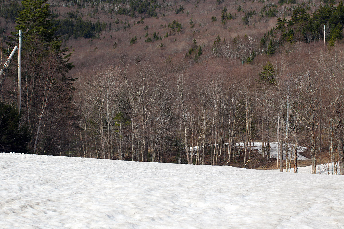
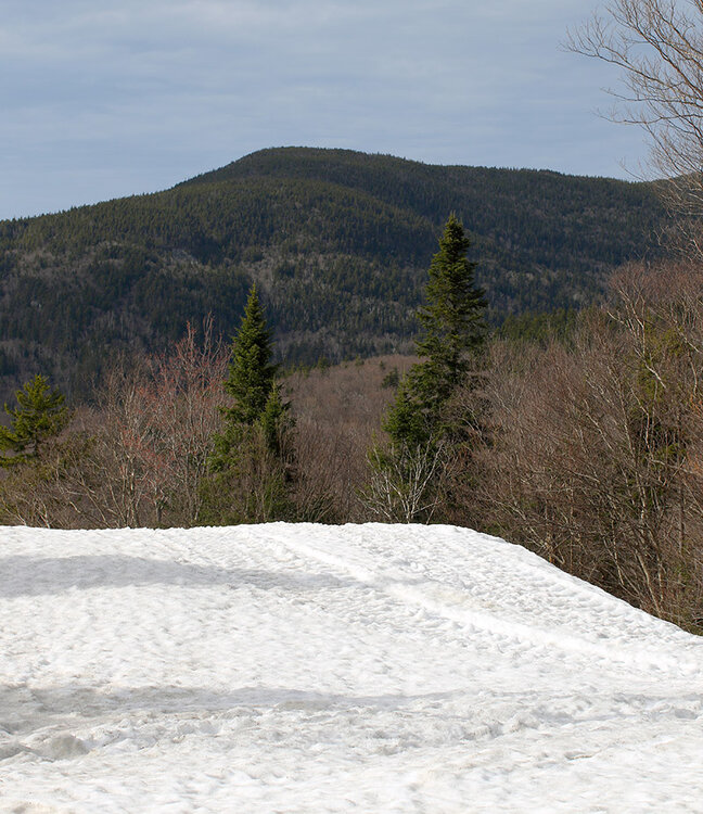
The forecast for the coming days looks fairly unsettled and showery, so I decided to take advantage of the sunny conditions yesterday to get out for a ski tour up at Bolton Valley. I expected that I’d need to head up to the main base at 2,000’ because the Timberline area would be too melted out to offer decent touring opportunities, and indeed that was the case. On the way up the Bolton Valley Access Road, I could see that the Timberline terrain was down to just patchy snow. There are still some continuous routes of snow up at the main mountain though, so that worked out well to get in some afternoon touring. Enough areas of terrain above the main base have melted out to make it practical to go with either hiking or skinning on the ascent. I just had my skis on my pack to simplify things without the need to bring skins, and indeed I found plenty of grassy areas for hiking. The snowpack at Bolton is certainly developing sun cups/melt cups in many areas now, so the turns weren’t as smooth as my past couple of outings, but with the warmth and sun, the snow was definitely soft enough for some decent spring turns.

-
0.35" overnight with some decent thunder around 4am.