All Activity
- Past hour
-
 That's 4 hours ago. I feel confident we will do fine in Wake co
 -

Winter cancelled/uncancelled banter 25/26
Volcanic Winter replied to Rjay's topic in New York City Metro
Definitely starting to adjust to these temps, today actually feels mild to me at 25f and I’m out in a lighter jacket than previously. You really do begin to acclimate rather quickly, but then again our home is set to 68 so it’s not overly warm inside where it destroys that. My parents house is on like 78 . -

January 30th- Feb 1st ULL and coastal storm obs
wxmaggot replied to JoshM's topic in Southeastern States
Been pouring just outside King NC for several hours now. Roads here were treacherous before this hit. Guess I'll make it to work in two weeks!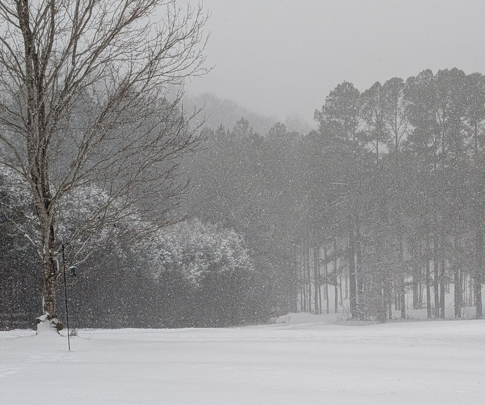
-

February 2026 Medium/ Long Range Discussion: Buckle Up!
Heisy replied to Weather Will's topic in Mid Atlantic
I hope, I’m a little worried about ridge bridge of death right before mid month. Can see it on the AiGFS and some other models. We’ve been able to avoid it so far so hopefully that continues. Too far out to know yet of course. I agree we’ll have multiple chances rest of year regardless though. It’s on the Euro OP too ugh -
66" here that winter. 34" after March 1.
-

Richmond Metro/Hampton Roads Area Discussion
wasnow215 replied to RIC Airport's topic in Mid Atlantic
Looks like not only do you have to be south but you have to be east also, because it is showing snow in Petersburg but no snow here in 23120 by Magnolia Green. -
Have reached 20 degrees. It's quite bearable outside without the wind and bright sun. The sun angle is already noticeably higher and stronger than 5-6 weeks ago.
-

Jan 30th-February 1st 2026 Arctic Blast/ULL Snow OBS Thread.
bearman replied to John1122's topic in Tennessee Valley
We are getting heavy snow again at the moment. -

February 2026 Medium/ Long Range Discussion: Buckle Up!
Chris78 replied to Weather Will's topic in Mid Atlantic
I was thinking the same looping the gfs through 384hr. Fast flow but multiple chances it appears. -

Richmond Metro/Hampton Roads Area Discussion
Rsheely88 replied to RIC Airport's topic in Mid Atlantic
No idea what Wakefield is seeing maybe Synoptics?? -- Changed Discussion -- As of 935 AM EST Saturday... KEY MESSAGE 1...A strong winter storm impacts the region today. Significant accumulating snowfall, blowing and drifting snow due to strong winds, coastal flooding, and major marine impacts are expected. The highest confidence is across south and southeastern portions of the area. There will be a very sharp gradient in total snowfall amounts, southeast of the US-360 corridor. Made significant adjustments to the forecast this morning after reviewing current conditions/radar trends and the 6/12z model guidance. Snowfall amounts have been lowered for much of the western and northwestern half of the area. Winter Storm Warnings have been replaced with Winter Storm Advisories across south central VA as well as western Tidewater/western Hampton Roads. First, there is a ton of dry air to our north and northwest. Currently at AKQ (Wakefield), the dewpoint is 3F and at OFP (Ashland) it is -2F. Any precipitation will need to overcome this dry, Arctic airmass. Also believe we may be trying to downslope the incredibly dry and cold air, located over the Ohio Valley, across the Appalachians and Blue Ridge...further drying out the local airmass. The latest 12z high-res model guidance is also significantly drier, especially north/northwest, with certain solutions even struggling to bring much more than an inch past the VA/NC border. Still think there will be a decent snowfall 4-8"+ for many areas across southside Hampton Roads into our northeastern North Carolina counties. There may even be a "jackpot" of 5-10"+ from far southern Virginia Beach down into Currituck County, NC. Northwest of these locations, there will be a very sharp gradient in snow amounts, and it is not out of the realm of possibilities that places such as Wakefield and Williamsburg (and northwest) may not see much more than a dusting. Didn`t go quite this low with the forecast, but would not be shocked. Thought about canceling the far northern tier of Winter Weather Advisories, but we are concerned that even a dusting of snow combined with the very cold temperatures could result in travel impacts. . -

2025-2026 Fall/Winter Mountain Thread
BhamParker replied to Buckethead's topic in Southeastern States
13.5 inches and still puking. NWS forecast for the afternoon says 5-9. . -

January 30th- Feb 1st ULL and coastal storm obs
mstr4j replied to JoshM's topic in Southeastern States
Getting close to the 4 inch mark in spartanburg right on 85 in Cowpens -

January 30th- Feb 1st ULL and coastal storm obs
KyleEverett replied to JoshM's topic in Southeastern States
I'm really hoping that heavy band over GSP fully rotates to Charlotte and south. It looks cool on radar. -
Heavy snow on radar headed your way
-
Visibility has dropped but the flakes are tiny. White smoke!
-

January 30th- Feb 1st ULL and coastal storm obs
Ravens94 replied to JoshM's topic in Southeastern States
Up to 35 here in the sun hole in sunset beach. -

The “I bring the mojo” Jan 30-Feb 1 potential winter storm
27596WXNUT replied to lilj4425's topic in Southeastern States
Emerald Isle? -

February 2026 Medium/ Long Range Discussion: Buckle Up!
NorthArlington101 replied to Weather Will's topic in Mid Atlantic
Clipper after clipper. I can deal with it They aren’t gonna perform well with mesoscale details but I’d be okay trusting its general output at this range. Whether it’s .05 or .15 of snow is a minute detail that I would trust it to grasp atp -

January 30th- Feb 1st ULL and coastal storm obs
donsutherland1 replied to JoshM's topic in Southeastern States
For today, my desktop is set to: -
I think it will too. 2017-2018 winter I received just under 70” thanks to the March nor’easters. Wonder when we see those amounts again
-
January 30th- Feb 1st ULL and coastal storm obs
UpstateSCBud replied to JoshM's topic in Southeastern States
I’ll show myself the door now…please no one hurt me
-
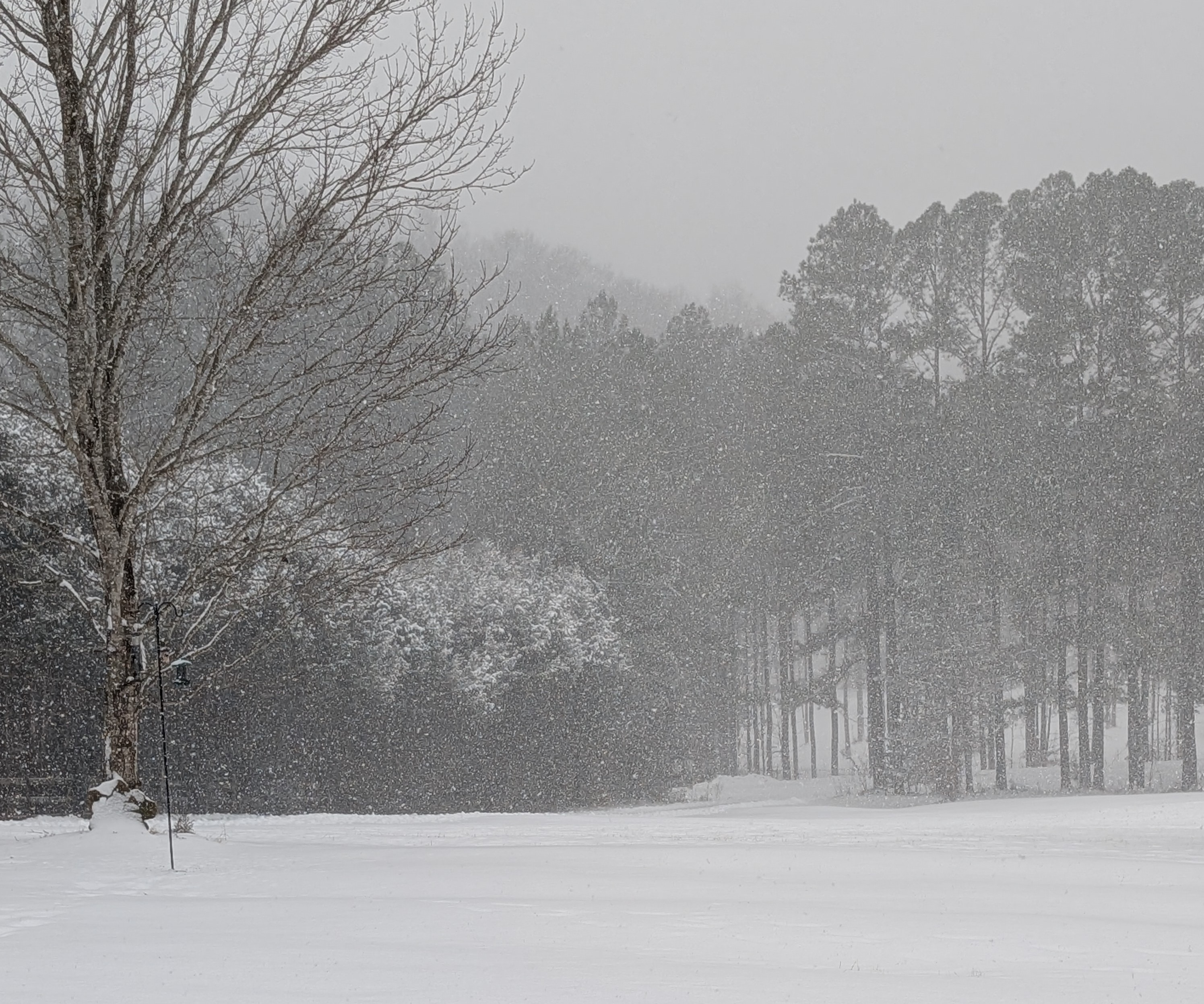
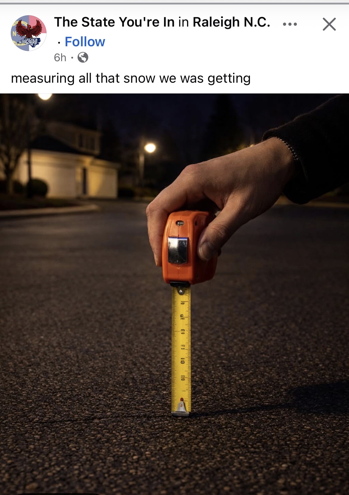
Not just 0 accumulation, but 0 flakes in Durham
-

February 2026 Medium/ Long Range Discussion: Buckle Up!
MDSnow93 replied to Weather Will's topic in Mid Atlantic
Am I remembering correctly that the AI models aren't as good at qpf? -

Possible coastal storm centered on Feb 1 2026.
CoastalWx replied to Typhoon Tip's topic in New England
Think you’ll get some too.