All Activity
- Past hour
-
 Have you met any possible new wives there yet?
 -
 Still drunk?
 -
 Hard sell here. HRRR crushes the areas raining now and everyone else gets half inch
 -
 Congrats on 2-3”
 -
North Branch meso site recorded 5.26” 24hr. Liberty had a local state of emergency. I was in town but nowhere close to where flooding was taking place.
-
Right between me and @Jackstraw Public Information Statement National Weather Service Northern Indiana 517 PM EDT Tue Jul 28 2026 /417 PM CDT Tue Jul 28 2026/ ...Tornado confirmed in Grant County, Indiana from thunderstorms on July 27, 2026... A preliminary survey from the northeast side of Sweetser, IN to the southwest side of Marion, IN has confirmed a tornado, of at least EF0 intensity, was responsible for damage to several trees, as well as at least 1 local business.The circulation quickly weakened, but straight line wind damage continued to the southeast. Track and detailed damage information will be released once further review of data from Grant County Emergency Management is received. This will be no earlier than the afternoon hours of July 29th.
-

2026-2027 Super El Nino
bluewave replied to Stormchaserchuck1's topic in Weather Forecasting and Discussion
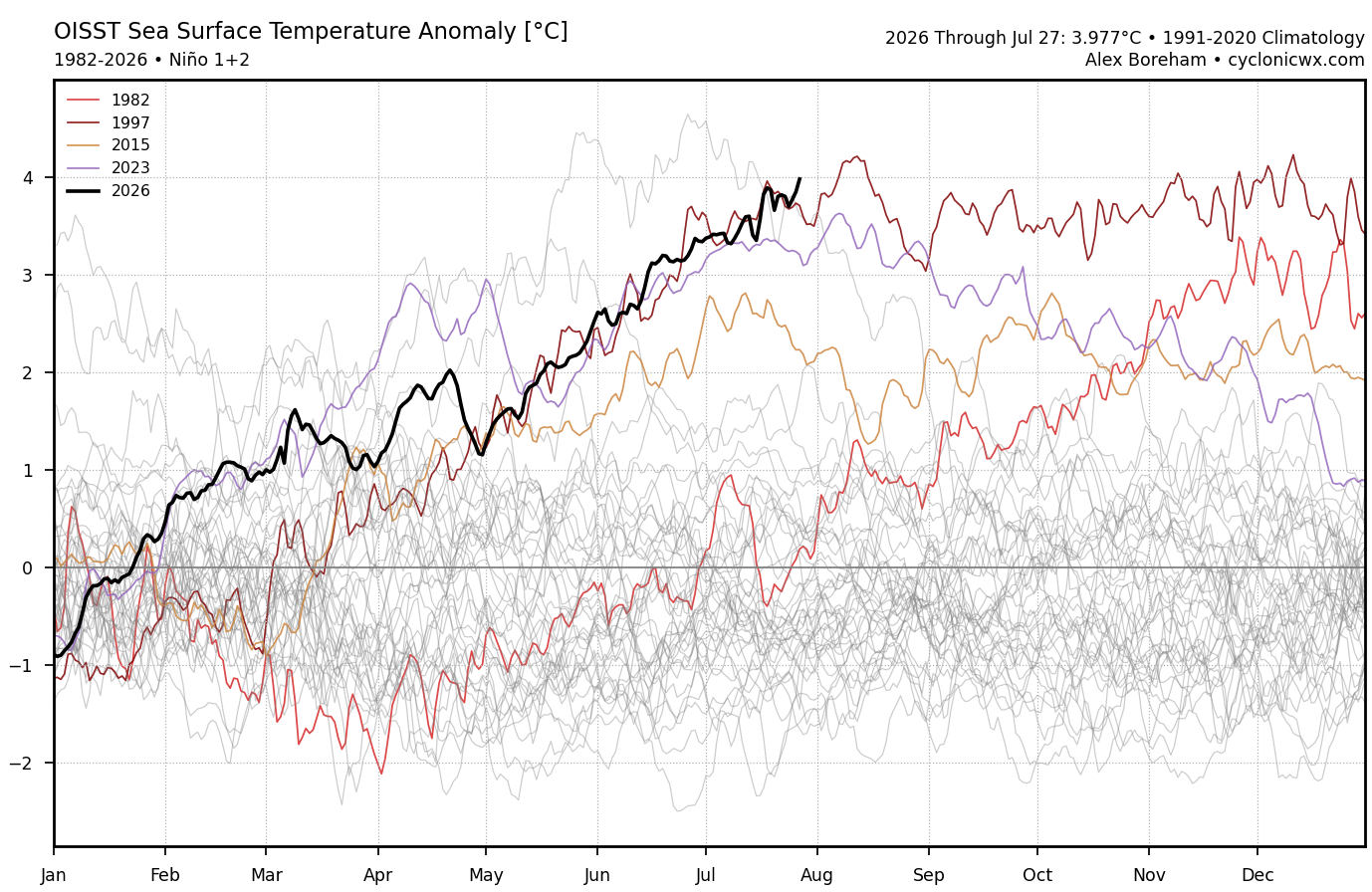
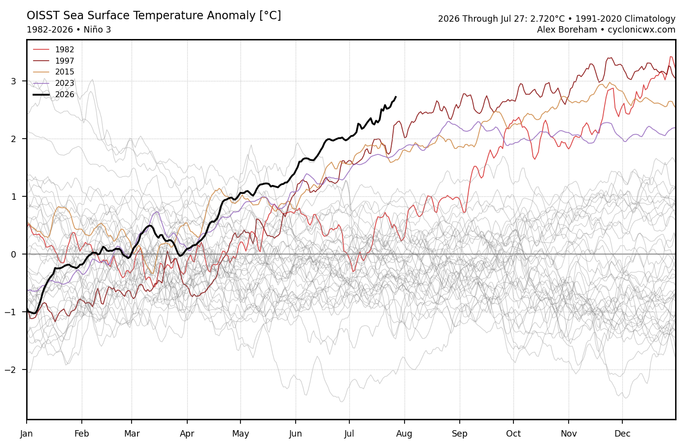
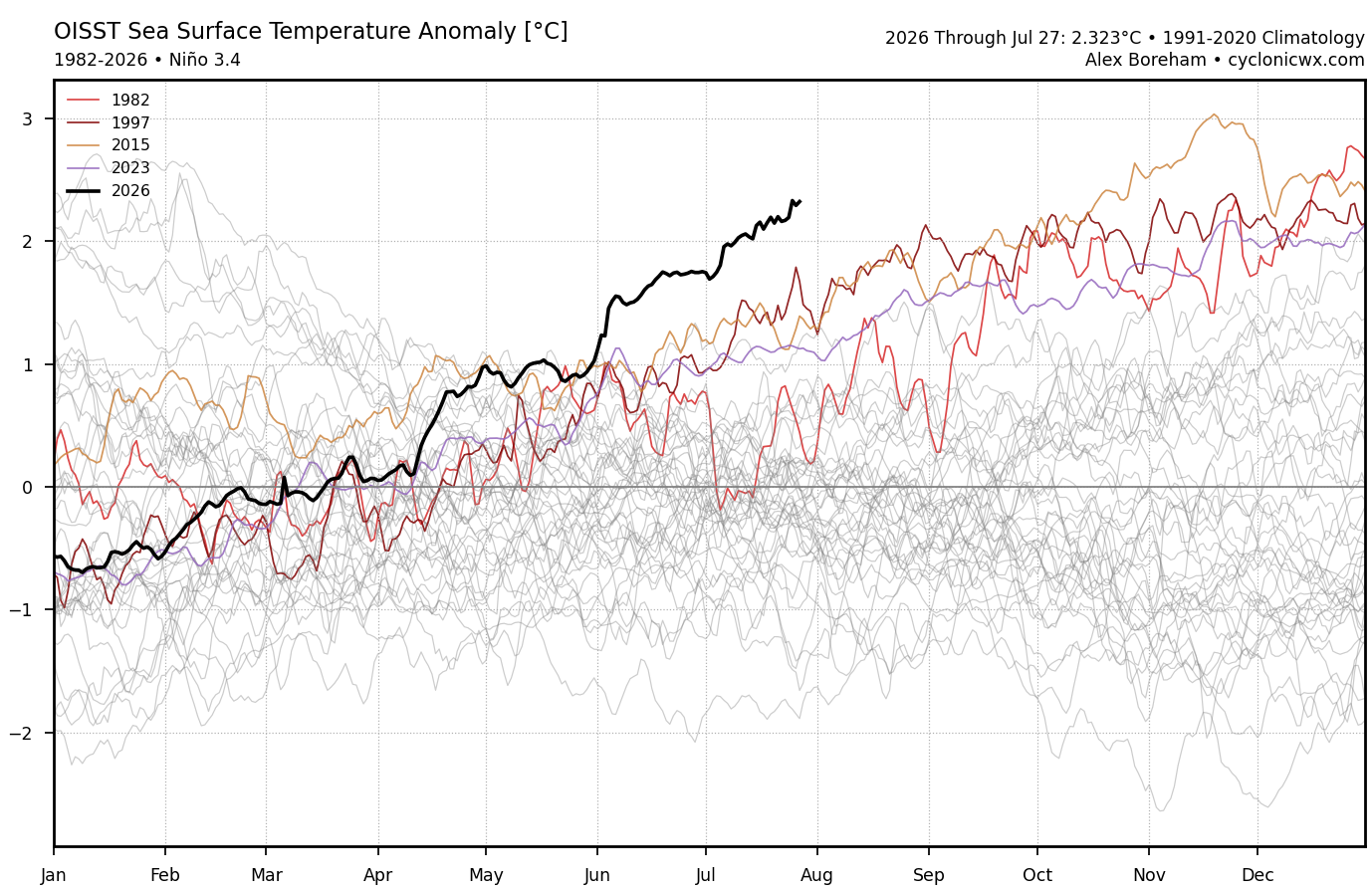
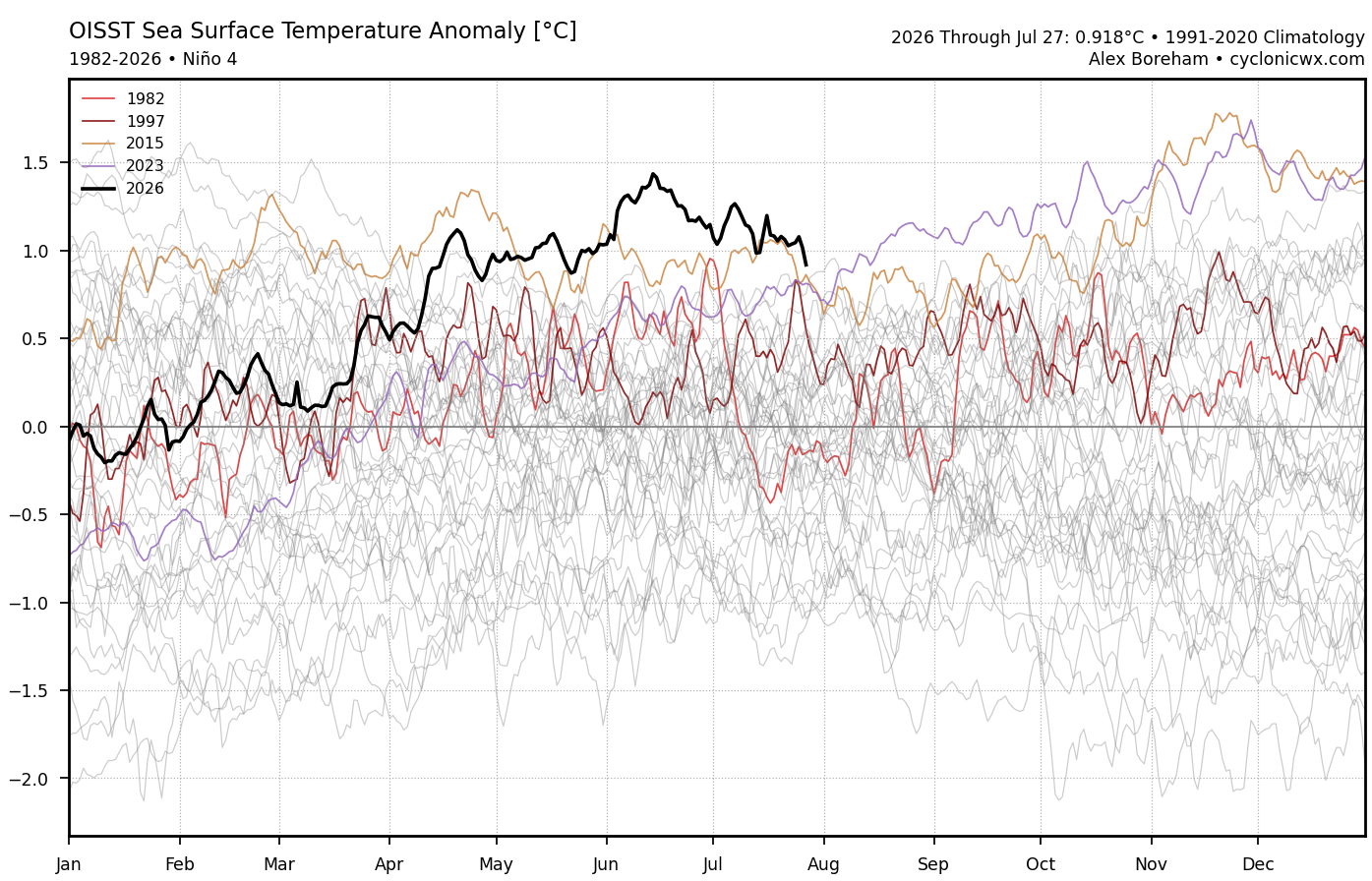
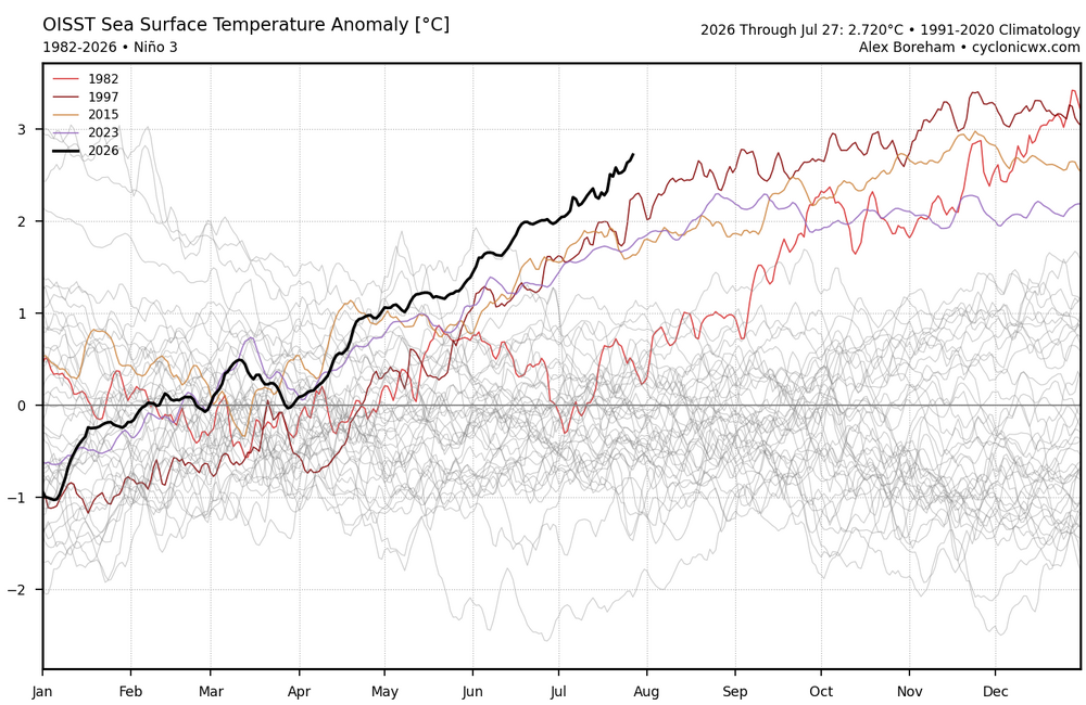
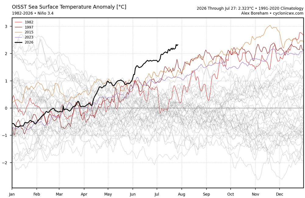
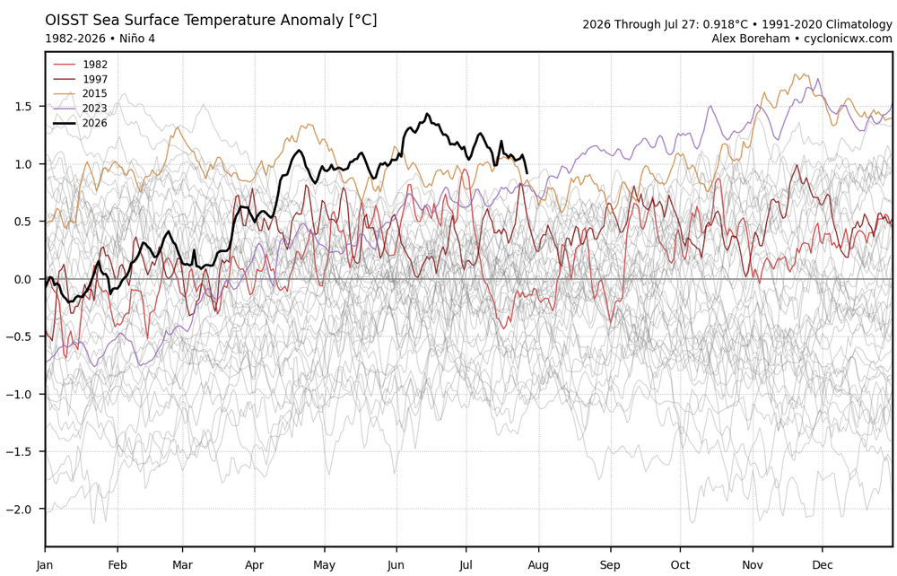
It would be interesting to know what caused the WWBs to be so much stronger this year than in 2023-2024 and 2015-2016? We noticed the record WWBs developing back in December north of Australia. These record WWBs are the reason that this is turning into an east based event over the last month. Nino 1+2 has pulled just ahead of 1997-1998 and 3 and 3.4 are significantly ahead of 1997-1998. Nino 4 has been declining this month. This is going to be a really extreme case study. Since these anomalies would allow the +30 C warm pool to get further east in the ENSO regions than it ever has been before.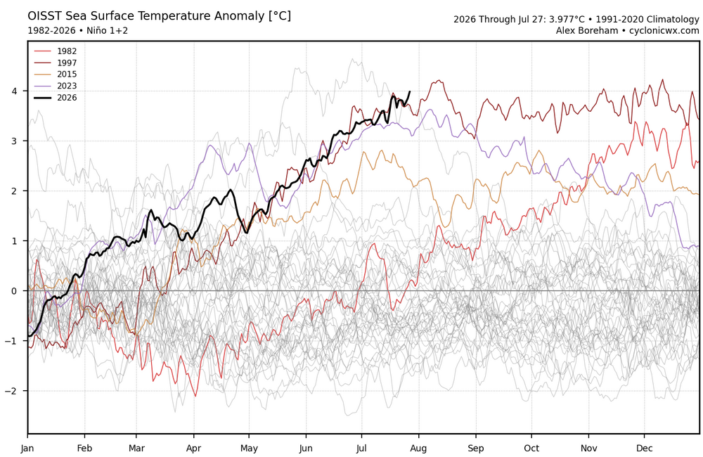
-
Looking ahead, the various AI guidance is pretty darn quiet (quieter than I've seen in a while) for the next 8+ days. Beyond that, we'll see. I know we have some heat lovers...but I personally am glad we are at least beyond the peak climo heat period in the area.
- 1,674 replies
-
- 1
-

-
- severe
- thunderstorms
- (and 7 more)
-

E PA/NJ/DE Summer 2026 Obs/Discussion
JTA66 replied to PhiEaglesfan712's topic in Philadelphia Region
0.20” -
About 1.6” here. Better than expected-developing low came through.
-
4.16” here. 9.21” for the month.
-
Farmingdale republic airport reported heavy rain around 3am
-
.58” yesterday
-
 HRRR did a very good job in this area, pretty much went exactly as I expected .
 -
 Going to be close.
 -
My mom back home texted me “where’s all this heavy rain we were supposed to get all day” I said y’all got duped. it’s over in eastern CT and NY state. Enjoy the dry day
-
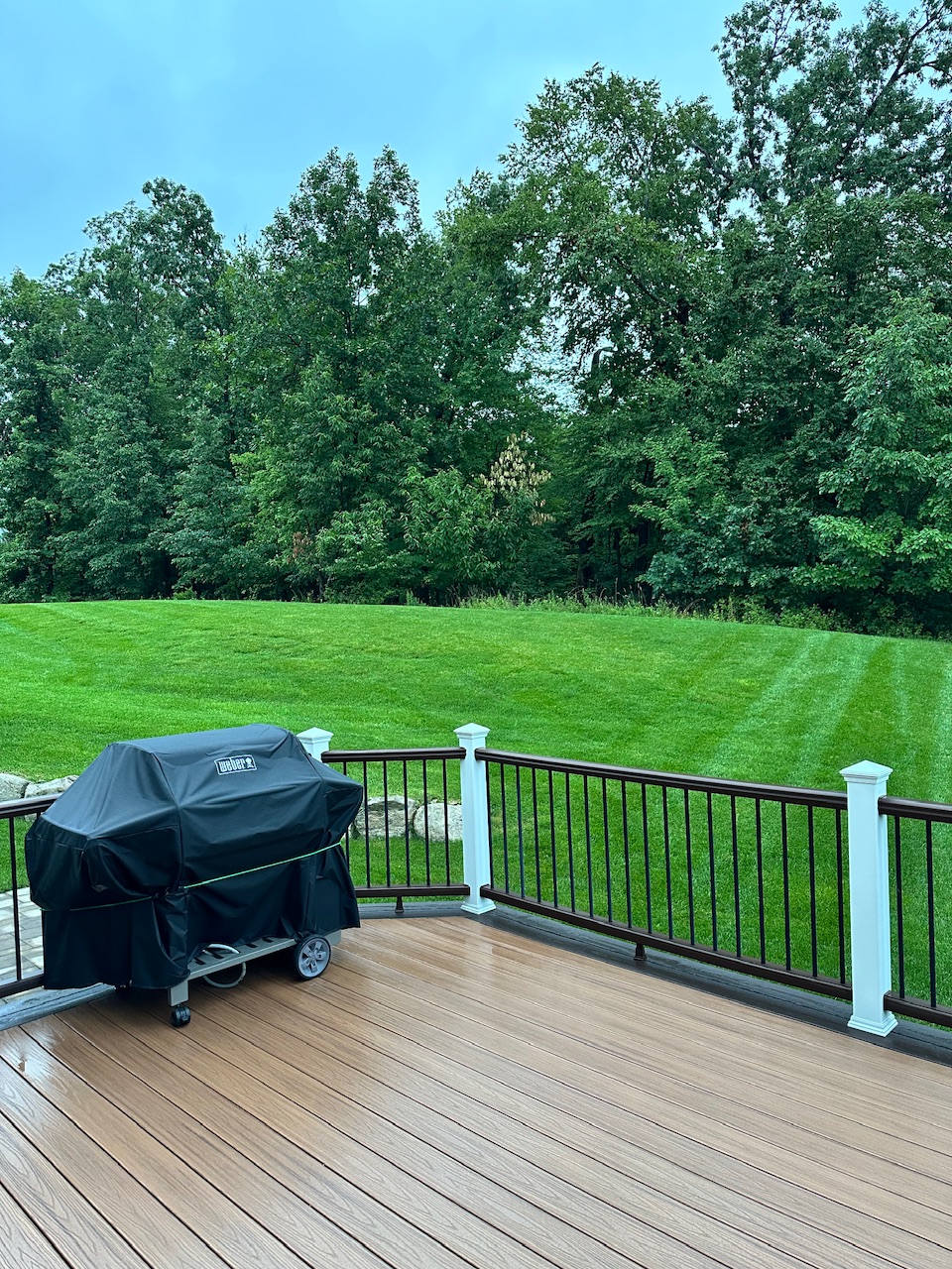
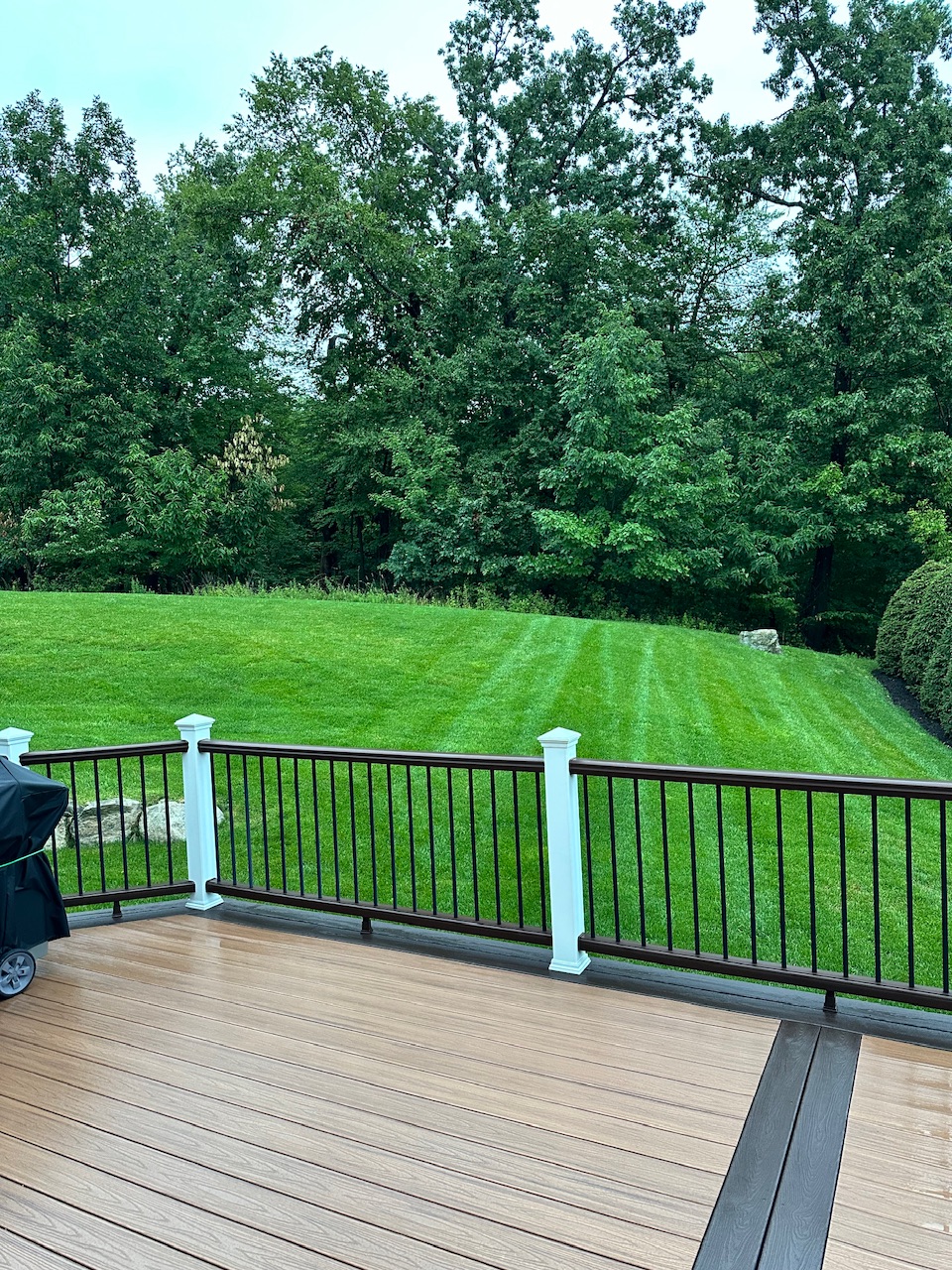
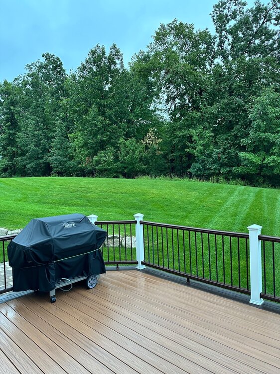
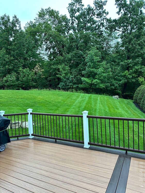
Event total here: 1.99". Enough but not excessive. While some slight long term dryness is still going on the drought up in my area is essentially over. July will end up being a very wet month up this way and for the sub forum with maybe a few exceptions. Just need to keep up at least normal rainfall next several months to keep from slipping back into dryness. Gotta love the negative tilt trof exiting off the Mid-Atlantic and SNE coast this morning. High anomalous for July. Not sure my grass has ever been greener heading into August.
-

Central PA Summer 2026 Discussion/Obs Thread
Mount Joy Snowman replied to Voyager's topic in Upstate New York/Pennsylvania
Low of 66 with .3” of rain. A few beautiful days ahead. -
Sam areas all summer.
-
OXK radar is right, there has been no torrential rain with this, just good ole heavy rain.
-

Central PA Summer 2026 Discussion/Obs Thread
Cgarr737 replied to Voyager's topic in Upstate New York/Pennsylvania
Total rainfall from yesterday’s event-2.12”. -
Will it rain on the chickens?!?
-
No it's not its just heavy, nothing we can't handle 2-3" totals so far will probably max out at 3-4 iso 5" over a 4-6 hour window which isn't devastating, just some minor issues I'd imagine. Also looks like steady rain is done in SWCT within the hour.
-
 Upslope not nearly as big factor this time of year, simply b/c low-level winds from the SE, E, or NE are not as strong, and fetch is much less. Ever notice summer low pressure areas are smaller than the cool season counterparts? Well, there is reason for that and thus you can't treat things synoptically all the same in the summer. Convection plays a much larger role in the summer, so that messed w/ things are well. Swaths from training regardless of topography.
 -
A few days ago Somewhere someone said congrats NW and NY state