All Activity
- Past hour
-

Arctic Hounds Unleashed: Long Duration Late January Cold Snap
cut replied to WxWatcher007's topic in New England
7 here in Trumbull currently -

Richmond Metro/Hampton Roads Area Discussion
jlewis1111 replied to RIC Airport's topic in Mid Atlantic
12z run of the nam will be huge. Lets see if 6z was a one off or the real deal. -
Next potential on EURO is like a carbon copy of Sunday. Trough digging into the south and a non coherent low skirting off the Virginia/NC coast NE. Obviously can change, but I don’t like seeing the same exact look that screwed up our threat this weekend mucking up the next
-

February 2026 Medium/ Long Range Discussion: Buckle Up!
SomeguyfromTakomaPark replied to Weather Will's topic in Mid Atlantic
Maybe the GFS will be right LOLOL -
Whiplash is the correct word. Violently different solutions between runs, but hey, you can stop looking at models now, it’s almost go time. May luck be in our favor fellas. I really hope this is the one to quench our thirst.
-

2025-2026 Fall/Winter Mountain Thread
Sw NC weather replied to Buckethead's topic in Southeastern States
We think the Nam is out to lunch on how it handles the upper level low? It’s been jumping all over the place but still gives me some pause because the 3k dried up down this way some to. -
Richmond Metro/Hampton Roads Area Discussion
jlewis1111 replied to RIC Airport's topic in Mid Atlantic
nam nailed last weekends storm with precip amounts euro is shit -

Arctic Hounds Unleashed: Long Duration Late January Cold Snap
Sey-Mour Snow replied to WxWatcher007's topic in New England
3 degrees, tied for lowest temp this season. -
Down to 6.
-

Possible coastal storm centered on Feb 1 2026.
WinterWolf replied to Typhoon Tip's topic in New England
Colder this morning in CT than Northern Maine. Impressive.
-

Central PA Winter 25/26 Discussion and Obs
MAG5035 replied to MAG5035's topic in Upstate New York/Pennsylvania
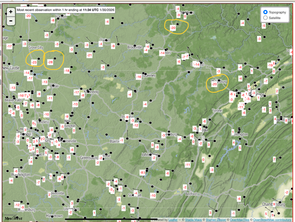
Been bouncing between -2 and -3ºF this morning here. Temperatures especially in the west and central this morning have ended up pretty close to the modeled temps of the coldest models (Euro/GFS). On the Mesowest network there’s several stations reporting -20 or colder, with a -28 near Slippery Rock. On the Ambient network there’s a -22ºF in the Barrens region SW of State College, a typical optimal radiational cooling spot. Temperatures tonight will likely be even colder overall with more widespread below zero lows.
-
If you had to extend this over Catawba County, would you be 4-8 there too?
-
Looks like the low for MBY will be 6. Tipton hit 1.
-
Not sure if this has been mentioned yet, but the winter storm warning has been changed in Knox County for accumulations of 4 to 8 inches .
-
Not sure if this has been mentioned yet, but the winter storm warning has been changed in Knox County for accumulations of 4 to 8 inches .
- 583 replies
-
- 3
-

-
- extreme cold
- snow
- (and 1 more)
-

Richmond Metro/Hampton Roads Area Discussion
eaglesin2011 replied to RIC Airport's topic in Mid Atlantic
True, but the Euro has been pretty consistent on its main moisture being south of us … Hopefully we can finally start to get some model agreement somewhere..Will definitely be pulling for the Nam to be right…Again, it’s pretty close to the best scenario of what we would want for a nice hit in this area… will be interesting to see what wins out… -
Possible coastal storm centered on Feb 1 2026.
WinterWolf replied to Typhoon Tip's topic in New England
I’m glad…we move on. If the cape gets something, good for them. Wasn’t meant to be. -

Arctic Hounds Unleashed: Long Duration Late January Cold Snap
wx_observer replied to WxWatcher007's topic in New England
Natural gas had a huge spike, too. Thankfully it's come down a bit. https://www.cnbc.com/2026/01/26/us-natural-gas-prices-snow-ice-winter-storm-fern.html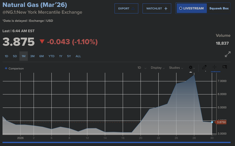
-
NYC will be just 2 degrees warmer than the record high temp on this date. Lots of records are forecasted to fall in Florida feel bad for vacationers.
-
Always is. I hate how uncertainty always needs to be mentioned tbh. That should be a baseline given to anyone and everyone following weather. There are never certainties. As much as we would like there to be. There are only probabilities. What makes this one more interesting than usual is the -AO already in place prior to it happening this time. That leaves the door open for it to quickly couple and eliminate the typical lag time. I'm getting pretty confident the split is going to happen. Ensembles are getting increasingly on board. Plus we've already had the precursor pattern for it. Not to mention that the timing shown on guidance is in line with when you would expect to see one after the precursor pattern happens.
-

Central PA Winter 25/26 Discussion and Obs
Voyager replied to MAG5035's topic in Upstate New York/Pennsylvania
We had no work on Monday due to snow removal, but got back to work on Tuesday. Here's my post snow water hauling adventures video... Be sure to adjust video quality to 1440p if possible. -
The Jan 31 Potential: Stormtracker Failure or 'Tracker Trouncing
jlewis1111 replied to stormtracker's topic in Mid Atlantic
6z Nam def trending North with precip amounts -
The Jan 31 Potential: Stormtracker Failure or 'Tracker Trouncing
jlewis1111 replied to stormtracker's topic in Mid Atlantic
-

Central PA Winter 25/26 Discussion and Obs
pawatch replied to MAG5035's topic in Upstate New York/Pennsylvania
-13° this morning. Rabbit was out eating birdseed from underneath my bird feeder this morning. Which surprised me. -
 0.4 but I was expecting-2. The fakers will get theirs tonight