All Activity
- Past hour
-
Dry gust front hopped over MBY then cells filled in to the east while original line fell apart. Rain screwed.
-

Central PA Summer 2026 Discussion/Obs Thread
AccuChris replied to Voyager's topic in Upstate New York/Pennsylvania
Picked up 1.20” of rain in Lebanon from the cells before with pretty gusty winds…true gully washer here before . -

E PA/NJ/DE Summer 2026 Obs/Discussion
Birds~69 replied to PhiEaglesfan712's topic in Philadelphia Region
Underwhelming...lights flickering was the highlight. -

Central PA Summer 2026 Discussion/Obs Thread
canderson replied to Voyager's topic in Upstate New York/Pennsylvania
Heat advisories issued for Thursday and Friday. Picked up .85” rain today. Glorious desperately needed rain. -
Fog lifted for a couple hrs this morning, and the sun came out jacking temps into the upper 60's, then the fog returned with temps in the low 50's. Fog has lifted this evening with some showers moving thru. It'll be back tonight.
-
18z GFS
-
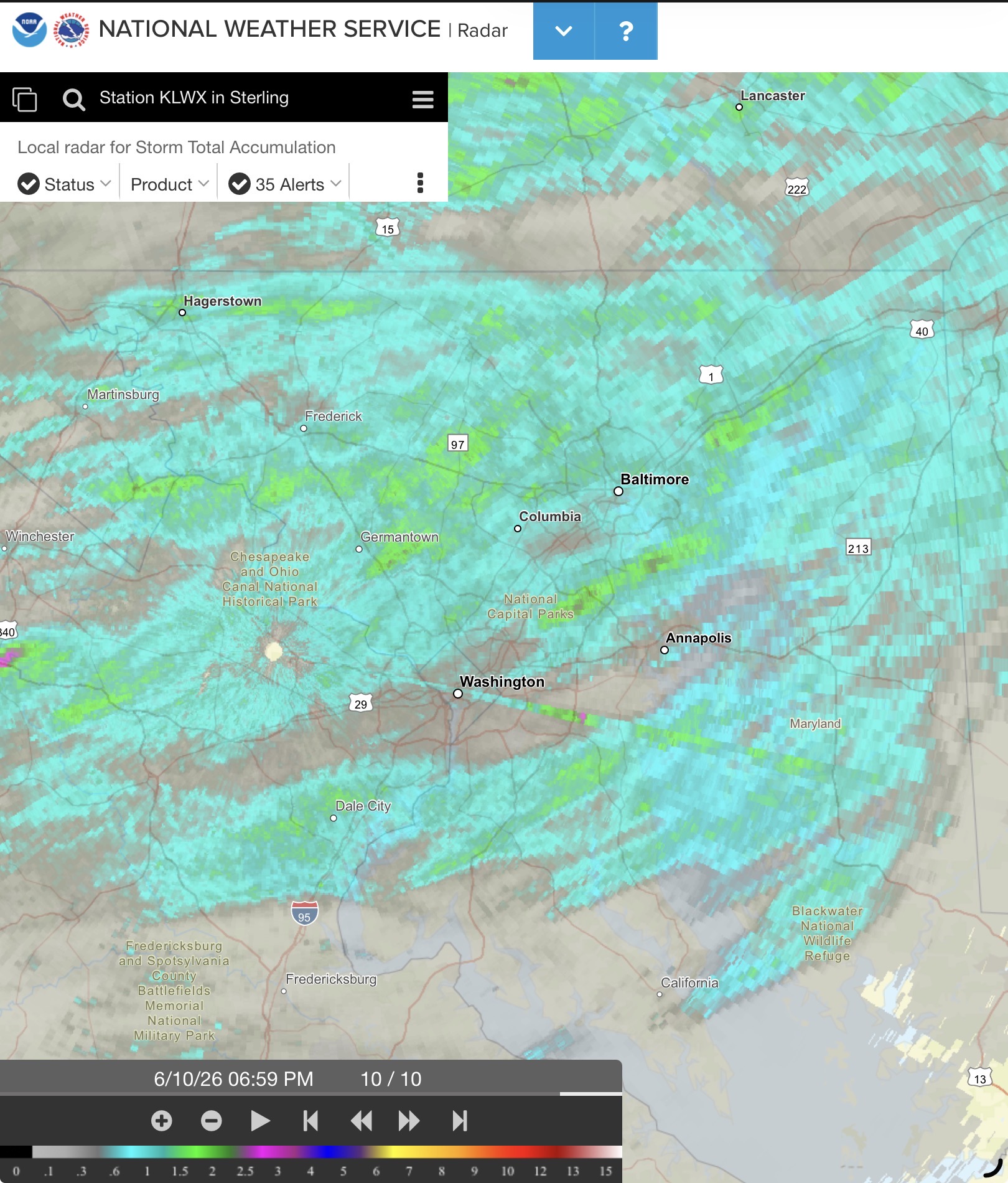
Looks like MBY received an estimated 1-2”.

-
.47"
-
Storms crapped out just before they got this far east which was expected. Gusts to 40 mph. Big show will be tomorrow.
-
CAMS show a violent atmosphere in Western MI tomorrow night, if we don't get rained out could be a high end event for around here
-

2026 Mid-Atlantic Severe Storm General Discussion
Eskimo Joe replied to Kmlwx's topic in Mid Atlantic
The June 5, 2024 tornado outbreak comes to mind. Arguably one of the greatest forecasting snafus east of the Mississippi River in the history of NWS. -

2026-2027 Super El Nino
PhiEaglesfan712 replied to Stormchaserchuck1's topic in Weather Forecasting and Discussion
The correlation didn't work for December 2021. That was a -ENSO/-QBO, and that December was an absolute blowtorch. -
Stilling raining lightly here on the back edge. .50 so far, was not really expecting that much.
-
Wouldn’t mind a quick downpour or two just to wash away some of this god awful pollen that’s caked on everything right now. At least the majority of the pine pollen has stopped falling from the trees around here but the lack of any appreciable moisture lately is taking its toll on many stuffy noses.
-
East tn is under a slight and marginal risk for Friday .
-
Heck…even June 29, 2012 was one LOL
-
Some of my most memorable severe days started out as SEE TEXT lol. Bring it.
-
are we going to get any meaningful rain whatsoever on western long island in the next 3 days?
-

Central PA Summer 2026 Discussion/Obs Thread
Voyager replied to Voyager's topic in Upstate New York/Pennsylvania
0.14" here, but the sun is out now and it's STEAMY... 77/73 -
This was an NBM issue. The ensemble runs (both EPS and GEFS were doing it) as of Wed-Thurs last week were forecasting the development of a stout 588-591 dam ridge centered over eastern IA and western IL between Tuesday and Saturday of this week but then there were big changes across the ensembles by Saturday to a much more progressive pattern. The NBM apparently doesn't like big changes developing in the ensembles between days 5-8 and tried to "correct" what it saw as an error on its own. The extended forecast grids for our area were a mess for a couple of days because I don't think the local offices are supposed to alter the extended forecasts anymore from what NBM generates.
-
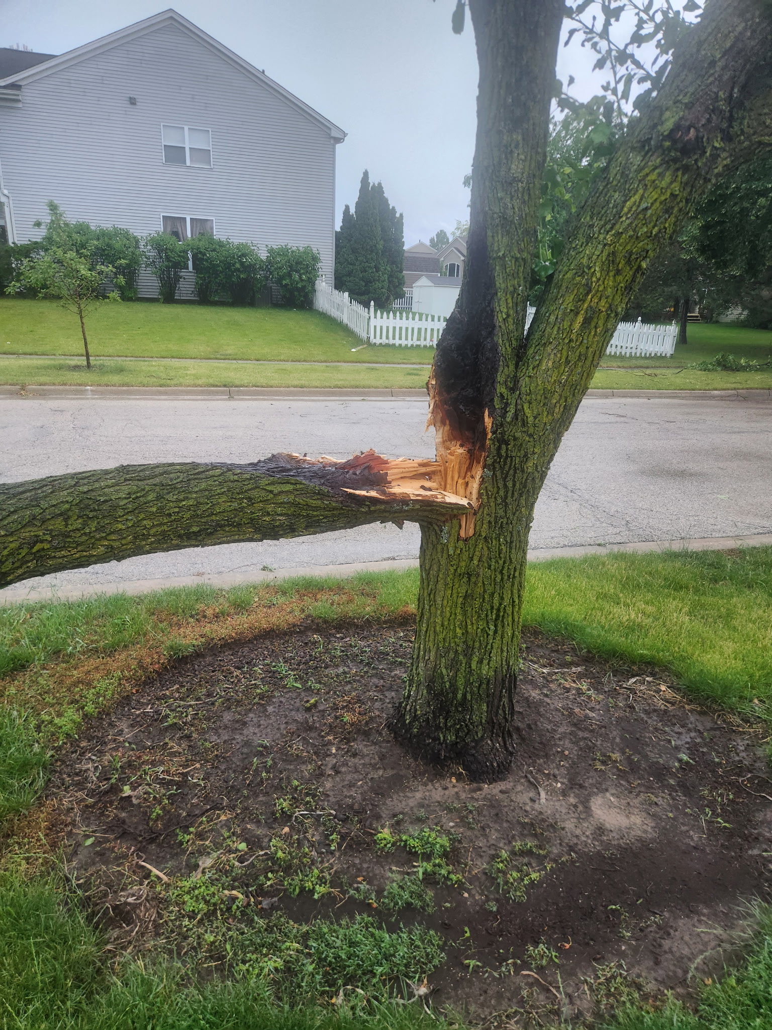
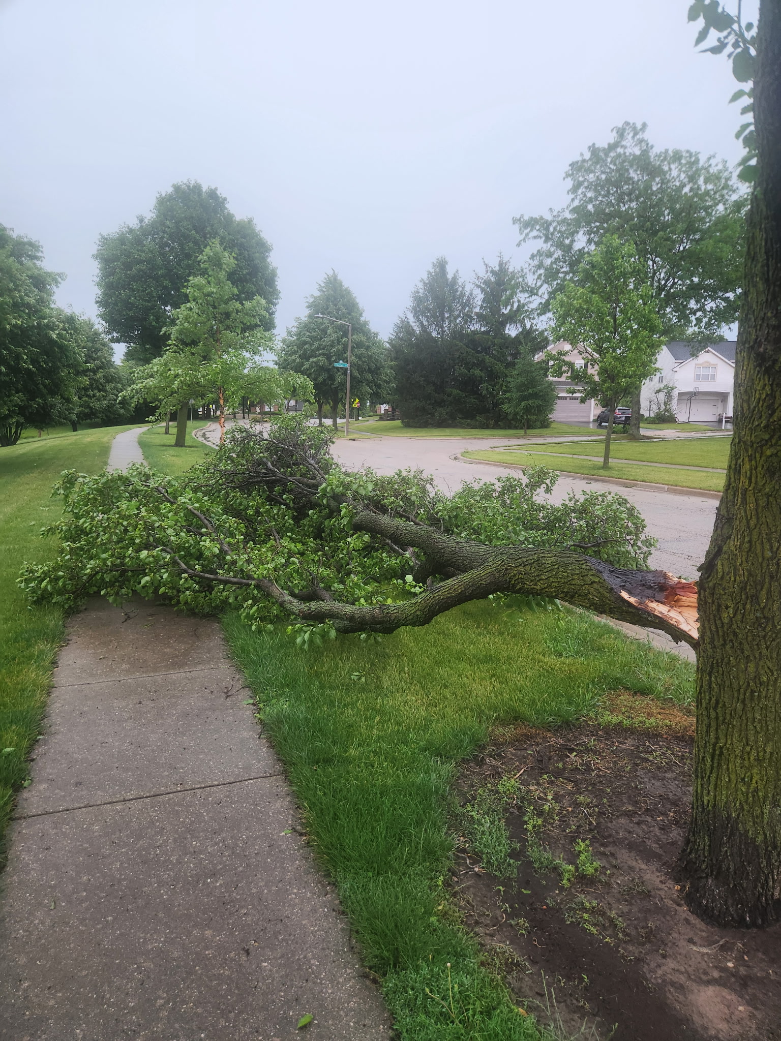
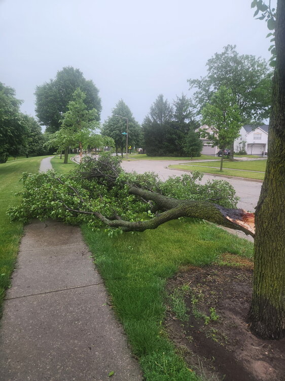
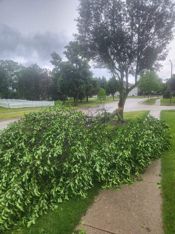
My brothers tree took a lightning strike in Algonquin. Power is still out there as well

-
Were you sunny? it was pretty much overcast 70% of the time here today.
-
Solid 30 seconds of rain here.
-
My place got to 92 with a heat index of 101 today Yesterday: several showers and thunderstorms hit my place. It was the most rain since early May, I believe.
- Today
-
Perfect skip over job here and the IL QC. Next round likely to stay south. Guess we'll see what happens with tomorrow's round.