All Activity
- Past hour
-

1/24-1/25 Major Winter Storm - S. IL, IN, and OH
A-L-E-K replied to A-L-E-K's topic in Lakes/Ohio Valley
Unfortunately yes -
Sleeting here in New Providence.
-
Thank you! It hit me when I pointed down and I was like oh yeah I need to get this! Also Dulles is reporting heavy snow and I am not far from there and seeing nothing but sleet.
-
20-24" amounts are gonna be scattered around 84 corridor from Milford PA to Waterbury CT
-
~6" OTG and absolutely dumping snow
-
You don't have wind?
-
Here a few pings now. Going out to measure.
-
Visibility has gone up, either the snow has lightened or the transition to sleet has started. Still not hearing any pings yet
-

Pittsburgh/Western PA WINTER ‘25/‘26
Mailman replied to Burghblizz's topic in Upstate New York/Pennsylvania
-
Hearing some sleet now in Harlem
-

Central PA Winter 25/26 Discussion and Obs
Blizzard of 93 replied to MAG5035's topic in Upstate New York/Pennsylvania
Does anyone know how the “snow depth” measurements work on the regional observations at MDT? The 7 am snow depth showed 3 inches and the 1 pm snow depth said 7 inches. Do they “clear the board” every 6 hours and start fresh? With 1.1 QPF through 1 pm, there should no way MDT only has a depth of 7 at this time right? -
30-DAY OUTLOOK DISCUSSION FOR FEB 2026 The February 2026 outlooks are issued against the backdrop of a La Niña Advisory and the potential emergence of an enhanced Madden Julian Oscillation (MJO) signal. La Niña conditions are present but are likely (75 percent chance) to transition to the El Niño Southern Oscillation (ENSO) neutral phase during the current January-February-March (JFM) season. The latest weekly Niño 3.4 index was at -0.8 degrees Celsius, which is still in La Niña territory. However, at depth, a pool of warmer than normal water has been steadily expanding eastward from the western Pacific, consistent with a potential transition to ENSO neutral conditions. Meanwhile, the magnitude of the real-time multivariate MJO index has been increasing in recent days in the Western Pacific. By the start of February, most of the European Centre for Medium Range Weather Forecasts (ECMWF) ensemble members predict this emerging MJO event to propagate to the Western Hemisphere/Africa or the Indian Ocean. Recent analysis of extratropical indices show that the Arctic Oscillation (AO) and the North Atlantic Oscillation (NAO) have been mostly negative in early January (although both have trended closer to zero in the past few days). The Pacific North America (PNA) index has transitioned from the negative to the positive phase during the first half of January. Combined natural analog composites derived from the recent evolution of these tropical (ENSO and MJO) and extratropical (AO, NAO, and PNA) drivers depict a 500-hPa flow pattern dominated by anomalous ridging over the northeastern Pacific, off the west coast of North America. Downstream troughing is favored over the west-central CONUS while above normal heights are more likely across the Southeast. Weakly below normal heights are favored across the western Bering Sea. This combined natural analog composite is remarkably similar to trends during the last 15 years, which also favor increased ridging across the northeastern Pacific and the Southeast, and below normal heights over the northern tier of the west-central CONUS. Natural analog composites, trends , and dynamical guidance from the Copernicus Climate Change Service (C3S), North American Multi-Model Ensemble (NMME), the Climate Forecast System Version 2 (CFSv2), and the Forecast Consolidation Tool (CON) (which includes both dynamical model input and statistical guidance) form the basis of the February outlooks. The latest CPC Weeks 3-4 Outlooks and associated ensemble guidance from the ECMWF, Global Ensemble Forecast System (GEFS), and the CFSv2 also contributed. Antecedent conditions such as extratropical SSTs, sea ice extent, and snow cover anomalies were also considered where appropriate. Statistical guidance is supportive of potential widespread anomalous cold air outbreaks across much of the Lower 48 states during February. However, dynamical model guidance is much warmer, particularly across the southern two-thirds of the CONUS. This dichotomy between the colder statistical and warmer dynamical model guidance results in increased uncertainty in the February temperature outlook. However, given the strong agreement between recent trends , ENSO, MJO, and extratropical analogs on the potential for anomalous cold across much of the northern and central CONUS, below normal temperatures are favored for much of these regions. The greatest confidence for below normal temperatures (40 to 50 percent chance) is indicated for the Northern High Plains, where statistical guidance shows the strongest signal. Conversely, statistical and dynamical model guidance are in good agreement in favoring above normal temperatures across the southeastern CONUS, with probabilities of warmer than normal conditions exceeding 50 percent across the Florida Peninsula. A second, but weaker, area of enhanced above normal temperature probabilities is posted for parts of the Southwest and Southern California due primarily to dynamical model guidance. Above normal SSTs off the west coast of the CONUS may also assist in increasing chances of above normal temperatures for coastal locations of Southern California. Enhanced probabilities of above normal temperatures were kept weak for this region as statistical guidance is much less supportive of increased warmth relative to dynamical model guidance. Above normal temperatures are favored across western Alaska due to very good support from statistical guidance. However, dynamical model support is relatively weak, so probabilities of above normal temperatures are only modestly increased. Conversely, below normal temperatures are weakly favored for most of Southeast Alaska and adjacent areas of the southeastern Mainland, consistent with C3S model output with some support from natural analog composites (especially across Southeast Alaska). Although the current La Niña is likely to transition to ENSO neutral at some point during JFM 2026, statistical and dynamical model precipitation guidance still generally reflect a La Niña signature for the month of February. Above normal precipitation is favored from the Northern Rockies, Northern High Plains, and parts of the Pacific Northwest southeastward to northern portions of the Central Rockies and Central High Plains. The greatest likelihood of above normal precipitation (greater than 50 percent chance) is indicated across parts of the Northern Rockies and adjacent High Plains, where both statistical and dynamical model guidance is in good agreement. A second region where above normal precipitation is favored is the Great Lakes, Ohio Valley, adjacent areas of the interior Northeast, and the Upper and Middle Mississippi Valley, consistent with La Niña Composites as well as with dynamical model guidance, especially the C3S. Typical of La Niña, below normal precipitation is more likely across the southwestern and southeastern CONUS. The forecast favoring drier than normal weather across these two regions has good dynamical model support from the NMME. Above normal precipitation is favored for all of western Alaska. Dynamical model guidance is in good agreement in depicting increased chances of above normal precipitation across northwestern Alaska while statistical guidance generally supports an extension of this signal southward to southwestern Alaska. Conversely, a tilt of probabilities toward below normal precipitation is indicated for Southeast Alaska and adjacent areas of the southeastern Mainland due primarily to dynamical model support, especially from the C3S.
-
The physics of this is both complicated and nuanced. For rain to freeze, it has to be super cooled. Heavy rain has less of a chance to cool. Heavy freezing rain has less time to contact other freezing surfaces, which can lead to a run off thus making it accumulate less quickly, especially on elevated surfaces such as trees and power lines. Each rain drop also releases a touch of latent heat which can take longer to accrue. It also can warm the surrounding area ever so slightly. That withstanding, heavy ZR falling into the 20s with a light accreation already in place ovverules most of the potential negation of other factors. So if this line brings a good amount of QPF, it will accumulate, and quite a bit. Quickly as well.
-

January 25-26 Winter Storm Potential
Birds~69 replied to Ralph Wiggum's topic in Philadelphia Region
Sucks the NE/Den game is in Den... 13F/sleet -

January 25-26 Winter Storm Potential
Violentweatherfan replied to Ralph Wiggum's topic in Philadelphia Region
Probably blowing off the roof I thought the same thing when I looked out my front door was like it’s snowing again just blowing off the roof -

Southern Crippler - Get well soon Jimbo Storm Obs
olafminesaw replied to BooneWX's topic in Southeastern States
Just missed the heavier returns. An appetizer for this evening I hope -
9.2 inches as of 1:30 so 2.7 inches in the last hour and half. Best rates of the day right now. 5.4° with heavy snow.
-
January 25-26 Winter Storm Potential
Violentweatherfan replied to Ralph Wiggum's topic in Philadelphia Region
Hey @Newman or @MGorse does warm air intrusion follow the same atmosphere levels or can it vary -

Central PA Winter 25/26 Discussion and Obs
MAG5035 replied to MAG5035's topic in Upstate New York/Pennsylvania
Past the 9” mark now with continued heavy snow rates and temps have torched up to 10ºF.
-
9.75 inches in new rochelle-still very heavy, blowing snow. Hopefully we have an hour or two before the sleet transition. .
-
 Impatiently waiting here. I did manage to shovel the deck of 6-8" from I have no idea when. 5*
 -

1/24-1/25 Major Winter Storm - S. IL, IN, and OH
Baum replied to A-L-E-K's topic in Lakes/Ohio Valley
Kicked back in here after an hour flurries. Maybe one last gasp. At least it’ll make the cold look better. -

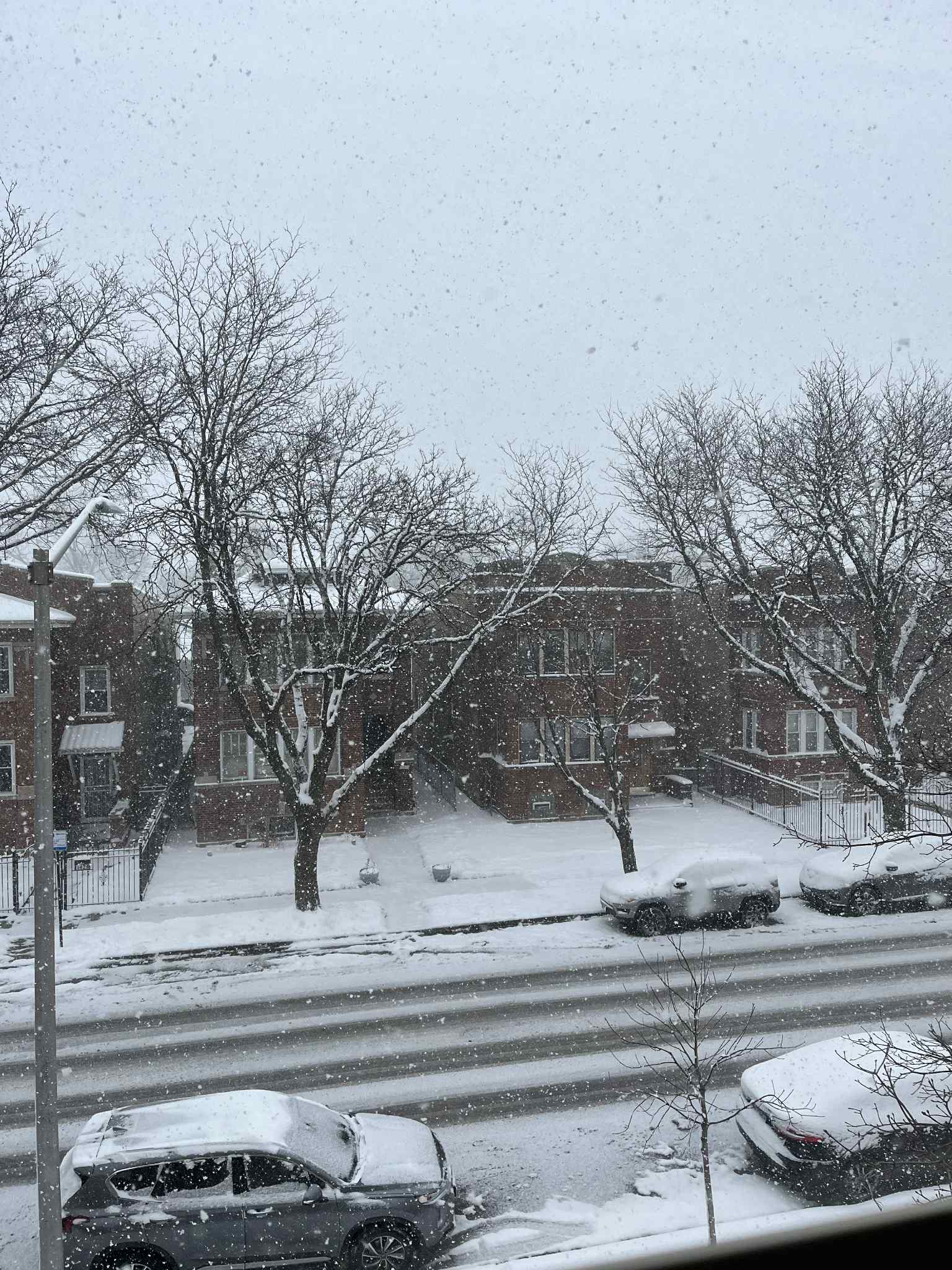
1/24-1/25 Major Winter Storm - S. IL, IN, and OH
pen_artist replied to A-L-E-K's topic in Lakes/Ohio Valley
Dumping out here on Austin blvd in Oak Park. Currently sitting close to 5" if not a little more.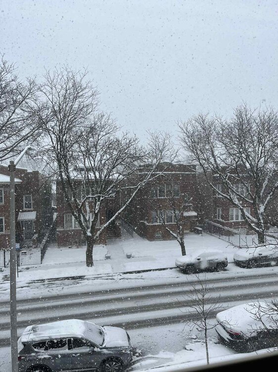
-
Eps shows snow for feb 3
-

Central PA Winter 25/26 Discussion and Obs
GrandmasterB replied to MAG5035's topic in Upstate New York/Pennsylvania
50/50 snow sleet. Crazy. I’m not sure how many times I’ve ever seen it go back to snow after warming to sleet. Zero maybe?