All Activity
- Past hour
-
Take me to where I said it ended.
-

Is we back? February discussion thread
40/70 Benchmark replied to mahk_webstah's topic in New England
Looks like we have some sort of SWFE on deck CIRCA the 20th.... -

Central PA Winter 25/26 Discussion and Obs
pawatch replied to MAG5035's topic in Upstate New York/Pennsylvania
28 degrees and another cloudy day perhaps. Few stray flurries. -
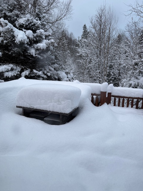
Time for a picnic table picture
-
For sure. He gets frustrated and wants to end everything. Anybody with any sense knows that there will be chances when you’re on 2/12. Silly statement for a meteorologist because a potential fails.
-
My outdoor table
-
Oh, we are gonna get Viener-ed alright.
-
Very snowy 06z gfs run
-
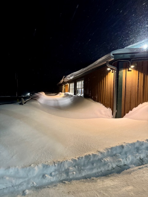
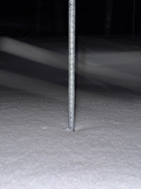
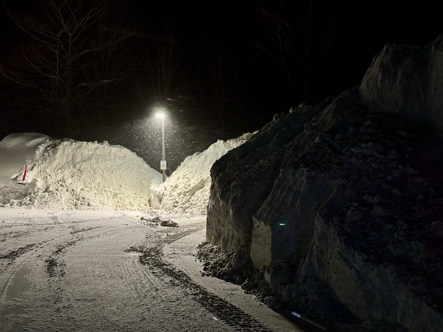
We got whacked with over a foot overnight, the stake is now up to 34” including compaction
-
Holy fuck. I said as a joke but we got more than a foot and it’s still snowing. Stake up to 34”
-

Pittsburgh/Western PA WINTER ‘25/‘26
Gordo74 replied to Burghblizz's topic in Upstate New York/Pennsylvania
Maybe this is where the mismatch is for me, personally. March is meteorological spring, so in my mind, any snow there isn't part of a winter expectation for me and only counts as bonus points. -

Is we back? February discussion thread
Baroclinic Zone replied to mahk_webstah's topic in New England

-
Well yeah met winter ends March 1 so we got about 2 weeks left.
-
I’d say deep winter is over. But not winter itself.
-
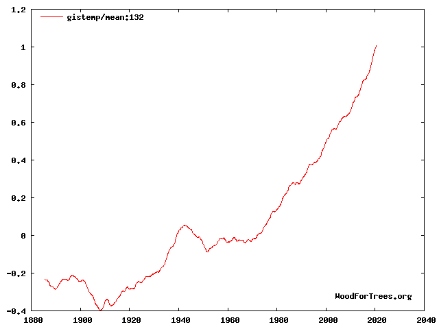
The earth's output is not constant. Instead It is modulated by ENSO. More radiation out during El Nino when the atmosphere is relatively warm and less during La Nina when the atmosphere is cool. Similarly the global surface temperature is modulated by ENSO, the earth's surface is warmer during el nino. Note that the climate system is dominated by the ocean and the rise in ocean temperature is steadier than the global surface temperature. There is also some variation in solar output over the 11-year solar cycle. If you take an 11-year average of global surface temperatures (below) most of the enso and solar variability is removed. Leaving mainly man-made forcing and a small volcano contribution.
-
Feb 10-11 Mid Week Minor Event - Ride the hot hand?
Baroclinic Zone replied to HoarfrostHubb's topic in New England
Added about 1/2” with squall last night. -

E PA/NJ/DE Winter 2025-26 Obs/Discussion
Mikeymac5306 replied to LVblizzard's topic in Philadelphia Region
You can bank on both of those GFS storms verifying as I am flying out to Vegas on the 22nd and coming back the 27th. -
-
I don't think we're "done" however, no epicosy for February for sure. Will March have a stretch that that dash hopes of an early spring for Torchy the Tiger... stay tuned
-

February 2026 OBS & Discussion
donsutherland1 replied to Stormlover74's topic in New York City Metro
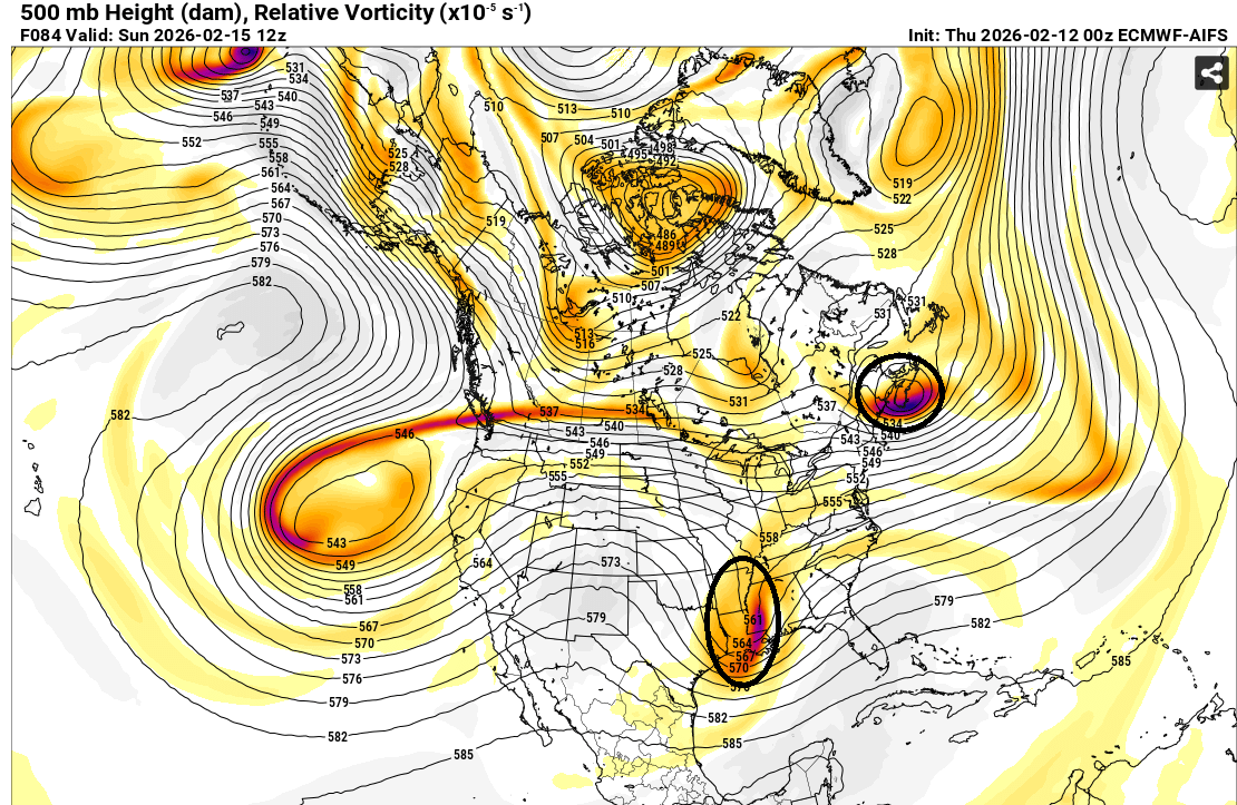
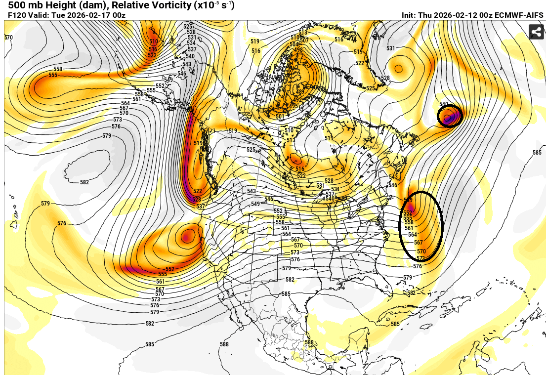
The ECMWF-AIFS is moving into it s high-skill range, where it continues to outperform the non-AI guidance. It continues to show very little prospect for the kind of occasional snowy solution that has popped up from time to time on some of the guidance. At 500 mb, its map tells the story about the low probability of phasing. The northern energy is well in front of the southern energy. This limits the risk of interaction, much less phasing. Not surprisingly, the other guidance now appears to be in line with the AIFS, with none showing a snowy solution for the NYC area. If one looks at the EPS ensembles, 16% showed 6" or more snow and fewer than 6% of members showed 10" or more snow during the 2/12 0z cycle vs. the respective 22% and 12% during the 2/11 0z cycle (in which the operational ECMWF showed a phased solution). Although it's premature to suggest that precipitation, should it arrive, cannot start as a little snow, sleet or mixed precipitation, the idea of a phased solution with significant snowfall appears unlikely. As has been the case much of this winter, should that outcome verify, the ECMWF-AIFS will again have led the way at an impressive lead time. Finally, the ECMWF-AIFS map 36 hours later shows a distinct failure to phase.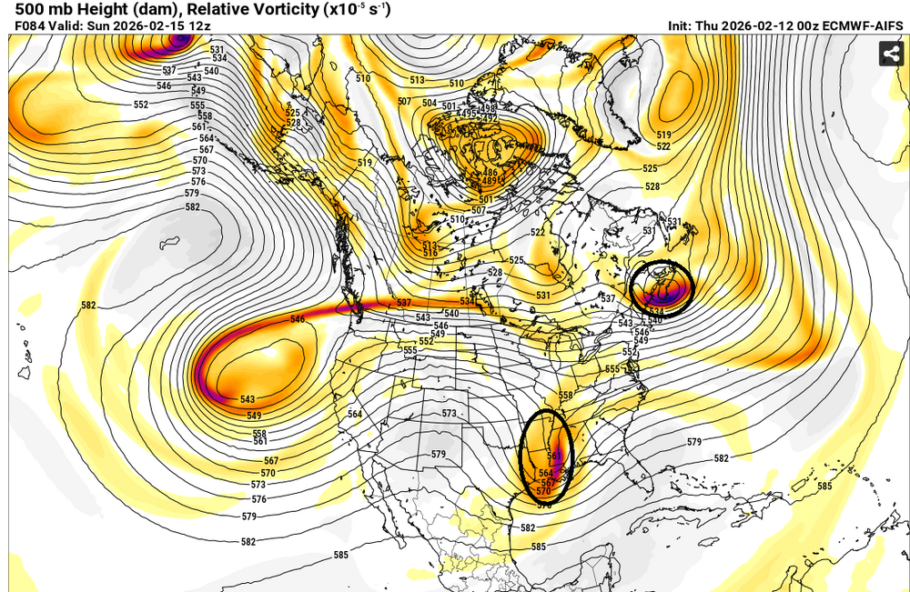

-

Central PA Winter 25/26 Discussion and Obs
mahantango#1 replied to MAG5035's topic in Upstate New York/Pennsylvania
-
Winter looks done
-

Central PA Winter 25/26 Discussion and Obs
Voyager replied to MAG5035's topic in Upstate New York/Pennsylvania
Currently sitting at 28 degrees this morning, which is not bad. The sad, and infuriating part for me, is that it appears that there will be no temperature rise today. Ugh... To add insult to injury for this warmanista, after two early shift Fogelsville deliveries, I get to go up into the tundra that is Hazleton. That god-forsaken place that has an entirely different winter climate than most other places in Eastern PA. -
 @CAPE Storm is back??
 -
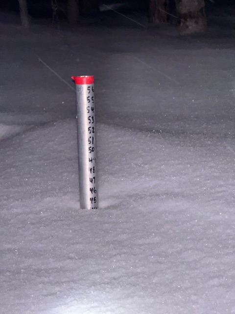
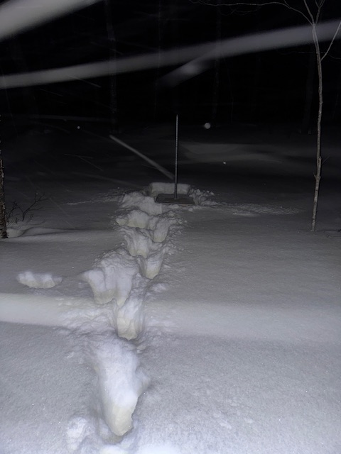
Snow depth at 1500ft is up to 45” again for the second time this season. Keeps snowing.