
All Activity
- Past hour
-
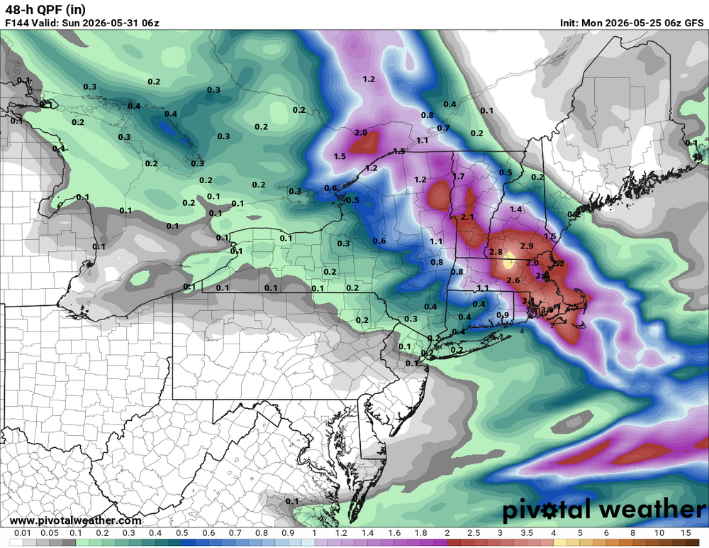
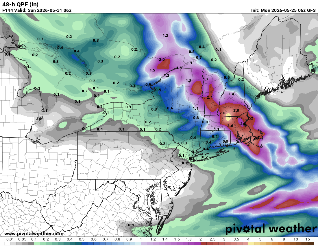
It will be worth it for the sneaky S+ risk! Noted the 06z GFS has a max of 4.55" rainfall right over FIT. Seems a lot for such a low track. Where is all the moisture coming from, esp. since there is not much of a sfc low initially? GFS not so OTL it seems b/c the 00z ECMWF has a max of 2.81" in the same exact spot. That kind of pcpn intensity and a cold 850? Things that make you go hmmmm....
-

Chester County PA - Analytical Battle of Actual vs. Altered Climate Data
chubbs replied to ChescoWx's topic in Climate Change
But it does matter how you slice it; and, you continue to cherry pick favorable comparisons and ignore the rest. I stated above that the slope difference between NCEI and PHL between 2000 and 2025 was not statistically different. Expanding the yaxis doesn't change that result. Looking over a longer period and re-normalizing the yaxis, we see that the delta between Chester County and the Philadelphia Airport has stayed the same since 1970. The delta goes up and down but without a long-term trend; 2000 just happens to be a minimum. Doesn't matter whether you use NCEI or high quality sites like Coatesville, Avondale USCRN, and DEOS. The answer is the same.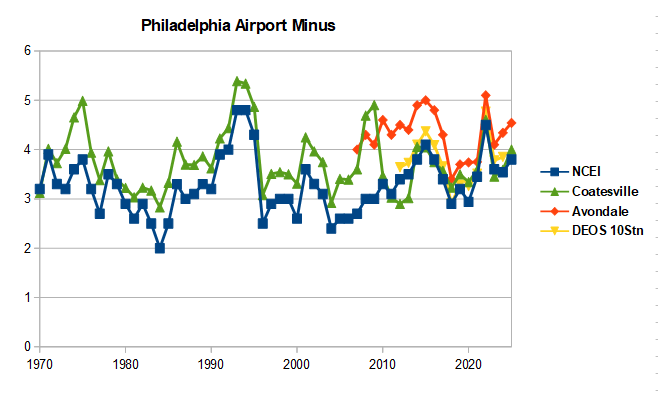
- Today
-
Up to .82” so far since Saturday, not stein but not impressive by any means. The lawn and plants are happy!
-
We’ve already lost next weekend. WTF?
-
Imagine if it was all snow
-
1.5 and it's raining again.
-
Showers The rain made my job easier this weekend
-
Eureka! It has been dumping on Lake Norman all night. Cornelius might wind up with 2-3 inches just in the last 4 hours.
-
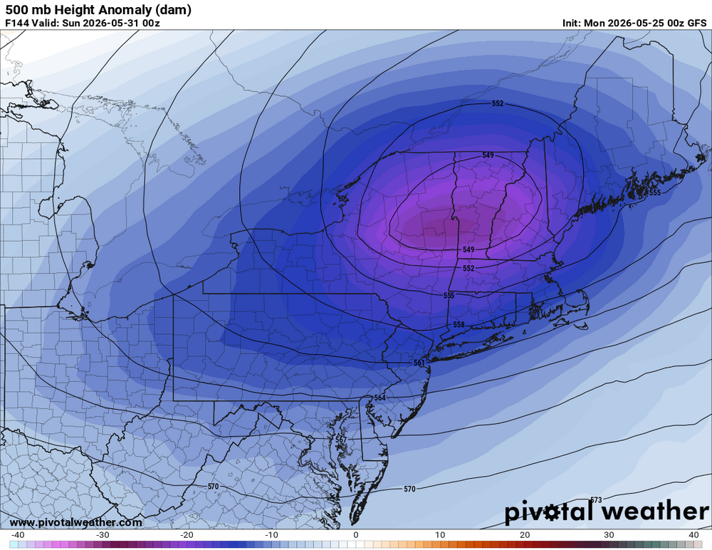
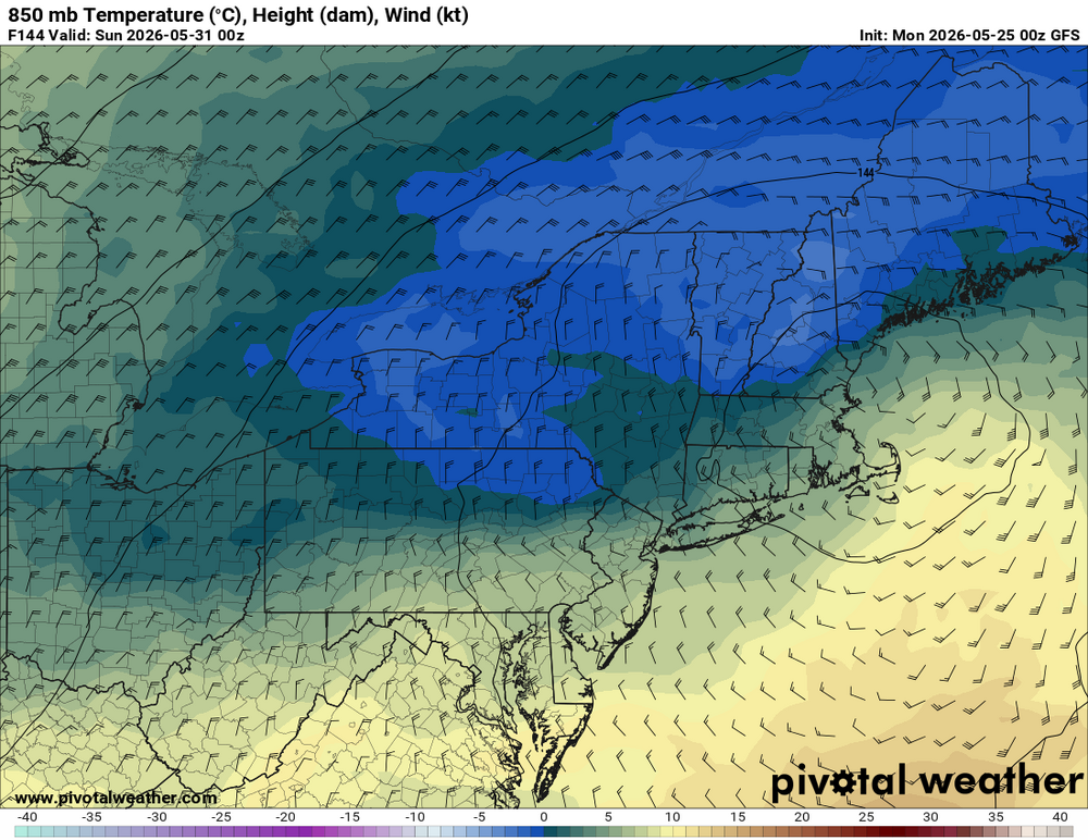
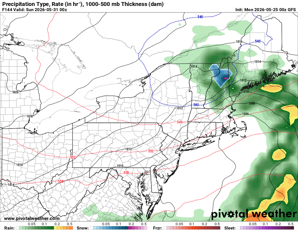
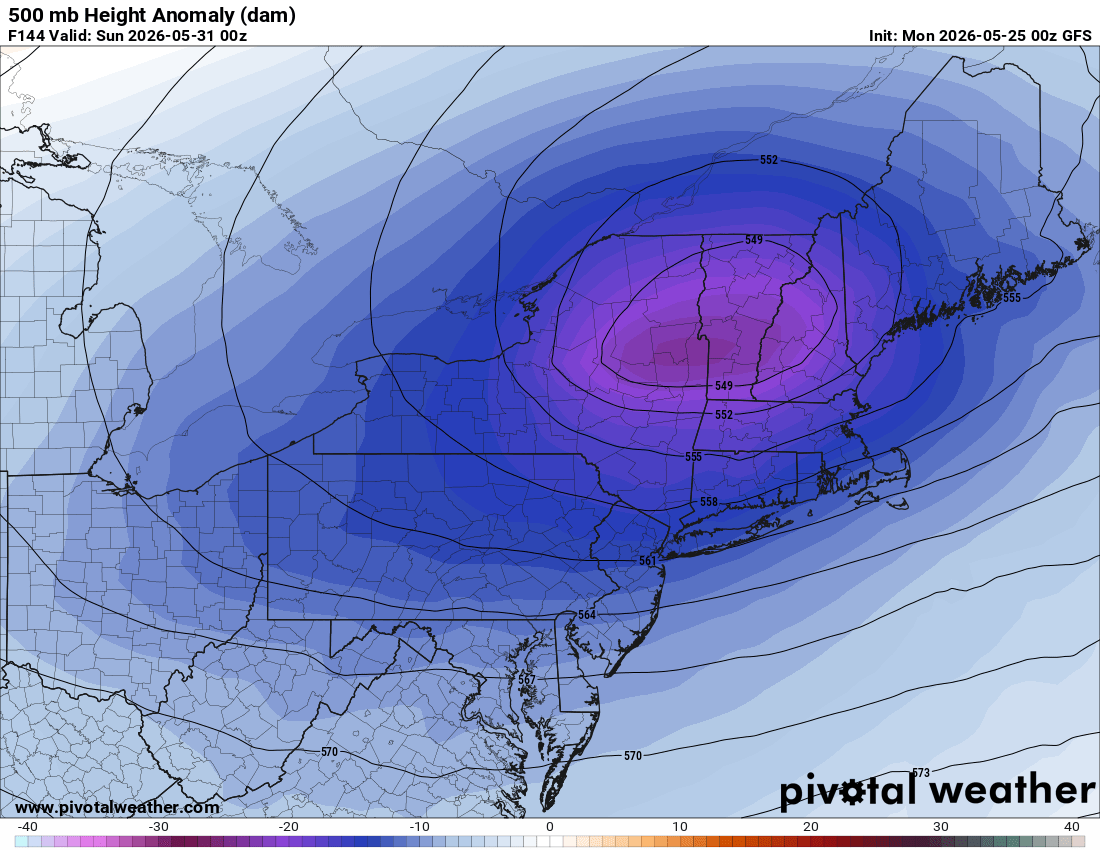
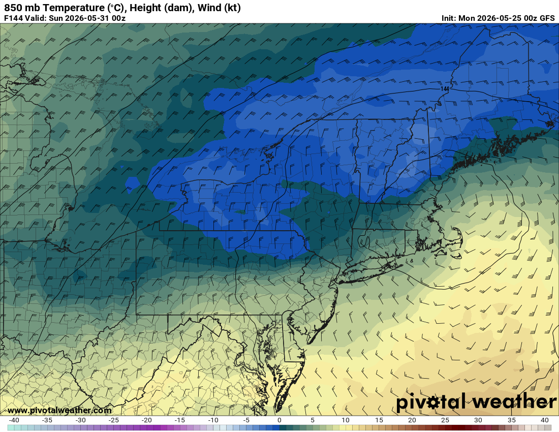
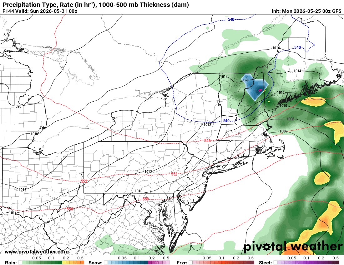
00z GFS significantly stronger and tucked back farther W w/ the closed 500 low for May 30. It shows 4-8" parts of nrn NH. What stands out is that the 00z GFS/ICON and the earlier UKMET show substantial QPF, 2-3" in some areas. This is absolutely key for the Scott S+ this time of year (intensity). I like that the GFS is showing more sfc low development just S of the region for more ageostrophic flow.
-
Yeah I'm closing in on an inch tonight already. Drought is getting some Mike Tyson haymakers
-
This batch moving through means business. 2.23” since 6:30 pm. Event tally so far is 4.33” which is easily the best rain I’ve had since moving here nearly 4 years ago.
-
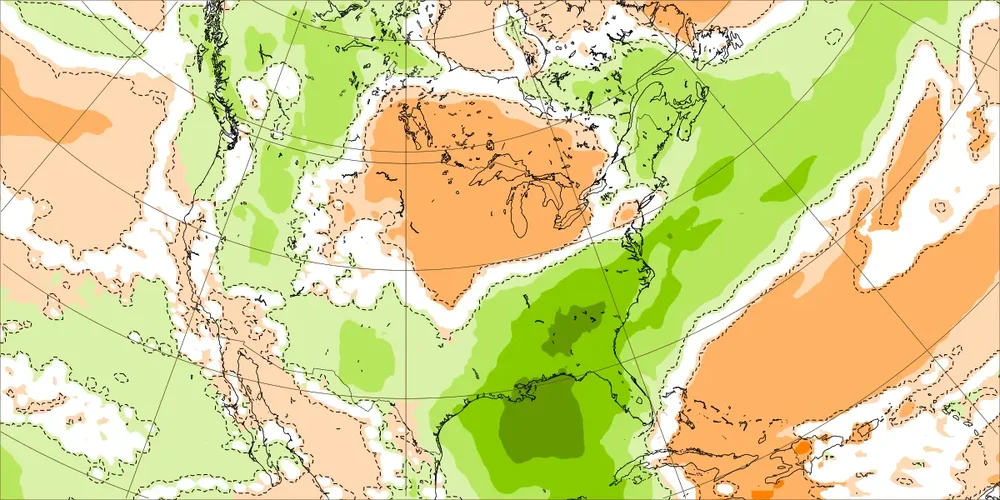
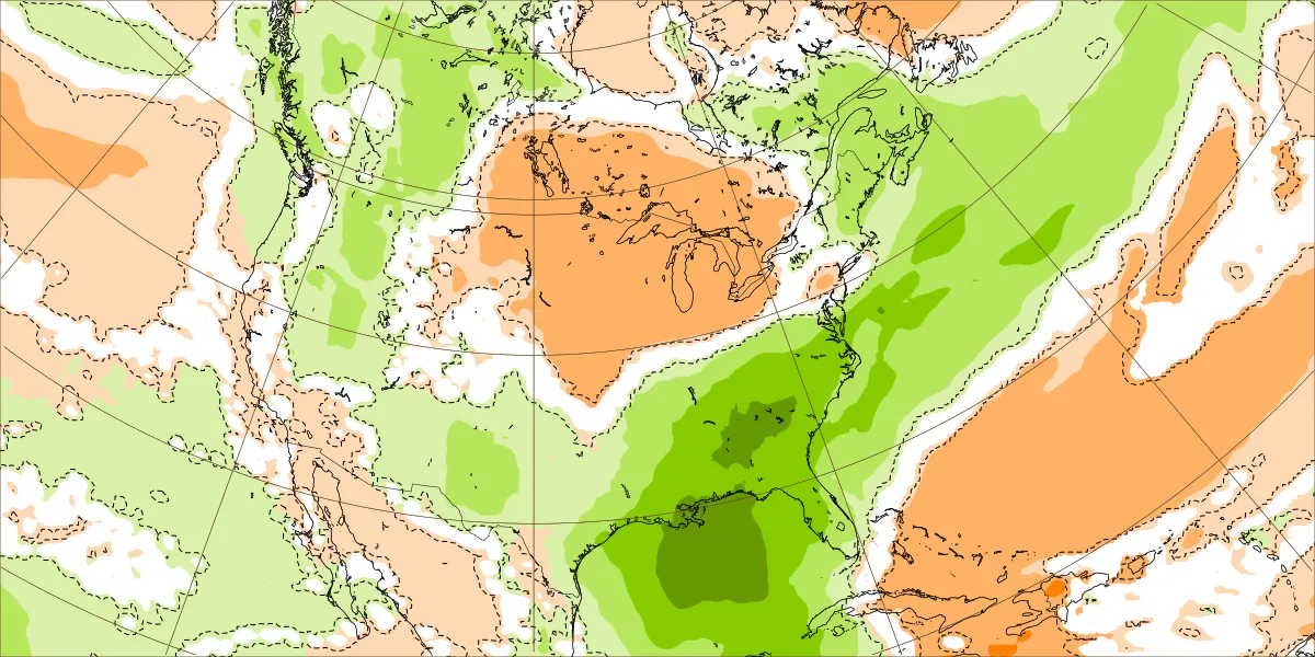
Today’s Euro Weekly for May 25-31 is even wetter in the SE and is close to the wettest on the entire globe for that week for land areas in terms of anomalies! This has a max of 3.5-4” over N GA/far NW SC and 2”+ for just about the entire SE, just what the drought doc ordered!
-

Occasional Thoughts on Climate Change
Typhoon Tip replied to donsutherland1's topic in Climate Change
June 6-10th ov/upper ma/ne -
WHOA Charles Town is up to 17.5 inches of rain! Those folks may soon be leading the entire nation in rain tallies! They have gone up 4 inches in the last three days. It looks like Charles Town, W Va and Binghamton, NY are gonnabe battlin' it on out for who has the most rain this year. It's official! Binghamton has edged Buda out of contention! The Score is Binghamton 18.83 to Buda at 18.7. Guess who's gonna win. Everyone East gets rain, Rain is like air east of Ole Miss. But Texas is a DRY DRY DRY place. We in Texas are easy as shoosh to beat when it comes to rainfall. I keep on thinking of what its gonnabe like when Austin is a 300 mile wide hypermegalopolis from reshoring and ultra cheap energy and ultra tech - but runs out of fresh water from millions and millions and millions and millions of people sucking up the little that's left in the aquifers and the Colorado River is a strip of desert sand. We best find a way to synthesize fresh water last millennium or there's gonnabe millions of people mass departing the DRY BOWL that is Texas! We are about to witness a complete civilizational upgrade all across the Nation then the Planet! So many new industries! So much robotics and AI! AI is going to be everywhere! If you happen to be a NERD you are gonnabe so damn stinking RICH you won't believe it! A hell of a lot of money that used to just disappear into certain places I will not mention - WILL BE FLOWING STRAIGHT TO AMERICANS and then everyone on the planet! The next three years are going to leave a lot of amazed people in total shock, with their jaws resting on the ground. This will not result from me digging Dale City out of a record 48 inch snowstorm. Although later on with sparkling new medical protocols, that just might happen lol.
-
Day 100 of my ski season yesterday at Killington. Temp was nice, skiing was good for a couple runs then in got a little crazy with crowds. No snirt but definitely some rocks and ice. Still better than not skiing and always fun to get out in May. We bookended the morning with Friday evening ride at Mount Peg and Saturday afternoon ride at Ascutney. I’ve heard it’s really good up high but I think it’s time to be done! .
-
Moderate to heavy rainfall tonight.
-
Look out @wncsnowthis band coming through Old Fort means business. Probably my heaviest rates so far
-
I actually think there worse than last year and will end up with a worse record. Their run Differential is atrocious. Probably time for another rebuild Lol
-
0.65” the last 24 hours 3.90” this month
-

2026-2027 Strong/Super El Nino
snowman19 replied to Stormchaserchuck1's topic in Weather Forecasting and Discussion
“Southern Oscillation Index is the most negative it has been with the current #ElNiño event. The subsurface warmth will continue to surface taking the SOI even more negative in time. This is the ocean/atmospheric coupling that is necessary. This is why it was important to recognize that El Niño impacts (not equal or the same everywhere) were going to occur much sooner than the "fall/winter narrative" -
We do need the rain witb potential Steiner summer headed in...take
-
And then in game 2, everyone sucks again and we flounder the entire game. Team is terrible
-
Just a hair over 3" here since Thursday afternoon. Looking at the radar another round is going to build in over the next few hours. Friendly reminder, if anyone is building a house and using a plastic septic tank, please fill with water before any heavy rain moves in. My new neighbor found out the hard way yesterday and his tank basically floated out of the ground and snapped all the plumbing going into it.
-
2026-2027 Strong/Super El Nino
snowman19 replied to Stormchaserchuck1's topic in Weather Forecasting and Discussion
-
If I can get .75” I’ll be happy.









.thumb.JPG.418e8a9a2902ae687ec35ff4bc0e038e.JPG)









.thumb.gif.f92b16c631a1d15d405ed77b33f0710d.gif)


