All Activity
- Past hour
-
While everyone is focused on the severe weather risk, we've busted into Heat Advisory criteria south of I-70. Some places pushing 110s for heat index.
-
1.33" and still raining heavily here, fairly frequent lightning for 2 hours now
-
Being on a lake in a storm is the worst!
-
Yeah that's where the biggest threat would be. No surprise here they are the tornado capital of the northeast
-

Saturday, July 18, 2026 Thunderstorm/Severe Weather Potential
CoastalWx replied to weatherwiz's topic in New England
I wonder if this stuff is gonna screw up SNE later. -
Another MCD for C into S VA into NC with STWatch needed soon in it... I guess we will get lumped into that Mesoscale Discussion 1649 NWS Storm Prediction Center Norman OK 1256 PM CDT Sat Jul 18 2026 Areas affected...ortions of southern Virginia...western North Carolina...far northeast Tennessee...southeastern West Virginia Concerning...Severe potential...Watch likely Valid 181756Z - 181900Z Probability of Watch Issuance...80 percent SUMMARY...Scattered to numerous thunderstorms will continue to increase in intensity this afternoon with a risk for damaging wind gusts. Trends are being monitored and a Severe Thunderstorm Watch is likely. DISCUSSION...Thunderstorms continue to develop across the higher terrain of WV, NC and VA at 1755z, and also along a confluence zone extending from northern VA into western NC. Despite weak mid-level lapse rates, diurnal heating of a moist boundary layer has contributed to MLCAPE of 2000 to 3000 J/kg and low-level lapse rates of 8.5 to 9 deg/C. In the presence of minimal CINH, storms should continue to increase in coverage through the afternoon and move generally east. Shear in the cloud-bearing layer will average 20-25 kts across northern portions of the discussion area and 15-20 kts farther south, sufficient for updraft organization and a risk for damaging wind gusts. Trends are being monitored and a Severe Thunderstorm Watch will be needed shortly. ..Bunting/Thompson.. 07/18/2026 ...Please see www.spc.noaa.gov for graphic product... ATTN...WFO...AKQ...MHX...LWX...RAH...RNK...RLX...GSP...MRX... LAT...LON 36938187 37458132 37957998 38207909 38197842 37907734 37557681 36927645 36077666 35487802 35237929 35118087 35298160 35678207 36228209 36938187 MOST PROBABLE PEAK WIND GUST...55-70 MPH MOST PROBABLE PEAK HAIL SIZE...UP TO 1.25 IN
-

Saturday, July 18, 2026 Thunderstorm/Severe Weather Potential
kdxken replied to weatherwiz's topic in New England
Rain and heavy smoke. For those on the spectrum enjoy. -

2026 Mid-Atlantic Severe Storm General Discussion
high risk replied to Kmlwx's topic in Mid Atlantic
I think they're going to do what I suggested earlier. Put a tornado box to our east and northeast where the better low-level shear is in place, and put a severe box over the rest of MD and northern and central VA. -

2026 Mid-Atlantic Severe Storm General Discussion
SnowenOutThere replied to Kmlwx's topic in Mid Atlantic
I suppose memorable is a sliding scale. I didn’t mean to imply we’ll see a widespread tornado or severe outbreak, but I think it might be a day where we reference it by date in the future when discussing upcoming severe systems. -
- 1,083 replies
-
- 1
-

-
- severe
- thunderstorms
- (and 7 more)
-

E PA/NJ/DE Summer 2026 Obs/Discussion
Psychguy replied to PhiEaglesfan712's topic in Philadelphia Region
Tornado watch just issued. -
Tornado Watch
-
2026 Mid-Atlantic Severe Storm General Discussion
high risk replied to Kmlwx's topic in Mid Atlantic
It's going to be an active day for sure, but I'm not sure I'm ready to say that it will be memorable. You're spot on about the high end instability, but while the shear is good, low-level shear is marginal and might actually decrease through the afternoon as the warm front advances to the northeast.- 1,083 replies
-
- 1
-

-
- severe
- thunderstorms
- (and 7 more)
-

Central PA Summer 2026 Discussion/Obs Thread
Voyager replied to Voyager's topic in Upstate New York/Pennsylvania
Yeah, it got better here too Is the rain more widespread that originally forecast? I thought there would be a distinct lull, and even potential clearing between the first round, and what comes later, but looking at radar, clouds and rain still stretch across most of the central part of the state from southwest to northeast. -

2026 Mid-Atlantic Severe Storm General Discussion
AlexD1990 replied to Kmlwx's topic in Mid Atlantic
Interestingly, stops at AA county -

2026-2027 Super El Nino
roardog replied to Stormchaserchuck1's topic in Weather Forecasting and Discussion
I feel like there’s just been a lack of typhoons in general. The entire Pacific has been very quiet for years if my memory is correct, even record low at times. So if we get an active Pacific season like snowman keeps saying then that is another thing that’s different than recent years. -
2026 Mid-Atlantic Severe Storm General Discussion
AlexD1990 replied to Kmlwx's topic in Mid Atlantic
Radarscope just lit up with a tornado watch -
One of the more humid days I’ve experienced here.
-
Ive mowed only once in the last 5-6 weeks
-
Deep thunder in the distance. Had to cut my hoops sesh short bc quite frankly I don’t like the idea of the smoke hiding the lightning. The grass here is mostly green…kinda wild seeing others to the east struggling to get precip.
-
92/79 for a 109 HI
-
2026 Mid-Atlantic Severe Storm General Discussion
high risk replied to Kmlwx's topic in Mid Atlantic
Time for that box, SPC.... Wind profiles definitely favor rotation today. Whether the rotation can be achieved at low levels is less clear.- 1,083 replies
-
- 2
-
-

-
- severe
- thunderstorms
- (and 7 more)
-

Saturday, July 18, 2026 Thunderstorm/Severe Weather Potential
Ginx snewx replied to weatherwiz's topic in New England
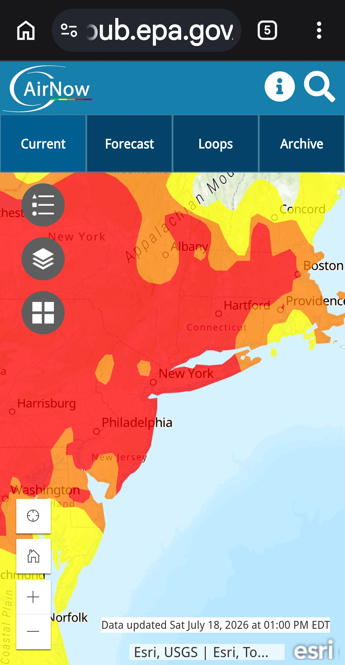
Smoke um if ya got um
-
2026 Mid-Atlantic Severe Storm General Discussion
SnowenOutThere replied to Kmlwx's topic in Mid Atlantic
I think we may be in the best severe setup of the year. We’re over 5000 CAPE, have 40 kt 0-6km shear, and okay enough ML lapse rates. There’s even 100+ surface helicity according to mesoanalysis! The smoke seems to also be inhibiting storm crowding by keeping or LL lapse rates down too. The storms now popping up on radar all have the bean look of supercellular development. We may be in for a memorable day. @vortex95 @high risk@WxUSAF@wxmeddler would love to hear your updated thoughts as storms begin firing! Also, just checked and our composite indices are crazy! We’re at 8 in Nova for supercells and 1 for sig tor (2 east of Baltimore)- 1,083 replies
-
- 1
-

-
- severe
- thunderstorms
- (and 7 more)
-
there is not going to be any clearing north of Trenton in NJ this afternoon - look at radar - all the clearing and building unstable air will be Trenton and points east and south and thats why I think those areas will get the most out of round 2 starting later today and tonight