All Activity
- Past hour
-
I’ve barely had the stove off. Euro finally starts warming it up after Monday. At least it torches info the following weekend.
-
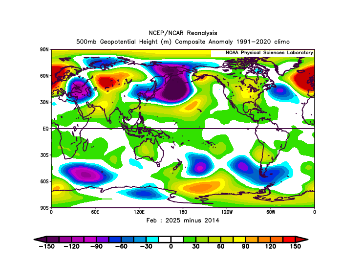
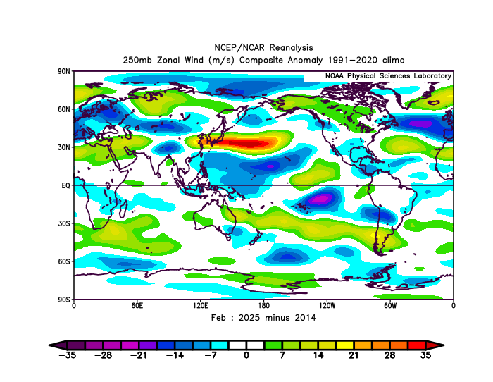
I agree with you that the 500 mb pattern in February was actually -PNA. But it was also -PNA in February 2014 with lower heights in the PNA region when we had around 30” inches of snow that month in NYC. The main difference was that the Southeast Ridge and Pacific Jet weren’t factors back in 2014 like they have become today. That big jet extension east of Japan coupled with a Southeast Ridge keeps the storm tracks through the Great Lakes.
-
Thursday? I turned pellet stove on yesterday and this morning
-
Happy birthday to @H2O!
-
Cold pool clouds and pop up convection for Saturday into Sunday but not much actual rain.
-
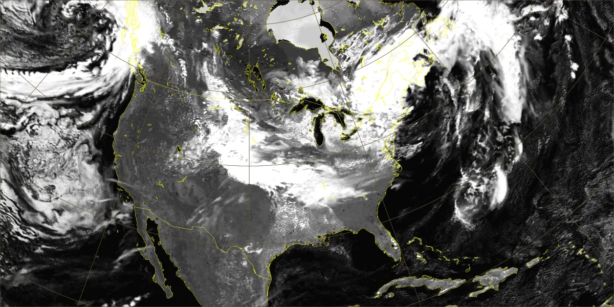
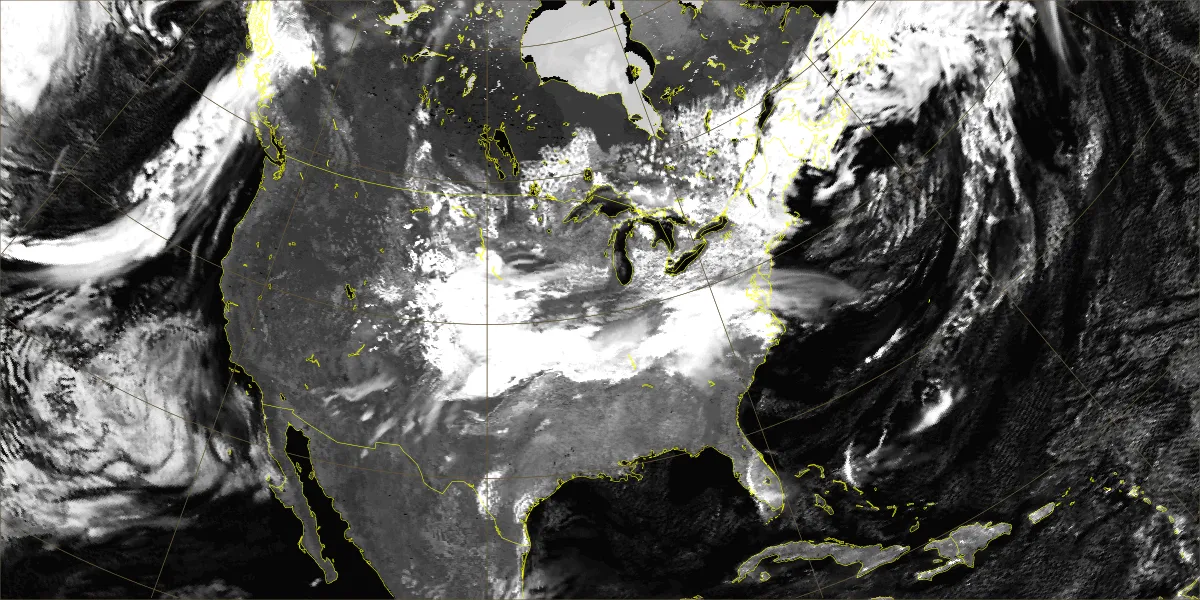
Radar looking mid for DC-north
-
I love the smell of wood smoke in the morning. It smells like...victory
-

Central PA Spring 2025
Mount Joy Snowman replied to canderson's topic in Upstate New York/Pennsylvania
56 when I left the house with no measurable rainfall but some spotty stuff starting to fall as I drove to the train station. -
Heat in my house is still on
-
A burnt-out educator decided to play every golf course in the state. That became his new career. Sean Melia is attempting to play all 350 or so courses in Massachusetts, and a growing number of golfers are following along. https://www.bostonglobe.com/2025/05/21/metro/golf-every-course/
-
45° outside and 58° inside. Feels more like morch.
-
-
Hazardous Weather Outlook National Weather Service State College PA 414 AM EDT Wed May 21 2025 PAZ004>006-010>012-017>019-024>028-035>037-041-042-045-046-049>053- 056>059-063>066-220815- Warren-McKean-Potter-Elk-Cameron-Northern Clinton-Clearfield- Northern Centre-Southern Centre-Cambria-Blair-Huntingdon-Mifflin- Juniata-Fulton-Franklin-Tioga-Northern Lycoming-Sullivan- Southern Clinton-Southern Lycoming-Union-Snyder-Montour- Northumberland-Columbia-Perry-Dauphin-Schuylkill-Lebanon-Cumberland- Adams-York-Lancaster- 414 AM EDT Wed May 21 2025 This Hazardous Weather Outlook is for central Pennsylvania. .DAY ONE...Today and tonight. Showers and thunderstorms may produce heavy rain, and bring the risk of small stream and urban flooding. .DAYS TWO THROUGH SEVEN...Thursday through Tuesday. The probability for widespread hazardous weather is low. .SPOTTER INFORMATION STATEMENT... Spotters are encouraged to report significant hazardous weather.
- Today
-
 Argar56 joined the community
 -
What a change in the monthly outlook from two weeks ago Based on sensitivity analysis applied to the latest guidance, there is an implied near 78% probability that New York City will have a warmer than normal May (1991-2020 normal). May will likely finish with a mean temperature near 66.0° (2.8° above normal). That would tie 2025 with 1986 as the 9th warmest May on record. Based on sensitivity analysis applied to the latest guidance, there is an implied near 53% probability that New York City will have a cooler than normal May (1991-2020 normal). May will likely finish with a mean temperature near 63.1° (0.1° below normal).
-
Yes. He was walking across my garage floor. I think he may have been too soon from emergence to fly.
-
Fixed MapsGL not loading completely. API update messed it up.
-

2025 Atlantic Hurricane Season
Stormchaserchuck1 replied to BarryStantonGBP's topic in Tropical Headquarters
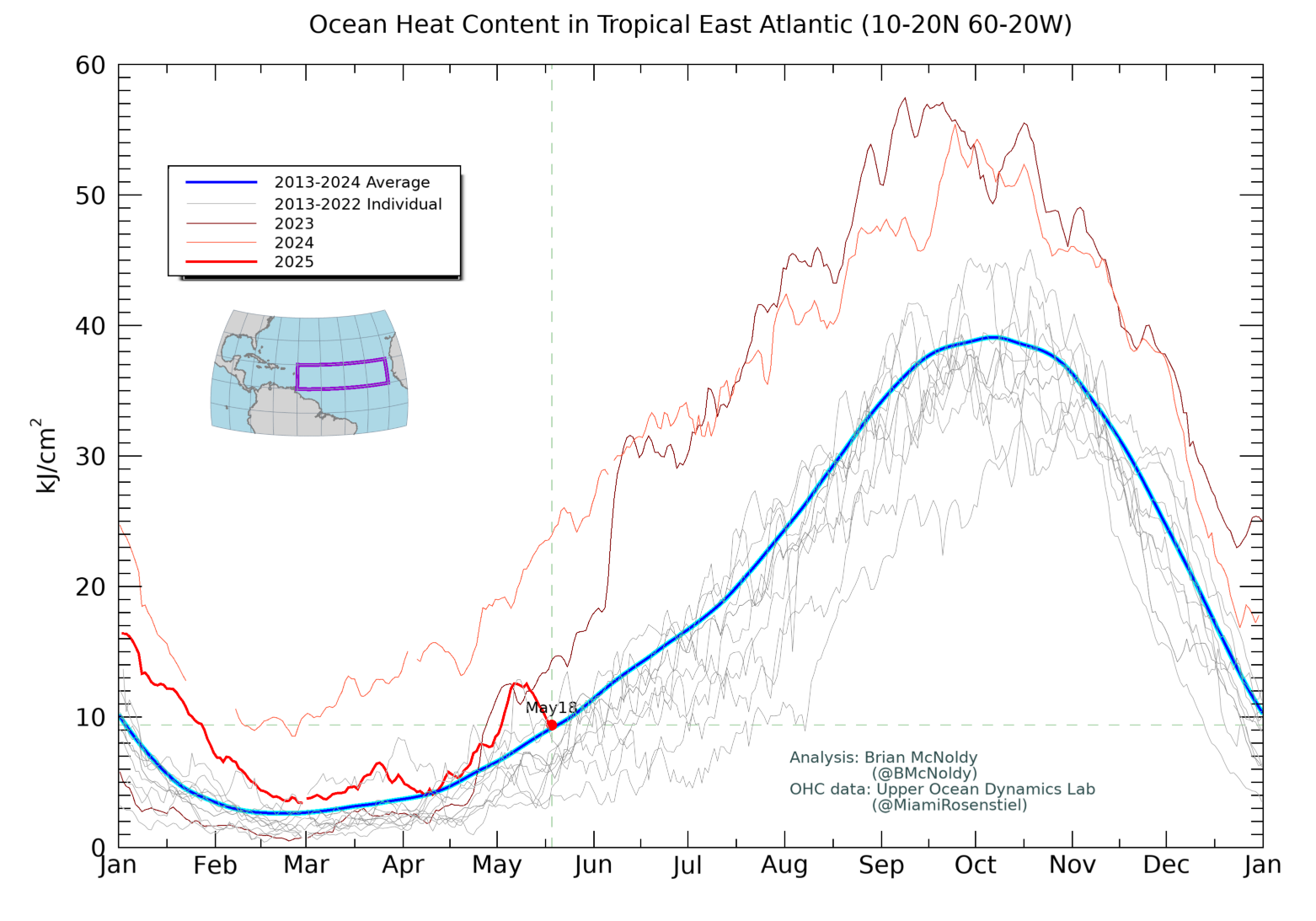
We're not getting that tripole Atlantic SLP pattern that you see in April-May's before hyperactive seasons -- it's actually more opposite, +NAO. -
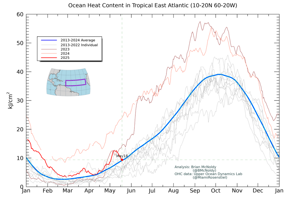
And just like that the Atlantic from 20-60W, 10-20N, OHC has cooled back down significantly:
-
Wowww you find this at your house?
-
Enjoy the rain. This trough should bring beneficial rain!
-
After scrolling and smash, just make a run for it barefoot! Here's another offbeat clip, Reed throws up in his mouth after a close call: https://x.com/Nerdy_Addict/status/1924982658649543083 I have no idea why and what is happening, Reed doesn't seem to be the type to get shook from a close call. It reminded me how there was a report that during a chase he had a seizure years ago, no closure on that either. https://www.facebook.com/watch/?ref=embed_video&v=1206443284825789 ^ Total bedlam, the others in the car start screaming that they are in danger, to stop recording, after the dominator is spun.
-
More than likely because they are updating AWIPS this week and couldnt reschedule.They gave the public advance notice because some things might be down at times along with NOAA radio the next few days
-

May 17th-20th severe weather discussion
CheeselandSkies replied to Chinook's topic in Central/Western States
Booked PTO to chase this Sunday-Monday back on May 9th. Managed to get there in time for the beauty near Arnett (@andyhb was on it as well). Then, hours after I thought the day was done, tried tangling with the Haviland-Plevna nocturnal beast when it was cycling northwest of Pratt. Quickly thought better of that and booked a room in Pratt for the night just as it was ramping back up. -
I think there’s pretty good agreement about upper 70s/low 80s to end May or start June. The GFS appears to be greatly overdone with the heat.
-
It might be interesting to watch the timing of the end of this pattern. Some of the models are indicating a quick turn-around into summer at the very end of May and during the first week of June. While one must be skeptical because this pattern has been so stubborn to leave, it can't last forever. WX/PT