All Activity
- Past hour
-
It’s all about perspective, right? It’s a letdown because we were looking at the potential of a foot or more of snow earlier in the week. But what if we were looking at a rainstorm earlier in the week and it evolved into this? We’d be doing cartwheels. That’s why an old-timer met likes to say, “enjoy the weather, it’s the only weather you got.”
-
Winter 2025-26 Medium/Long Range Discussion
Nelson replied to michsnowfreak's topic in Lakes/Ohio Valley
Doesn't look like we are going to shake this northwest flow (west ridge) any time soon -
Just saw in the NE forum cold thread that the Brunson, MN coop hit -43.
-

Southern MD / Lower Eastern Shore weather discussion
CAPE replied to PrinceFrederickWx's topic in Mid Atlantic
The snow part depends on how hot and heavy it is at the beginning. We need it to come in and go moderate to heavy pretty quickly, and for the snow to last several hours. That's our chance to pick up 5 or 6" before the sleet takes over. As for freezing rain, it looks like there is a decent chance for you and I to pick up a quarter inch of ice, then maybe ending as plain rain with a temp of 33-34. Closer to the coast there will be a a longer duration of rain, and little to no zr. -

Jan 24-26 Weekend Snow and Sleetfest Model Thread Part Tres
mappy replied to H2O's topic in Mid Atlantic
Ahh thanks! -
Jan 24-26 Weekend Snow and Sleetfest Model Thread Part Tres
Eskimo Joe replied to H2O's topic in Mid Atlantic
Brining and salting won't help much with this event. Surface and near subsurface temperatures are just too cold. Plowing will be the key here. -

January 24-26: Miracle or Mirage JV/Banter Thread!
dailylurker replied to SnowenOutThere's topic in Mid Atlantic
Everyone gives the NAM a hard time. I've always respected it big time. It might not show what we like sometimes but that not it's fault. The gfs imo should be retired. It's just causes confusion. I set my expectations way back yesterday and I feel great about the storm. I just want my grass covered at this point and it's a win. Icy trees would be awesome too. -

Jan 24-26 Weekend Snow and Sleetfest Model Thread Part Tres
SnowenOutThere replied to H2O's topic in Mid Atlantic
Oops! Always good to have a second set of eyes. Thank you! -

1/24-1/25 Major Winter Storm - S. IL, IN, and OH
nwohweather replied to A-L-E-K's topic in Lakes/Ohio Valley
Relax, this isn’t a wildfire barreling towards your town. Just enjoy lots of snow and days working from home -
Southern Crippler - Get well soon Jimbo Storm Obs
Stormpc replied to BooneWX's topic in Southeastern States
23/7 Currituck NC. Windy. High clouds. -
Extreme Cold, Snow & Sleet: SECS 1/25 - 1/26
WeatherGeek2025 replied to TriPol's topic in New York City Metro
reggie and gfs next -

January 25-26 Winter Storm Potential
anthonyweather replied to Ralph Wiggum's topic in Philadelphia Region
6-8” Lehigh -

Pittsburgh/Western PA WINTER ‘25/‘26
TimB replied to Burghblizz's topic in Upstate New York/Pennsylvania
-

Jan 24-26 Weekend Snow and Sleetfest Model Thread Part Tres
mappy replied to H2O's topic in Mid Atlantic
Howdy neighbor. I’m surprised roads aren’t brined yet haha -

Jan 24-26 Weekend Snow and Sleetfest Model Thread Part Tres
Maestrobjwa replied to H2O's topic in Mid Atlantic
....that are much easier in Niños See we don't have as much problem in those. And y'all wonder why I rant about ninas so much. Ninos are so much simpler with the wave interactions as long as the cold is there. -
Pittsburgh/Western PA WINTER ‘25/‘26
SteelCity87 replied to Burghblizz's topic in Upstate New York/Pennsylvania
Sweating bullets in Crafton lol -
Jan 24-26 Weekend Snow and Sleetfest Model Thread Part Tres
RDM replied to H2O's topic in Mid Atlantic
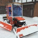
Nice graphics and well written. 2 is a lot of freezing rain. You may want to add the decimal points in the 2, 4 and 6 for clarity. -

Jan 24-26 Weekend Snow and Sleetfest Model Thread Part Tres
SnowenOutThere replied to H2O's topic in Mid Atlantic
It wasn't the nina. It took cosmically bad luck to ruin this setup. A stronger NS would've been fine if it wasn't for the Baja low becoming a neg tilt monster that trended north, I mean it was such an insane set of circumstances it cannot be blamed on Nina. Instead I think the only explanation is that we've been cursed by a witch or some sort of supernatural being. -
Desperate times call for desperate measures!
-

Extreme Cold, Snow & Sleet: SECS 1/25 - 1/26
WeatherGeek2025 replied to TriPol's topic in New York City Metro
unreliable model -

“Cory’s in LA! Let’s MECS!” Jan. 24-26 Disco
Prismshine Productions replied to TheSnowman's topic in New England
Have fun with that sunshine Sent from my SM-S166V using Tapatalk -
The sun is still poking through the clouds here
-
According to Gemini (aka "ask Jeeves"): In 2026, the FV3 model (specifically in its High-Resolution Window and GFS implementations) is noted for a more conservative approach to "warm noses" (elevated layers of air above freezing) compared to older models like the NAM. Warm Nose Prediction Characteristics Layer Integrity: The FV3 tends to maintain colder column integrity better than the NAM. In winter weather setups, it often predicts a weaker or later-arriving warm nose, which can lead to forecasts for more persistent snow while other models might suggest an earlier transition to sleet or rain.
-
Pittsburgh/Western PA WINTER ‘25/‘26
Rd9108 replied to Burghblizz's topic in Upstate New York/Pennsylvania
Do not underestimate the warm tongue but looks like with track its south east of the city. -
Alright Imma need next weekend to produce...that's all I'm saying. This weekend kinda hurts, lol

