

Stormpc
-
Posts
3,350 -
Joined
-
Last visited
1 Follower

About Stormpc

-
Jackson holiday is a big disappointment as well. Let's see what happens though in the next year or two. You never know but I suspect he's going to be a journeyman
-
100% AGREE with everything you said. They will not trade Alonso. At least not this year. Maybe next year if they can dump part of his salary but they're going to have to pay some of it too. The problem is the core players that came out of Norfolk probably overachieved for a while and gave a false sense of hope for the future. Gunner needs a change of venue. Cowser is just average at best. Westberg probably is going to struggle to get on the field. Adley will probably just be a mediocre ball player. They have no pitching. And fundamentals are terrible. Manager Choice was very suspect. Elias is probably gone in the offseason.
-
No compete for the Orioles tonight. Another bad one.
-
Pete is a wasted bandaid. 3 years from now he's Chris Davis. And they are not ready to win now or in the next couple years.
-
The CORE has struggled since mid 2024. No one has gotten better. Thats the problem. No money spent on FA starters doomed them as well
-
Yes. Looks like a wet microburst.
-
Frozen precipitation in the form of sleet made it all the way to my house. Crazy 24 hour turn of events. A few mangled flakes in there as well as we speak.
-
Agree. I've actually had more snow since I moved down here in 2018 than mild spot in Nova
-
Eh. Just light snow. But it's late February on the Northern Outer Banks and this is all I can ask for. A few good winters here since I've been down this way.
-
Was going to say the same thing. Radar is paltry over me but it's snowing very hard.
-
Doubtful. The winds at the surface at 3 inches are too variable. Can't get a good fetch because of it.
-
Yes it's drying out for us on the Southwest flank of the precipitation. As this thing pulls North. You might be right. We may be done.
-
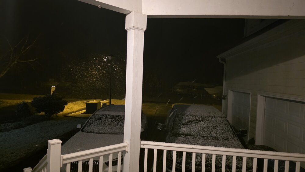
The tail end of that band is rotating through. It did its job. Laid a solid coating down. Brought the temperatures down near 33. Let's see if this can go on a little longer. I see a little drying to my west.
-
Down to 33.6. Once we flipped to snow it's already starting to stick.
-
34.1. Need some rates or a couple ticks down to see anything on the ground. My cold air came quick. Lots of times it comes down from the Eastern Shore through Virginia Beach and into Northeast North carolina. A lot less land friction. Sometimes it works out this way.


