All Activity
- Past hour
-

Saturday night/Sunday 12/13-12/14 Jawn
Kevin Reilly replied to Ralph Wiggum's topic in Philadelphia Region
Yea could be the storm is slowing down a bit and drawing in more moisture off the Atlantic or the models are picking up on the best lift and convergence which to me may be more likely with a squeeze effect out of all the available moisture. This will be fun to see unfold. -

12/12: The little Friday clipper that could? Or won't.
aldie 22 replied to dailylurker's topic in Mid Atlantic
When is this one supposed to start? -
We could call it getting… railroaded fuck shit’d?
-

Central PA Winter 25/26 Discussion and Obs
canderson replied to MAG5035's topic in Upstate New York/Pennsylvania
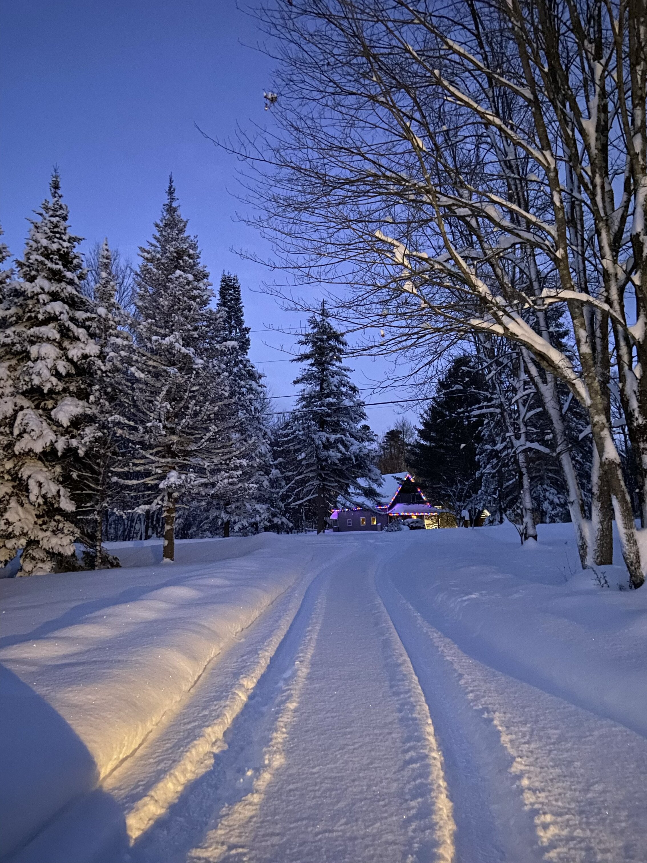
This gorgeous shot was posted in the HBGere with.Cameras group tonight. https://www.facebook.com/share/p/14Pmn8ttuD2/? -

Saturday night/Sunday 12/13-12/14 Jawn
Birds~69 replied to Ralph Wiggum's topic in Philadelphia Region
Better chance the rug being pulled out or Lucy screwing with Charlie Brown kicking the football... -
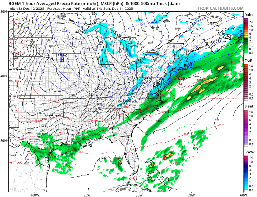
18z Ukie. Remains hope for N/NW crew with Rgem.
.thumb.png.02addb7a016c4d00653d15988576b466.png)
-
^ If I had a nickel for every time NE NC and SE VA got in on the snow action the past several years...
-
Hell of a way to start a winter! 15” the past three days and 42” on the season so far. Upslope crushed pretty good last night/this morning to the tune of an additional 8”. Almost 20” otg.

-
Cousin just called from South Jersey he said they have sprayed the roads by him
-

Central PA Winter 25/26 Discussion and Obs
mahantango#1 replied to MAG5035's topic in Upstate New York/Pennsylvania
I guess I'm in for a dusting of snow tomorrow night. -

12/12: The little Friday clipper that could? Or won't.
wxdude64 replied to dailylurker's topic in Mid Atlantic
Well, a glance of the 24 precip analysis says I'm like Wile E Coyote..... Had about 2 hours of light snow this morning, visibility never dropped below 4 miles and only place it accumulated was on the snow left from previous events. On to the next event, I surely can't complain after the past 10 days. -

Minor snow possible sunday 12/14/25
WestBabylonWeather replied to WeatherGeek2025's topic in New York City Metro
Finally -
Perhaps some potential behind the front for a little snow for NE NC and SE VA
-
I have no complaints up here in Putnam with how winter started. It has been cold, and we still have some snow on the ground. But I know winter nowadays never sustains itself, and the fact that a warmup looks likely around Christmas is shocking to nobody. I don’t even think a bookie would take the bet anymore for warmth around Christmas. On a side note, with these unpredictable winters and shrinking ski seasons, I really wonder how many seasons Thunder Ridge has left. Between the shortening season and the ancient lifts…
-
A tale of two nations
-

December 2025 Short/Medium Range Forecast Thread
Carvers Gap replied to John1122's topic in Tennessee Valley
18z suite commentary...I will just update this post. 18z GFS: At 162, it looks like it is about to unload some cold air into the Lower 48. The trough in the PNW is less, and the BN heights over northern Canada look to be rotating southward. At 183, this looks like it is gonna send it all??? -
Road crews were working today anyway. If you wait until tomorrow, you're paying overtime.
-
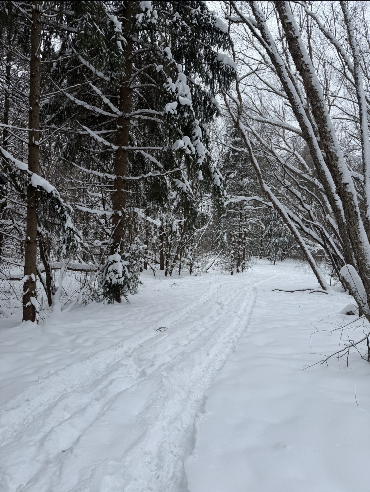
Front blasted through. Winds howling, snapped this photo at work right before all the snow was blown off the trees.

-

Minor snow possible sunday 12/14/25
RU848789 replied to WeatherGeek2025's topic in New York City Metro
"GFS, your failure is complete." Spoken in the voice of Darth Vader. As an aside, the system told me I couldn't post a GIF showing these 3 images as it was too large, but I was able to paste the 3 images in separately. Seems a bit odd. -

Saturday night/Sunday 12/13-12/14 Jawn
LVblizzard replied to Ralph Wiggum's topic in Philadelphia Region
Aside from the 18z HRRR and 12km NAM, all models in the evening suite have either held serve or gotten a little more amplified. Also, 21z RAP now gets 2” nearly to Scranton while the I-95 corridor sees 4-6”. Wonder what this means for the 0z runs…will we see a more robust system? -
18z GFS obliterates Kamu
-
I think I heard that in an Elvis song
-
and I just looked at the ICON and it says YEP also,,,,,,,,ps I literally just looked th these 4 models for the first time in days,,,,,,thoughts for Saturday into Sunday ?
-
Trouble? You’ve come to the right place. .
-
Same in AA Co. not sure why.


.png.c4b60188ae68373b51692663a069acd2.png)