All Activity
- Past hour
-

2025-2026 Fall/Winter Mountain Thread
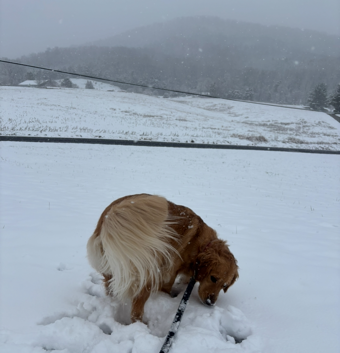
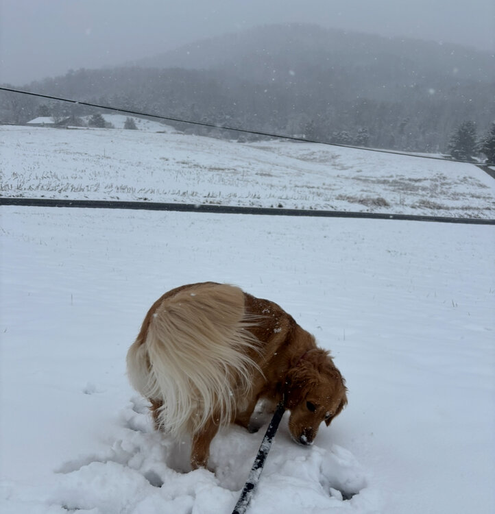
Maggie Valley Steve replied to Buckethead's topic in Southeastern States
I drove up to Soco Gap (4300 ft) at the Haywood/Jackson County line at the Parkway. Snow squalls are dropping enough snow to cover 19 at times above 3800 ft, but our DOT is standing by with salt and plows.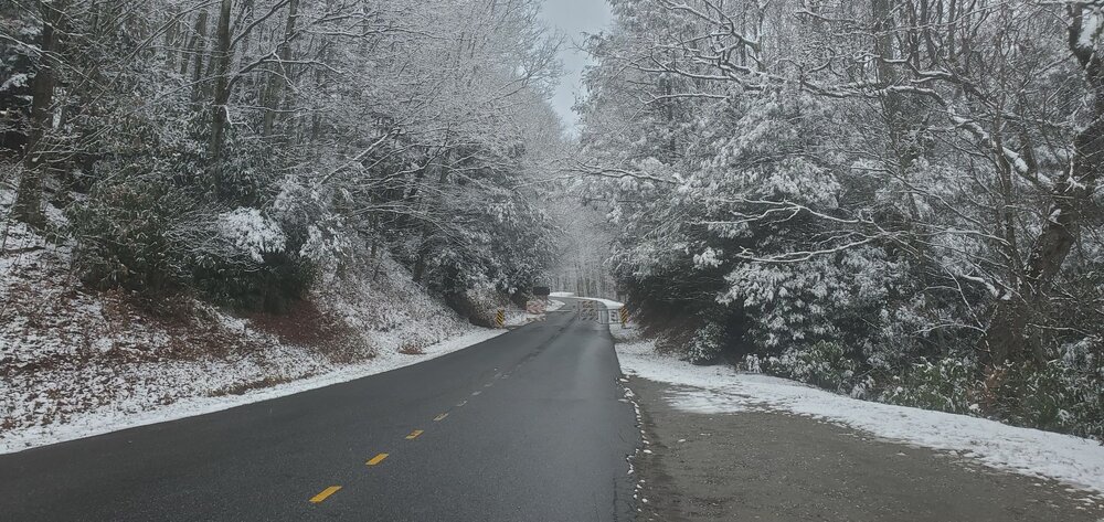
-
Great freaking picture Tyler!
-

Central PA Winter 25/26 Discussion and Obs
Itstrainingtime replied to MAG5035's topic in Upstate New York/Pennsylvania
There is another system moving through the mid-Atlantic today with more snow - beautiful winter scene in central VA right now: https://www.youtube.com/watch?v=wgkdREYOfw0 -
This event is not really like last week other than maybe roughly the same line where you get some accumulation....it's weak with a lot less QPF. It'll be good for high elevations in NNE. PRob mostly a 0.15-0.30" QPF type deal outside of the upslope elevated spots which might see 0.5-0.75"
-
12Z GFS and 12Z Euro Very Close
-
Meh, from watching those maps over the years, seems like we're in D1 or higher most the time. Nothing to really be concerned about until you get to D3.
-
Great view!!!
-

The Monday wintry event potential (12/8/25)
NorthHillsWx replied to GaWx's topic in Southeastern States
Newport News getting hammered. Enjoy -
It’s all about the radar. It’s really squeezing it out as it comes down on the lee side. .
-

December 2025 regional war/obs/disco thread
moneypitmike replied to Torch Tiger's topic in New England
Managed to hit 20*. Dipped back to 19 now. -
That’s what she said.
-

December 2025 regional war/obs/disco thread
Damage In Tolland replied to Torch Tiger's topic in New England
Just like last week .. sigh
-

Winter 2025-26 Short Range Discussion
roardog replied to SchaumburgStormer's topic in Lakes/Ohio Valley
Most of the models have shifted south. The HRRR seems to be drunk with the 970 something low in the U.P. -

The Monday wintry event potential (12/8/25)
SEwakenosnowforu replied to GaWx's topic in Southeastern States
Is rain what we call this?? More like a few sprinkles or a Trace of rain. lol -
From Paul Roundy: "Base state supports Bering Strait and Greenland blocking, with troughing in the eastern US. A fast component of the MJO signal moves through Indian basin to Maritime Continent 15-30 Dec offsetting the cold eastern US signal and potentially forcing a period of warm anomalies in the eastern US."
-
radar and snow reports from Virginia
-
Annnnd it stopped
-
About 4inches here and 28 in my back yard. Eagle Rock, VA
-
After hovering around 32.2° all day, the temperature has finally dropped below freezing to 31.8°. I measured 1" of snow at 1pm, but it doesn't look like much has accumulated since then despite the continuation of steady light to moderate snow. Looking at radar, once this steady snow ends, it looks like flurries and snow showers will continue into the evening.
-
Unfortunately true .
-

December 2025 regional war/obs/disco thread
RUNNAWAYICEBERG replied to Torch Tiger's topic in New England
Yea. We were buried with stubborn troughs into Cabo early and often past several shitty seasons. -
Hear that! At this point, I guess I’m just rooting for anything over 1”.
-

December 2025 regional war/obs/disco thread
Snowcrazed71 replied to Torch Tiger's topic in New England
I think this time last year and even the year before, we already started to see storms digging deep into California. Looking for any glimmer of hope possible. -

The Monday wintry event potential (12/8/25)
PackGrad05 replied to GaWx's topic in Southeastern States
nothing but rain still in southern wake. -
Given the background -PDO/Nina, we’ll almost certainly deal with west coast troughing again this winter…but I’d rather roll the dice with it in later January and February versus December. And hopefully it’s not digging into Baja…a lot more manageable when it’s a PAC NW trough.