All Activity
- Past hour
-
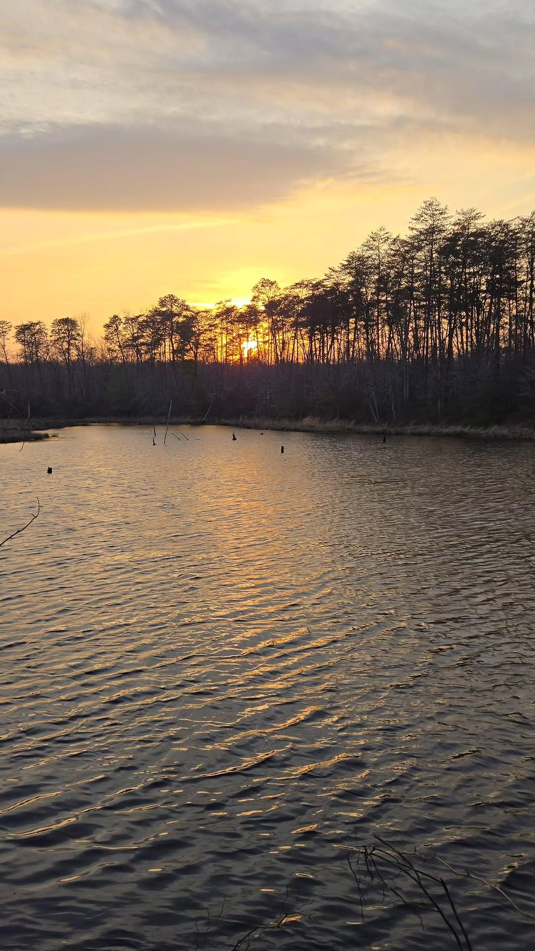
jai alai is really nice!
-
-

Central PA Spring 2026 Discussion/Obs Thread
canderson replied to Voyager's topic in Upstate New York/Pennsylvania
Same for Boston! -
Maybe this strong El Nino will change the state of the PDO
-
70/51 after a high of 75°. Got a bit windy for a little while this afternoon
-

It's time to grade Winter 2025-26(now that it's actually over)
Stormchaserchuck1 replied to CAPE's topic in Mid Atlantic
C+/B-. I don't like dry and cold, which it was a lot. The 11" storm sticking around for a month was awesome though. The other 4 months were meh. I think it only snowed (flurries or more) 11 times. Edit: the early Dec storm overperformed and I got 7"! Loved that one, there were 20+ flashes of green lightning. -

It's time to grade Winter 2025-26(now that it's actually over)
dailylurker replied to CAPE's topic in Mid Atlantic
A Third season in a row with climo snow and an extended period of cold. This winter was really cool. Lots of really memorable experiences related to ice. I also spent 5 days on the Tug Hill getting clobberd by LES. I also chased the coastal blizzard in February. I spent that storm in Harrington Delaware. -
I thought you were talking about a bug this am
-
Ima gonna go sit and wait on that cell near Frankfort IN. Its dangling pre frontal all alone and has that look. Its moving @ 60 right at me so shouldn't have to wait long lol Edit: shoiuld have a helluva shelf cloud from velocity if its not too dark
-
On and off thunder and rain in Northern Summit County, OH. Nothing too extreme yet. Cooling down for sure, though.
-
 We'll figure it out at some point over the next couple of months. Let's just continue predicting and honor Roger. Maybe Don can help too.
 -
Some positive trends today with signs that the front may stall late next week and we could get some actual widespread rainfall.
-
Enjoy. That looks great. It got to about 70 here…felt like it was even warmer, compared to the trash we’ve had lately.
-
 I am not a techie, however if I can help in anyway I work from home so I almost always have time to do something, if someone wants to point me in a direction to look stuff up just tell me where.
 - Today
-

It's time to grade Winter 2025-26(now that it's actually over)
Chris78 replied to CAPE's topic in Mid Atlantic
I've got to go D+ for my yard. Only 60% of climo snowfall and the 5th year in a row of sub 20" Seasonal snowfall. Which was unheard of until the last 5 years, Going all the way back to 1899 when records started at HGR. Sad run of winters honestly for Northern and western areas. -
 I would still like to continue to play the game; I would also like it to be renamed "The (year) Roger Smith Forecast Contest"
 -
Made it to 78 Looks like next week there will be 1 day in mid 80s!
-
Ended up being a nice day. Low 60s, sun in and out. Started off shitty though with light showers. Peepers are out in full force now. Loud af.
-
2 1/2 days on a single page?
-
Distant smoky wildfire smell out here today. Edit: just saw there are wildfires down in NC
-
Had a few sprinkles here today. SPC FTL with yesterday's day2 outlook for northwest IL/east IA.
-
Glad I held off putting the tree fertilizer spikes in as we received nothing for rainfall today.
-
85f in Naples, FL Sent from my SM-S921U using Tapatalk

-
Phreakin' confirmed hailers lining up in IN/IL. Stay up there dammit Tor watch for OH where lake breeze interaction has a better chance with already organized cells. Mesoscale Discussion 0292 NWS Storm Prediction Center Norman OK 0325 PM CDT Thu Mar 26 2026 Areas affected...much of Ohio into western Pennsylvania Concerning...Severe potential...Watch likely Valid 262025Z - 262200Z Probability of Watch Issuance...80 percent SUMMARY...Gradual convective development should support an increasing risk for supercells late this afternoon into this evening. Hail, damaging gusts are likely, with a couple of tornadoes possible. DISCUSSION...Afternoon visible and radar imagery showed an area of showers and weak convection gradually intensifying across southern Lower MI into northwestern OH. Located along and south of a front/lake breeze intersection, warming and moistening of the air mass across much of OH and PA this afternoon has resulted in weak to moderate buoyancy. Area VADs show very strong mid-level flow with elongated and veering hodographs. This will favor a mix of supercells and linear segments as the primary storm mode. Given the sufficient buoyancy and strong low/deep-layer shear, hail and severe gusts are likely. Tornadoes are also possible given ESRH of 300-400 m2/s2. Additional vertical vorticity near the lake breeze boundary could also support a locally greater tornado risk given favorable storm motions parallel to the lake shore. Recent CAM guidance and satellite trends regarding the ongoing shallow convection/showers over northwest OH and Lower MI show them gradually deepening as continued heating and mid-level ascent erode inhibition. This should support an increase in the severe risk late this afternoon into the evening. A Tornado Watch will likely be needed. ..Lyons/Smith.. 03/26/2026 ...Please see www.spc.noaa.gov for graphic product... ATTN...WFO...CTP...PBZ...RLX...CLE...ILN...DTX...IWX... LAT...LON 41748249 42038144 42058046 41617949 41077934 40447956 39768013 39258145 39148316 39458405 39838433 40468450 41188445 41648424 41758388 41768347 41748249 MOST PROBABLE PEAK TORNADO INTENSITY...100-130 MPH MOST PROBABLE PEAK WIND GUST...65-80 MPH MOST PROBABLE PEAK HAIL SIZE...1.50-2.50 IN NOAA / National Weather Service National Centers for Environmental Prediction Storm Prediction Center 120 David L. Boren Blvd. Norman, OK 73072 U.S.A. [email protected] Page last modified: March 26, 2026 Disclaimer Information Quality Help Glossary Privacy Policy Freedom of Information Act (FOIA) About Us Career Opportunities
-

It's time to grade Winter 2025-26(now that it's actually over)
WxUSAF replied to CAPE's topic in Mid Atlantic
B+ A if curving for a Nina.