All Activity
- Past hour
-

Central PA Summer 2026 Discussion/Obs Thread
canderson replied to Voyager's topic in Upstate New York/Pennsylvania
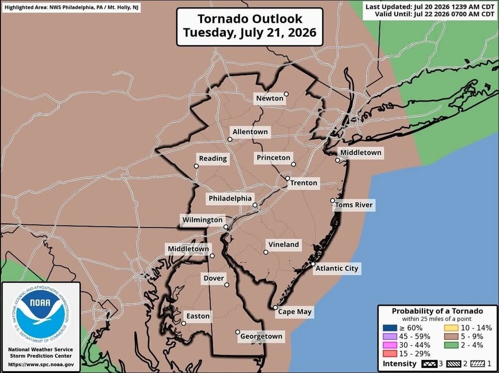
Hive mind question; Have tickets for a show at Merriweather Post Pavilion in Columbia, MD, Tuesday. Would you bail given the forecast? The venue is in the woods and is a bowl that can flood. -
-
The daily downpour is underway here. Hopefully this doesn't continue, as I have some outdoor stuff planned for 6 I'd rather not have to change. I thought I was good when the chance was only 30 percent today.
-

E PA/NJ/DE Summer 2026 Obs/Discussion
Mikeymac5306 replied to PhiEaglesfan712's topic in Philadelphia Region
You think this morning was nice, look at what Friday and Saturday morning bring. -
You're in a wild mini-drought apparently. It's crazy how rain can be close and still miss you basically every day.
-
too cool! Trap pond is excellent for that type of sightseeing. I believe it is also the furthest north occurrence of cypress trees. I think we are pretty lucky in the relative abundance of wildlife we still have in this area. I get to see deer in my park at least a few times a month, and there is a groundhog up the street, as well as multitudes of very bad squirrels and a diverse variety of bird.
-
Storms are really blowing up in north-central Iowa. They should side sse down the outflow boundary from this morning's storms. Cedar Rapids is well east into the morning cold pool, so I'm not sure if the storms will be able to get this far east.
-
 Unfortunate. I enjoyed your posts. Stop in once a year when we have a convection threat.
 -
Last year was a frontloaded warm summer, with the heat wave in late June and the warmth lasting all through July. The summer pretty much ended after July 31.
-
I see the 18z HRRR has a round for around midday, and then a long break for the afternoon before a big round for the early evening.
-
 Very, very doubtful. Maybe some TORs here though, 12/26/15 featured a violent EF4 in DFW. S Rockies hopefully will cash in on Nino climo, not too far of a flight / drive from here to N NM and SW CO.
 -
18Z HRRR not many changes, does move a bit to the RRFS/Hi RES GFS idea the first round 15-18Z may be mostly NYC north but the 22-02z period looks like a strong line of storms
-
proper torch
-
GFS and NAM keep me in the 60's on Wednesday. Would be v refreshing
-
0.17” of precipitation from the dying line of convection this morning
-
 Glad you were able to get out and escape the leftism of New England. Wish we could . This winter it’s entirely possible you get more snow than we do !
 -
Today is the 10th consecutive 90 at MSP, setting a new record. While the daily high temperatures weren’t noteworthy, the duration certainly was. I’d classify this as a historic heatwave around Minnesota.
-
Mt Mitchell definitely plays a role. Central McDowell where I live can miss out in this type of flow. We rack up with NE/E or SE flow. And do well in S flow. Anything with a W component is very hit or miss.
-
I recently learned that whole house generators have a life span of around 20 years. a friend has had one for 20+ years, and it recently stopped doing its weekly test run, so he had a guy out to service it. Found a blown fuse, which he replaced. when he fired up the generator, the battery literally exploded. No diagnosis as the unit was well out of warranty and there was no guarantee that they could even figure out what the problem was.
-
ORD and MDW ended up with 6 90°+ days during this heat wave, all consecutive. ...ORD... July 13th: 93°/69° July 14th: 96°/74° July 15th: 95°/76° July 16th: 91°/75° July 17th: 92°/75° July 18th: 91°/70° ...MDW... July 13th: 92°/69° July 14th: 96°/73° July 15th: 95°/76° July 16th: 91°/78° July 17th: 94°/77° July 18th: 91°/71°
-
It made it up to 91° at ORD and MDW on Saturday.
-
It made it up to 91° at ORD and MDW on Saturday. ...2026 90°+ Day Tally... 12 - MDW 11 - ORD 11 - RFD 11 - ARR 10 - PWK 10 - LOT 9 - UGN 8 - DPA
-

2026-2027 Super El Nino
Stormchaserchuck1 replied to Stormchaserchuck1's topic in Weather Forecasting and Discussion
That's a good point. This is 2 years after a Solar Max: We know that +AO/NAO is favored +1-5 years after Solar Max. Also, 4/5 Super east-based Nino's have happened during +NAO decadal phase (82-83, 97-98, 15-16, 23-24 -vs- 72,73). This year will make 5/6 Super Nino's happening in +NAO decadal unless we see a 09-10 type -NAO season. Check it out.. 13 February's in a row have had +NAO, and most are >+1.00 NAO! 2014 1.34 2015 1.32 2016 1.58 2017 1.00 2018 1.58 2019 0.29 2020 1.26 2021 0.14 2022 1.68 2023 0.92 2024 1.09 2025 1.60 2026 0.68 - Today
-
Probably not. I think we've already seen the worst of the heat. Unlike those years, we've had heat early and often, with 80s as early as March, 90s as early as April, and 100+ earlier this month. I highly doubt we see more 90-degree days in August than in June or July.
-