All Activity
- Past hour
-
Too cold.
-
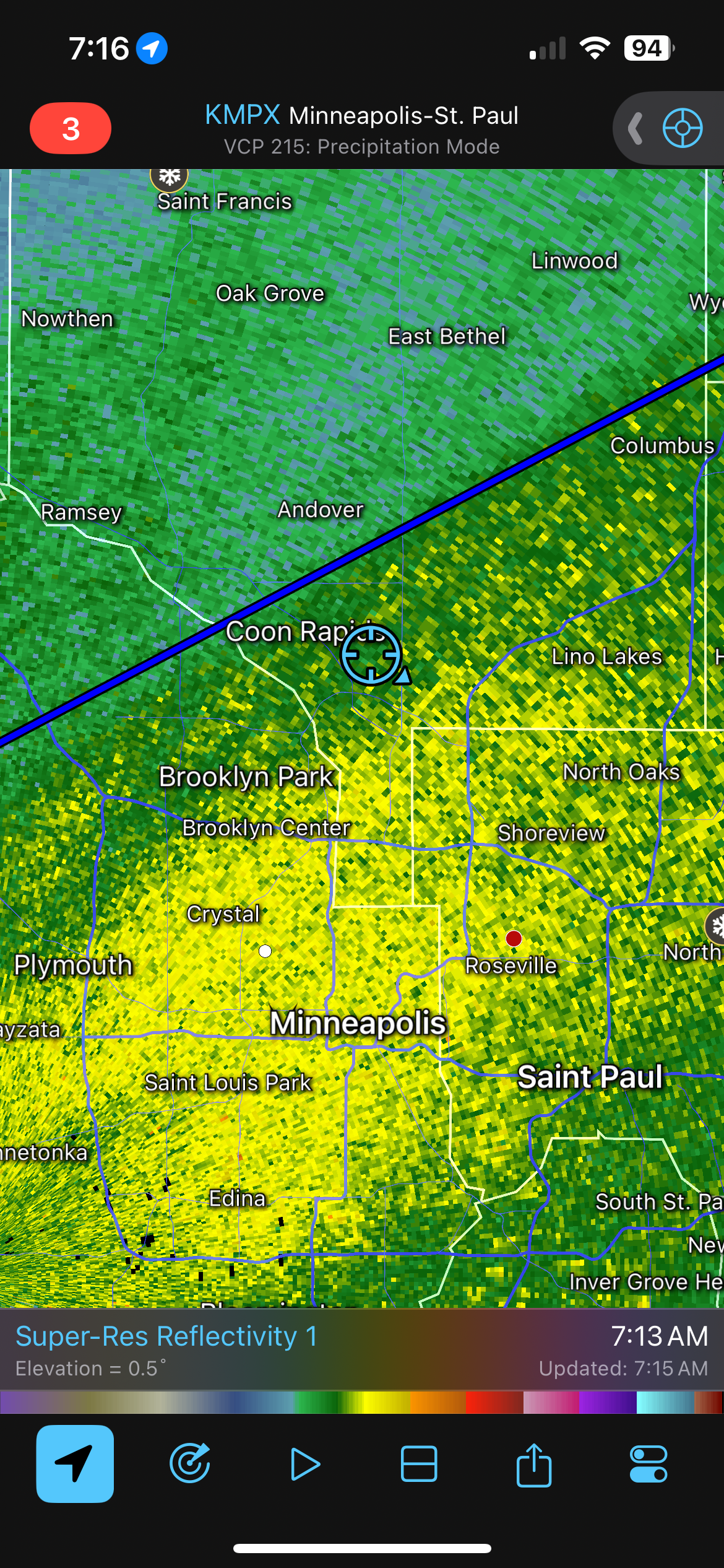
Yeah coming down nice in this secondary heavy right now. 7” over here in Woodbury as of 7 am and I’m guessing MSP is doing at least as well given they reported 5” at midnight. Looks like jackpot zone of 10-15 from Rochester over to Wausau and then a buffer zone of 6-10 up to the southern half of the metro. Bummer for the north side though being so close. AIFS over the past few days was the closest with the placement. Most models showing 4-6” additional today over here so that 12-13 threshold for significant storm still in play for MSP? .
-
That's a heck of a radar in LaCrosse, WI right now. Thundersnow and thundersleet.
-
Not to downplay how bad things are out there right now because they are bad but it’s going to end up being a huge anomaly in the end. Didn’t you guys just have a string of good winters the last decade? I know 22-23 was cold in the west for sure. It’s not like some switch was flipped and now this is the “new normal”. When March 2012 happened over here after a warm and snowless winter, I read a couple of articles about how this was going to happen more because of climate change. Well, no surprise to me, nothing even close to that has happened since. Or how about the “permanent” Texas drought I kept reading about in the early 2010s? Next thing you knew it was flooding there.lol.
-
This heat event will be among the most impressive heat events on record relative to climatology. It will rank up there with the March 2012, June 2021 PNW, September-October 2024 Southwest heat events in terms of peak temperatures relative to normal. The national March high temperature mark of 108° should fall. Numerous cities will surpass not just March, but also April monthly records.
-
Updraft Helicity Index
-
@Ginx snewx would you happen to have a snowfall total recorded for Jan 7-8 1996? I dunno how far your records go back but you gave me Dec 2000 so i thought maybe you might have one.
-
Yeah it’s ripping right now. We still have 10+ hours to go according to the HRRR
-
Hi sorry, just seeing this. Was at a concert last night. I see it’s all been handled. Thanks for starting a thread
-
Urban heat island? lol
-

E PA/NJ/DE Spring 2026 Obs/Discussion
Violentweatherfan replied to PhiEaglesfan712's topic in Philadelphia Region
So SEPA can anticipate at least some wicked thunderstorms right? -
-
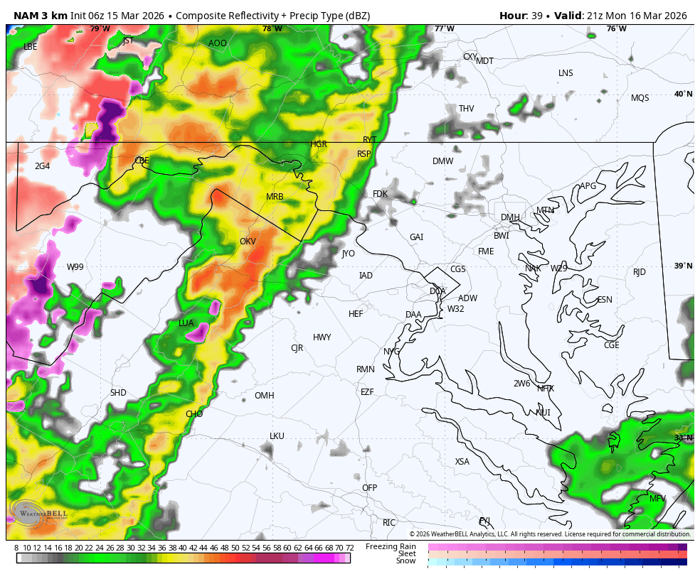
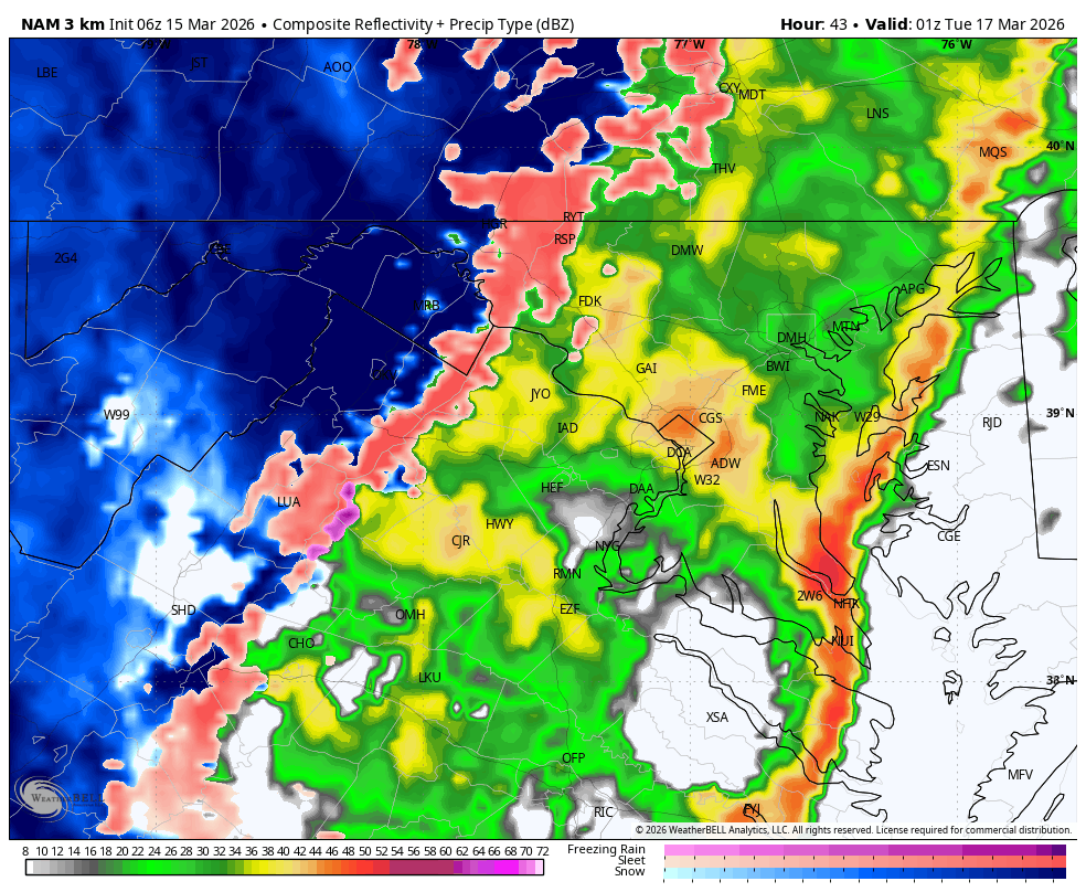
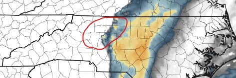
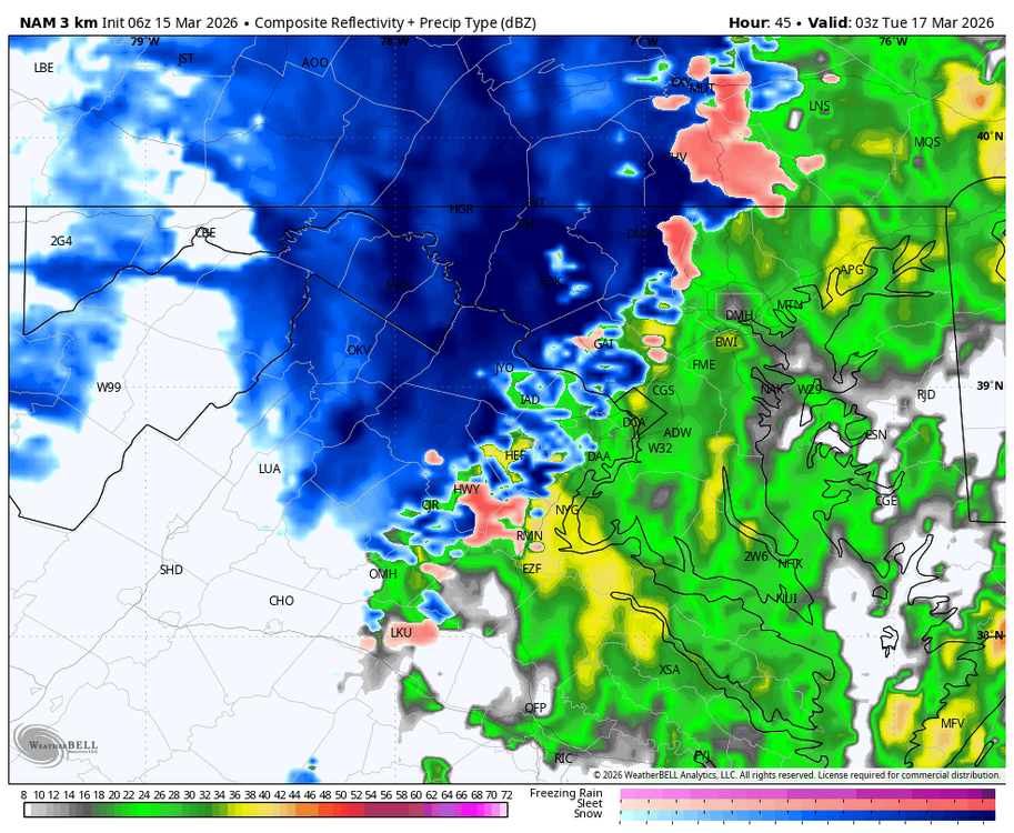
Pretty big numbers for sure. One model NAM 3K, but this brings attention here in the Triad area.
-
Guidance has also backed off on the blocking a bit.
-
This new band should help the totals a bit. All depends on how long it sticks around. Really coming down right now. .

-
Webcam for Marquette:
-
never said otherwise, but it’s especially important for this event. Good thing that doesn’t look to be the case here (with the first band anyhow), though seems to be setting up a bit farther south than modeled, so the heart of the TC metro may miss out on the biggest totals.
-
Pity that MSP isn’t the bullseye but this should still end up with substantial totals at the airport. Going to go out and do round 1 of shoveling and measure soon.
-
Cross posting in here
-

3/16/26 Severe Weather Event Thread (Day 2 MOD Risk)
Eskimo Joe replied to Kmlwx's topic in Mid Atlantic
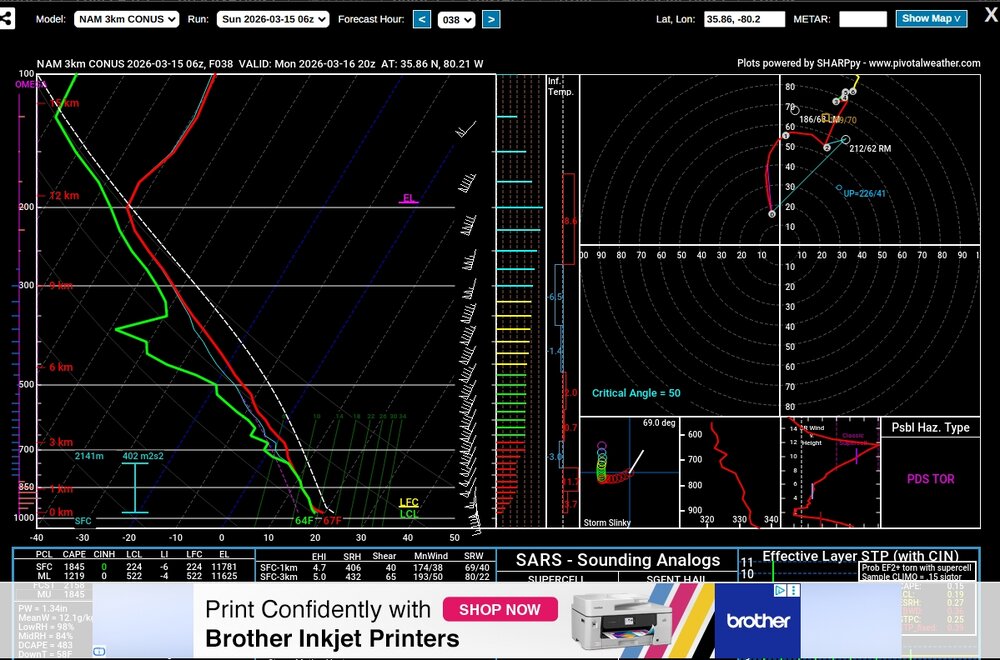
06z HRRR had a UHI track from Dulles right to York, PA, another right over DC< and two more through Stafford and La Plata. Wow. -
lol, so bad
-
NOAA is downplaying any snow potential.
-
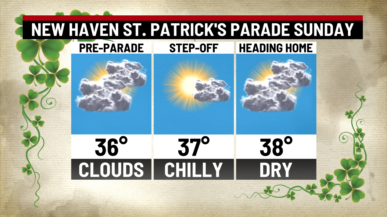
Great Irish like day for the New Haven parade...

-

3/16/26 Severe Weather Event Thread (Day 2 MOD Risk)
Weather Will replied to Kmlwx's topic in Mid Atlantic
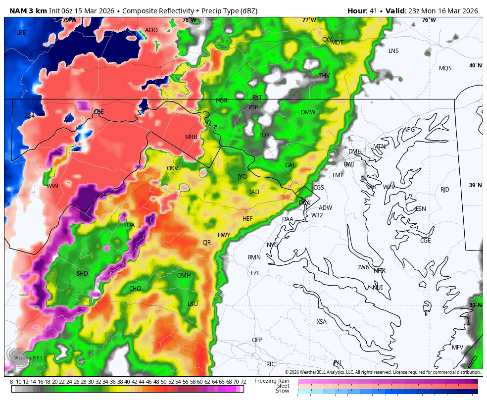
WB 6Z 3K NAM for Monday evening starting at 5 pm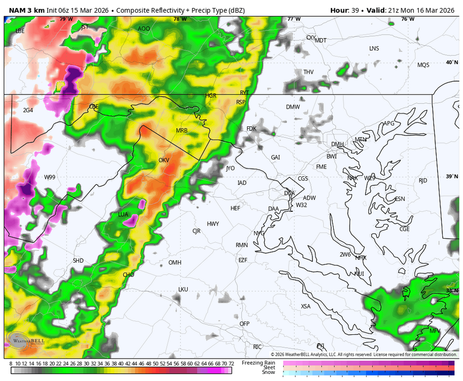


-
Hrrr a little more tepid. Last time it did this is was closer to correct. We’ll see if it ramps up as we get closer.