All Activity
- Past hour
-
.thumb.gif.f92b16c631a1d15d405ed77b33f0710d.gif)
Augdewst 2026: Summer's Last Stand
Torch Tiger replied to Prismshine Productions's topic in New England
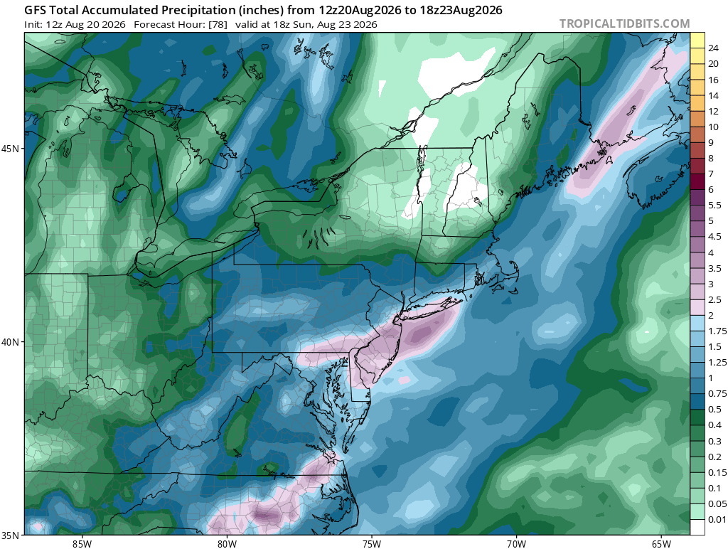
1.5-2.5" next 5. We'll see -

E PA/NJ/DE Summer 2026 Obs/Discussion
Kevin Reilly replied to PhiEaglesfan712's topic in Philadelphia Region
This seems underway just northeast of Dover Delaware moving NE into Southwestern NJ that is some pretty heavy-duty flooding rains there moving NE. -
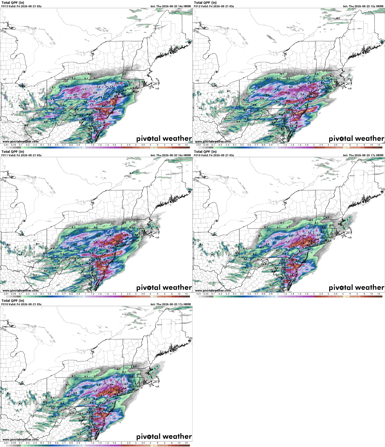
Hrrr been bouncing around as usual
-
looks like thats it for us
-
Rained briefly here at Coppin about an hour ago, now clearing up with patches of blue sky and grey clouds. Oppressively humid though.
-
Latest HRRR dry slots most of that area
-
-
Got clipped by a heavy downpour 0.09
-
Rain has begun here. A few brief heavy downpours but they moved through quickly. Radar filling in.
-

-
Sun has broke through over here. 85/76/77
-

Augdewst 2026: Summer's Last Stand
Cyclone-68 replied to Prismshine Productions's topic in New England
Once again the same area struck about 100x this summer. It’s getting old -
Nice storms harmlessly sliding to my SE. The 81 rain shield in full force again.
-
Garner 1:55 We have had spectacular thunder for a good while-window rattling About that rain-where it be at? It isn't here
-

E PA/NJ/DE Summer 2026 Obs/Discussion
The Iceman replied to PhiEaglesfan712's topic in Philadelphia Region
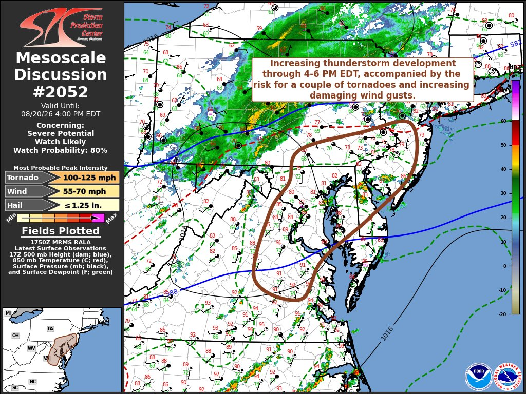
Mesoscale discussion out Mesoscale Discussion 2052 NWS Storm Prediction Center Norman OK Aug 20, 2026 17:53Z Areas affected...parts of southeastern Pennsylvania...central and southern New Jersey...north central and eastern Virginia...much of Delaware and Maryland. Concerning...Severe potential...Watch likely Valid 201753Z - 202000Z Probability of Watch Issuance...80 percent SUMMARY...Thunderstorms are likely to develop and intensify through 4-6 PM EDT, accompanied by the risk for a couple of tornadoes initially and increasing potential for strong to severe gusts spreading toward coastal areas into early evening. DISCUSSION...Moderate to strong boundary-layer destabilization is ongoing across much of the northern Mid Atlantic, particularly within seasonably high moisture content air advecting northward through the coastal plain, to the east of deepening (albeit weak) surface troughing to the lee of the Blue Ridge. This is occurring downstream of mid-level troughing, with at least a couple of convectively generated perturbations and belt of augmented westerly flow (30-50 kt in the 700-500 mb layer). It appears that associated forcing for ascent may increasingly begin to impact a corridor from central Maryland through southeastern Pennsylvania by 20-22Z, if not a bit earlier, supporting the initiation of intensifying thunderstorm development. At least initially, this may include a few evolving supercell structures in the presence of strong deep-layer shear. Downstream of a developing wave along a weak low-level baroclinic zone strengthened by differential heating, low-level hodographs are forecast to remain modest to weak. However, they may still be sufficient to contribute to potential for a couple of tornadoes, aided by appreciable near-surface buoyancy developing in associated with insolation, warm advection and dew point increases into the lower 70s F. Otherwise, at least some upscale growth of initial storms will contribute to increasing potential for damaging surface gusts, with additional thunderstorm development southward along and east of the deeper lee surface troughing. ..Kerr/Smith.. 08/20/2026 ...Please see www.spc.noaa.gov for graphic product... ATTN...WFO...PHI...AKQ...CTP...LWX... MOST PROBABLE PEAK TORNADO INTENSITY...100-125 MPH MOST PROBABLE PEAK WIND GUST...55-70 MPH MOST PROBABLE PEAK HAIL SIZE...UP TO 1.25 IN -

2026 Mid-Atlantic Severe Storm General Discussion
wxmeddler replied to Kmlwx's topic in Mid Atlantic
Red Box coming soon.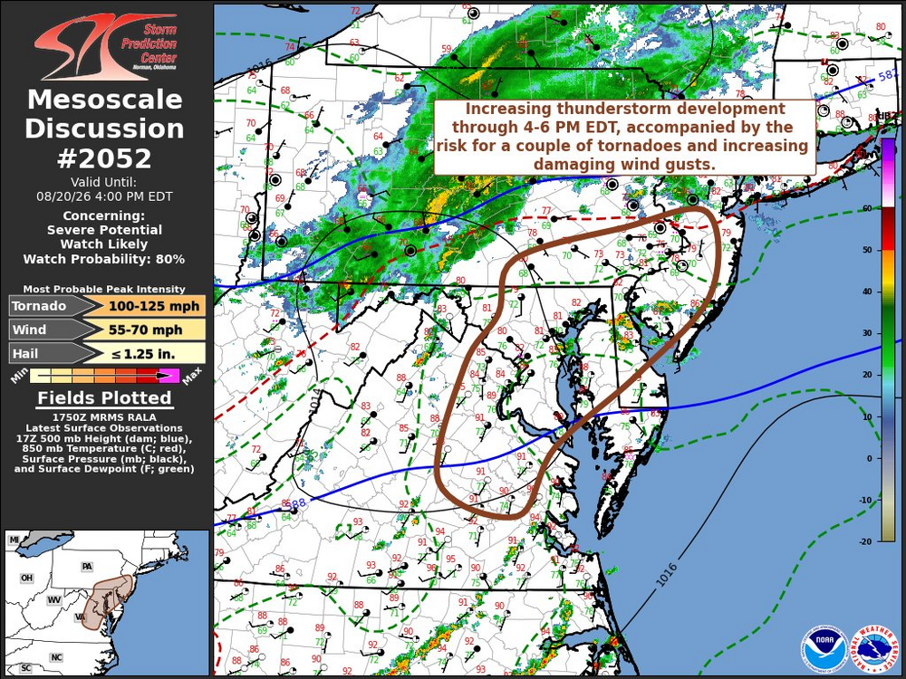
- 2,041 replies
-
- 2
-

-

-
- severe
- thunderstorms
- (and 7 more)
-
No reason to think this train pauses before printing some 1.8-2.0 months.
-

Augdewst 2026: Summer's Last Stand
powderfreak replied to Prismshine Productions's topic in New England
Can you meh yourself back into 1”+?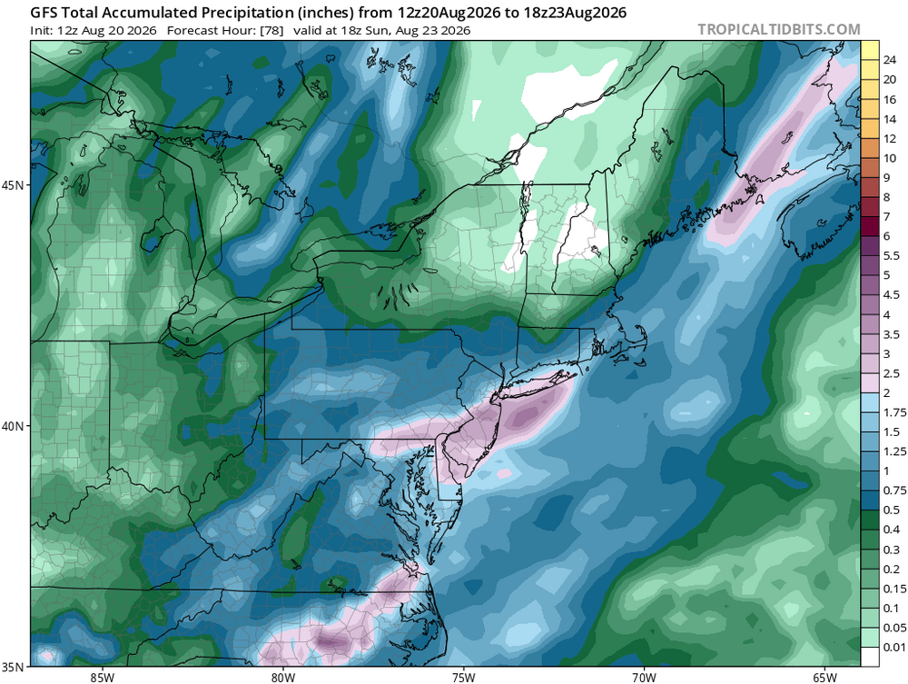
-
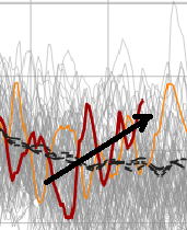
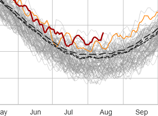
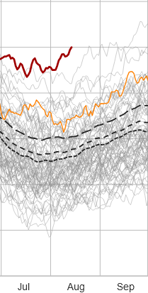
the s. hemisphere the tropics are lewd while the antarctic itself has a scary trend line originating over the last 1.5 months. It'll likely correct down some - we hope. The scalar value at the end of that rust curve is ~ 4th or 5th overall, to date. You don't wanna see early positive anomaly investments of that look before their annual recover is set to get going, in about a 3 weeks.
-
wow! This guy did the math!
-
-

Augdewst 2026: Summer's Last Stand
Sey-Mour Snow replied to Prismshine Productions's topic in New England
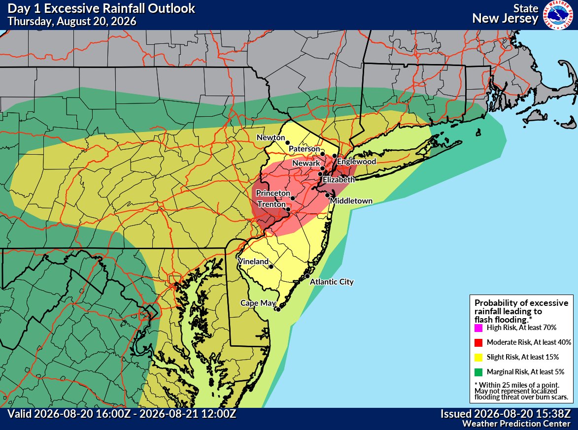
Upgraded WPC outlook looking like southern CT will see a good 2-4” soaking tonight.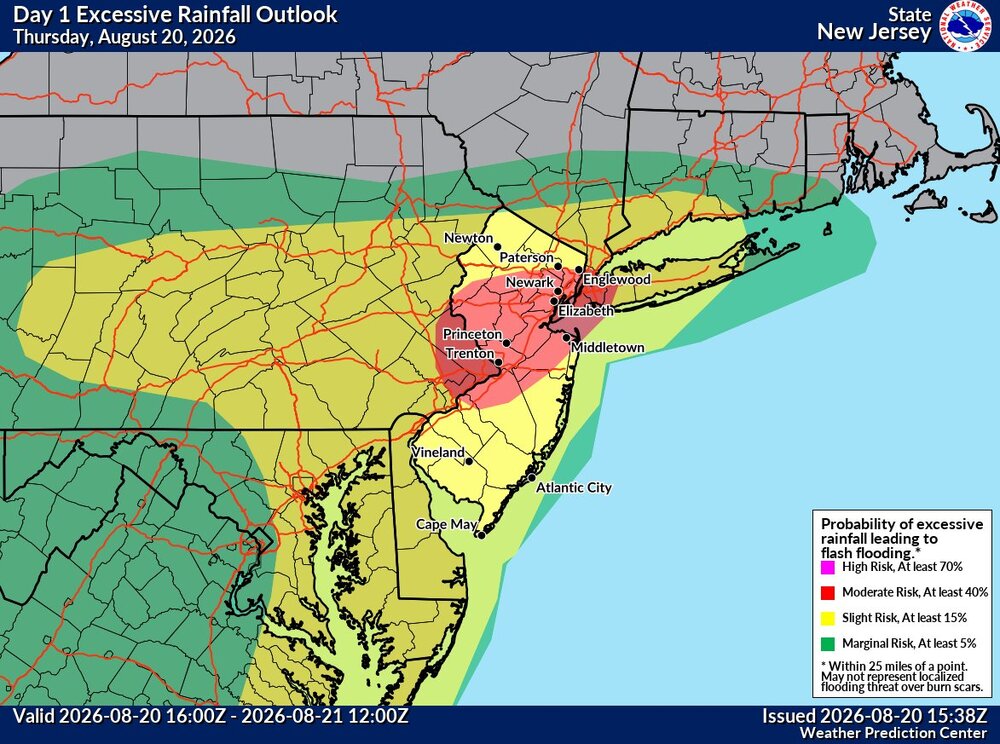
-

2026 Mid-Atlantic Severe Storm General Discussion
SnowenOutThere replied to Kmlwx's topic in Mid Atlantic
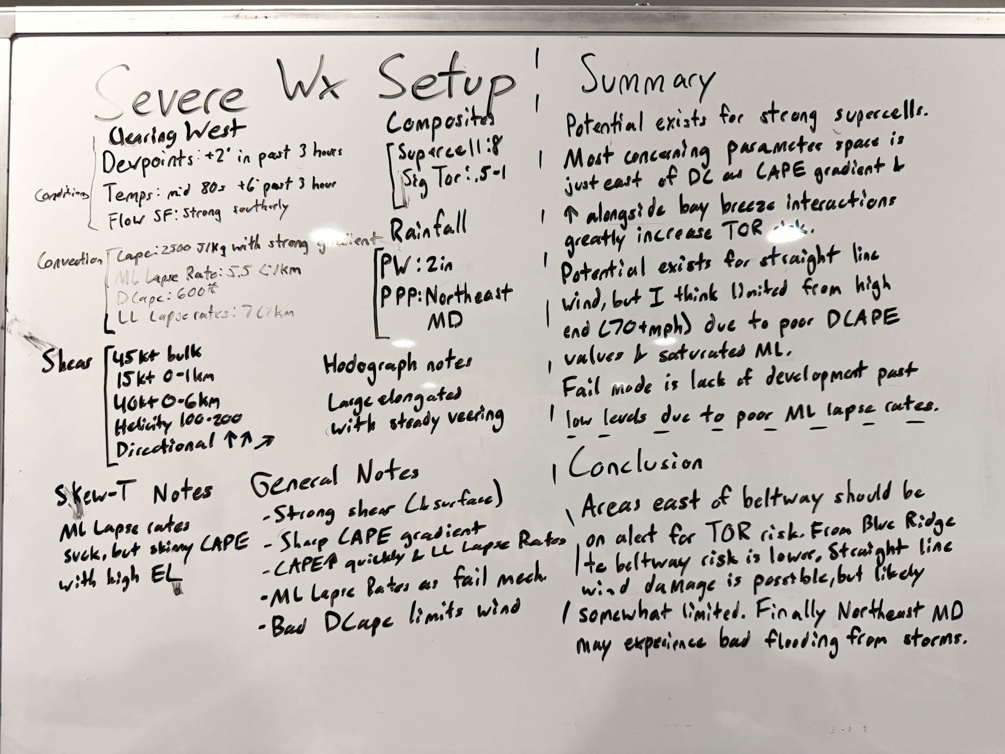
My take on today. Made before the Dulles sounding, but I doubt that changes too much from the parameters shown on mesoanalysis.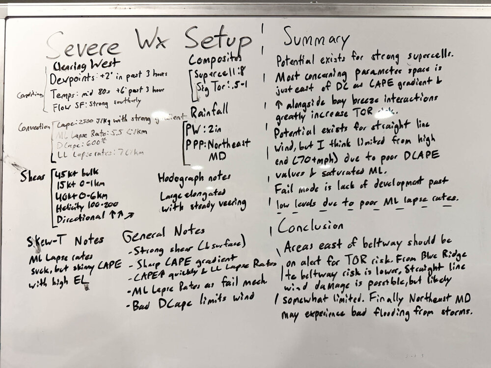
- 2,041 replies
-
- 1
-
-
- severe
- thunderstorms
- (and 7 more)
-
I share your skepticism, b/c so many fails this summer. But past performance does not....
-
Stay safe.