All Activity
- Past hour
-
.79” and 35 gray cold degrees.
-

Central PA Spring 2026 Discussion/Obs Thread
WmsptWx replied to Voyager's topic in Upstate New York/Pennsylvania
After two beautiful days (and my second sunburn of the season), we're back to this dog shit. Ugh. -
I’m not thinking anything here other than novelty nonsense
-
here's last winter compared to 78. do you guys notice anything?
-
0.75”. Please nobody say we are in a drought
-
Thanks for posting these. I’ve seen similar charts showing lowered global wx related disaster costs in more recent years. Does anyone know the main reasons? Despite these drops (assuming these charts are accurate and not deceptive/being presented in proper context, which may very well be the case), are they projected to continue dropping as we continue to warm? That’s key to know.
-
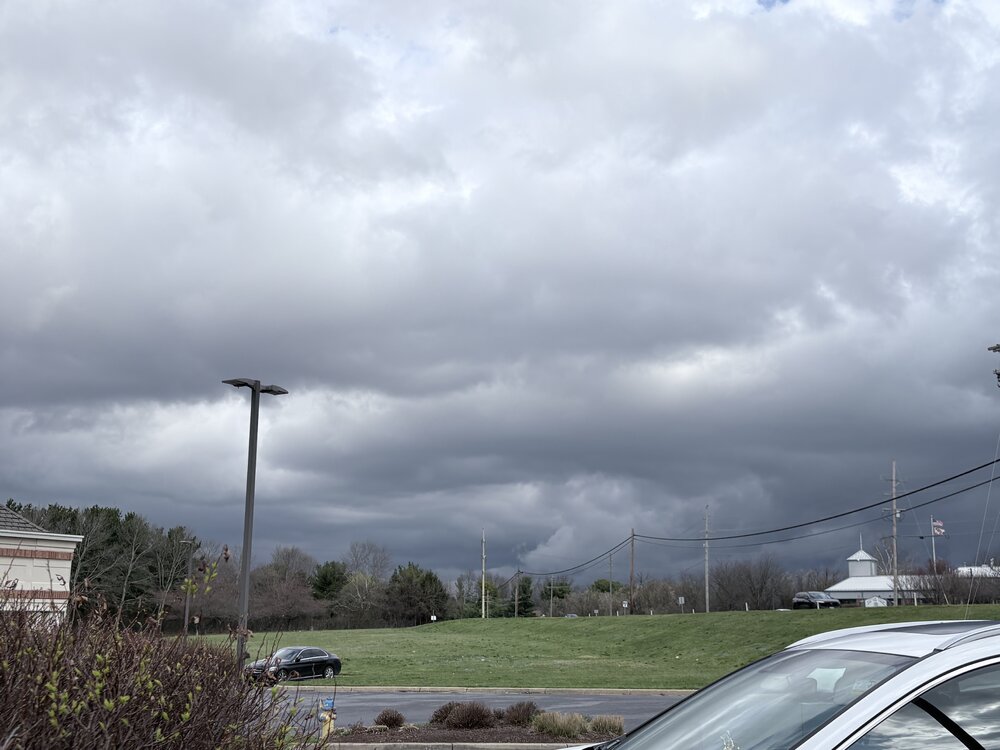
Up at the vets office looking NW
-
Congrats Dendrite!
-
I’m certainly not all cold all the time…but that’s not relevant in this thread.
-
It’s like someone flipped a switch after March 2019. March Monthly Total Snowfall for ISLIP-LI MACARTHUR AP, NY Click column heading to sort ascending, click again to sort descending. Mean 0.5 0.5 2026 0.2 0.2 2025 0.0 0.0 2024 0.0 0.0 2023 1.6 1.6 2022 1.6 1.6 2021 T T 2020 T T March Monthly Total Snowfall for ISLIP-LI MACARTHUR AP, NY Click column heading to sort ascending, click again to sort descending. Mean 8.2 8.2 2019 4.1 4.1 2018 31.9 31.9 2017 7.4 7.4 2016 3.2 3.2 2015 19.7 19.7 2014 5.4 5.4 2013 7.4 7.4 2012 T T 2011 2.1 2.1 2010 0.4 0.4 March Monthly Total Snowfall for ISLIP-LI MACARTHUR AP, NY Click column heading to sort ascending, click again to sort descending. Mean 5.4 5.4 2009 13.6 13.6 2008 T T 2007 3.8 3.8 2006 3.2 3.2 2005 13.3 13.3 2004 5.7 5.7 2003 3.7 3.7 2002 T T 2001 10.3 10.3 2000 0.2 0.2 March Monthly Total Snowfall for ISLIP-LI MACARTHUR AP, NY Click column heading to sort ascending, click again to sort descending. Mean 5.8 5.8 1999 9.1 9.1 1998 1.6 1.6 1997 3.7 3.7 1996 12.0 12.0 1995 T T 1994 5.0 5.0 1993 13.3 13.3 1992 7.6 7.6 1991 1.9 1.9 1990 4.2 4.2 March Monthly Total Snowfall for ISLIP-LI MACARTHUR AP, NY Click column heading to sort ascending, click again to sort descending. Mean 3.0 3.0 1989 3.0 3.0 1988 3.4 3.4 1987 1.7 1.7 1986 0.1 0.1 1985 T T 1984 13.0 13.0 1983 T T 1982 T T 1981 7.1 7.1 1980 2.0 2.0 March Monthly Total Snowfall for ISLIP-LI MACARTHUR AP, NY Click column heading to sort ascending, click again to sort descending. Mean 3.1 3.1 1979 T T 1978 10.4 10.4 1977 4.0 4.0 1976 3.9 3.9 1975 1.2 1.2 1974 8.0 8.0 1973 T T 1972 1.0 1.0 1971 1.0 1.0 1970 1.0 1.0 March Monthly Total Snowfall for ISLIP-LI MACARTHUR AP, NY Click column heading to sort ascending, click again to sort descending. Mean 6.9 6.9 1969 11.0 11.0 1968 3.0 3.0 1967 21.7 21.7 1966 0.0 0.0 1965 4.5 4.5 1964 1.0 1.0 1963 M M 1962 M M 1961 M M 1960 M M
-
I live in reality…not ACATT
-
our cooler winter came at great expense
-
What he said was perfect, and spot on. Sorry if you don’t like it. Get your mouth off of the warminista weenies. And all kidding aside as well, that’s cool that you’ve contributed to getting the ASOS fixed…I honestly think that’s great.
-
33° cloudy. .91" for the event
-
3k tries to get Ditty his inch. 69.9” final?
-
Looks like the cold front is hung up on the mountains so that's great. May warm up more than forecast.
-
There's been a BN pattern that's been pretty specifically attacking N/E of the Mason Dixie line latitude. One that is unrelenting. It's really just a variation of the same aspects that brought folks cold and snows through much of the winter. However, the last three weeks lost much of the high latitude blocking - as we move through March toward April it is more and more required that there be a direct cold air feeding into a snowing scenario. Blocking was a means to supply that direct source. What's left is a BN but not BN enough without that sourcing.
-

Central PA Spring 2026 Discussion/Obs Thread
Voyager replied to Voyager's topic in Upstate New York/Pennsylvania
I just hope we don't ride the boundary all summer long where we get a nice day or two followed by 2-3 muck days, then a nice one again, and so forth and so on. I'm delivering Hazleton today again, and it's cloudy, drizzly, and 36 outside. Nasty, depressing stuff. -
Kidding aside. For the last decade plus, almost every met in here has called out ASOS/AWOS sites when they are starting to run out of line. We overanalyze temps and dews in here daily so we notice when a site starts to report data that is out of place with the norm. I think we have personally contributed to some of these sites getting fixed earlier than they would’ve otherwise been. I have mentioned many times about how ASOS is very responsive and that they had to go with 5 min running means to better mimic the slower response of liquid thermometers. We’ve all mentioned how it’s difficult to thread all of the site’s records with changes in instrumentation, shielding, and siting. It is what it is. But this was just about throwing “UHI” out there because of heat records when every site out there in tumbleweedville is breaking records by 10°F.
-

2026-2027 El Nino
40/70 Benchmark replied to Stormchaserchuck1's topic in Weather Forecasting and Discussion
Yea, weaker just allows for other influences to have more impact...which aren't necessarily cold influences. Weaker events are just colder on average because they aren't overwhelmingly strong east-based events, and thus have greater variability. -
-
Not great
-
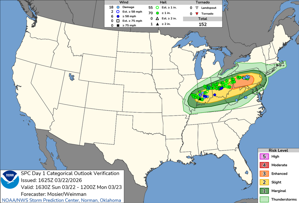
March 23 1966: A snowstorm brings a foot of snow to southern Minnesota. For Monday, March 23, 2026 1913 - A vicious tornado hit the city of Omaha, NE. The tornado struck during the late afternoon on Easter Sunday, and in just twelve minutes cut a swath of total destruction five miles long and two blocks wide across the city killing 94 persons and causing 3.5 million dollars property damage. (David Ludlum) 1916 - Pocatello, ID, received a record 14.6 inches of snow in 24 hours. (The Weather Channel) 1987 - A blizzard raged across western Kansas, and the panhandle of Texas and Oklahoma. Pampa TX received 21 inches of snow, and winds gusted to 78 mph at Dodge City KS Altus OK. Governor Hayden declared forty-six counties in western Kansas a disaster area. In southwest Kansas, the storm was described as the worst in thirty years. (The National Weather Summary) (Storm Data) 1988 - Thunderstorms developing along a strong cold front spawned tornadoes near Roberts ID and Bridger MT. Strong and gusty winds prevailed in the western U.S. Wind gusts in the southwest part of Reno NV reached 89 mph. (The National Weather Summary) (Storm Data) 1989 - Charlotte and Wilmington, NC, reported rainfall records for the date as showers and thunderstorms prevailed in the southeastern U.S. Freezing rain glazed parts of North Carolina and southern Virginia. Gale force winds produced a heavy surf along the coast of North Carolina. (The National Weather Summary) (Storm Data) 1990 - An upper level storm system produced heavy snow in the Lower Missouri Valley. Snowfall totals ranged up to nine inches at Kansas City MO, with eight inches reported at Falls City NE, Columbia MO and Saint Louis MO. Thunderstorms produced heavy snow in the Kansas City area during the evening rush hour. (The National Weather Summary) (Storm Data) 2007 - A trailer is thrown through a bowling alley as a tornado moves through Clovis, NM. About 100 homes and businesses are destroyed, at least three schools are damaged and telephone poles are snapped. Thirteen tornadoes struck a dozen communities along the New Mexico/Texas border. Two people were critically injured. 2011 - A series of tornados are spawned from severe thunderstorms in Pennsylvania. In Hempfield Township dozens of homes and a high school auditorium where students are rehearsing a play are severely damaged.
-
oh man what is this coming nino going to do to our climate baseline
-
Just take your mouth off of vortex’s before you do it. TIA


(002).thumb.png.6e3d9d46bca5fe41aab7a74871dd8af8.png)

