All Activity
- Past hour
-

Central PA Spring 2026 Discussion/Obs Thread
canderson replied to Voyager's topic in Upstate New York/Pennsylvania
country roads, take me home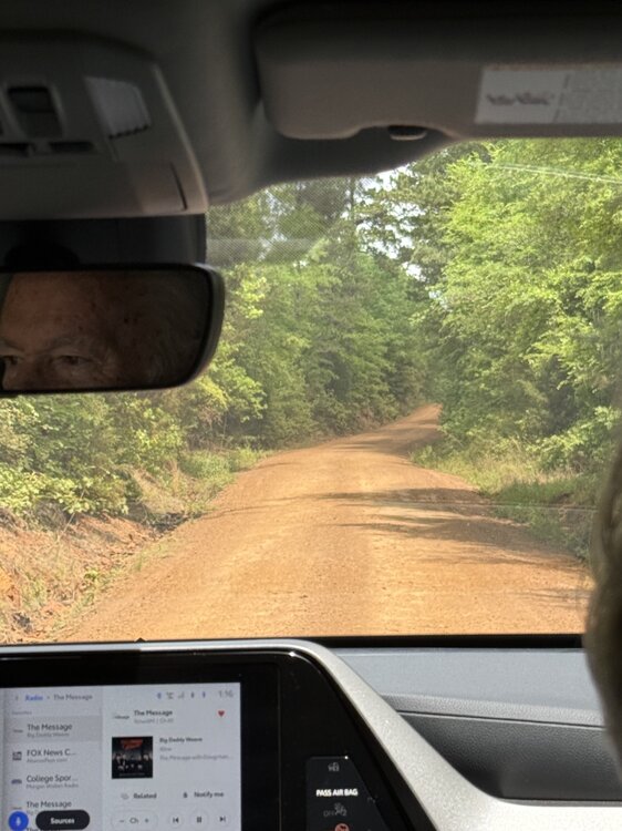
-

Central PA Spring 2026 Discussion/Obs Thread
Jns2183 replied to Voyager's topic in Upstate New York/Pennsylvania
If you're in the mood the nerdout, I’ve been drifting into the "ghost math" of how we actually capture the sky. It turns out our rain gauges are essentially professional liars, especially when the wind is busy whisking our snow away or the radar beams are overshooting the action entirely. I’ve pulled together a little guide on the invisible physics behind it all, from the way a breeze "deflects" a snowflake right past the collector to why our local airport totals might be missing a good 15% of the real story. It’s dive into fluid dynamics and PA weather quirks, perfect for anyone who wants to see the logic that turns raw data into the actual ground truth. https://jns182wx.github.io/Gauge_Bias_Correction/ I have a couple of calculators for anyone to try figure out their own biases Sent from my SM-S731U using Tapatalk -
Remember when we used to bitch about a cold wet April. I’d take one of them bad boys about now. Lol
-
Im anti hype. El nino coming nearly for sure. But to predict super so far out....totally skeptical.
-
It’s not a blocking signal. Weak signal at all actually but enjoy the delusion.
-
@nw baltimore wx How's the DFH event going?
-
Yep next week
-
Dead on 70.0 for the high at my house.
- Today
-
There is a truly Brobdingnagian blob of oceanic moisture inbound to the Cordillera. A goodly yuge chunk of the Pacific is inbound to dump world-ending amounts of heavy snow tonight! It's gonnabe a world of hurt out there as 2-4 inch per hour snow rates overtake all the Sierran ski resorts tonight. Stay tuned, I will keep y'all updated! Palisades Tahoe is already getting demolished! https://www.palisadestahoe.com/mountain-information/webcams Alpine Tahoe is getting hammered, too! https://www.palisadestahoe.com/mountain-information/webcams#tab=alpine
-
normally I am anti hype when it comes to these things but this year's nino looks like the real deal https://twitter.com/webberweather/status/2041789633940615498
-
Enjoy the sweat, it’s the only sweat you got.
-

Central PA Spring 2026 Discussion/Obs Thread
Voyager replied to Voyager's topic in Upstate New York/Pennsylvania
62 over a forecast high of 57. It got nice late, but this morning was another story. Drove to East Stroudsburg to see my grandson's baseball game. I lasted 2 innings. The cold, in your face wind, was just too much to take. -

Central PA Spring 2026 Discussion/Obs Thread
mahantango#1 replied to Voyager's topic in Upstate New York/Pennsylvania
68 for the high today, forecast high was for 62. -
Popped a 63. Nice evening to grill on the patio
-
haven’t seen a cloud all day, remarkable air mass. wind died down and it’s perfect outside
-
Pretty incredible stretch of temperatures coming up for Mid-April. We have had warmer, and similar length stretches of warmer temps. But having 70s and humid for at least 5 days straight is impressive, as usually it's dry when we get warm for that long this time of year, ala 2023. Going to be stacking up the rain totals as well, especially if areas have multiple rounds of T-storms. Could be a significant flooding issue in the UP and basins coming off of that area and the North Shore where there is still a significant snowpack. GRB has noted the possibility of the Menominee River reaching moderate or major flood stage later in the week. That plus the multiple severe days is going to make it a very busy week for the region.
-
Tomorrow will be a bit cooler with highs in the 50s. Afterward, much warmer weather will develop on Monday. Temperatures will likely peak in the 80s Tuesday through Thursday. No rain is likely through at least next Friday. The ENSO Region 1+2 anomaly was +1.2°C and the Region 3.4 anomaly was +0.2°C for the week centered around April 1. For the past six weeks, the ENSO Region 1+2 anomaly has averaged +1.25°C and the ENSO Region 3.4 anomaly has averaged 0.00°C. Neutral ENSO conditions will continue through at least mid-spring. The SOI was -27.62 today. The preliminary Arctic Oscillation (AO) was +0.933 today. Based on sensitivity analysis applied to the latest guidance, there is an implied near 81% probability that New York City will have a warmer than normal April (1991-2020 normal). April will likely finish with a mean temperature near 56.7° (3.0° above normal). Supplemental Information: The projected mean would be 3.7° above the 1981-2010 normal monthly value.
-
My yard

-
65. Perfect. Super dry though. Maybe some rain with a front in 10 days looks like the next chance on current guidance.
-
A few showers have developed in the foothills
-
These winds are beyond aggravating.
-
Ditty should move to New Jersey. Of course the fire is near refinery. Isn't everything near a refinery in New Jersey? https://www.nj.com/gloucester-county/2026/04/extremely-large-brush-fire-reported-in-nj-amid-elevated-wildfire-risk.html
-
pretty much perfect - it doesn't get better than this in our region.
-

E PA/NJ/DE Spring 2026 Obs/Discussion
JTA66 replied to PhiEaglesfan712's topic in Philadelphia Region
Yeah, we’re overdue for an epic drought guy meltdown. -
It’s significantly warmer then yesterday on the south shore with the offshore wind .