All Activity
- Past hour
-
I definitely don't miss the frustrating ocean induced cool weather that define Long Island springs. I remember being frustrated seeing NJ in the 80s and my house being in the 50s with ocean mist and fog. Or sometimes it would be nice and in the 70s or 80s north of Long Island (CT, upstate NY) and LI still stuck in the 50s or 60s.
-
Saturday looks solid 65-70 I-90 South similar to yesterday
-
We had one in 2016

-
Storms trying to get going locally but nothing exciting. Not even much lightning.
-
Huge winter incoming.
-

Central PA Spring 2026 Discussion/Obs Thread
Superstorm replied to Voyager's topic in Upstate New York/Pennsylvania
Huge contrast across state. 47 Lancaster 82 Pittsburgh . -
Those storm cells near the Quad Cities should be watched very closely. There seems to be some issues with other nearby cells interfering, but the cells over McCausland and Colona might be starting to get that “look.” The tornado-warned storm moving towards Toronto, IA also bears watching; it’s about to merge with the line behind it.
-
Sun breaking out a bit imby
-
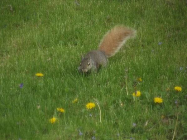
I know terrible pics but first time I've seen a squirrel with a gray body and a brown reddish tail..


-
Picked up 1.01" so far since last evening. I'll take it.
-
Nice sup heading right at us. If it can get it's act together this could get interesting.
-
Lol, classic
-
The line looked potent, and was severe-warned, as it moved through Cedar Rapids, but it was bit of a dud.
-
South of Davenport looking gnarly
-

E PA/NJ/DE Spring 2026 Obs/Discussion
Albedoman replied to PhiEaglesfan712's topic in Philadelphia Region

-
Weather spotter confirmed tornado in the warning text now
-
Nice line trying to get going SSW of the quad cities, out in front of the main line.
-
 late.. DCA: +2.5 NYC: +2.2 BOS: +2.2 ORD: +2.6 ATL: +3.0 IAH: +0.7 DEN: +3.5 PHX: +2.8 SEA: +1.8
 -

E PA/NJ/DE Spring 2026 Obs/Discussion
PhiEaglesfan712 replied to PhiEaglesfan712's topic in Philadelphia Region
Where? Vermont? NH? Maine? Because there isn't any snow happening anywhere near here. - Today
-
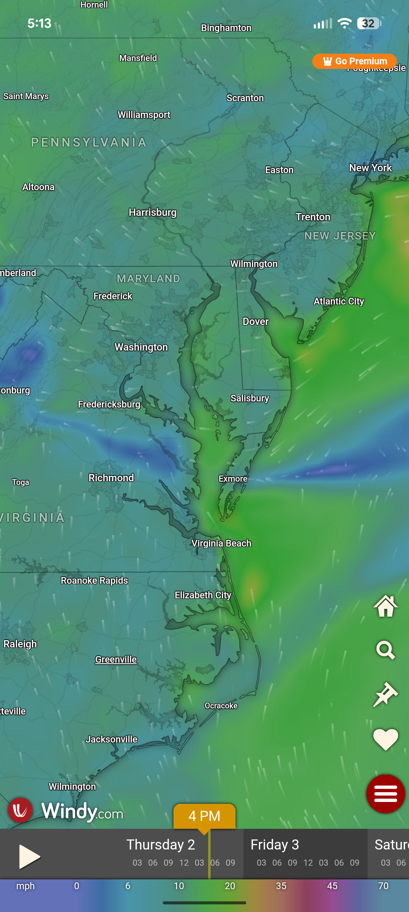
Wind vector shows the BDCF boundary pretty clearly.

-
On the other hand, a month ago today would be in the low 30s…progress…
-
Back Door Cold Front... Northeast Marine Layer.... Ocean Wedge... whatever you want to call it.
-
We've got a WWA tonight into tomorrow morning for IP/ZR and the AFD also has RA Saturday night into Sunday, but the P&C forecasts show 7 days with nary a drop for every place in the GYX CWA (at least Portland to Jackman). Computers are fun. CAR area forecasts are more logical.
-
It’s dryyyyyh in Wake Co. I also don’t remember it being this windy everyday? It seems like the gusts are moreso than in other years.
-
huge storm with 2" to 3" hail at Ottumwa Iowa (tornado warned for several minutes now)