All Activity
- Past hour
-
 Just slapping you around like he slapped that fan that reached out and grabbed him
 -
As you would say "good to know"
-
Coldest air in New York in 50 years?
-
Snow has started here. Sporadic flakes.
-
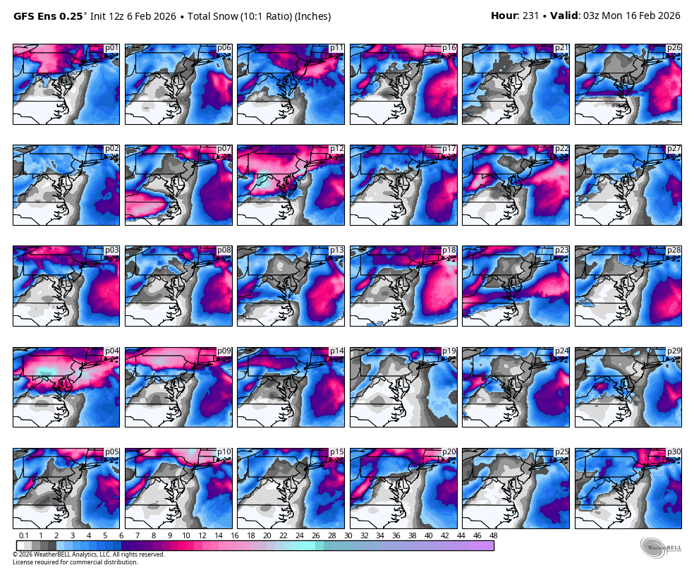
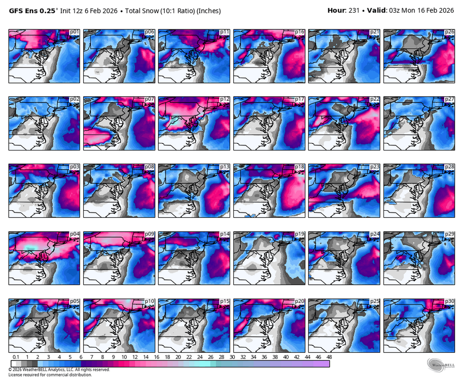
Ripping SN/SN+ in Hooville 28/17
-
 Is there any chance sea ice forms in Long Island Sound? Side note, I like the cobalt color the NWS uses for their new extreme cold warnings.
 -

Is we back? February discussion thread
Damage In Tolland replied to mahk_webstah's topic in New England
Machines/ Euro > GEFS -
Sticking on my north facing sidewalk and street edges. Any exposed grass and mulch covering up now. 27 degrees
-
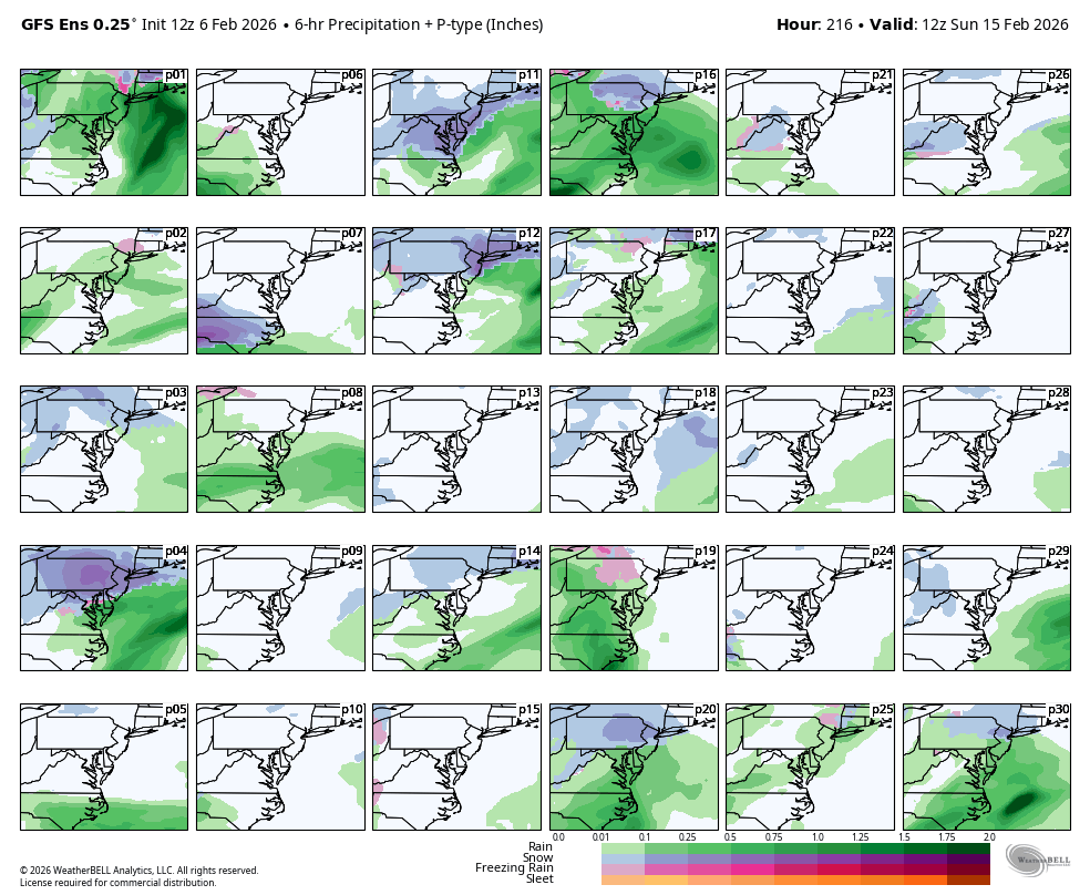
 Few members all rain and several no storm or whiffs. WB 12Z GEFS.
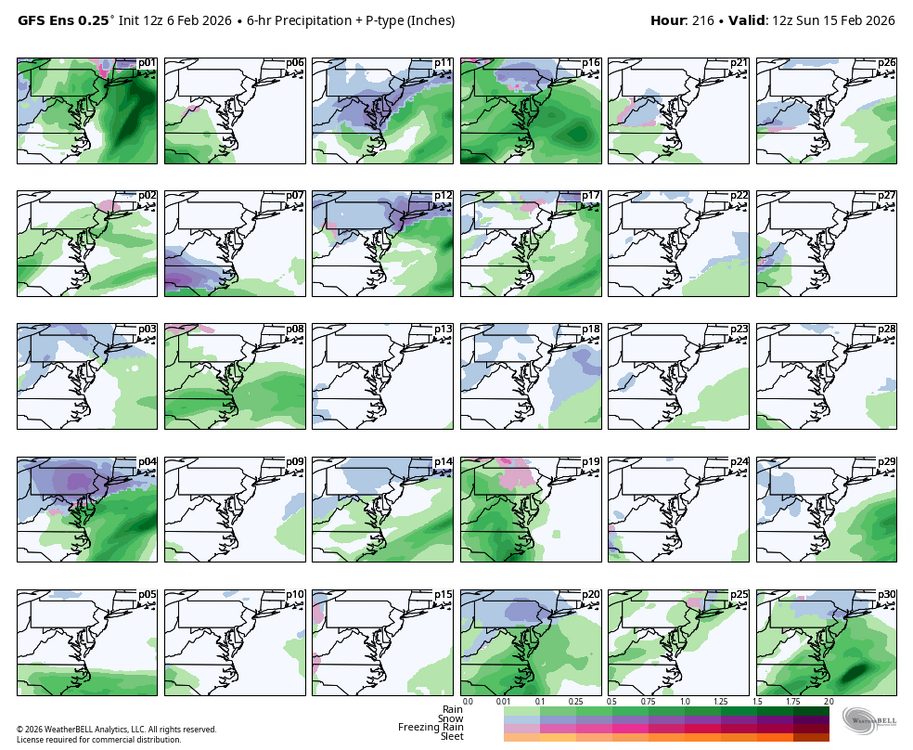
-
 NYC coldest temps in the last 50 years are -2/-3 in Jan 94. So I assume you are leaning colder than that.
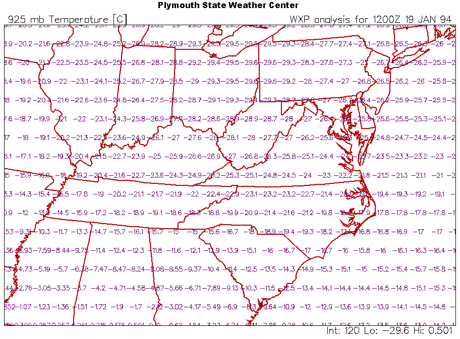
-
 I hope not. Flurries just started here fwiw.
 -
Light snow under green returns in Haymarket
-

February 2026 Medium/ Long Range Discussion: 150K Salary Needed to Post
Shad replied to Weather Will's topic in Mid Atlantic
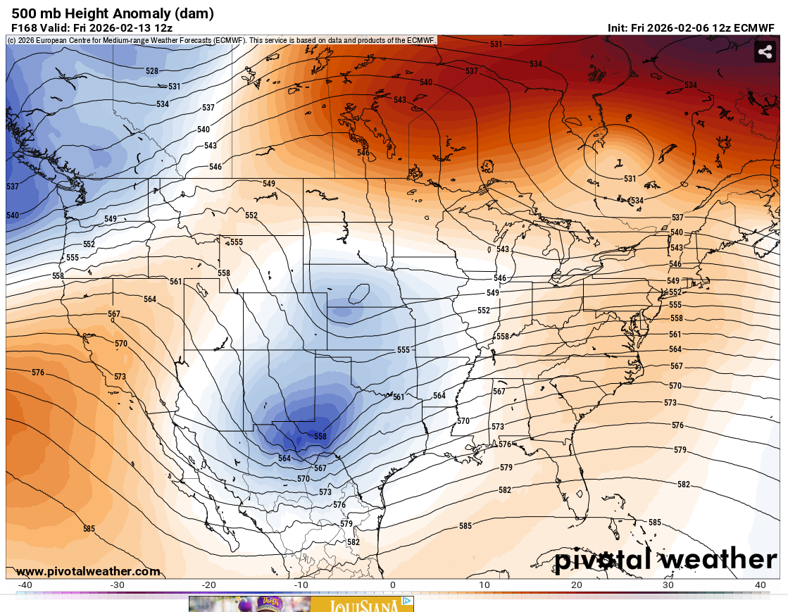
I mean it is pretty awesome but id let it get in its wheelhouse of 180 hrs before feeling 100% confident -

Winter 2025-26 Medium/Long Range Discussion
A-L-E-K replied to michsnowfreak's topic in Lakes/Ohio Valley
congrats boston -
 And that’s why you use the median not the mean
 -

2025-2026 Fall/Winter Mountain Thread
Maggie Valley Steve replied to Buckethead's topic in Southeastern States
Flurries at Cataloochee now. I suppose there's a non zero chance. -
 Typically I would say this has a north trend written all over it. This year gives me a bit of pause.. Though I still think that.. But I think everyone has this concern. Still nice to track for now.
 -
That's a decent pulse of snow cresting the Catoctin Mts. Hope it holds together.
-
Told y'all this would be a successful thread.
-
If I was going it would be on the back of the big law gf... I'm happily headed down the @IronTy path.
-
Winter 2025-26 Short Range Discussion
A-L-E-K replied to SchaumburgStormer's topic in Lakes/Ohio Valley
ancient board discourse -
WB 12Z GEFS only has two acceptable members out of 30 or 6%. But it is a start!
-
Some were saying the cold wasn’t impressive but that looks impressive to me. It might not match the warm anomalies out west with a warmer world but to downplay the cold the last three weeks isn’t being honest.
-
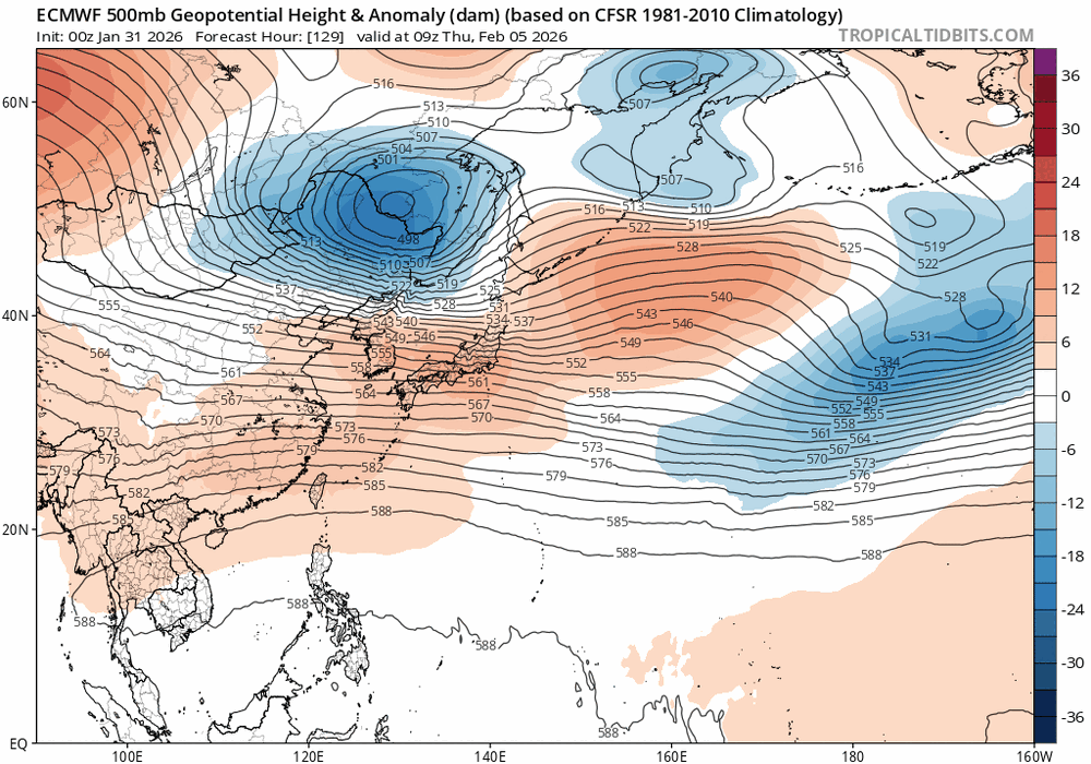
Be very cautious what the models show show into the extended pattern

-
GEFS/GEPS mean has a storm in Gulf of Maine. That's meh for SNE.