All Activity
- Past hour
-
Dude is click bait
-
 https://levocarepharma.shop/# synthroid 25mcg price
-
The weather flatlined.
-
Head to Canaan valley this winter lol
-
fyp
-
It better snow, that’s all I got to say lol
-
Depends on snowpack. I rarely get much frozen ground here. Mostly areas where I clear snow.
-
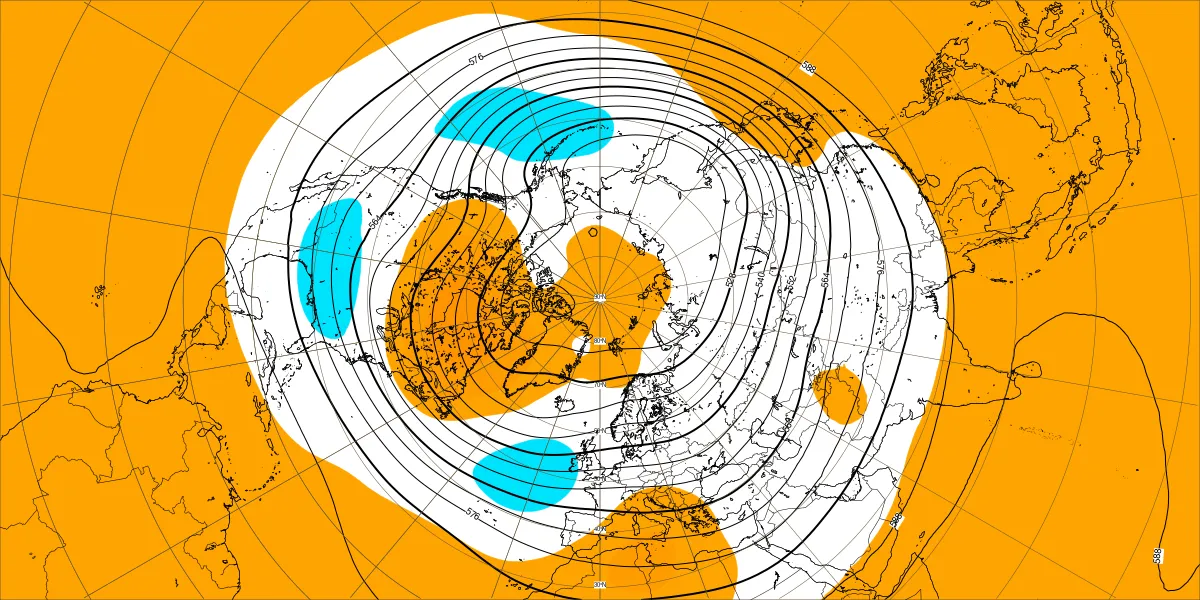
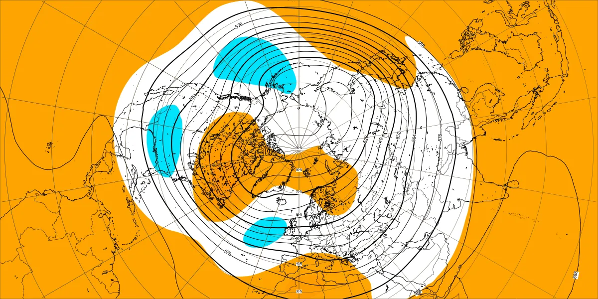
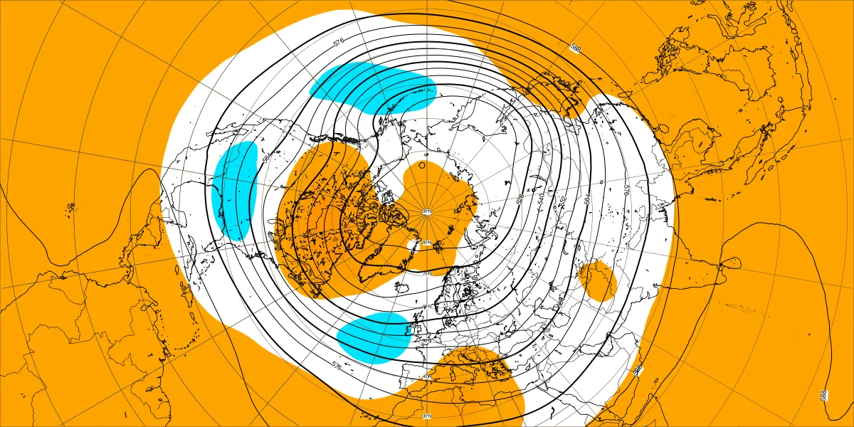
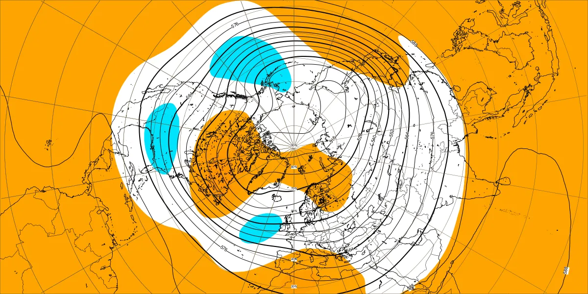
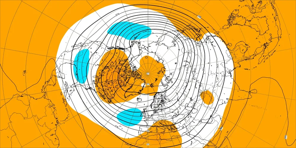
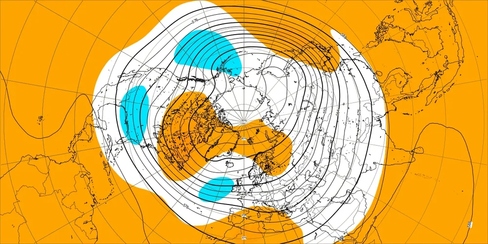
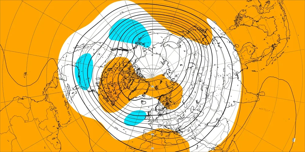
Last 2 weeks of today's weeklies lining up with seasonal with the trough in/near the GOA and a distinct SE trough, very similar to the Euro seasonal I posted a couple of weeks ago.
-
Drove over falls this afternoon and it is as low as it looked this summer. Crazy to see it this low again.
-
This is proged for the first few days of November, not that it makes a huge difference probably.
-
A nice step down in progress…last years was good too. Beautiful weather.
-
Extended 11-15 isn’t too bad. Might average AN but some cool shots too between now and then.
- Today
-
Alek is the king of using an op model run beyond 300 hours. lol
-
2026 Mid-Atlantic Severe Storm General Discussion
wxmeddler replied to Kmlwx's topic in Mid Atlantic
There hasn't been anything official official, but news from the NWA Conference is that they want to trial it (assuming in certain CWA's only) by 2028. -
Taking the HECS chance off the table for now, let’s look at the last 3 super ninos. 82-83 wasn’t too bad actually, over 12” outside the Feb 83 HECS for Baltimore. 97-98 was obviously a shutout more or less. 15-16 was about 6” outside Jan 16 HECS. With this one being stronger than all of them and more east-based (for now, I’d wag it tends towards more basin wide as the winter progresses), I’d probably only put my Baltimore area forecast at 2-6” outside a HECS chance? But obviously the chance for a HECS is well above normal. I’d even go as far to say that the odds of a strong phasing low taking a traditionally favorable snow track for us is VERY high. 97-98 had like 3 of those! But will there be cold air? So I agree with @psuhoffman that when you put that together you get something like 1 in 3 odds maybe? So do you weight that and take 0.33x18” + 4” or something as your forecast total? Kinda no since I actually think a total like 8-14” for the year is less likely than either 2-6” or 18-24” lol. So to do a CWG kinda thing is probably wag: 0-2” 20% 2-6” 40% 6-14” 10% 14-24” 20% 24”+ 10%
-
order isotretinoin without prescription: DermaTret Direct - buy isotretinoin 40mg capsules
-
So we probably got that going for us fwiw.
-
We are still 9 days out, but halloween is looking fairly normal temp wise
-

2026-2027 Record-breaking El Nino
mitchnick replied to Stormchaserchuck1's topic in Weather Forecasting and Discussion
@GaWx Your SE trough is showing up nicely on the last 2 weeks of today's weeklies. Pretty much in line with seasonal.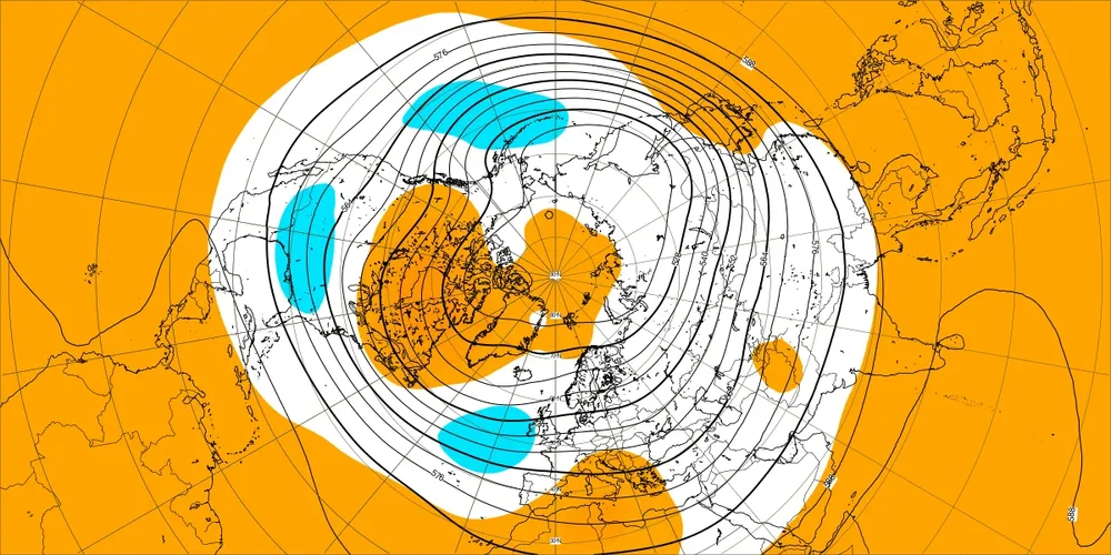
-
Yeah it's clearly boosting spirits city wide
-

2026-2027 Record-breaking El Nino
snowman19 replied to Stormchaserchuck1's topic in Weather Forecasting and Discussion
The 30C isotherm/warm pool has actually strengthened and expanded in size. The center of it is at 140W. Absolutely insane -
Ya but with big implications and can change patterns depending on strength and which way it goes..
-
2026-2027 Record-breaking El Nino
EasternLI replied to Stormchaserchuck1's topic in Weather Forecasting and Discussion
Looks like they recently raised the scale a degree on these. +12C has expanded. Let's get some +13... -
I'm loving it. My sons finishing up high school soccer-nice to not sit in the rain or mist
-
We can roll with it. Growing season is mostly done. Plenty of rainy 50 degree days coming. .