All Activity
- Past hour
-

Mountain West Discussion
mayjawintastawm replied to mayjawintastawm's topic in Central/Western States
Changed here at 5 PM sharp, was real heavy for an hour, now much lighter. Catching its breath I guess. Accumulation is going to be hard to assess due to melting as it falls, but my white styrofoam box lid is ready and waiting. Maybe an inch and a half?? -
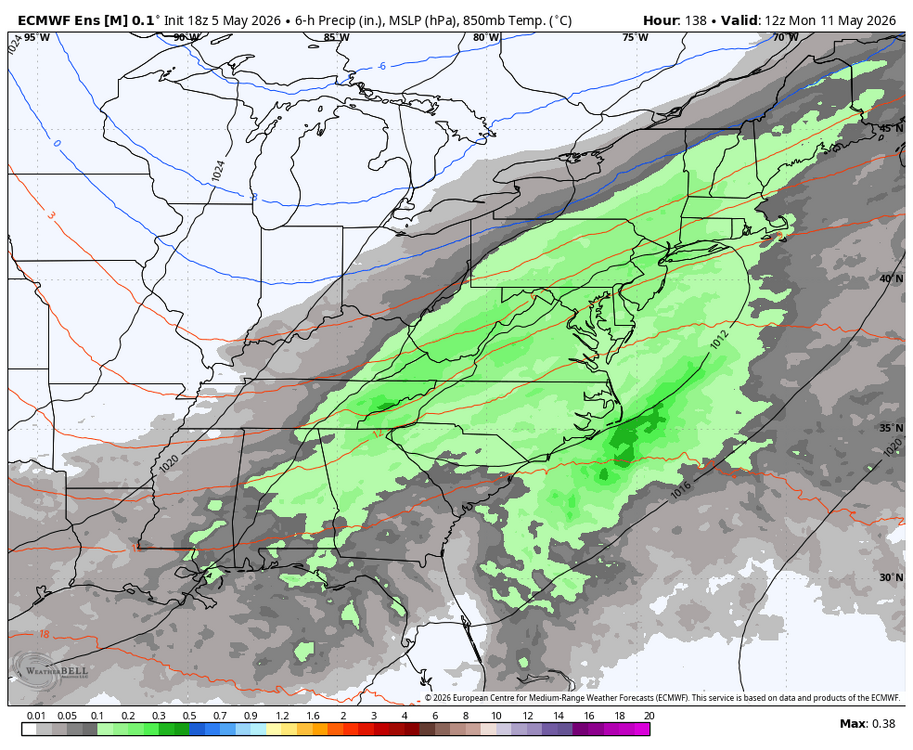
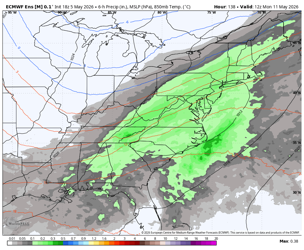
WB 18Z EPS. Rain still possible on Monday.
-
They’re terrible. And the manager is the worst part. He has no idea how to manage a bullpen. Frankly, I’d be way happier with Showalter.
-
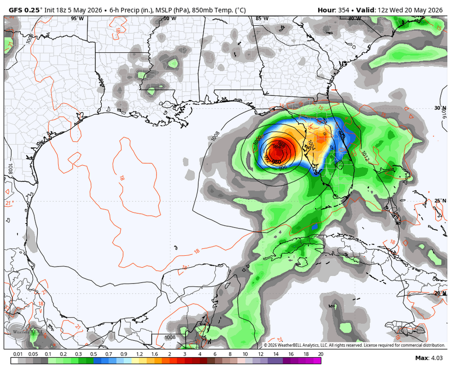
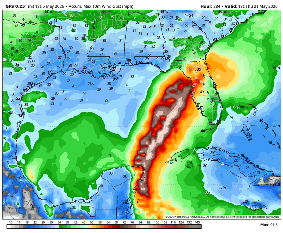
WB 18Z GFS at range. GOOFUS is off to an early start in the tropics.
-
I’m pretty sure my lawn will be super-green next winter.
-
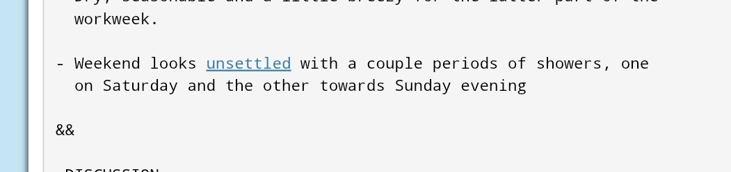
Saturday looks rainy. Sunday looks like it could be good though, warm for Mother’s Day at least.
-
A tad breezy out there tonite here
-
I mean in 22-23 the entire eastern seaboard got shafted and if the niño version of that is the setup we get...
-
This Os team might be worse than last years. Verdict still not out.
- Today
-
We saw how those Nor'easter/coastal calls absolutely tanked. Sell
-
We had hail around midnight last night again. Pea to dime size so just loud. I've had more storms with hail this late winter/early spring than any single period I can remember. Think last night was the 5th time its hailed since Feb. Most of it like last night. One storm had some 1/2 to 1 inchers. Maybe this month will get exciting towards the end and the beginning of June.
-
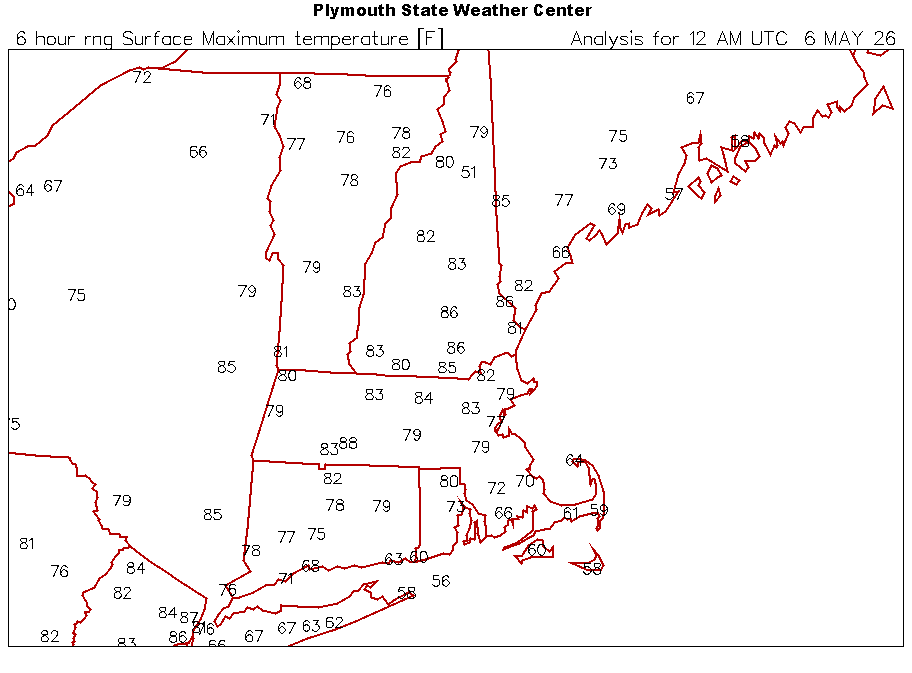
Today's Highs: TEB: 87 EWR: 86 PHL: 86 New Brnswck: 85 BLM: 82 TTN: 82 NYC: 81 ACY: 77 LGA: 77 ISP: 67 JFK: 66
-
Feast or famine rain wise. Just another South Carolina winter day here. 40's/50's and rain lol.
-
Enjoy
-
change to all snow at Denver
-
Let's not start this ass weekend s*** again.

-
CEF is off
-

2026 Mid-Atlantic Severe Storm General Discussion
SnowenOutThere replied to Kmlwx's topic in Mid Atlantic
From LWX: Honestly a bit surprised tomorrow got such a long writeup but the increasing risk of storms became high enough to rule out a hike in Shenandoah tomorrow. Recent guidance has trended a bit slower with the front`s progression through the area, which could potentially allow for a bit more destabilization tomorrow afternoon. As a result, the trend has also been slightly upward with CAPE values. Much of the destabilization appears to occur as a result of low-level moisture convergence in the vicinity of the surface front, which causes dewpoints to rise into the low to mid 60s. That being said, there is still a fair amount of uncertainty with respect to how much destabilization occurs, and also the areal coverage of storms that form. Shear certainly won`t be lacking tomorrow, with most soundings showing long, straight hodographs, with around 60 knots of effective bulk shear and over 100 knots of shear in the cloud bearing layer. So, if storms form, there is a conditional threat for supercells. The 12z HRRR for example, hinted at this possibility, with weak UH tracks. The thermodynamic environment is a bit odd, and casts uncertainty with respect to what hazards storms could potentially produce, if they occur at all. Model soundings show long, straight hodographs, which would normally be supportive of hail production. However, profiles are nearly saturated and moist-adiabatic at low-levels, with a considerable amount of the CAPE below the freezing level, which is unfavorable for hail production. Winds in the mid-upper levels are very strong, but aren`t overly impressive just above the surface. And model soundings show a good amount of dry air in the mid-levels (which yields DCAPE values around 700 J/kg), but very moist air at low-levels and poor low-level lapse rates, which would be unfavorable for transporting higher momentum air down from aloft. Machine learning guidance is downplaying the potential for severe thunderstorms, and SPC currently has us outlooked in general thunder. However, tomorrow is at least worth monitoring from a severe thunderstorm perspective given the CAPE/shear combination that could potentially be in place (high end scenario of around 1000 J/kg of MLCAPE, and 60 knots of effective bulk shear). -
-
Warmer global temps = more instability = more wind
-
-
Euros been hinting at that too
-
Down to 60 at my location with the strong southerly wind off the water while Staten Island and Newark are at 79


.thumb.gif.f92b16c631a1d15d405ed77b33f0710d.gif)